More details are there, or on the backing github project. You can also run the programmes for yourself if you want to tweak it, or just show your region.
This tool can help you find possible tagging mistakes in river topology, like change in a name, or find places where 2 rivers aren’t properly connected up.
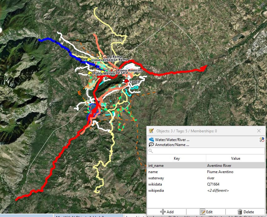
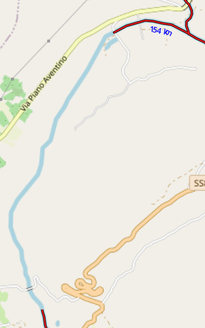
You’ve ‘exposed’ 3 lapses in ‘river’ flow continuity in my area of regular mapping, two sections in the Fiume Aventino. except they are tagged same as before and after.Je nais comprend pas
Edit: And thank you for this great new addition QA.
Edit2: Good moment while there to create a river relation with 10 members, remove repeating wiki tags from parts to incl different wiki language links for different sections.
Great tool indeed, thank you for this.
So, if I understand the coloring scheme, it shows only when it’s part of the same waterway. If another waterway is close to that but different color, then it doesn’t connect and may need fix to verify if indeed it connects or not to the other waterway.
I’m definitely going to have a more in-depth look at this when I’m back home. I’ve mapped a lot of rivers and waterway relations, and I’m sure there’s a lot more to be mapped and validated!
Are you considering to add waterway=canal as it’s based on my memory quite often used, for situations where the original river is blocked by a weir in order to guide the water flow through a power station. Those sections are usually man made and tagged as canal. Same goes for locks.
Or do you consider such situations as “not connected”?
The main point was: In my understanding it would be valid, one waterway contains sections with river and canal and still should be considered as connected from my point of view.
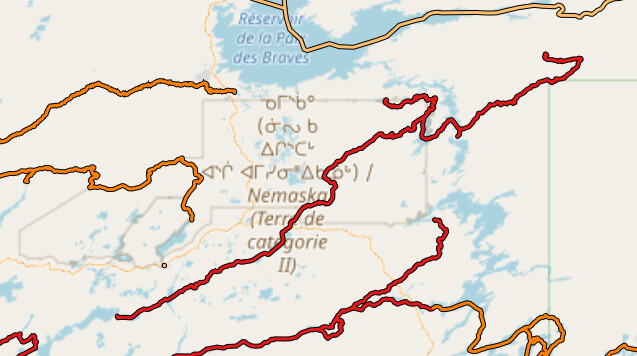
Great Amanda. An other challenge is to interpret partial derivations of water basins rivers with dams / water control like for the James Bay Project. On the image below, the east-west rivers are interpreted but the south-north waterways + tunnels in the direction of the northest reservoir are not interpredted. I corrected names and added Relation : Bief Rupert (16220173). We will see if this helps.
From a quick look at the code, it seems that the tools look at waterway=river connections only, so maybe I’m wrong, but I would not expect it to handle more complex situation as of now.
Very nice result anyway!
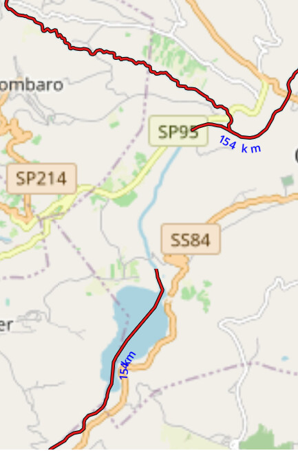
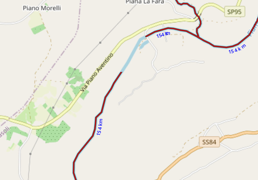
After having tweaked the Aventino river members, the deviation being different language wikis referenced, looked this morning. No change in same zoom, but homing in on the gap, the rubyred highlighting shows. It may have something to do with rendering. The 154km, seems to be the sum length of all the rivers that come together (to say if unsaid), there are at least 3 involved here, but think the total of the 3 is more than 154.