Weglose 'Wege' im Hochschwab

In den letzten Wochen wurden von MisterY
viele highway=path + trail_visibility=no im nördlichen Hochschwab gesetzt.
Basis für diese Änderungen waren Wegbeschreibungen und die dazugehörigen .gpx-Files auf alpenvereinaktiv.com und bergfex.at

Beispiele:
Griesstein und Ebenstein (Überschreitung, SG I+) • Bergtour » alpenvereinaktiv.com

Weg: 1305940733 | OpenStreetMap

Hochschwabgruppe - Feistringstein 1.836m - Überschreitung - BERGFEX - Wanderung - Tour Steiermark

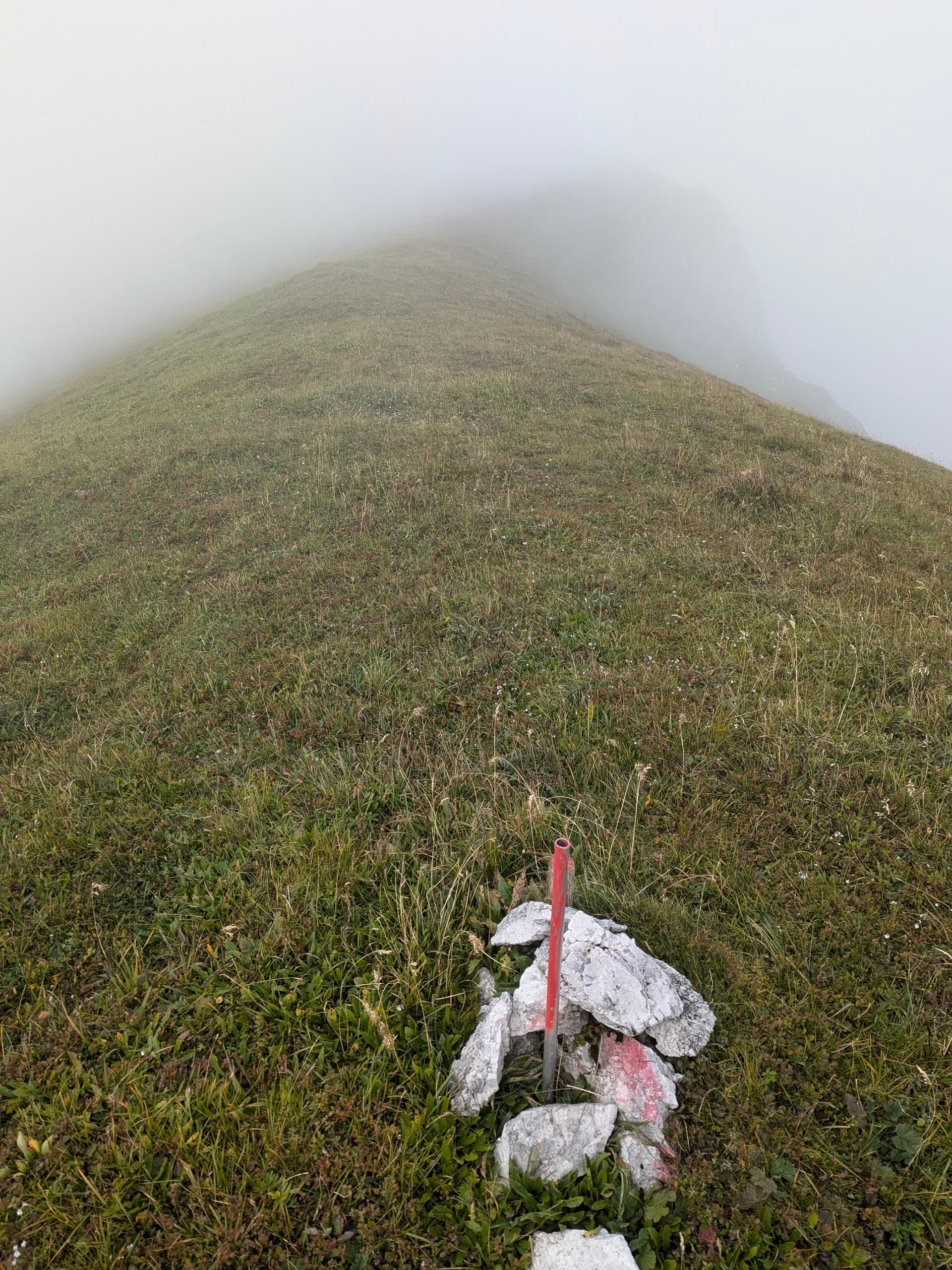
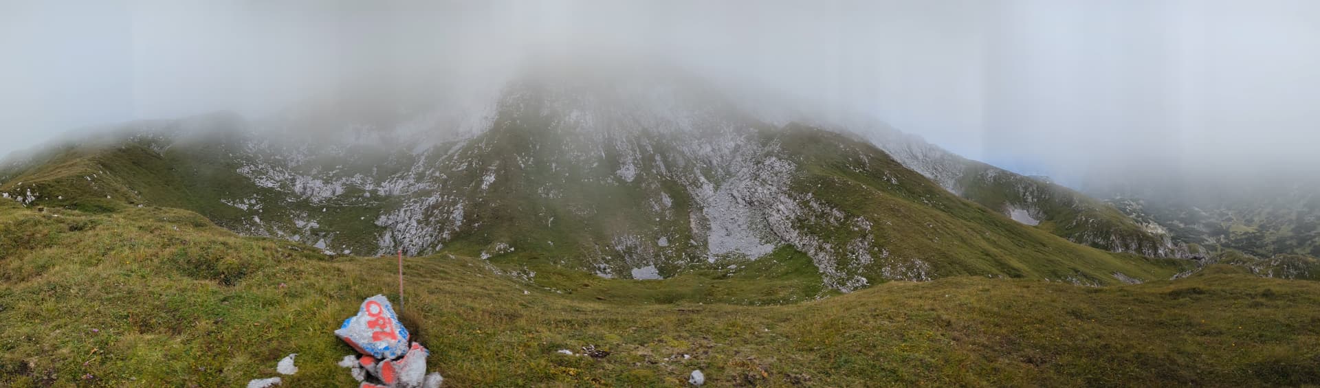
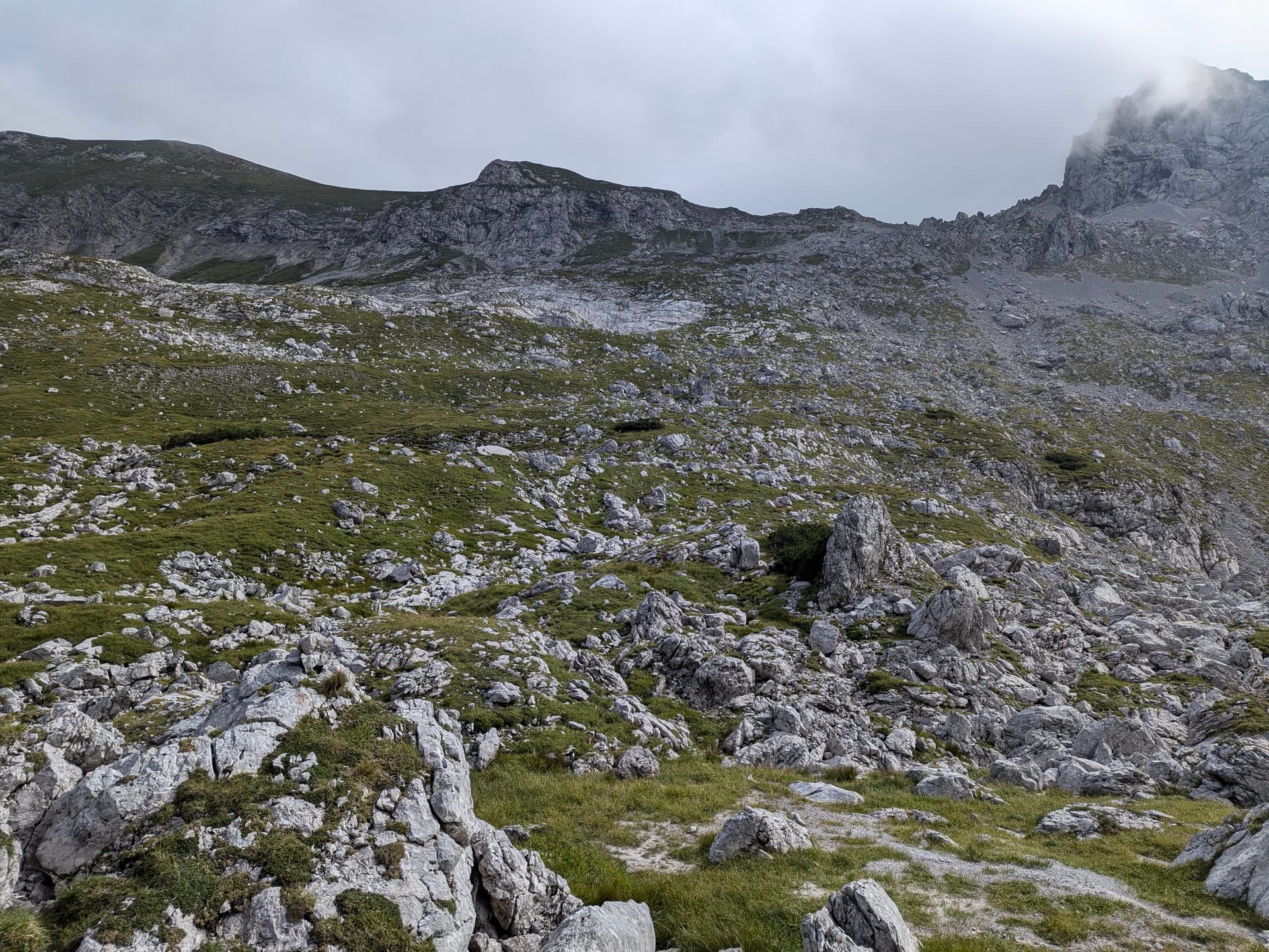
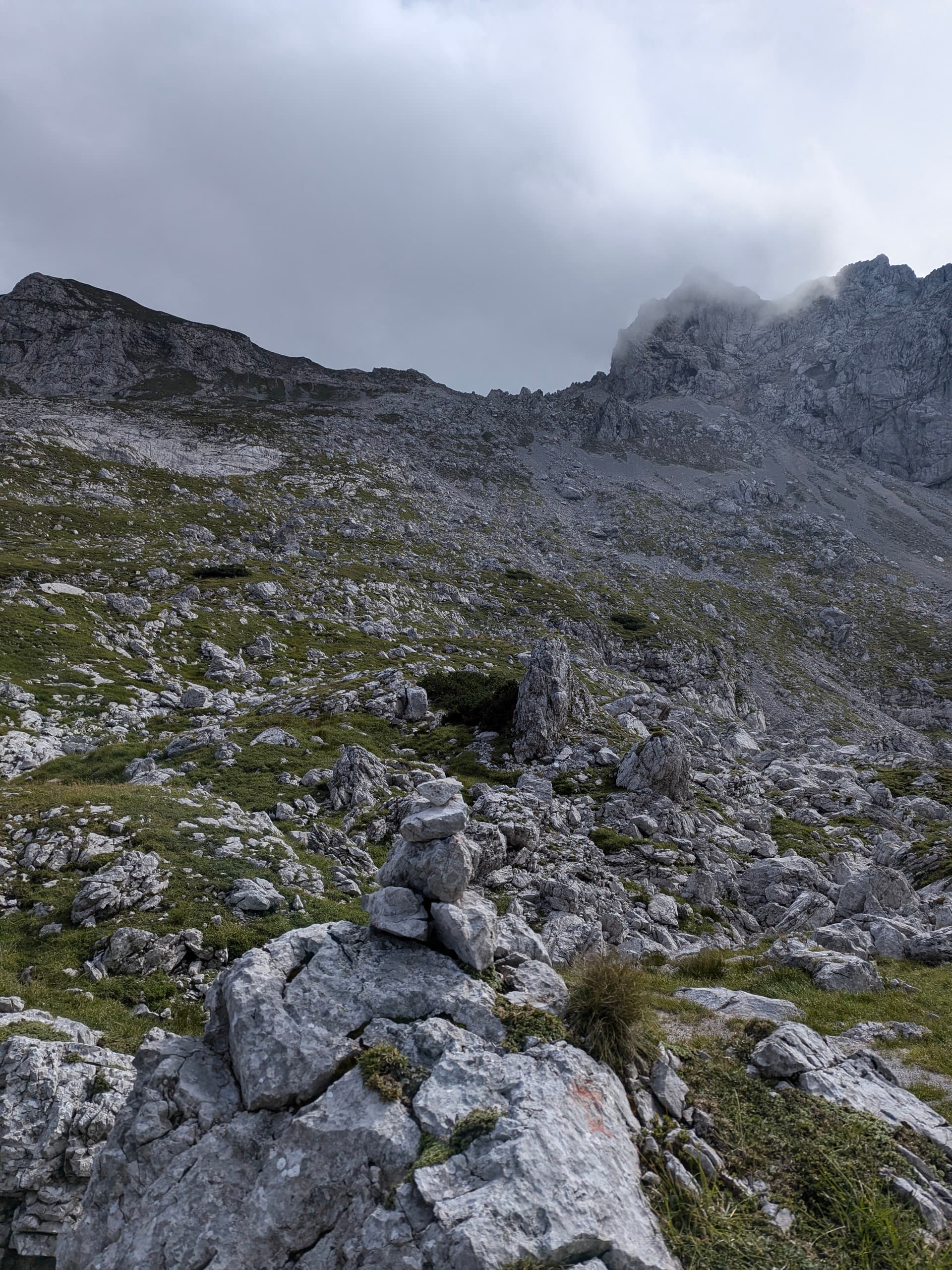
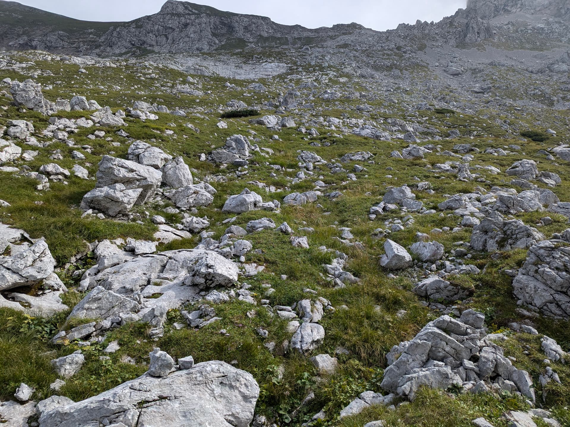
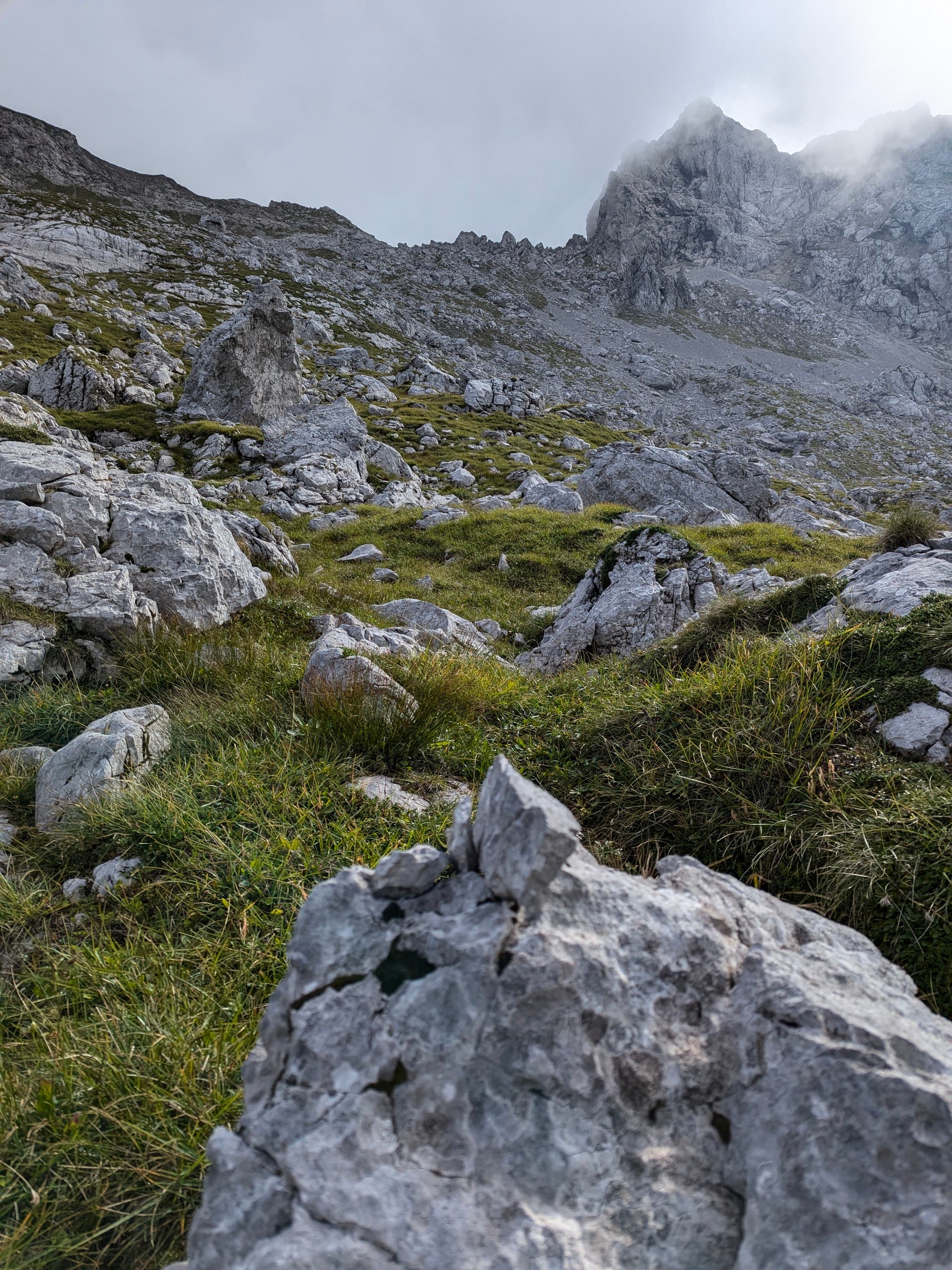
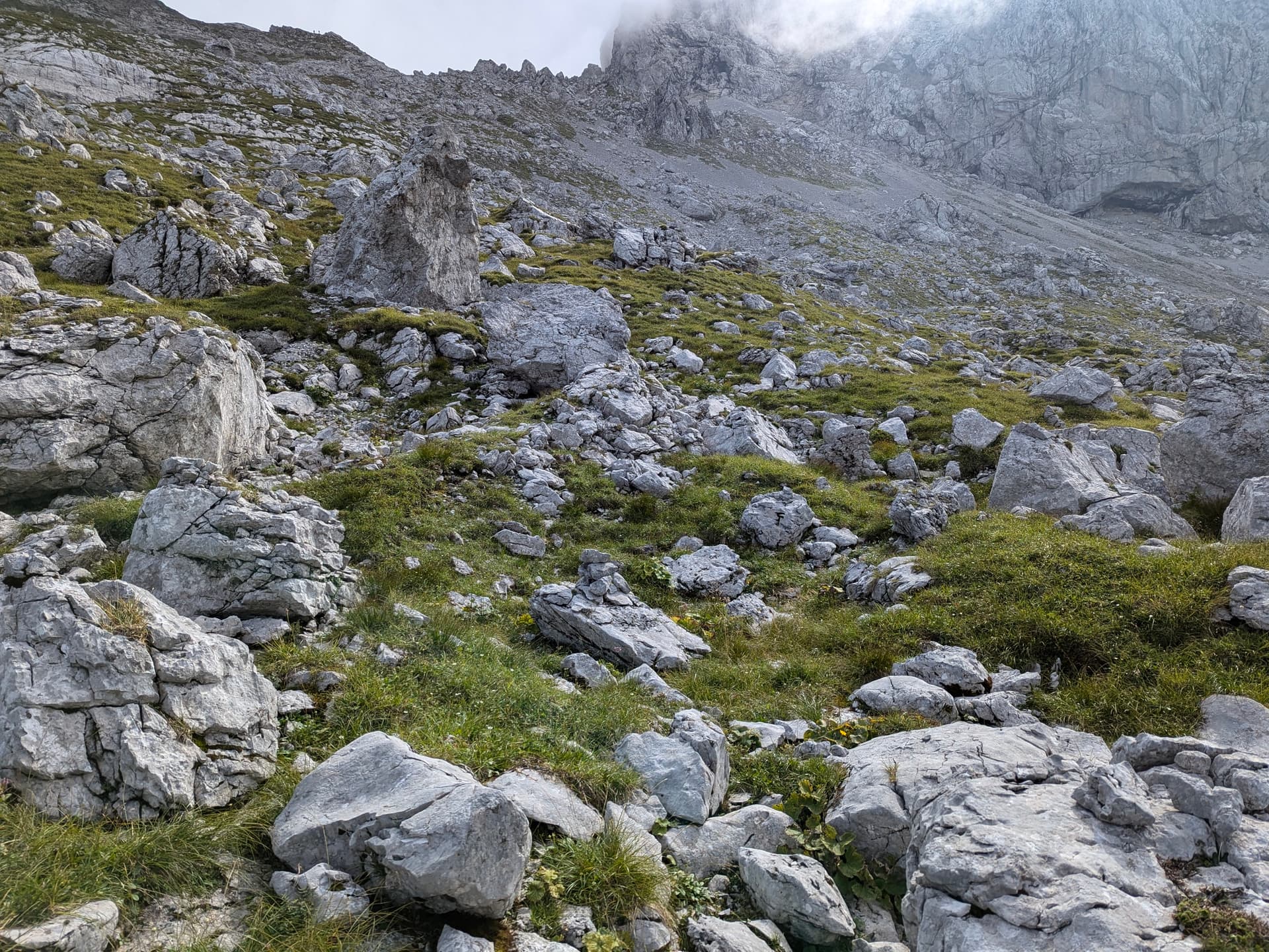
Der Hochschwab ist ein nicht ganz jäger-unproblematisches Gebiet und ich musste schon ein Paar Diskussionen über das Eintragen diverser Wege führen. Ich hatte immer den Standpunkt vertreten, dass nichts erfunden wird, sondern nur vor Ort vorhandene und nachverfolgbare Wege als highway=path eingetragen werden. D.h. es muss ein Minimum an Steinmännern, Steigspuren, Schnittspuren, Farbmarken geben und der Weg müsste zu mindestens theoretisch auch ohne Karte verfolgbar sein.

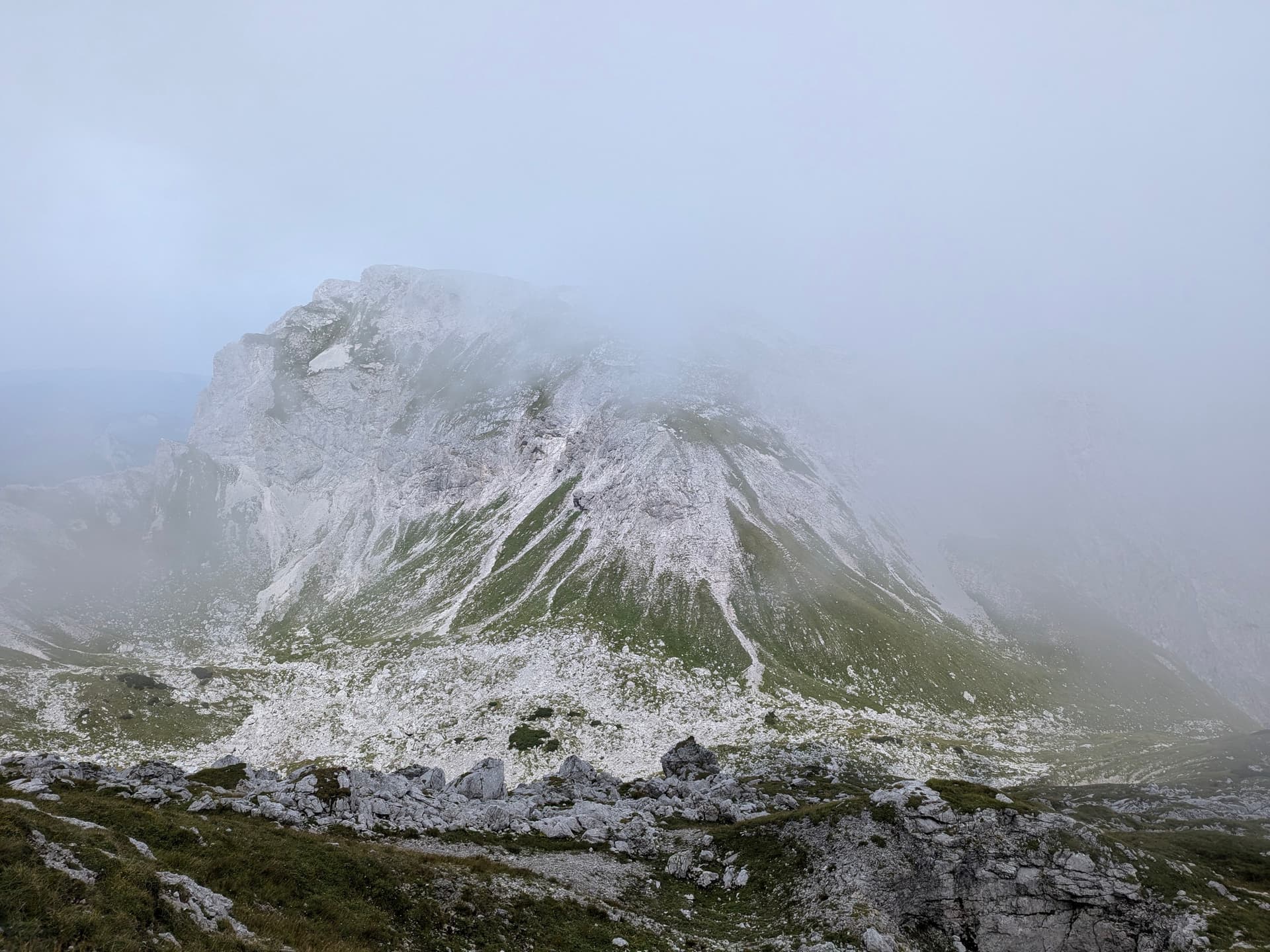
Bei den beanstandeten Wegen (Beispiel Feistringstein) sieht man vor Ort nichts oder nur extrem wenig. Beim Beispiel handelt es sich um aufgearbeiteten Windbruch bzw. felsdurchsetzten Hochwald. Wegfindung ist beliebig und erst oben am Kamm, wo das Gelände felsiger und latschiger wird und sich alle potentiellen Zustiegsmöglichkeiten vereinigen, bildet sich ein Steig heraus. Dieser Steig ist einigermaßen ausgetreten, an notwendigen Passagen auch ausgeschnitten und wurde von mir auch so in die Karte eingetragen.
Die Meinung von @-=|MisterY|=- ist, daß alles was begehbar ist, auch als Pfad getaggt werden kann.

@baumgrenze und ich haben einige von diesen Wegen wieder gelöscht, bevor jetzt ein Edit-War beginnt würde ich das hier gern zur Diskussion stellen.

3 Likes

Wo nichts ist sollte IMHO auch nichts eingetragen werden.
Nur weil man irgendwo durchgehen kann (!) ist das noch lange kein Pfad, auch wenn mehrere Leute die ungefähr gleiche Linie gewählt haben und ihren GPS-Track dazu veröffentlicht haben.

2 Likes

Just for the sake of discussion, this is not my opinion, this is from the examples on the OSM wiki:
https://wiki.openstreetmap.org/wiki/Path_examples

I would point out, in particular:

  • “A path with no signs at all but too narrow for motorcars so it’s not a highway=track but starts from the end of a track. Allowed and not totally unsuitable for cycling, but known to be walkable.”
  • "A path through an urban forest as in “there is something used for transport”; walking is possible on dry and non-winter days with a sure foot, but you wouldn’t route anyone there. "

From other discussions on the topic, I see that a “walkable terrain” is, by definition, a path. I find it incredibly misleading to have dozens of dead-end paths on Hochscwab. Does it mean you get close to the top and have to turn back? Or does it mean you can connect to another path and find your way to the hut?

Does it mean you get close to the top and have to turn back?

Sometimes, If you need this information add a noexit=yes

Or does it mean you can connect to another path and find your way to the hut?

Sometimes the terrain is walkable, walk the trackless terrain and enter all obstacles in the map.

DE:
Meine Meinung ist, wenn jede begehbare Wiese eingetragen wird, besteht die OSM-Karte nur mehr aus Wegen. Ich habe MisterY Fotos geschickt, damit er sieht, das es sich nur um begehbare Wiesen handelt.
Zumindest muss der weg als trail-visibility=no eingetragen werden, dann kann ich die Wege bei meinen selbsterstellten Karten ausblenden.

EN:
My opinion is that if every accessible meadow is entered, the OSM map will only consist of paths. I have sent MisterY photos so that he can see that these are only accessible meadows.
At least the path must be entered as trail-visibility=no, then I can hide the paths on my self-created maps.

My opinion is that if every accessible meadow is entered, the OSM map will only consist of paths.

We can address individual concerns separately. I would very much disagree with you conclusion. Almost no matter which area you select, it will soon become obvious that there are more limitations to movement and free, open, and accessible areas are more of an exception than the rule. This works both for urban and wilderness areas, with different type of obstacles.

As can be found in prior discussions on the topic, in this forum, it stems from experience that, once a path is established between two key points, no additional paths emerge. It becomes highly redundant to add more.
Which begs a question - what would be the purpose of filling all accessible space with paths?

On the other hand, the benefit of adding a safe passage through a potentially dangerous terrain is clear. At least to me.

Wenn Way: 1305940733 | OpenStreetMap nicht bereits gelöscht wäre hätte ich das auf der Stelle gleich getan.

Die Bezüge auf die Dokumentation oben sind nicht nachvollziehbar. Beide Fotos zeigen deutliche Spuren am Boden.

Im Gegenteil: Das erweckt bei Leuten die den Daten vertrauen den Eindruck, dass es dort einen Weg gibt. Wenn das nicht stimmt und sie das erst dort erkennen, dann kann das bös enden.

1 Like

Wie es eh immer öfter inzwischen passiert bei ‘uns’. Liest man immer wieder in der Zeitung - gerade am Berg sollte man meiner Meinung nach etwas vorsichtiger sein, einfach Wege einzuzeichnen.

Noch vor dem Kleinen Ebenstein verlässt man sie wieder und steigt einsam, aber weglos an der Nordseite der Schaufelwand ab.

“Weglos” impliziert ja dass es dort keinen Weg gibt, d.h. auch kein highway=path.

Habe selbst vor nicht allzu langer Zeit einen ‘Weg’ aus OSM gelöscht den jemand als Abstiegsmöglichkeit von einem Gipfel eingetragen hat. Vor Ort hat sich dann herausgestellt dass dort nicht einmal minimalste Steigspuren oder Markierungen/Steinmännchen vorhanden waren. Der vorgeschlagene Weg war auch extrem steil mit mehreren kleinen Kletterpartien über Felsvorsprünge. Mit sehr viel Mühe und Vorsicht war es schon möglich dort vom Berg runterzukommen, aber für Leute ohne ausreichend Erfahrung die diesen Weg zufällig auf der Karte sehen und sich dort einen normalen Wanderweg erwarten hätte das schnell in einer Rettungsaktion enden können.

1 Like

Auch ich finde, dass “Gehmöglichkeiten”, die keine Wege sind, nicht als path eingezeichnet werden sollten. Auch manche paths im Himalaya sind extrem diskutabel, wie z.B. der Mt.Everest-Nordostgrat (sh. Note: 1480240 | OpenStreetMap). Ich halte das für Schnapsideen.

1 Like

Ich würde sagen: “Weglos” expliziert, dass…

Auch umgekehrt, als erfahrener Bergsteiger, macht es einen uU stutzig, wenn in der Karte ein “Weg” eingezeichnet ist und vor einem dann nicht einmal Steigspuren zu finden sind. Da kann man auch schnell falsche Schlüsse ziehen.

Daher halte ich es auch weiterhin für richtig, Wege nur einzuzeichnen wenn sie auch sichtbar sind. Obs im Gegenzug sinnvoll ist kleine Stückerl ( Note: 2539592 | OpenStreetMap ) rauszutrennen, bin ich eher skeptisch.

2 Likes

OK, I’ve done my little tour. Done what I wanted to do, seen what I wanted to see.

I will show you in photos why I think that adding the paths is useful. It is 21st century and we all use phones. A digital map and a GPS are not 100% reliable but are better than nothing. Grassy areas don’t have stones for cairns. Besides, in a fog, even having them is next to useless.

Here is me, trying to “follow the terrain”, as recommended by OP.

Cliffs are on both sides, on the way to Hinterer Polster.
Finding the correct route up is also lots of fun:

Trying to find a climbable slope was only possible when the fog cleared for a bit. Having a path on the map would have been indispensable.

Btw, in the area between Griesstein and Ebenstein, where some claim there is nothing, I found about a dozen cairns. Will sort out the photos and videos in the coming days.

I disagree on the principle here. The purpose of a map, for me, is to show the way, just like any other marker on a tree or a stone. It’s 21st century. Why should we not use the media that we have?
I also understand what you are saying (to a degree) but really feel there needs to be a way to say “there is a safe passage here” on a map. This needs to be raised at a higher level and is a reason why the “Path controversy” even exists.

And here’s absolutely the most magnificent point of the route, just for the sake of it.

Edit: to clarify the purpose of a map, I’d use the term “treasure map”. It shows a path to the treasure, which is not obvious.
Edit 2: There are tags on a path to clarify that it is not always visible on the ground. But that does not mean that the path is not there. I find it worse to have paths on Hochschwab that simply end nowhere, without connection or a meaningful destination. Obviously, whoever created the visible line before that point, was going somewhere. The path does not end there, even though the visible part of it does.

Meiner Meinung nach ist eine Anwendung von highway=path + trail_visibility=no nur dann sinnvoll, wenn markierte Wanderwege nicht sichtbar sind. Man braucht den Pfad für die Relation, kann sich vor Ort aber anhand Markierungen zurechtfinden.

Ansonsten hätte ich auch zwei Beispiele für eher fragwürdige Pfade die mir schon länger aufgefallen sind:

Als source ist “GPS” angegeben, also man kann dort vermutlich gehen und es ist eventuell auch der sinnvollste Weg durch das Gelände, aber reicht das allein für eine Eintragung? Nach dem Kriterium könnte man ja auf jeder Wiese eine beliebige Anzahl von Pfaden eintragen.

1 Like

I have already addressed this earlier in the thread. What would be the point of doing something like that?

Hope you’ll be able to spot the cairns. On the photos it looks a bit weird because the stones are everywhere. In reality they were really easy to see, going in the direction from Griesstein to Ebenstein. Not so the other way around, perhaps because I wasn’t looking for them.

Bei solchen “cairns” wundert es mich nicht dass eine Karte “indispensable” ist, wie es oben geheißen hat. Auf der Totalen seh ich jedenfalls keine, außer vielleicht, dass es zu der Senke oben geht?

Da einen Weg einzeichnen, der den drei-Kiesel Häufchen aus den Nahaufnahmen folgt – und keinen auslassen – das ist ein Tagesausflug allein.

Der nächste wird die wieder löschen, wenn dort keine sind. Wenn der andere die dann aber wieder einträgt, weil es sich nämlich um unsichtbare Wege handelt […]

Mapping a hiking path that is completely invisible on aerial images without having been there just from a description somewhere online is a no-go, I think we can all agree on that.

If all you want is guidance in an app you can follow when you already know where you want to go, just create/import a gps track.

Not sure who claimed that, but you didn’t know either at the time you mapped the path. That’s part of the issue here.

Whether the cairns are sufficient to map a path there is hard to tell from photos alone. Single snapshots don’t really give enough information and cannot replicate the context one would have while physically being there.


Someone in one of the related topics put it quite well in a way that matches my expectations/requirements for a trail in OSM:

I don’t think this requirement is fulfilled here (if we leave out potential physical markings for a moment). One person following a description someone else posted online is not exactly shared common knowledge.
Physical markings on some parts of the path may be enough to justify mapping those parts, but it sounds like they were quite limited.

1 Like

Most of the problems here arise from the lack of a clear (or too broad) definition of a Path.
I found this discussion (among others) to summarize the issue well:

There is a clear difference between a Way and a Path, as seems to be the concensus here in the thread. What I’m looking for is a Way, a possibility to pass between two key points (i.e. a saddle and a peak, through a narrow safe pass). There are quite some cases like this that I came across. Some are marked by metal/wooden poles, some by cairns. Meaning someone had put enough effort to mark the route for others. I would like to be able to see this on the map, whether or not the path is actually visible on the ground or if it differs from the surrounding area.

As mentioned elsewhere, one of the main reasons for this is routing. However, I found Orux, which can also include straight-line segments in a route, and then provide the total length and a time estimate. So that problem is handled, let’s say.

Another problem lies in the quote you mention: " there needs to be a not insignificant group". What is a “non insignificant group”? From what I’ve seen, there have been people going on these routes, writing about it on the touring portals, setting up the cairns, or posting on their web sites. I can’t say how many, but they have gone a route that was obviously safe enough to bring them back to write about it.

I agree. What I can say from the field is that I followed the most logical route back, and ran into the cairns. Obviously, the route was clear to someone else before me, too.

I agree, but that really depends on the definition of a Path. There are already tags for visibility and other path features, which give away the impression that mapping paths in this way is possible.

Thanks for your feedback. So far I haven’t seen any of my questions answered and I’m leaning to taking it as a lack of interest in discussion, really, and more as a “my way or the highway” type of mentality.

“It sounds”? You may as well look at the photos yourself or ask here. I was there three days ago.

That is true. However, the path was deleted quoted “knowledge” as the source. Now, after being on the ground, it seems that this “knowledge” source has holes and its relevance is questionable.