Following my presentation in State of the Map EU earlier this month, I am reaching out to the OSM community to propose the creation of a international working group to improve the integration of EuroVelo routes in OSM.
To give you a bit of background, I am working at ECF (European Cyclists’ Federation), in the EuroVelo Team, managing our EuroVelo route database, implementing the track updates that we receive from our national partners (they are responsible for developing the routes on the ground) and leading on the topics of route quality and gathering GIS data. So I have a good overview of the EuroVelo network as a whole and where the data comes from
What would be the aim of this working group?
The focus of the WG would be on making EuroVelo route integration on OSM more coherent and accurate. In particular, here is a non-exhaustive list of topics that could be discussed:
See if the suggested tagging system on the EuroVelo wiki page makes sense and if we should add tags or extra details (maybe more explanation on the fact that EuroVelo routes are super-relations, or super-relations or super-relations, and how to extract such data?)
Look where there are tagging issues for EuroVelo routes across OSM and correct them
Decide what to do with undeveloped EuroVelo routes (should they not be mapped? Should they be mapped with a specific tag?) and make everything more consistent (at the moment, many undeveloped routes are mapped on OSM)
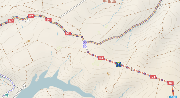
Look for discrepancies between the official EuroVelo tracks and the itineraries marked on OSM, potentially using Knooppuntnet (knooppuntnet.be)
Identify areas where there is few infrastructure data mapped and call for local OSM communities or propose challenges on MapRoulette to complete EuroVelo routes data
So this post is a call for anyone interested in joining this WG, and any ideas that you might have! Please answer this thread if you would like to contribute or to be kept in the loop
I also have a concrete question. For the next steps: I was thinking that an OSM mailing list might be the best way to get started. Do you agree or would anyone have another idea? And could you tell me how I can proceed to create such a mailing list? I was not able to find this information.
Thanks a lot and looking forward to reading your comments
Excellent idea, which resonates with my own proposal to maintain (and hopefully make more homogeneous) the twelve European hiking E-paths. The tags are similar, the problems are similar, and the tools are the same. Maybe we should coordinate the two working groups, or even combine them?
As for the medium, I’d say anything but email, please My own experience is that Telegram/Matrix, Discourse and the wiki each covers a different phase of the discussions, from unstructured short-lived brainstorming to formal proposals that can be tested.
Except for the issue that all bicycle routes come with forward and backward roles to accommodate the different ways needed for the two directions of movement. In essence, each bicycle route relation contains two routes. This is a complication when it comes to tooling and applications.
Apparently not all (e.g Way: 587553919 | OpenStreetMap). And I actually know a couple of places that are one way for hikers, even if it is very rare. In any case clarifying the forward/backward issues might help us with hiking routes that double back on themselves, and the bicycle people could maybe help us hikers with that.
The Eurovelo there has many forward and backward roles. Anyway, just saying, it needs dealing with, and tooling for maintenance and data use is complicated by this setup.
Is there an official, license-compatible source we could use for these?
To take a concrete example, I know that some Sustrans routes in Hull, England have changed. Have the Eurovelo routes also changed? Is there a licence-compatible source that we can use to fill in gaps?
More generally, still in the UK, Sustrans has removed its listing for some national routes along busy roads. What is the status of the Eurovelo routes that shared the same roads?
cycle.travel (my site/app) has rendered and routed across EuroVelo routes for several years now:
so I’d be very interested to be part of this.
Decide what to do with undeveloped EuroVelo routes
This is a massive issue. The EuroVelo group on Facebook is full of people who’ve followed an OSM-based map in good faith, and been routed along an undeveloped EV route (not tagged as such) which has been completely unsuitable for cycling. It’s got to the point where I’m going to have to manually filter them out from c.t if it’s not fixed in OSM, but I’d rather not have to maintain a separate dataset.
The simple and strict answer is: unsigned routes should be deleted from OSM, because they simply do not exist on the road. A non-existing route cannot be used by a router or shown by a renderer.
OTOH there are many routes under development, and from idea to realisation can take many, many years. Some of these may be perfectly cyclable, others absolutely not.
In Belgium and Nederland, mappers have used the proposed: prefix for routes “under development”. This allows data users a choice whether to render/use the routes, and some applications have a switch where the user can toggle the display/use of proposed routes.
I imagine a renderer would be inclined to render proposed routes, maybe in an adapted style, while a router would be more careful and not use proposed routes but use the weight/cost of actual ways instead, or just route from start to end without regarding the proposed OSM route at all.
So the proposed: prefix would be your filter attribute.
Routes developed at national/regional level (typically, they are part of a local cycle network) but not signed with EuroVelo signs yet - I think these should be mapped as EuroVelo but with some kind of tag to say that they are not signed as such
Routes “under development” or “at the planning stage”, meaning that these routes have been selected to become EuroVelo and the region/locality may have plans to improve their infrastructure, but they can contain dangerous sections - we can decide that these routes should not be mapped in OSM but in some countries, they are the “best available solution” for cyclists and it’s still interesting information (and currently, some undeveloped routes are mapped as EuroVelo on OSM, for instance EuroVelo 2 in Belarus and EuroVelo 8 in Cyprus, so if we decide not to map undeveloped routes these should be removed. Also, we don’t have national partners in those countries so I don’t know what is the real development level of these stretches, it may be better than we think)
We are currently working on establishing a common open source license for all EuroVelo tracks. At the moment, there is no clarity on the general EuroVelo license - each track belongs to the National EuroVelo Coordination Centre (NECC) that is managing it, and sometimes tracks belong to the regions that they get them from. This complicates everything because the license then is different in each country.
We are going to make a proposal to the NECC for a common open source license. Do you know which licenses make it easy for OSM? If we go for a license of the type ODC-by, with required attribution of www.EuroVelo.com, would that make things complicated on OSM? I would guess yes, since the required attribution changes when we put tracks on OSM?
Regarding Sustrans, EuroVelo routes should follow the NCN routes and change when the NCN is modified. However, we don’t always receive timely updates from Sustrans and our tracks in the UK are quite bad and imprecise. OSM could maybe help with improving www.EuroVelo.com in this case! If there are doubts, Sustrans is our NECC in the UK and responsible for deciding what NCN routes the EuroVelo itineraries should follow. But most of the routes are not signed with EuroVelo signs in the UK, so easy to modify.
I am with you on the problem of inappropriate routes. We sometimes have the same issue for hiking (maybe less often).
However, we may have to deal with a conflict of principles here:
provide useful maps, not dangerous ones
map the world as it is, not as we’d like it to be
Here, I believe that mapping as proposed something that is actively published by an operator would not respect the second principle. Maybe a workaround would be to add appropriate tags on the ways so that the inadequacies are immediately visible to the user, without taking into our hands to second-guess operators