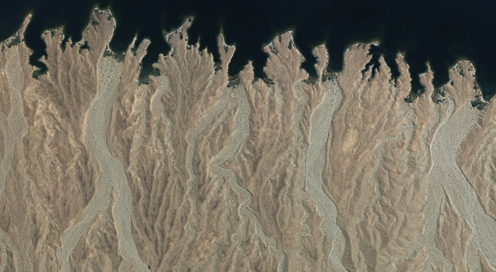
The waterway analysis that @amapanda_ᚐᚋᚐᚅᚇᚐ , @watmildon, and others have been working on identified a number of closed waterway=wash features in the US. These were either bars of sediment in and alongside rivers, or the wide areas of dry desert washes – coarse to fine alluvium in either case.
Most of the features were awkwardly tagged when they were imported from the USGS National Hydrology Database (NHD). To avoid having waterway loops, @watmildonrecently retagged these features as natural=wash.
For the bars of sediment in and alongside rivers, I think the established natural=sand, natural=shingle, or natural=shoal + surface=* tags are appropriate and suitable.
However, we seem to have problems mapping the wide areas of dry desert washes. The established OSM tags and conventions don’t fit well with these features. That has led mappers to some creative interpretations and adaptations as they map these areas:
natural=water - Obviously wrong because the wash is dry. Often the result of previous imports. E.g., Way: 47356327 | OpenStreetMap
natural=water + water=river + intermittent=yes - An attempt to fit the established OSM tags to a dry wash, but it makes something that is normally dry look like it is normally wet, and it fails to capture the fact that there may be many years between floods in a dry wash. E.g., Way: 46227123 | OpenStreetMap
natural=water + intermittent=yes - Same as above. Note that a natural=shoal feature may be underwater part of the time, but the tag distinguishes it from “water.” E.g., Way: 47356794 | OpenStreetMap
natural=shingle - “Shingle” is specifically rock that has been rounded by the motion of water. Dry washes don’t have enough water to smooth out their rocks, so this is incorrect. E.g., Way: 47356799 | OpenStreetMap
natural=scree - “Scree” is specifically the broken rock that accumulates at the base of a cliff or other rock face. That’s not a dry wash. E.g., Way: 47425055 | OpenStreetMap
The examples above are from the US, but appropriate tags for dry desert washes could be used elsewhere in the world, particularly in the Middle East where this type of landform is also prominent.
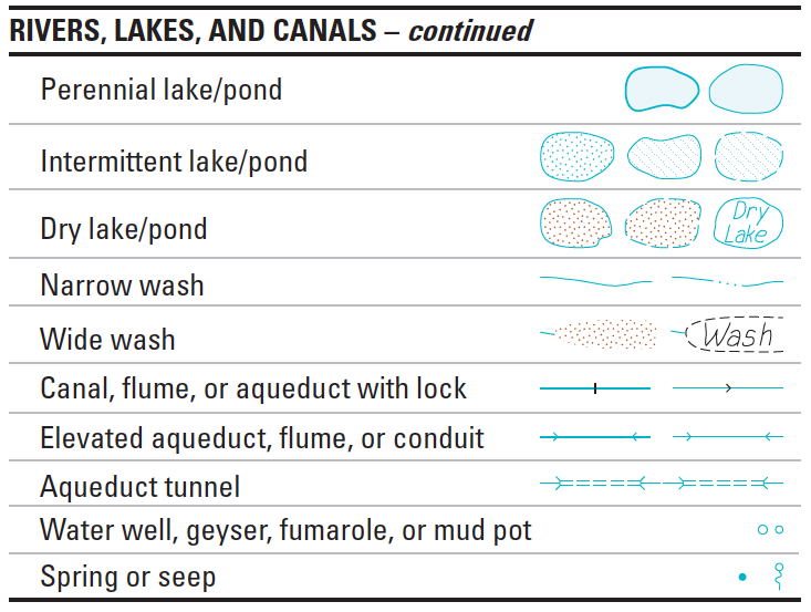
Can we agree on tags that work for the wide areas of dry washes? Possibly natural=wash or natural=dry_wash combined with surface=gravel/sand, which would be similar to the usage for natural=beach?
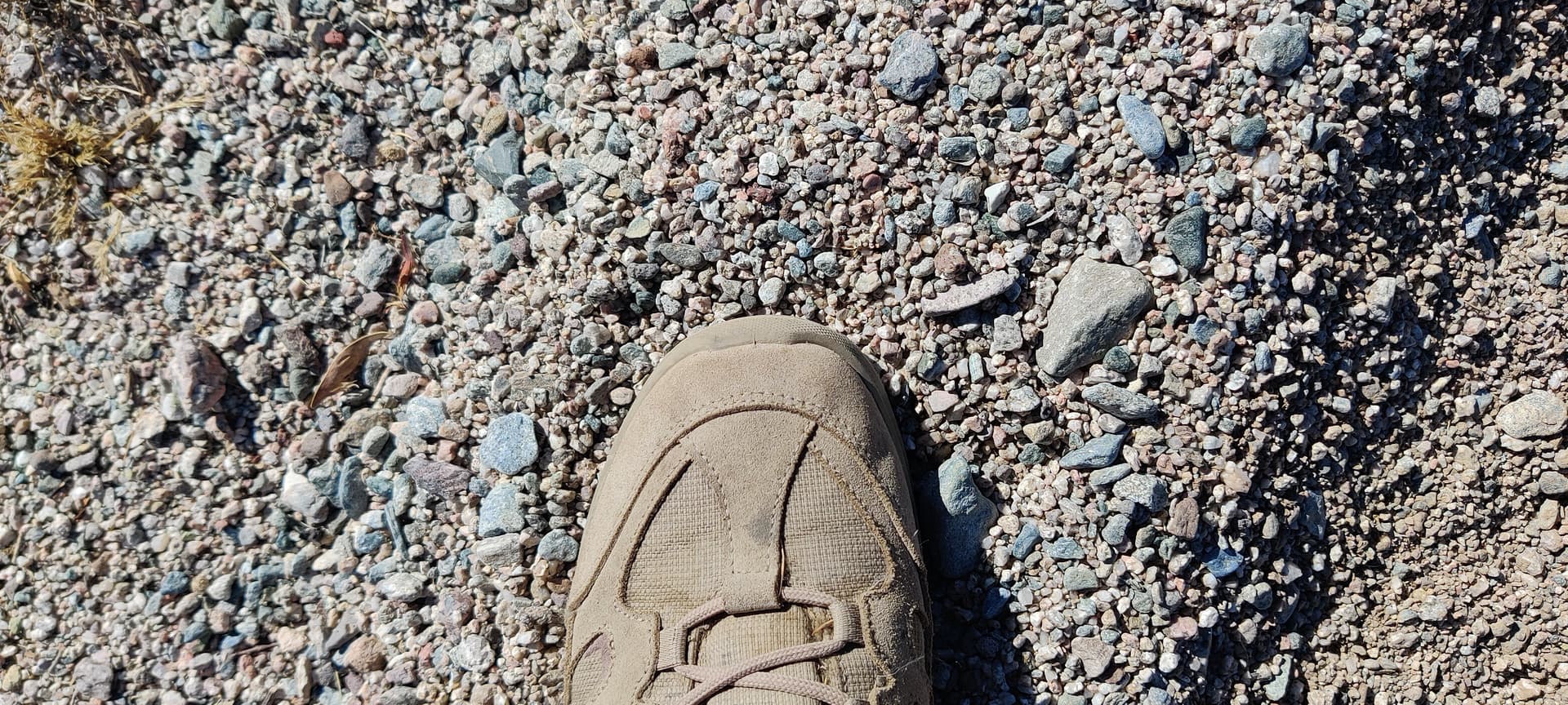
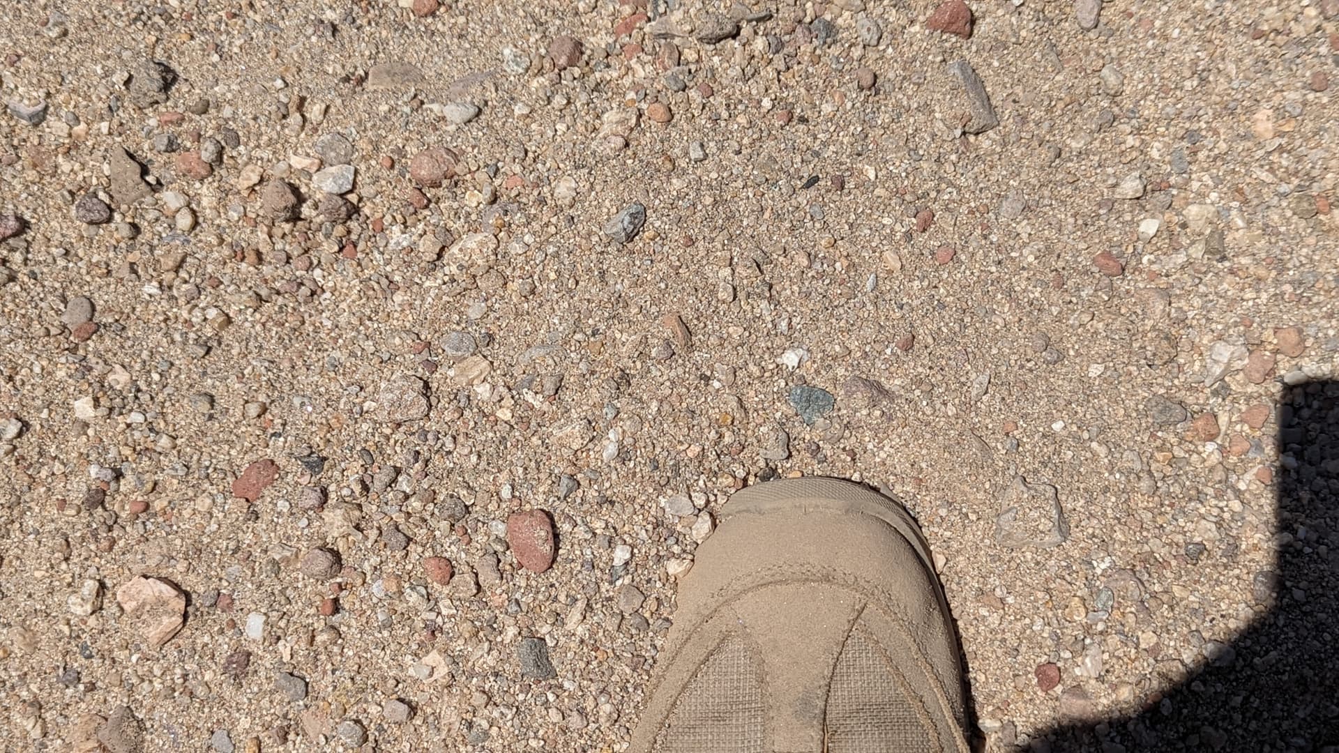
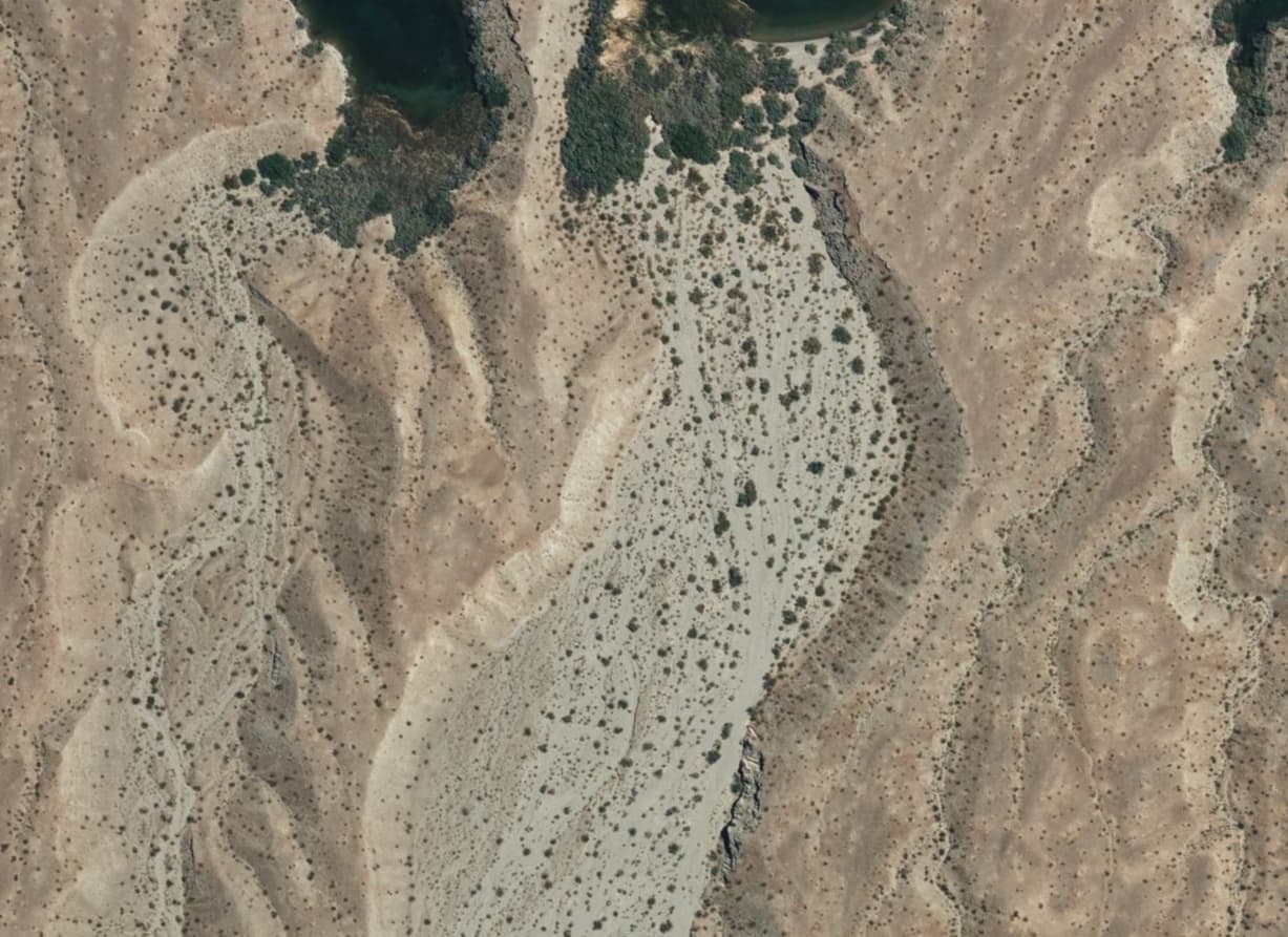
A picture of the sediment in the wash at the same location. Although the wash may appear sandy from a distance, the surface is actually a mixture of pebbles, gravel, and cobble.
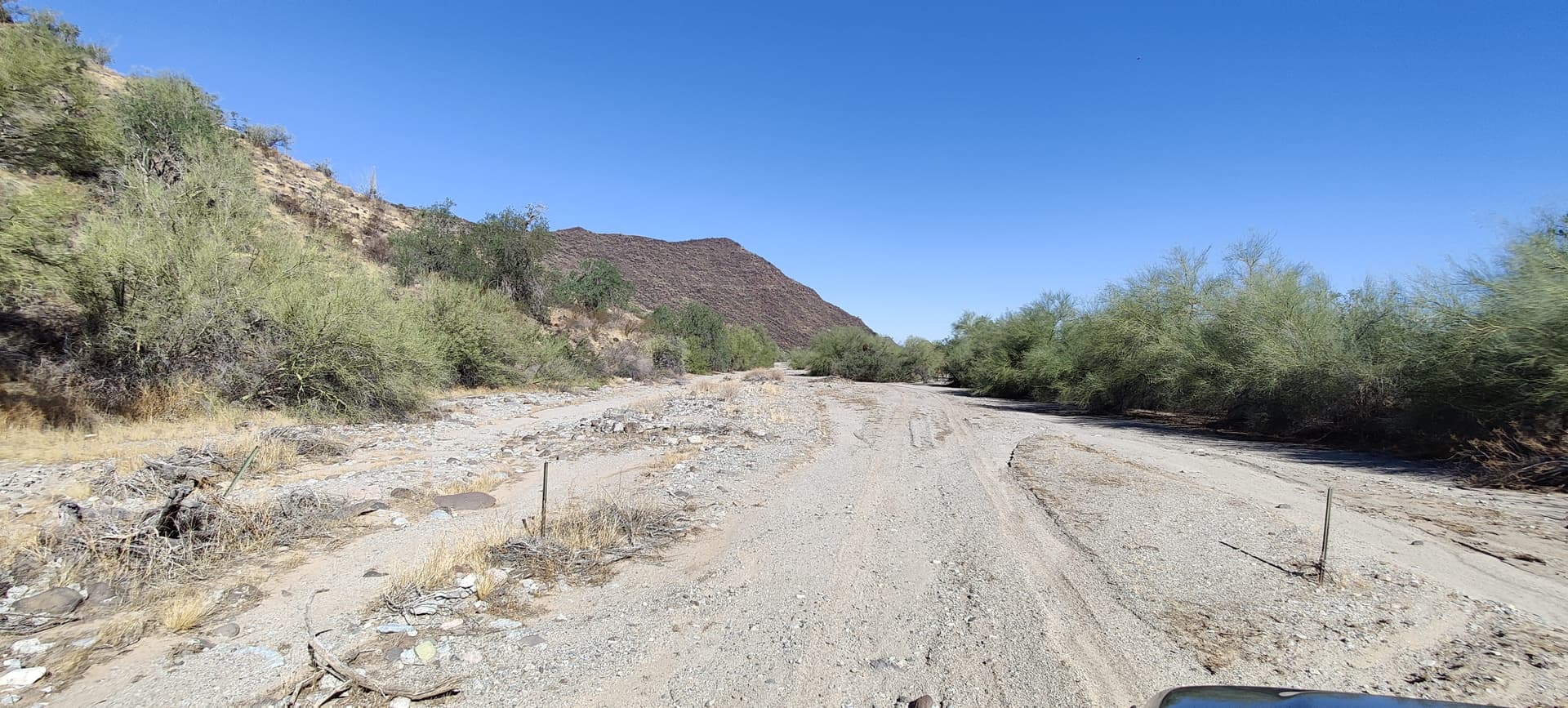
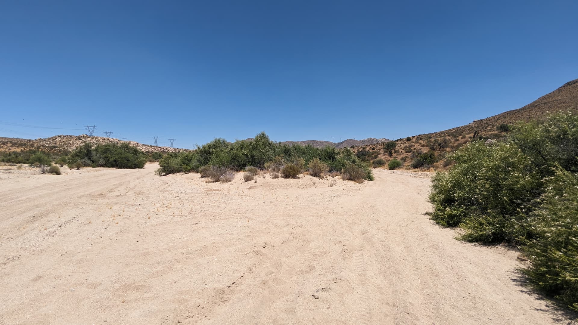
A desert wash in California at 32°37’34.7"N 116°09’03.5"W. Note the larger and more robust scrub in the wash in comparison to the adjacent terrain. The natural=sand/scree/shingle tags imply barren surfaces, which desert washes typically are not. That’s another reason not to use those tags for these features.
Note the pronounced (i.e., verifiable) banks of the wash and the shifting (i.e., not permanent) lines of the water courses of successive floods. Darker sediments in these pictures have accumulated desert varnish as they have been undisturbed (i.e., dry) for hundreds or thousands of years.
For lack of better tagging, I have been using waterway=stream|river with intermittent=yes.
These are waterways in that they are features created by water flow. And when water is present that is where it will flow, it is just that water is seldom present. On the old mailing lists one suggestion that was not agreed to was a way to indicate ephemeral water instead of intermittent.
I am most familiar with these features in Arizona and Southern California but, if I understand what I have read, the desert areas of the Middle East, North Africa, and Australia have similar features. It would be nice if a tagging scheme compatible with other areas with this type of feature have common tagging conventions.
To further complicate OSM tagging, desert washes are often used as routes for motor vehicles during the 99.9% of the time they are dry. Some think that one way dual tagged as a highway is okay. Others think that two separate overlapping ways is better.
Using waterway=stream + intermittent=yes for the course of water through a dry wash like the examples above is OK, I suppose. Water does flow through these areas sometimes, and it’s reasonable to map that as a waterway even if its precise location isn’t verifiable because it changes frequently.
I agree that the combination of waterway and highway in desert washes is a little awkward in OSM. In narrow canyons you can have a waterway and highway that are truly coincident. And in wide washes, validators complain about the waterway and highway “crossings,” which is a fictitious notion in a desert wash. Either it’s dry and you can drive through it. Or it’s wet and you can’t.
I tend to think that the issues with waterways and highways in washes are mainly concerns about style and limitations of the validators. I don’t know if these things are real problems for data consumers.
In any case, the thread above is about mapping the broad areas of the washes, as distinct from the waterways that run through them.
Thanks for bringing this up. I’d love to better establish good natural feature tagging for desert areas, since the UK origin of OSM’s landcover tags makes for some odd bedfellows.
That said, I actually think natural=shingle isn’t such a bad fit for some of the surfaces you’ve photographed. The rocks in those washes are typically pebble-sized and definitely deposited by water as sediment dropping out of a flow. To my subjective eye, at least some pebbles look like they’ve been rounded a bit, though not as much as in a riverbank in Alaska or something. The OSM wiki defines natural=shingle as “an accumulation of rounded rock fragments, usually pebbles and gravel, but sometimes larger, deposited and shaped by movement of water”, and that “the rock fragments are usually well-rounded and lack sharp corners and edges”. This seems to be broad enough to encompass these features as well.
I’m not highly opposed to coining a new tag as well, but I think it would be an uphill battle to secure community support (editors, rendering, etc), especially if it conflicts with existing natural tags used for landcover like sand or shingle.
In any case, the thread above is about mapping the broad areas of the washes, as distinct from the waterways that run through them.
For washes wide enough to map as areas, the old USGS topographic maps often showed them as sand. I agree with your earlier post that they are not always sand and that is probably not ideal. But just tossing out what has been done in the past by professional mappers.
The thing with the rock-like tags, natural=sand/gravel/shingle/scree is that they just refer to the sediment alone. Dry washes have a vibrant ecosystem, and as you can see in the broader pictures, typically more vegetation than the surrounding areas. Arguably, natural=scrub could be a good tag for these areas, except that it wouldn’t distinguish them from the surrounding terrain which would also be tagged with natural=scrub.
But I don’t think we want to confuse the rendering style with the underlying tags. There might be several different tags that could end up being rendered the same way.
I’m in favor of dedicated tagging for dry washes. To me an intermittent waterway is wet a significant portion of the time and dry for another significant portion. Washes are dry most of the time and that makes them a different kind of feature in my mind. The same also applies to dry lakes and ponds.
I am generally in favor of experimenting with increasing the specificity/granularity of tagging. Renderers catch up, mappers get more savvy etc. If we pick a few things now, and they are applied reasonably consistently, we can always decide “Well that didn’t work” and do a bulk edit into the more general tagging.
I was joking with another mapper about how I’d be happy with anything that isn’t natural=water, water=no_water.
If you notice above, USGS doesn’t even bother trying to map the water course through wide dry washes. For the sake of OSM’s data model, I think using waterway=* ways to approximate the water course is worthwhile, especially given the ongoing discussion about mapping virtual waterways.
Hmmm. Maybe terminology has changed since I was raised in the Sonoran Desert area of Arizona, but “dry wash” seems redundant. Though I guess it might help explain what a “wash” is to people unfamiliar with the term.
Arroyo and wadi are two other terms for dry waterways I’m familiar with. I’m sure there are many others. Perhaps rather than using any of these regional terms (none of which seem to be British English) we might build off existing tagging for perennial waterways.
I was thinking dry_stream would be for a wash that is waterway=stream sized when water is flowing and dry_river would be for a larger one. Basically an easy transition for small and large washes that are currently tagged as waterway=stream|river + intermittent=yes.
I’m not super familiar with desert environments, but do washes ever have what would be considered “normal” flow for a non-intermittent stream? Or do they alternate between dry and flood-stage? If the latter, a waterway=dry_stream wouldn’t necessarily be jump-able when water is flowing.
This would be my interpretation. Though I’d probably classify a wash less than maybe 5 meters wide as dry_stream which is a bit wider than I think a stream would be tagged if perennial.
The ones where I was raised basically had two states: Dry and full. Though “full” did vary a bit but usually had water across from bank to bank the variation was how high up the banks the water was when full.