Most of the maps I’ve seen based on OSM data are for driving, cycling or hiking.
Even the tagging scheme is car-centric. Highway=primary, secondary etc. is given according to how important a road is for long distance travel, that is, mostly by cars.
This doesn’t work well for pedestrians.
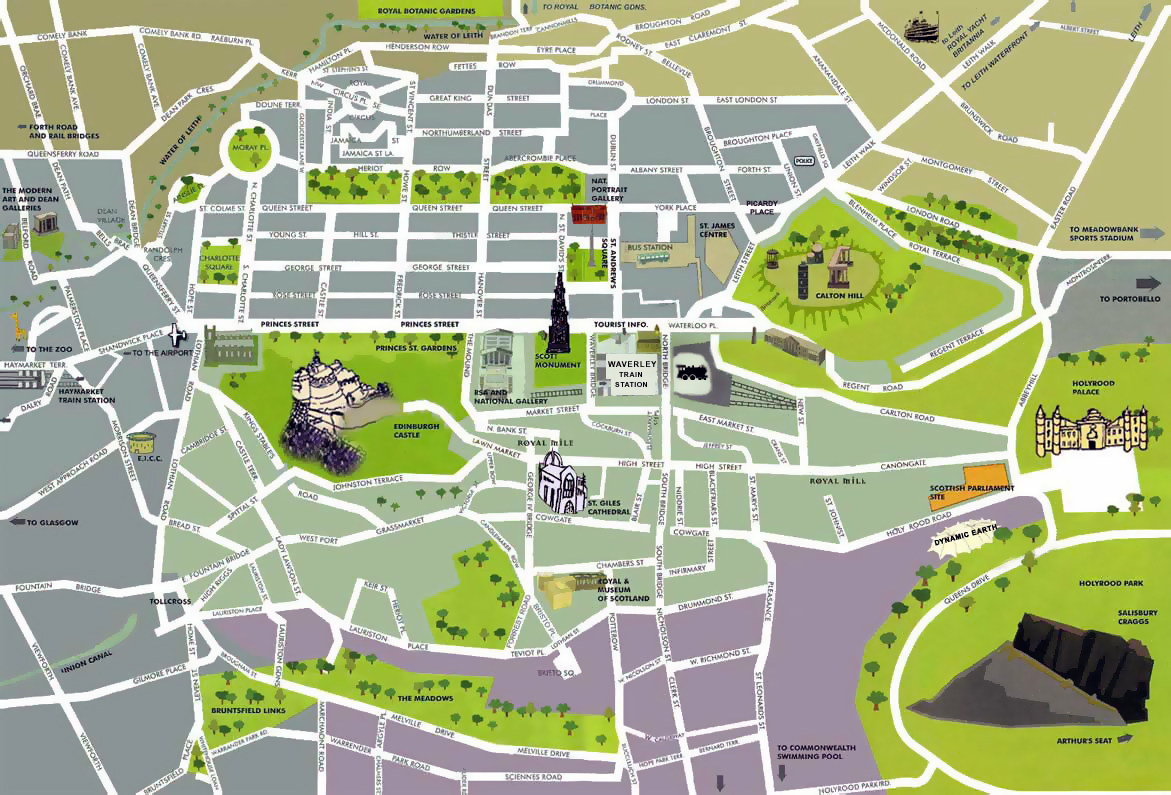
Look at the map of a major European city, and there is a good chance that some of the most important thoroughfares - such as Princes Street, Edinburgh, or Boulevard Anspach, Brussels - are barely visible. This is because they have been closed to cars and (correctly) mapped in OSM as highway=unclassified or pedestrian.
I’m looking for a map style that doesn’t make the width and colour of a road depend on how important it is for cars. Ideally it should take into account areas, width, sidewalk tags, etc.
On rural roads it could show verges and shoulders usable by pedestrians as well as the sidewalk tag, footway surfaces, etc.
This could also serve as an incentive to better map pedestrian infrastructure.
Princes Street is closed to private cars, not fully pedestrianised: it’s open to buses, taxis, trams, bicycles, emergency vehicles…
It also has a very wide pavement and links many of the city’s most important POIs. Whatever the best highway tag is, most map styles don’t try to reflect that. So I was wondering if anyone here knows of a map style that does?
Surprisingly this hasn’t been much explored in OSM. I have seen occasional maps which have experimented with showing (say) more bikeable roads with a thicker line. (I thought I had one in my github stars somewhere but haven’t been able to find it on a quick search.)
One of the principal challenges is that most people’s mental geographies are shaped around the road network as set out for cars. Especially at smaller scales, showing minor roads more prominently than major ones runs the risk of confusing the user’s expectations. That’s why I show trunk roads and motorways fairly prominently on cycle.travel even though they’re usually not bikeable: a lot of people get their bearings by “oh, there’s the M40” or “oh, there’s the main road from Oxford to Chipping Norton”.
Unfortunately, this is compounded by pedestrian/cycle networks often being disjointed compared to car infrastructure.
I suspect you could do a good job of it in many cities. So too in rural areas with good pedestrian (or cycling) infrastructure. To get round network issues elsewhere, you might need to generate through routes using a router and then represent those in the cartography somehow. Footways are doing an interesting job with curated walking routes in London, and SlowWays is broadly equivalent in the rural UK (though their data isn’t open yet, so it’s kind of immaterial).
It would be an interesting project - go for it. Perhaps the main purpose of OSM is to enable this sort of experimentation and innovation.
Even the tagging scheme is car-centric
This is a bit of an over-simplification but let’s not get diverted from something potentially interesting by tag-wanking
The unclassified bits of Princes Street are here and here. The tricky bit is that there isn’t really anything tagged there (beyond being closed to cars) to give a nudge to a renderer and say “this is an important urban pedestrian road”.
Outside of town, it’s a very different story. Following lobbying by OSM US, a couple of the US-based map apps now take more notice of these tags and differentiate different sorts of trails. The web maps that I create for UK and IE also take these into account. Designations such as “Public Bridleway” don’t apply to Scotland, but Core Paths do.
For cities, maybe you could use external footfall data to create some sort of equivalent classification?
The term mental geographies captures exactly what I meant. For a pedestrian in the city centre, the most prominent streets are the wide ones, the ones often walked, the ones with many “POIs” on them, and those long straight roads that neatly divide a city into two, that tend to get used as reference points.
I probably chose a poor example. To answer the question, Princes Street, Edinburgh, is two lanes each way, shared by buses, taxis, and cyclists, with tram rails on one of the lanes. It’s a bit of an odd one. Just look at pedestrian streets in any major city. They are rendered (it’s not that they are literally not visible) but they are not rendered as prominently as the roads that cars happen to take if they want to go to a different city. The point is, a classification based on a road’s importance in the national road network does not match up well with the mental geography of people who walk around the city centre. This is fine. I don’t mean to imply that there is a problem with the tagging scheme. It obviously serves a useful purpose.
It does mean that a map for pedestrians has to more or less ignore the highway tag and look at other data. I don’t know if I’ll have time to seriously look into this. I was hoping someone had already done it! Thanks all for your suggestions and pointers to related projects. It does seem like some external data or some postprocessing would be required. From among existing OSM tags, area, width and sidewalk width are obvious choices.
Core paths look like they could be part of the solution for Scotland (Princes Street is actually one!). @SomeoneElse Do you know if the license for this data is compatible with OSM?
Thanks, I enjoyed watching that talk. Old maps, from a time when most people walked (example), often do a far better job showing road width and perceived importance than modern ones. The cartoonish maps made for tourists (example) also tend to get this right.
What you’re describing sounds like a city guide map. These pedestrian-oriented maps typically depict streets as negative space between the blocks, which contain the interesting bits. They may still include some car-oriented details like one-way arrows and parking lot symbols, but the roads aren’t the primary focus.
I think there’s still a lot of ground to break in rendering a city guide map out of OSM data. Among 2D maps, the closest things I can think of are Straßenraumkarte Neukölln, which imitates an urban planning sketch in its realism, and A/B Street, which is more of a traffic simulator. 3D renderers typically also deemphasize car-centric functional classification in favor of physical characteristics.
To achieve the look of a traditional city guide map, the renderer would need to depict roadways at their actual widths instead of some abstract fixed width. Although there is the width=* key and it’s possible to infer street widths using a variety of lane-related keys, it’s difficult to depict the actual widths seamlessly without awkward joints. I think area:highway=* is underappreciated for how it could facilitate urban, pedestrian-oriented renderers.
I guess it boils down to: if you want something rendered, you need to tag for it.
In the sense that information which isn’t there, can’t be rendered.
And, chicken and egg, information that gets not rendered on any map, will not be mapped consistently.
Tricky. The width and importance (for cars) of a road is also important to pedestrians crossing or following it. It’s true that most maps overemphasize roads, in particular the road areas. They don’t scale realisticly when zooming.
I guess with tools like mapbox you could create a style that does not overemphasize motor roads. and emphasizes pedestrian elements. Maybe a few adaptations to the mapbox Outdoors map would give a reasonable rendering, which could make a tagging effort in a articular area worthwhile, which then could trigger better rendering…
Princes Street hasn’t been tagged as a Core Path in OSM - my guess is that (among the plethora of other signage there) it just got missed.
For completeness, usage of the “designation” tag in Scotland can be found here. Compare with here for Wales (a much smaller country) and you can see that fewer are mapped - but it’s obvious less of a priority because of the Scottish Outdoor Access Code.
With regard to the usability of the data, you can see the process elsewhere from the OSM wiki. The Scotland section is a bit light (less of a priority for the reason mentioned above), and the local councils page is missing any Scottish information. In England and Wales, each council releases data, and the licences differ. Individual OSMers have asked each council for licence-compatible data. I don’t know whether the structure in Scotland is the same. You can try the mailing list, but it’s not very active.
Usual shout-out for Peter Gould’s Mental Maps : a great book on mental geographies. Unfortunately it looks hugely expensive on the second-hand market.
In terms of viewpoint there’s a vast range from local inhabitants navigating to specific points to tourists who are interested in a relatively small number of features & routes between them. I’m struck by this 'cos in Edinburgh I avoid Princes St if I’m going from A-B and, for instance, will prefer to use Rose Street which just isn’t as busy (still true if I’m going to a shop on Princes St). I do something similar around Oxford Street in London, and used to have a large number of walking routes between Euston & Charing Cross & Victoria stations avoiding the main roads.
A lot of pedestrian navigation in cities is away from the centre and in these cases I want to know little short-cuts, paths taking me through green spaces as well as routes away from roads with heavy traffic. Mapping for OSM has led me to discover short cuts in areas I know well, and it makes them reasonably visible (particularly as the are used for routing). Even good topo maps are pretty poor at this, and they often don’t discriminate between private and public paths. To date OSM-based maps with a focus on walkers have tended to be oriented to hiking in rural & wilderness areas. There are some interesting ideas pointed to in this thread for consideration of what is needed in urban areas.
Thanks! Princes Street is not signposted as a core path so the only way it could be added would be from the official data.
I’ve done some digging and found that a map and dataset of all core paths in Scotland which would save us from having to contact each council individually. Sadly it is currently “available for Public Sector Geospatial Agreement (PSGA) members and licenced partners only. This dataset is currently NOT available under an Open Government Licence (OGL).” The good news is, more data should be made available under the OGL soon. I’ll be keeping an eye on this, as it would pave the way for adding designation tags to OSM, cross-checking to see if any paths are missing in our map, etc. Maybe we could use some of the tools that have been developed for public rights of way in England and Wales.
For cities, maybe you could use external footfall data to create some
sort of equivalent classification?
It is already intrinsically contained in the grid data. One can assign
to each point in the network the maximum of the lower distance of start
to the point and point to the finish over all shortest routes passing
through that point. This treats detours that are superseded by shorter
ways in the neighbourhood like dead ends and highlights the footways
that are part of long distance routes.
I’ve given a talk
(alas in German, but some impressions on the slides
pages 9 to 13 may give the idea) on the FOSSGIS in Passau about that
approach. It works well for a city like Passau, marking a grid of links
through the city center that are indeed appealing. Beyond the talk
demonstration, this got no feedback, so got a priority too low to ever
implement it.
The issue is that any information with third-party copyright is excluded from the RPSI regs - which may be why it’s currently not available.
But it may well be worth submitting a RPSI request (you can try through Whatdotheyknow or email the appropriate FOI team) and seeing what they come back with. The ICO will deal with complaints if the response is not satisfactory (for example you think there are “unnecessary restrictions on re-use”).
Robert Whittaker (rjw62) is the master of using this legislation. Follow any of his requests on Whatdotheyknow? to see how it’s done: hint, requires dogged persistence, and a fine eye for detail.
Thanks both. For now I just sent an informal email. I got a reply very quickly saying they would publish more data under OGL soon. The chap even helpfully offered to let me know when that happens. I’ll look into other approaches if this doesn’t work out.