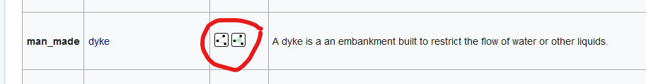
Embankments, such as dykes but also embankments carrying roads and railroads, and one-slope embankments. The fact is that OSM has defined the tag man_made=embankment as a line indicating one crest line for one slope down the right side of this line. Which is fine, because often only one side of a full embankment qualifies for useful mapping. If two sides qualify, just map both sides. Can’t get more flexible than that, and it preserves all existing data without any alteration. Yes there can be some confusion when talking about an embankment. I wasn’t sure when I started the topic, or I would have specified it in the subject line of this topic, that we will continue the one-sided approach, and where necessary just map two sides separately. Then it doesn’t really matter if a dyke is one or two embankments, and if our bosom canals have a full (two-sided) dyke at each side, so in fact two crestst, four crest kink lines, four slopes and four toes. You just map the slope or slopes that you feel need to be mapped. And you map them as simple or as rich as you want; keeping in mind that a renderer can only render the information you enter.
So far, I see no special case for Dutch dykes, except that they will often need the richer mapping (crest to toe) to provide the necessary information.
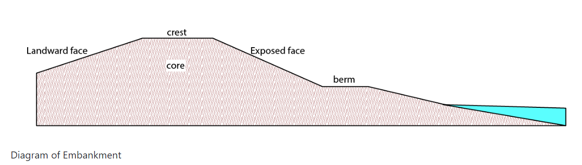
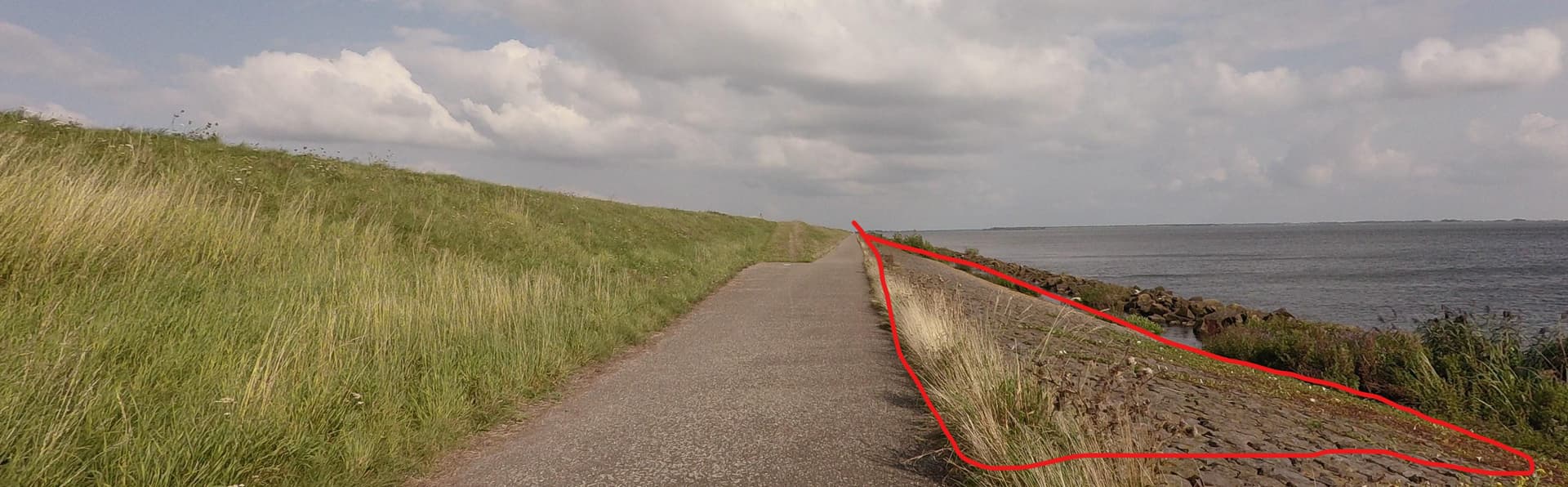
The thing we want to add is where the embankment slope stops, especially when the situation gets complicated, which often happens.
About the flat sections in a slope. Train and road embankment usually do not have these, large dykes usually have one flatter section in the slope. This may or may not be worth mapping separately. If there is a road or cycleway on it, one would assume that the slope stops at the road side, and if it resumes at the other side, you may want to map it as another man_made=embankment line. A toe line would only be necessary if the mapper thinks it is worth it.
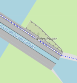
If it’s not a dyke but a series of flat terraces with embankment slopes in between, you may want to map the slope toes to show how much flat terrace there is between the slopes. Fits perfectly in the embankment crest-embankment toe model, no matter if it is implemented as an area or as two separately rendered lines. Again, if the landuse of the terraces differs clearly from the slopes, you may not feel the need to map the toe lines.
( That is not-mapping for the renderer, I think? Which is fine with me, it happens all the time in OSM-wonderland.)
It all fits within this simple model.