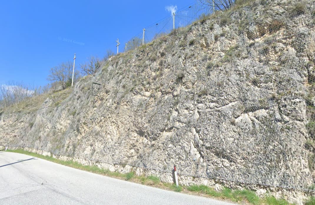
We got many tens of miles if not hundreds in the region… roads laid in rock cut outs, and since it’s rather unconsolidated, netting and barriers to catch what comes of the rock wall and mountain slope. The barrier on top is of avalanche protection type, but what is that rock wall called and do we map this?
There is the key cutting=yes to be added to a way which can be used for a U-shaped cutting (both sides of the road) or for a cutting on one side only (cutting=left/right) which is normally completed by an embankment on the other side of the way. I have used this key a couple of times but it will not be rendered in carto (contrary to embankment).
A separate key man_made=cutting (in completion of man_made=embankment) is not documented and has only few uses as @Mammi71 already mentioned.
Although the tagging of embankments and cuttings should be quite simple there is no comprehensive scheme for both. There was an extensive discussion recently about the use of man_made=embankment here
and a lot of what had been said there applies to man_made=cutting as well. Would be great to have a scheme for all kinds of embankments and cuttings including a full documentation in the wiki.
I have no idea about a tag for the wire net cover - I myself would not tag the separately at all.
For less detailed mapping, there is documented cutting=yes on high-/rail-/waterway - the opposite of embankment=yes, so to speak.
For detailed mapping of embankments, man_made=embankment is well documented and widely used. For the opposite, no equivalent is documented in the wiki. However, according to taginfo, there are about 180 uses of man_made=cutting. This is probably not rendered.
But be careful:
there could also be confusion with cutline.
there could be many cases where man_made=embankment was used instead of man_made=cutting
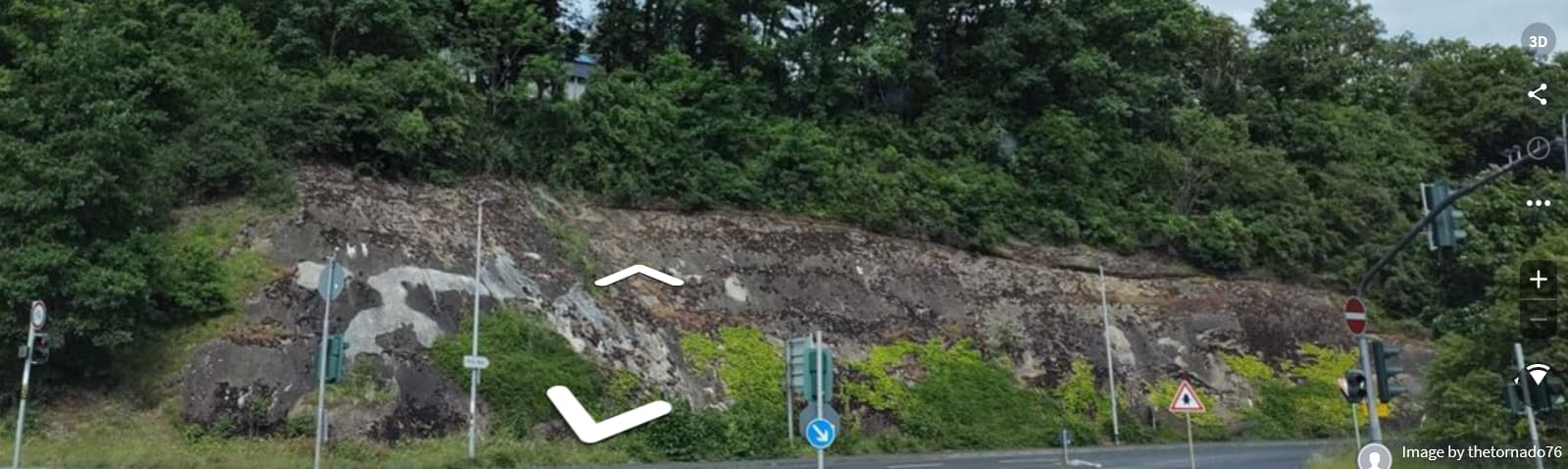
there could be cases where natural=cliff was used instead, although this is not natural.
I recently replied to a German mapper colleague who also misses man_made=cutting: let’s use it and let’s document it. And we should ask osm-carto to render it in the same style as man_made=embankment.
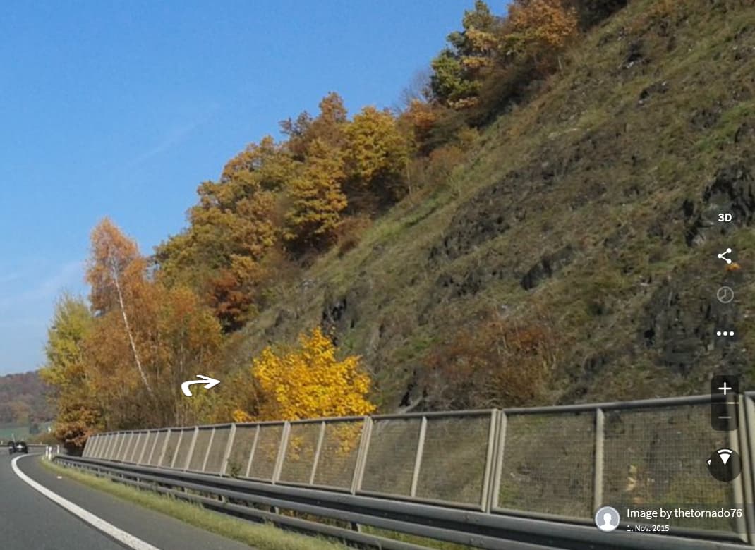
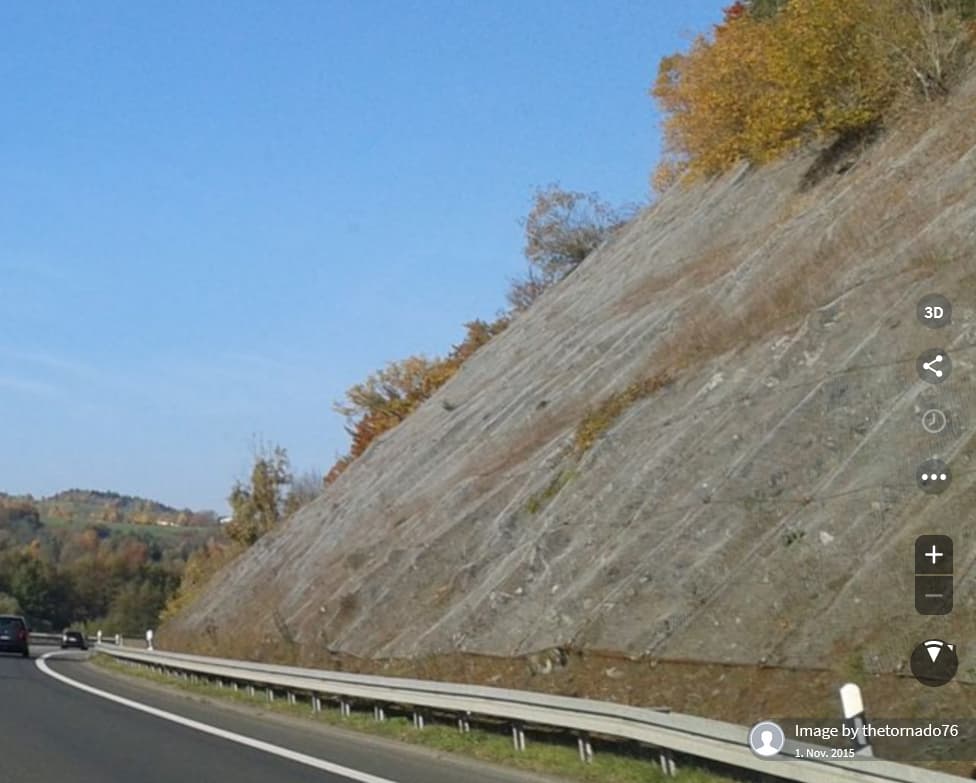
cutline I use exclusively for ‘thru’ i.e. something the same on both sides mostly scrub and wood and mostly for pipeline, power lines, aerialway, piste (ski zones), firebreak and often too have for convenience a track used by farmers and service/maint vehicles. In a way it becomes a rockface.
Embankment I see as an artificial elevation… the avalanche protection conveniently shields from falling off the artificial cliff, and knowing the local public safety constabulary, they’d put otherwise fencing up as they do around tunnel entrance and ‘cutting’. Cutting is a tag that goes on the road, at least can’t remember it having gone anywhere else. I’m unsure with the 1 sided, the other side guard rails or railing in stone as is the case here.
Thanks for that…
Reading the cutting wiki you sold be me on the cutting/left (700 uses) / right (1400 uses). The yes may stand as that is the general understanding, some will be scratching their heads what then the diff is of yes v both (900 uses) where JOSM only offers no/yes as answers. Might be a case of a custom preset whipped up in a jiffy with easypreset.
I’ll wait a bit for any other input, then will tag it as resolution.
ciao
(think I forget to do something to the OP allowing a thumbs up on individual comments in this thread… only the voting function shows.)
For cuttings in soft ground with vertical sides, I use barrier=retaining_wall (because this is what is built in these cases), while for cuttings in rock, maybe natural=cliff can be used if the result is vertical or almost vertical?
I never mapped these safety nets and anchors, but from my understanding they could be mapped if you are interested in. I guess, in this case we should have 2 methods at least: as a property on the road and as a property of the cliff, or some of these might qualify for mapping them as their own features.
Maybe something like rockfall_protection could be used as a key? Values could be something like drape, fence etc.
How exactly would you apply this tag? What do you draw?
Bottom line/top line/slope area/…
Direction (which side is low).
If rendering is to be the same as for man_made=embankment, then the “points” are to the low side, and you would want to tag the upper crest of the cutting slope?
I think precision would be a bit harder than with embankments, most cuttings I know of are not straight lines or nice curves from beginning to end, they tend to use natural formations enhanced with brute force.
Except the cuttings in Nederland, which are mostly like retaining walls under viaducts and at tunnel entrances.
It became convenient because large areas along sections of the ‘cutting=left’ (given the way the road was drawn), is bare rock slopes i.e. the near vertical cutting is invisible from above and practically follows the road side, but the aerial shows those barriers as a grey line some meters back continuing thru the scrub fringes too for a long stretch.