I’ve recently made some updates to narrow roads in Chiang Mai that were previously tagged as highway=service + service=alley, and some other misleading combinations including unsigned vehicle legal restrictions tags.
Based on the latest Wiki revisions, Mapillary, and local knowledge, I have re-classified them into more appropriate categories, such as:
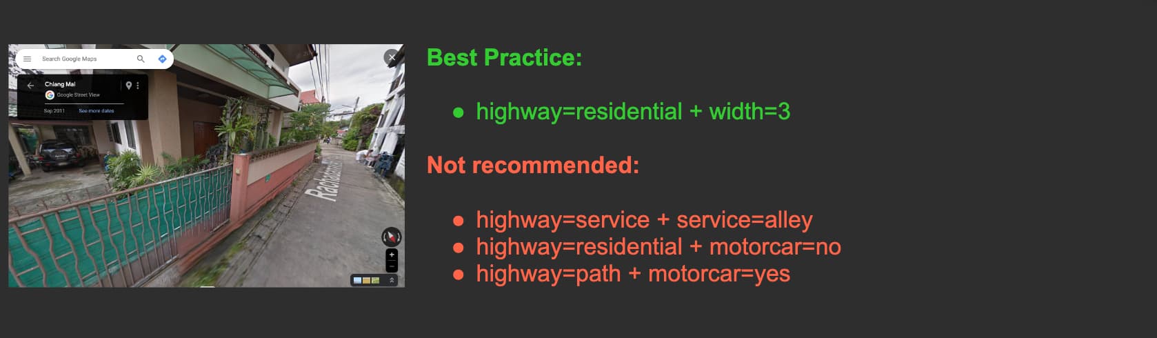
Residential roads wide enough for a single motor car (at least 2 meters wide): highway=residential + lanes=1 + oneway=yes/no + surface=*
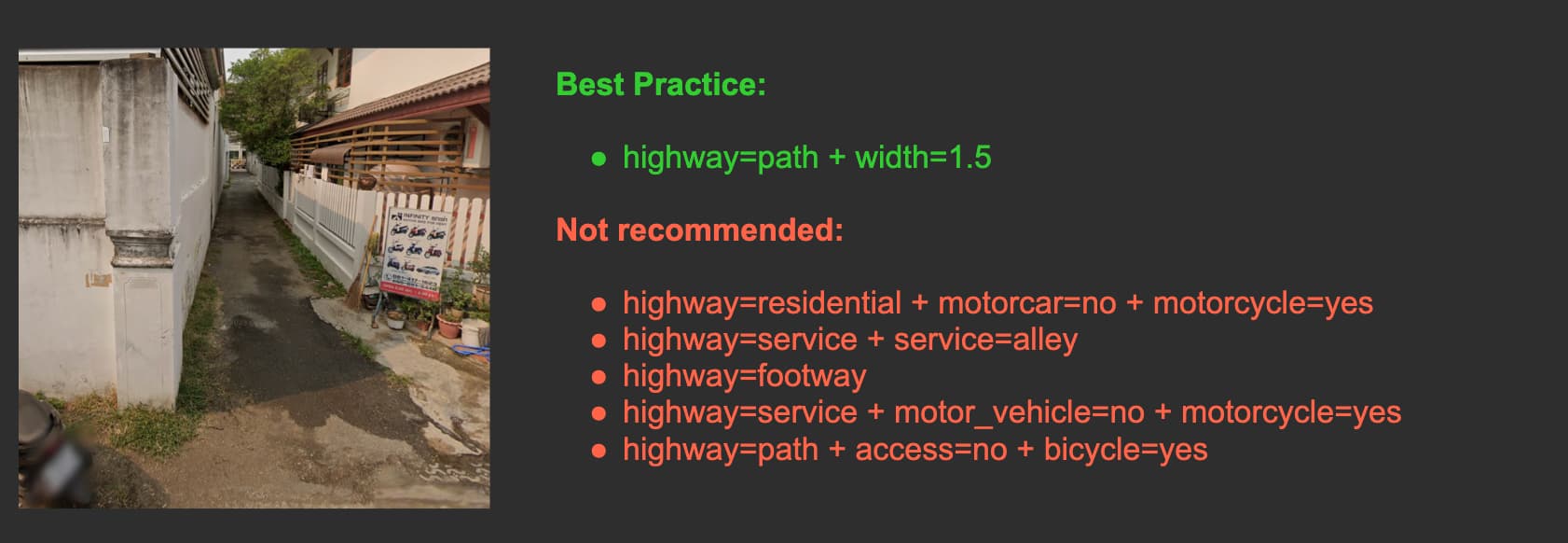
Roads too narrow for motorcars (less than 2 meters), and not restricted to motorcycles via signs/steps/barriers: highway=path + width=* + surface=*
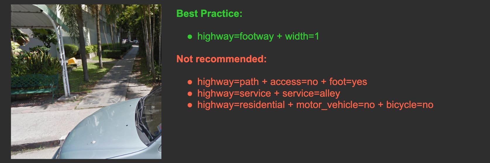
Roads too narrow for motorcars (less than 2 meters), and restricted to motorcycles via signs/steps/barriers: highway=footway + width=* + surface=*
There are still many narrow roads and motorcycle paths in Chiang Mai and other provinces that have been incorrectly tagged as service=alley, highway=footway, and other different combinations. I encourage anyone who comes across these to update them accordingly based on the latest Thailand Wiki definitions.
If you’re unsure whether a very narrow road is passable by car, look for vehicles inside adjacent house driveways. If at least one car is parked inside, it means a section of the road is passable.
I recently reclassified dozen more narrow roads in Chiang Mai that were still inconsistently (re)tagged as either service=alley or using a variation of motor_vehicle=Motorbike-Yes/Motorcar-No and motorcar=no + motorcycle=yes
As per our current Thailand wiki documentation, I’d like to highlight the following points:
It’s generally considered inappropriate to include motorcar=no or motor_vehicle=no on narrow roads without specific signage or obstacles.
Unnecessary legal access tags are hard to maintain and understand for new mappers, and may lead to more misinterpretations.
The tag service=alley should not be applied to narrow roads providing access to the front entrances of residences or shops.
To indicate that a road is too narrow for a car but accessible to motorcycles, the recommended tags are highway=path + width=X (where X usually less than 2 meters).
Determining the passability of certain narrow roads can be challenging; a simple method is to check for the presence of cars in nearby driveways, which are often present.
Including the width tag is crucial to maintain consistency and prevent fluctuations in highway tags. It should be added whenever the width is roughly known (one can add source:width=estimated)
These guidelines are not specific to Thailand but align with global wiki standards. Happy to revisit these discussions if you have a compelling argument for a Thailand-specific narrow road rule. Here are the relevant threads:
@Saikat_Maiti, I have exchanged before with a few of your Grab mappers, but still spotting some inconsistencies in how they map narrow roads. Any thoughts on this tagging approach? Could it possibly clash with Grab’s routing capabilities?
There is a discussion about this rule now, including some Asian countries. In places like Tokyo and Taipei, service=alley was used many times for this particular case as urban planning in Japan and Taiwan is different from English-speaking countries. Thailand might have similar city planning, especially in older parts of cities, where old narrow streets were adapted for car traffic.