I find landuse to be superfluous here on the South coast of England. In nearly all urban cases, the ground floor is retail or commercial, with house=yes in all floors above. This mixed use makes a defined area of landuse disruptive, unhelpful and misleading.
Also, landcover=grass, used for instance to describe a small grass area is not rendered in openstreetmap.org in the same way as it would be for landuse=grass.
This all seems very clumsy to me. Has this been discussed before?
1 Like
There have been a number of mail list discussions about “landcover” in the past. I personally like using landcover=trees, landcover=grass, etc. Because I don’t have to decide what the use is. For example when dealing with trees, are they being “used” for forestry, recreation, watershed management, etc.
But I have been on the minority with this opinion and the people maintaining CartoCSS (for the “reference” rendering of OSM data on the main OSM website) have decided not to support landcover tagging. So I generally will use both the landuse=* and landcover=* tags and my personal rendering looks first for landcover.
2 Likes
I use landuse=grass for non-agriculturally exploited grass patches, city dressing so to speak. Renders fine. The landcover is FAIK a a non-rendering key in Carto standard.
3 Likes
you do not need to do this also with landuse=forest
in every case tagging is the same (see Forest - OpenStreetMap Wiki for gory details)
note that landuse=grass is also suitable for that
There was an extesive discussion about landuse vs. landcover recently here
also including the grass issue … I’d say everything about this issue had been said there.
Btw: landuse=grass is one of the most stupid tags imho but I am using it myself because it is firmly established since ancient times ![]()
2 Likes
Some discussion on the carto bug tracker:
This is often mapped as landuse=retail + building=apartments which describes both features.
1 Like
Looking forward to the day an epiphany hits and the decision is made to render fell as scrub, for Pete’s sake an area on the OSM map the size of Scandinavia looks like it still needs mapping and it catches me out time and again. We have grassland, grass, meadow… even under microscope they look the same. Take a landscape of vineyards and orchards… you really really have to use the 20x magnifier, same in texture and exact same green. For something so up in front for most viewers it sure is treated as the bad orphan.
I’m guessing the you’re talking about “OSM Carto” here?
I wouldn’t hold your breath; just use a different renderer already ![]()
2 Likes
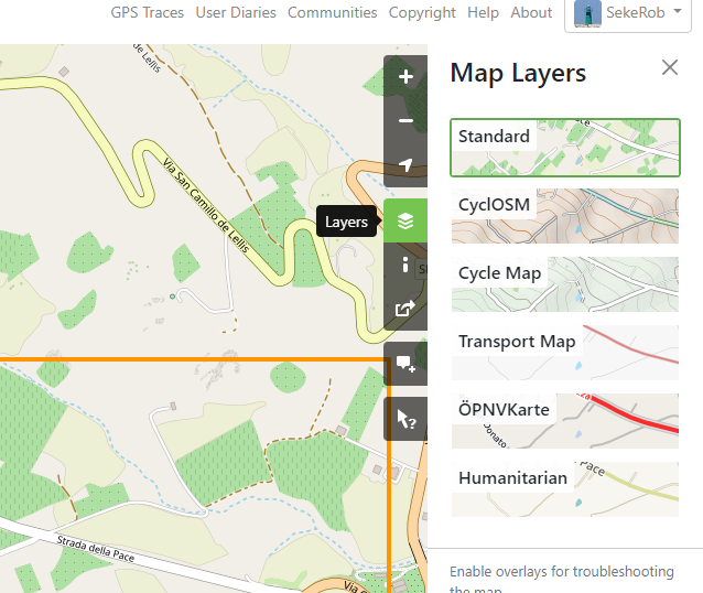
If I knew how to make a ‘best’ or ‘better’ rendering map showing on the OSM site, image below, I’d switch in a heartbeat. It’s where JOSM jumps one to clicking the link to the change set view just uploaded. It’s where I go after uploading a CS to ogle if all shows up (except the building:parts for which I returned to F4 as SGL’s instant updating went AWOL)
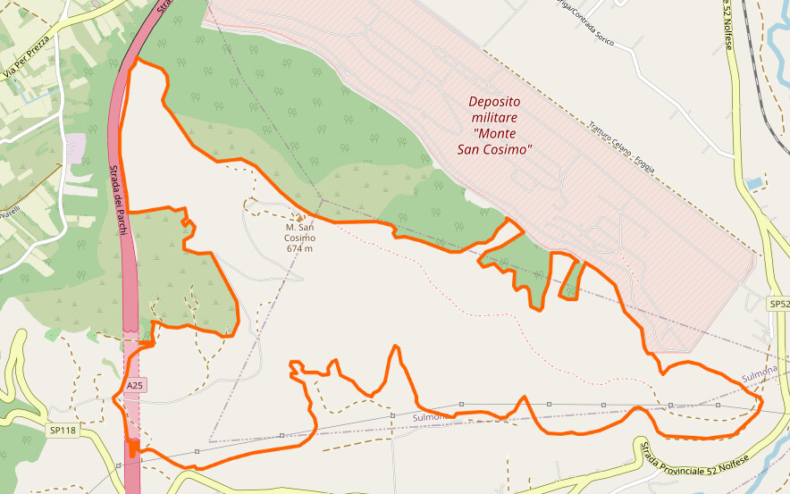
I like the French Carto rendition which for instance shows the (correct) lining on sports pitches (in ID edit mode only) but can’t remember seeing one that actually does have a depiction for fell of which we have some mapped zones here on the mountain slopes such as
Always drawing a blank. If there is one, I’d like to crowbar it into the JOSM imagery selection menu
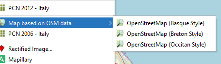
Isn’t that list just based on the JOSM wiki? You can also add your own layers. Before https://josm.openstreetmap.de/wiki/Maps/United%20Kingdom#map.atownsend.org.uk (disclaimer - my site) was added I used a custom entry for it:
tms[24]:https://map.atownsend.org.uk/hot/{zoom}/{x}/{y}.png"
Incidentally those tiles (and the map at map.atownsend.org.uk) is less precious about tags like landcover=grass and might solve some of @UtterClutter’s issues above in the South of England.
Looked at that wiki page not realising it is the crowbar. Italy has poor showings in that list, nothing that is current and covers my region…
(precious or precise, that’s today’s question ;o)
Following this page is pretty simple. Italy’s about the same size as Great Britain in OSM terms; a server to handle a “nice” rendering of it (perhaps even based on OSM Carto, but with some of the low-level gripes fixed) would cost about €15 a month - not a massive amount of money if a few people chip in. Also, OSM Italia is part of Wikimedia Italia so you could try rattling a tin in their direction.
1 Like
A while I ago, I tried to offer a solution but not enough people agreed. While I also begin to see the disadvantage of the :secondary, :tertiary tags, a tag :additional=commercial;residential seems perfectly reasonable to me.
In my experience, urban landuse is really most useful for getting a rough idea of the use of an area, as a corner shop, cafés, and other similar things can be found in residential areas, just as apartments may exist above shops on a primarily retail Main Street or High Street.
1 Like
Speaking as someone in whose vicinity there are lots of fell mapped, I’d prefer those rendered as heath, trust me ![]() Maybe that tells us something about why fell is not rendered in standard view?
Maybe that tells us something about why fell is not rendered in standard view?
It’s funny because we got fell and heath mapped side by side, but than we got grass, grassland and meadow side by side and there’s no telling, but yes, looking at pictures, “if natural=fell than render as heath” would do fine, long at there’s feedback on the standard map that (large) areas have been mapped.
(I like the farmland render as it has light outlines so the plots can be made out).
edit: typos
Usage of natural=fell is a bit inconsistent (in the UK at least when I last looked there were multipolygons, linear ways and nodes with the tag). I ended up with this test (“render as heath unless it’s been mapped on a highway”).
In many ways natural=heath has been the loser here - much of what is mapped (in the UK at least) as natural=heath isn’t really heathland at all.
It’s examples like this why it’s really, really useful for people to experiment with their own renderings and not survive on the thin gruel that OSM Carto supplies!
:sigh:, grass is not really a use. Which IIRC is the whole purpose of the landcover.
Might also work as surface=grass but I don’t think that renders on areas either.
2 Likes
Meadow, pasture, sports, recreation, verge, dike.