Introduce Pathless / Alpine Path / Off-Path?

I wish people new to this path-saga would not use “we have always done it this way” and “there are secondary tags, nothing is broken, move on” as the only arguments for keeping the status quo. Particularly as the many fellow posters here spend a lot of energy proving that things are broken.

In a nutshell:

  • highway=path has so broad scope that it is practically useless in its bare form to deduce practical suitability of the way in question.
  • many routers and renderers, particularly general-purpose ones, currently do not consume those secondary tags, of which there are too many (sac_scale, smoothness, surface, incline, width, informal, …)
  • many mappers do not have time and inclination to add those secondary tags, which would often require re-surveying
  • as a result, people using the map get stranded, lost or hurt
  • one proposed solution was to introduce another highway tag and retag most difficult/invisible trails so as to immediately remove them from general-purpose maps. That would not happen overnight, and hiking apps would presumably consume those first.
  • there are other proposed solutions (refining path=)…

…but please do not pretend as if the problem does not exist. Yeah, it may not be pronounced in relatively mellow topography of Great Britain, but in countries featuring more wild and rugged areas, it’s a thing.

8 Likes

Yes - that’s the key point here.

The UK has 3 different legal systems - England and Wales, Scotland and Northern Ireland.

England and Wales has a whole bunch of legal rights or way, but no general access elsewhere**. Scotland has “right to roam” laws, and Northern Ireland has a series of similar but slightly different rules to England and Wales.

In England and Wales, a legal right of way may correspond to one of

  1. an obvious path of some sort on the ground
  2. a less obvious path, that is perhaps well signposted
  3. no obvious path and signposts, but you can still get from A to B (perhaps across open moorland)
  4. literally no way to get from A to B because it is too dangerous / physically impossible to do so.

Something like (1) obviously deserves a regular highway value. In England and Wales that’d typically be footway or bridleway rather than path because path doesn’t allow the legal status to be recorded properly (but that’s a different discussion to this one).

I’d also happily map (2) as a regular highway value, perhaps in combination with trail_visibility or similar.

I probably wouldn’t map (3) myself, since there’s no highway to add, but if someone’s added it I might not delete it. This is an example of one of those that I linked to earlier. I also wrote a diary entry about a similar one - the photos there tell the story.

An example of something in category (4) is here. The green overlaid northwest-southeast line is a legal right of way. You’d have to hitch a lift with Dracula from just up the road to get across the ravine that the stream has cut, and through the bracken.

The problem that I have with highway=pathless is that I suspect that some people will use it for (2), which I think (as I think @ZeLonewolf said) that that’s perfectly OK to tag as a path. I can sort of see the point of using it with (3), but think that if we had to have the legal right of way from my diary entry in, just designation=public_footpath rather than a highway=not actually a highway would be better. Someone tagging (4) as any sort of highway would imply to me that “this is a route that you can take” when in any normal sense it absolutely isn’t.

** As an aside, I believe that all of these paths are across access land. Technically, in all of these cases the foot access is yes, even if that is moot because it’s not physically possible to do it. designation=access_land has been used for this, but it’s far from universal in England and Wales where it applies.

Editing to also reply to:

As described above, in England and Wales we absolutely have things that other countries would tend to map as highway=path but don’t because of the legal nuances here (among other reasons).

“mostly unrestricted access on foot”, certainly.

In a lot of places, the legal access is available as open data, so if someone wants to create a map that overlays “legal access rights” over “what paths actually exist” they absolutely can do that.

4 Likes

I am reading this through machine translation since I do not speak German, but @gebux expressed exactly why he deleted the paths you apparently added:

there must be a minimum of cairns, climbing marks, cut marks, color marks and the path should be traceable

From that description, it sounds like you mapped a path in a place where there was no trace at all of a path. In that case, I’ve been very consistent with the view that in such cases (@SomeoneElse’s category 3), nothing should be mapped. If my understanding here is accurate, I agree also with the deletion and would probably remove a path marked through open land if I encountered it during survey.

2 Likes

Some of it, yes.
It was deleted based on “knowledge”. I went down that route a few days later and found dozens of cairns along the way. They were strategically placed at locations where one could easily get lost. Nothing on the grassy part (the route is kinda obvious and there are no stones to use), then again a few cairns just before the cliffs. The photos have been added later (Weglose 'Wege' im Hochschwab - #16 by _MisterY). A decent section of that day’s tour can also be found on the Austrian Map.

To me, that is still a valid path but the “community” opinion seems to be that it isn’t. It is certainly more accessible and marked than some of the well-known paths that I’ve been to later, and which are mapped as paths (i.e. Pathway=* for ways not used by or intended for cars - #144 by _MisterY).

What is missing is a clear guidance on what a path is or isn’t. Every participant seems to have their own criteria of what a path is - “there is nothing on the ground”, “it needs to be known”, etc. In the end, I just added the cairns and let it be.

However, having some kind of separation between types of paths (exactly the kind of distinction that is made for roads) would be useful.
This is depicted on a legend of maps of alpine countries and listed in the “Examples from Different Maps” section at Documenting solution proposals for `highway=path`.
The sac_scale was starting to look like one solution, being the tag on which someone can rely for difficulty.

1 Like

Given I was around when highway=path was formalised, I don’t think that applies to me :wink:

My argument is that this is primarily the user’s own fault for not having sufficient common sense. Furthermore, I’m arguing that it would be worse overall to have many more useful and not-in-an.y-way-dangerous paths excluded from maps and routers, which is what would happen if there was a new highway=* value.

The question really is whether paths that aren’t entirely visible on the ground, but nevertheless form part of a valid/recognised/legal/least-worst route are best rendered on maps and available in routers by default. I think they should be, for the reasons I’ve set out above.

I’m not “pretending that problems don’t exist”, I just think the issues you’ve raised can be sufficiently dealt with by the use of secondary tags - by better documentation and by encouraging their use amongst mappers and data consumers.

3 Likes

@Robert_Whittaker @ZeLonewolf Do you ever use these pathless/off_trail paths? Somehow it seems to me that main opposition to somehow change tagging of highway=path is from people who are not very active hikers and certainly never actually do go off-trail. I wonder if this is true or not?

IMHO this is just hyperbole. People get stranded, lost or hurt not as a result of using a specific map or another, but either because of natural events like landslide or rockfall (so you can do little about), or because they did not prepare sufficiently for the environment they were going to and underestimated the dangers. These kind of accidents usually happen to unexperienced people in the mountains, before there was GPS it happened with paper maps. It is natural that a “path” in London or Rome can look very differently to one on the Mont Blanc, and you must expect it when using a map, even if both are just a white line that looks completely the same.

2 Likes

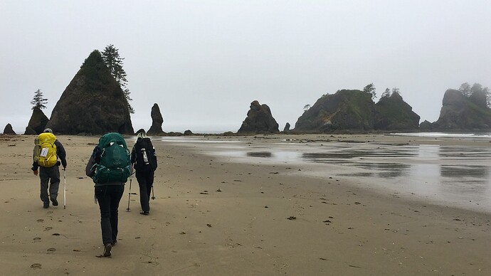
A path can certainly be on sand. Here’s a sandy path:

Sand path through grass field (Unsplash)

I do make a distinction between the above visible path, and a well known hiking or walking route that just follows the shoreline. This doesn’t say “path” to me:

It’s just “make your own way across the beach”.

3 Likes

It’s not an issue that a “path” in London looks quite different than a “path” in Mont Blanc.

It’s an issue when one “path” in Mont Blanc looks completely different than another “path” a hundred meters away.

And I’m not being hyperbolic at all.

2 Likes

Dunno, I am kind of experienced (over ten thousand km walked and scrambled in all sorts of terrains but probably mostly mountains) and it has happened to me several times that I found myself somewhere based on OSM where there was no path and I was not entirely happy about being there. I never got hurt (maybe thanks to experience), but just blaming a user is not the best response. I deleted the outright dangerous ways, like unnecessarily going over a glacier under a lot of rockfall when there was a perfecly safe not-even-scramble pathless path half a km in a different direction and rerouted some to a more sensible path [though they were pathless, haha] as who am I to delete them.

A very good safety model is the emmental model and one hole in there are good maps. We can do better than tell users that when we mislead them, it is their mistake.

8 Likes

Not to broaden this already extensive discussion, but I will :slightly_smiling_face:.

highway=path is also used to map cycling opportunities for both casual cyclists and experienced mountain bikers. These users may be, for example, trying to cover all of the roads in trails in a given area (e.g., wandrer.earth users)

Visibility=* is helpful, but more is needed. The allowed access bicycle=yes tag means a route is legal, but that doesn’t mean that it is passable. MTB:scale=* is helpful for maintained trails, but does not seem widely used and certainly not for casual hiking trails nor does it help much for recreational cyclists vs. MTB users.

Words that come to mind include “disused”, “impassable”, “MTB:necessary”, or even “bicycle=legal_but_you’ll_have_to_carry_it=often.”

I just want to make sure that any significant reworking of highway=path includes some consideration of the wider user base.

1 Like

I think it rather depends on “whether there is actually a path there or not”, and by “path” I mean something that someone would look at on the ground and say “yes, there’s a path from A to B”. That might be a gravel farm track, or it might be a route between cairns across moorland, or it might be between two English/Welsh “public footpath” fingerposts across an otherwise featureless field or along a beach. In all of these cases there’s obviously a path. Where it gets tricky is when that isn’t the case.

The existence of a legal right of way doesn’t necessarily mean that there is an actual path on the ground that someone can physically follow. There probably is, especially if the surrounding countryside is fairly tame and flat, but there absolutely are counterexamples like the ones previously mentioned here and here. You could definitely argue that those two should be added to OSM as designation=public_footpath, with the council PRoW data as a source, but to add a highway=footway or highway=path tag would say that there is something there that does not exist.

1 Like

It’s not true. I lived in Hawaii awhile back and most weekends I would venture into uncharted parts of the forest and locate and map trails. In some cases these adventures ended in dead-ends or near-disaster. For example, I mapped these:

I also personally hiked and mapped the North South Trail, a 77-mile long distance trail in my home state.

Anyways, I no longer live in paradise, but I touch grass all the time. I do think it’s fairly unproductive to have to lay out our OSM résumés in order to participate meaningfully in tagging discussions. The arguments should stand on their own.

5 Likes

Well, yes, I was just thinking that if it were true that only people not using those pathless paths were opposed to them, we were failing to translate our experience into words. That is probably not the case, at least with you.

Don’t worry. That is certainly the case. Just look at the threads linked in the first post. There is a whole list of issues. And if you are aware of more, please add them to the Documenting Problems post.
Here we are just discussing one case, which I thought was the most obvious, alas…

1 Like

I think that is best: Where fire fighters draw / suck water from a natural source. (I wrote that before I looked at wiktionary). Same goes for “weglos”, I now think off-trail is best.

Not true at all for me. I don’t regularly walk on alpine routes, but I definitely go out walking a lot, and will often use routes where there is little or no immediate evidence of a path on the ground, apart from some infrastructure (e.g. a gate, stile, and possibly a Right of Way sign) at field boundaries and roads. But there would still definitely a “path” (in the most general sense) there between A and B: from a legal points of view, because of the infrastructure evidence, and because of actual usage by people. Physically such routes might well fall into the “pathless” category some are promoting, but I think we would absolutely want to show them by default on a general purpose map and have them available to routers.

Here’s a photo of a public footpath across a field in the UK: https://www.geograph.org.uk/photo/528395 . In this case, there’s a clear direction sign in the foreground, and the farmer has marked the path across the field with herbicide. But an equally common situation would be that there’s no sign at the start (just a gap in the hedge) and no indication of the route across the field, save for the exit point at the far side - which you might only see when you’re almost on top of it. I’d argue that there’d still be a highway=path that can be mapped in such cases by virtue of the end-points and usage, even if it’s not immediately visible on the ground at each point across the field.

An example more like the alpine routes that started this debate might be the summit of Schiehallion (that I went up last summer): OpenStreetMap . The top is mostly bare rock and scree. There’s not really anything that physically resembles a path for the last few hundred metres, but there’s clearly an obvious linear route that people follow from the end of the visible trail to the summit. It would be silly to exclude the final part of the route to the summit from rendered maps or routers. It’s where people go, and if you go up there in person in reasonable weather, you’ll see plenty of people following that route. (For those concerned about people’s safety: In this case, the presence of the rendered path on the map arguably keeps people safer, as it shows the sensible way to the top. The absence of other mapped paths acts as a subtle indication that it might not be a good idea to try a different route.)

2 Likes

I see that much as you do: There is no path, there are markers. But markers not a path. In a strict sense that is. Cairns aren’t a path neither, I have yet to observe a path that runs over cairns.

But there are the “hikers” - they want paths, to plan their hikes with a router, and they want everything be a path… Key trail_visibility was recently amended, so markers and treading amount to the same.

I certainly would not call that off-trail what the picture shows, from my limited command of the English language.

Why not? You can follow it, and it was left by humans.

What if someone left muddy footprints on the rock, would that be a path?

How much wear and tear would you consider necessary to call it a path?

Obviously, there is a language barrier separating us: In case of no path just markings, we’d never say, follow the path, we’d say, follow the markings. Or if it was about a natural feature, we’d never say, follow the path, but say, traverse that ledge, e.g.

1 Like