I am guessing you can answer that?
It was a kind of a joke, and I’m aware of such change will never happen (i suppose). But with enough tags on a highway=path, you can define any of the current highways which are used for transportation. Or I’m wrong?
Sure, it’s just more practical to package often encountered sets of tags and give the packages nice names.
The elephant (HGV in the pictures) fits nicely on this path, right from the start. No need to make the path wider for the six-wheeled beast.
Width or Narrowness of path is just a red herring. Sadly, this is so often told to newbies, that width is an issue in deciding between path and track.
Recently been to an area where all the footpaths were mapped track, because wide enough for four-wheeled vehicles. The location was not even reachable by four-wheeled vehicles.
Path is about designation. At least, when it was invented. I read some statements recently in this forum, that path is about lack of decision. I consider that more appropriate.
I don’t understand why highway=path is needed.
Can’t the other highways used, with appropriate tags?
Which other highway variants with which tags?
I mean: cycleway, footway, bridleway.
Probably my question can be deleted. Answering it is just waste of time. This issue has been discussed 10-15 years. I don’t expect the current path discussion in this forum, will solve the problem.
It was again answered in the current bundle of threads. The other question has also been raised: why have cycleway, footway, bridleway, when you can use path + *way=designated. Looks like we’re on middle ground as it is!
The problem is that hiking trails and mountain bike trails do not match the expectations for highway=footway / highway=cycleway.
Only using highway=footway and highway=cycleway instead of highway=path might theoretically solve the issue of cyclists being routed over hiking trails because of the implied legal access (which could be wrong in a lot of cases), but that’s about it.
It would do nothing to solve the issues of normal pedestrians being routed over difficult hiking trails or cyclists being routed over mountain bike trails. In fact, it would make that situation even worse because it would completely erase any distinction.
Isn’t this problem solvable by adding correct tags on the footway/cycleway? I assume such tags must set with “path” if you for example don’t want route pedestrians to difficult hiking trails.
That would essentially be troll tagging.
Cycleway and footway convey certain expectations to users. A normal person on a normal bicycle should be able to use a highway=cycleway. An additional tag=not_actually_a_cycleway destroys that and makes highway=cycleway less useful as a whole. (The same goes for footways).
About simply adding additional tags:
In a lot of cases, we simply do not have tags that can express that easily.
What we do have is a tagging scheme for legal access (access=*) and various tags describing physical characteristics of a way (surface=*, smoothness=*, width=*, incline=*, trail_visibility=*, etc…).
Legal access is, as has been mentioned before, not the issue here. That is usually pretty clearly defined and the tagging scheme is also quite straightforward and unambiguous. The problem is whether it is practical to use a path for walking/cycling.
The physical characteristics of a way can help with that decision, but the problem is that they are extremely tedious to tag and can also be fairly hard to tag accurately.
If I’m hiking along a hiking trail, it’s obvious whether a path is suitable for cycling or not, but there’s no easy way to express that. I don’t want to stop every 10 meters and get out my phone to tag the surface and smoothness of a piece of way, even less do I want to get out a tape measure to tag the width.
Adding these tags remotely is often simply impossible since you really need the on-the-ground information for these tags.
sac_scale=* and mtb:scale=* are the best contenders here, but they also highlight an additional problem: Many data consumers simply don’t know or care about additional tags and don’t evaluate them. Having different main tags for these highways that each have very different implications is a feature not a bug.
That is exactly the problem here. highway=path itself is completely inconsistent and therefore does not convey much useful information. Extending that inconsistency to other tags is not the solution.
1 Like
Not really - there are places in OSM (where I am is one) where footway “is used for mapping minor pathways which are used mainly or exclusively by pedestrians” (as the first line on the wiki page says). There’s no expectation of “urban”, which you seem to be implying. Other OSM communities don’t do this - which is why we’re in this mess.
However, I absolutely agree that using cycleway on mountain bike trails would be a problem - there there is an expectation of “I can cycle on this on something resembling an ordinary bike”.
1 Like
Yeah I’m aware that this is (unfortunately) less true for highway=footway than it is for highway=cycleway.
Overall I’d still expect highway=footway to lean more towards urban style ways compared to highway=path.
2 Likes
I recently suggested on the wiki talk page that this should be clarified, but I am not sure if that is still a good venue to discuss changes to the wiki :-). I think something like this should be added:
path vs. footpath
In some regions, footpaths are mostly used in urban settings and are usually constructed (paved or compacted). For trails outside of urban areas where surface is ground that are often primarily used for hiking (or possibly for moving cattle but also inter-community human transport), highway=path is typically used. In other regions, this distinction is not uphold and it is common to find footpaths in nature.
This sums up my expectations both from reading the wiki and from seeing highway=ṕath and highway=footway used out in the wild - places as far as Europe, Southern America, Nepal or Jordan (and also the way these are rendered, for examply mapy.cz render footway as something with very even surface, possibly paved or compacted, but also other consumers, even JOSM).
However what are the reagions where this distinction is not valid? I think you are from the UK and looking at Lake District now, it also seems to follow this distinction :-).
1 Like
Many data consumers simply don’t know or care
This is why I came to think a collage or various pictures on the wiki for highway=path is a good idea.
2 Likes
I would suggest that here is a more more sensible place than a wiki talk page.
I think it depends on the first or last mapper ![]() . In an area I’m familiar with, here is
. In an area I’m familiar with, here is path and here is footway. None of those are other than foot paths**, so ways like this really need more tags to be useful.
These missing tags can’t be solved via wiki (or armchair OSM) editing; they really need someone to actually go there. As an aside, I created this page to identify problems, and the Garmin maps I create highlight those sorts of missing tags too.
** Edit: actually, I’m wrong - there’s a bridleway that goes up Skiddaw from the southeast!
And what a beautiful mess it creates:
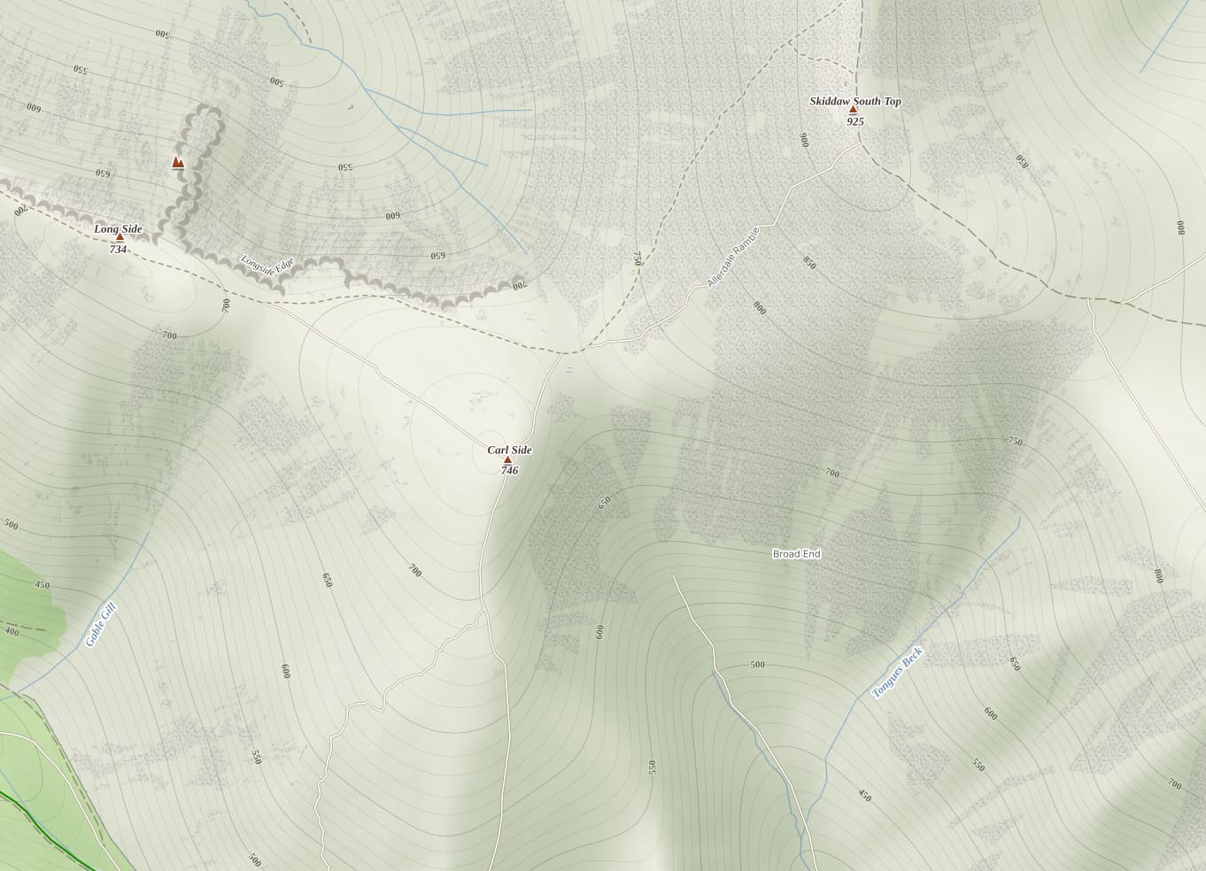
(also is that really a highway=track what goes through Skiddow South Top?)
I am bad with overpass, but I would be curious if one could get a number of footways vs paths outside of urban boundaries (and vice versa). My expectation is that it would be something like 9 : 1, but maybe I am wrong.
Then I will welcome comments on the proposal above.
Aha:
I wonder if a bridleway being rendered as track is sensible, probably not :-). That is an issue with the renderer though.
1 Like
No. To this southeast this track is a bit of an outlier. It’s not entirely impossible - it is an agricultural area (sheep), but I suspect other pairs of eyes might suggest other tags.
What actually is that screenshot from? It looks … less than useful? Compare with my effort (designed to highlight public rights of way, but also shows track vs footway/path and de-emphasises “problem” footways/paths) and Tracetrack Topo.
(Anecdote)
Been there, done that, even before I knew OSM was the base map of my routeplanner. No mountains in Nederland, but some of the hilly woods and wooded/scrubby dune areas can get quite rough, and the planner saw mtb paths as ordinary cycleways. Hybrid touring bikes sporting 5 gears, with luggage packs are not built for that! Still, we managed most of the time, had to turn back only once or twice, and we got very strong from lifting bikes over obstacles.
I’ve got to say, we were on a mission: cycle the outer border of Nederland, on paths on the line or as close to line as possible, any path, and sometimes across the fields or terrain. We did have to mount broader tubes, though.
1 Like