This the third instantiation of trying to cope with reality: There is no use in adding more language to the documentation. There is already too much text there, in my opinion. Still, I’d like to at least change the top picture and I made a collage:
It shows three locations: 1) So called shared use (municipal) infrastructure, that featured highly in the process of proposing the tag. 2) A path in the woods, something that was prominent in the pictures accompanying the proposal process. 3) A (pathless) route in mountainous terrain, something that the tag has been widely used for since the sac_scale proposal, where it played an important role.
Any objections?
PS: At least the picture might help to tell mappers and consumers alike, that all the essence of paths is in the attrubutes.
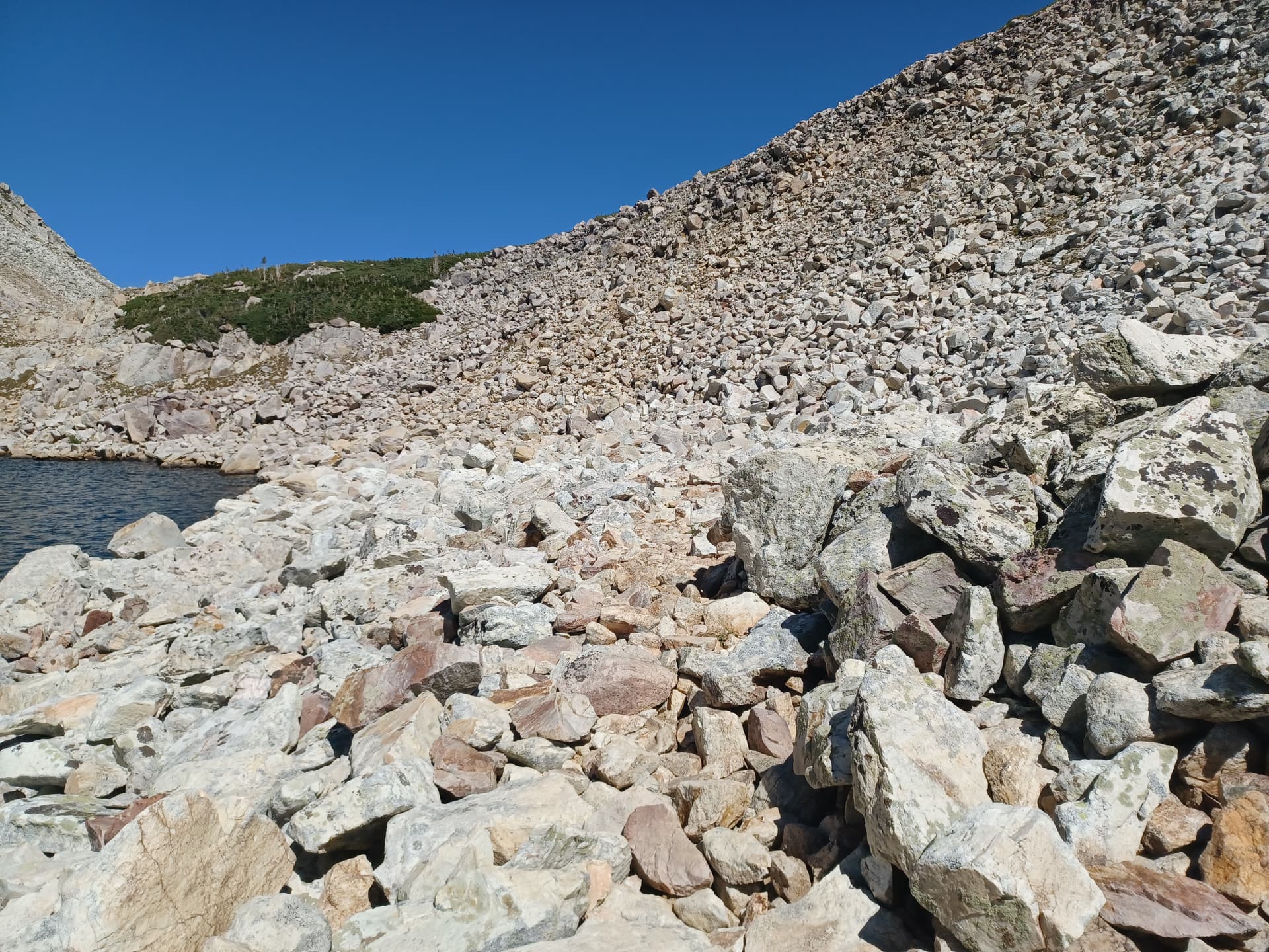
It would be helpful if there were people on the images (at least when there is mainly gravel / rocks) because it is really hard to grasp the dimensions otherwise.
In every pic there are some other objects giving you some idea about the dimensions of the path or the stones covering the ground. Either you can see some trees, some grass or the ripples on the surface of the lake.
Same as above. The rock fragments in the pics of post #2 cannot be pebbles, as those are found in riverbeds and not on rock covered mountain slopes. See natural=scree for this stuff.
I have no problem with dimensionality in all pictures in the collage of mine, neither in those of @tekim s. There is vegetation in all of mine, should be good for size, shouldn’t it?
The trees in bottom of the collage are Pinus mugo (Latschen in German), as typical for where base rock limestone. I took measure in the administrative terrain model: The incline of the cliff is 60° in average and height around 60m to where the scree starts.
I like this picture, because the route is right in front of your eyes. It is only little more than 100m long. It is not a difficult scramble, hands for balance mostly, the only short part where hands for advance necessary hidden from sight though in the lower centre.
The openstreetmap path is tagged T6, a hikr.org user gives T5- and this section UIAA I. I’d say, surefootedness (including height for heights) all it takes. The footholds sometimes smaller than the boot, but plenty and solid rock. And that is good, the route quite exposed: Any tripping or slipping likely fatal. People died there, deliberately or by accident.
Not sure I understand the question: Perhaps you do not see a path in the images of Mike’s? Likely, it is an path with trail_visibility=no?
That rules out all of the sac_scale sample images but the “hiking” one. None of them show any visible path.
I fully understand your concern though: So even when summing the likes for the pro and the contra posts above should give me green light to swap the image on the Wiki, I did hesitate. Because you know: It hurts that 43% in the poll linked above consider it fine to map pathless UIAA III routes as a path – and the picture would support their stance!
So, collage redacted, please click through:
If I were asked for advise on location, in both cases I never would say: “Follow the path to the ridge …” or some such. I’d say: “Your target is over there” and point with the finger in the direction.
For completeness, the “path” in my collage viewn from the bottom point (0) – My friend and I were lying in the grass for likely half an hour debating where to start and traverse. Then I got up, went ahead and it proved easy.
I voted for path with (mandatory) extra tags, because of the current usage. If there were a suitable other highway type, I would vote against highway=path for this kind of passage.
Visibility and self-navigating over an area: I have no problem seeing Nederland’s 100m wide beach as a sand path mapped as the center line, adapted for obstructions. Same as I have no problem seeing a 50m wide traffic area as an asphalt road mapped as the centre line, sometimes not even adapted for traffic islands. If there is a start point and an end point it’s fine with me that people find the best way to cross the area, and draw a way to represent that.
That makes even more sense to me than invisible paths criss cross over a flat pedestrian area to support routing.
Well, a 60° wall mapped as a centre line compares badly with a beach. I do not want to say, there are several ways to traverse that wall and my way is the only way. I just remind: In the wall, a single step in the wrong direction can get you from UIAA I terrain into UIAA V terrain.


