Flat maps are also not that useful or accurate in very steep terrain.
Do you plan such routes/trips before you go?
There were some interesting comments in this panel discussion about people staring at the little blue dot on their mobile device screen as they navigate the wilderness. Timestamp is 32:58 if the video doesn’t start there automatically:

Generally, I mostly ramble and scramble into the Blue. This public-transport, bike, hike trip though wanted planning: Reading descriptions available online mostly. It is a famous route, plenty of material. So to say, due diligence done, as the proponents of mapping a path there say.
PS: For completeness, I do not want to downplay beaches. If I were to the Netherlands and got shown a path where there is the Sea at high tides and people should exercise due diligence … As a stranger, who would tell me?
If you are refering to the images I posted of the US Forest Service trail in the state of Wyoming, the rocks range in size from a large loaf of bread to a kitchen appliance, such as a dish washer. The trail is visible as the rocks are a little worn where the trail goes, and in some cases smaller rocks have been used to fill the gaps between larger ones.
I agree with you generally, but mapping these routes just helps keep the hiker/climber in the approximate correct location when you consider that the combined accuracy of OSM and the GPS device the hiker is using is probably at least +/- 2 meters (and probably worse) - nevertheless, being in the approximate correct location is a lot better than being 100+ meters off route and getting cliffed out or worse.
Even with the most spatially accurate map data, the best GPS device, and the most complete and descriptive tagging, one should consult one or more sources that give a narrative description of the route and provides ground level pictures of locations where it is important to “get it exactly right.” One should also consult recent trip reports because late lingering snow in the spring, and early snow in the fall can dramatically alter the difficulty of the route, as can other recent weather events.
Fact is that OSM often does not tell you exactly what to do. Most roads are usually drawn as one way, neglecting all kinds of details, which you will deal with when you are there, often vehicle dependent, signage dependent, lineage dependent, etc. This is by no means unique for a path. You’ll have to find your way, and if you traverse a traffic island because the way crosses it, or drop off a hill because the path has been washed away, it’s your fault, you can’t put that on OSM, or any map.
If someone doesn’t know that flat sandy beaches are flooded twice a day, without a fixed flood line, well, it’s about time (s)he learned that! Same with paths in rough terrain: they do not tell you which rocks to step on, and obstacles are to be expected and dealt with when you are there.
Now there’s a limit of course; I would not expect to have to take a different side of a mountain. But an area with a more or less clear starting point/line and a more or less clear target point/line, I can accept that as a path, even when it’s steep and not sand. An operator indicating that it’s an unmarked DIY part of a waymarked route (which is verifiable) also helps, it would establish start and target points.
It’s up to the local mapper/mapper community to judge where it’s no longer a path with difficulties. I also have no problem with pathless areas plus half-routes leading up to them. (I do prefer not to include pathless areas in route relations.)
I also would prefer a method to indicate that a connection is not an exact path but may include unmapped obstacles that require the traveler to find their own way to the next more precise location or regular path/road. As long as that is not available, highway=path will have to do!
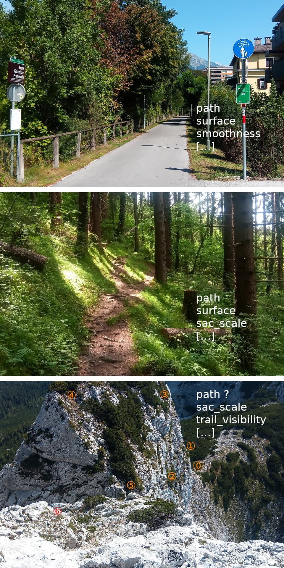
I think it would be best to show tekim’s first photo (with the snow patch) as the third in the collage. As long as “pathless paths” are controversial, let’s not include them on the wiki, because that may later be an argument to include them. With tekim’s photo as the third, I think the point that highway=path can have a wide range of appearances is also very well made.
2 Likes
I found a well researched article, Concerns raised over crowdsourced maps used by popular hiking apps – Learned a new term: crag-fast.
I am still at a loss what to do with this picture - highway=path certainly is the most easy method of connecting waypoints of a pathless route, while debated, it is used.
The main problem reported is that the apps do not render the available information. If it’s that important, they should use all available information on the map. A simple measure could be to e.g. display a red exclamation mark when it gets risky.
That’s one way to look at it, but often less is more in cartography. Many general purpose maps, even if outdoors focused, don’t actually want to display these pathless routes at all. They just want to display regular hiking trails. We make this harder than necessary for them by including both things under the same primary feature tag.
Sure they can exclude combinations including a high sac_scale, a low trail_visibility, etc but the fact that this would be necessary is extremely non-obvious. Welcome to OSM. Paths? Oh yes those are tagged highway=path. Well except some things that aren’t paths are also tagged highway=path so you’d better exclude those. How to identify which ones aren’t paths? Well, there are a variety of other tags that are sometime present and sometimes not…
10 Likes
Really? I would say you can’t miss the fact that almost all objects in OSM come with a set of tags, often defining, often refining. Considering extra tags is always required.
Almost all objects come with a set of tags? I must say the statistics show the opposite. Looking at highway=path on TagInfo we can see that almost 30% come with a surface tag, 4.5% come with trail_visibility, almost 4.5% come with sac_scale, and less than 3% come with smoothness. If these tags didn’t overlap at all, around 42%[1] of highway=path uses would come with one of them, and around 58% wouldn’t. In reality they do overlap so the percent that comes with none of these four extra tags is likely somewhere around 60-65%.
Now maybe you mean almost all objects have the potential to come with a set of tags. This I agree with, and I too would like data consumers to make use of them. However, I can easily forgive a data consumer for not noticing these extra tags because the majority of objects don’t currently have them. By moving towards a separate primary feature tag for pathless routes we could avoid this common oversight.
30% + 4.5% + 4.5% + 3% = 42% ↩︎
1 Like
Sorry for not being clear. Yes that’s what I mean. To know what exactly is meant and relevant details connected with objects, data users have to process extra tags. They can’t be surprised by that. They could be surprised by having to process specific tags that come up in the process of developing OSM. But that, too, is inherent to OSM since day 1, and still going on today. OSM is getting more and more detailed, and data users who do not keep up are missing out.
1 Like
I am a bit bewildered, why AllTrails gets so much of a blame. Their cartography is using a lot of what openstreetmap data has on offer. They even hide some paths, where they consider them not appropriate for their customers (based on sac_scale and informal too.)
A quote from press article linked above: He was bang on the dotted line on the app but he couldn’t find the path on the ground. User error?
Said that, my collage turned into something resembling more like an illustration for a tutorial for mappers and users about how to provide useful information, rather than the picture of something on the ground. It features three panes. A fourth was suggested.
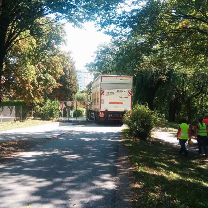
If a term needs four pictures to show the basics of what it means, I say, it is badly designed. I think I am going to stop being a nuisance. Still I’d like to share a picture of yesterdays. It is about paths being to narrow to drive four-wheeled vehicles on them:
3 Likes
I wonder, if we apply that to all terms in OSM, how OSM is doing in terms of design quality…
Four variants in a soectrum is not that much, I think.
A path is as wide as the elephant that walks it.
1 Like
Why not call everything a “path”, where a way goes from A to B, and can be travelled by walking, cycling or by a motor vehicle? And deleting most of current highways like cycleway, footway, track, unclassified, residential, trunk etc.
Separating these new “paths” with: surface, maxspeed, width and different access rules etc.
That was one of the ideas behind highway=path and is what got us into this mess in the first place.
3 Likes
I’m guessing that this might be a joke, but just in case it isn’t…
If we were to do that, it would add literally no information beyond the highway key already on the way. The purpose of the footway … motorway subdivision that existed since the start of OSM was to divide highways into different subsets that different data consumers might be interested in.
That, as people have been banging on about for ages, is the problem here.
3 Likes