Probably someone exported the OSM data as GPX track and then imported it.
So I see here OpenStreetMap :

How to revert it?
Probably someone exported the OSM data as GPX track and then imported it.
So I see here OpenStreetMap :
How to revert it?
They are just public GPS traces, why you would like to revert it? I’m afraid there is no way to block user to upload their traces, is up to you, how you will use it.
Regards,
Grzegorz
it is useless and distracts from actual traces
Hi, You can turn the Public GPS Traces off on the OSM map page. Click the Layers icon (right side of the page), this opens another menu. Untick the box Public GPS Traces, the GPS traces disappear. Magic!
That does not solve the problem.
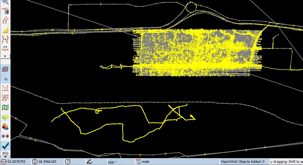
The problem is not the actual recorded and uploaded tracks of streets and roads, but the GPS tracks of the building outlines.
I think the question was how to get inappropriate public traces flagged, reviewed and eventually removed. Now that it was pointed out, I can think of a few ways a creative vandal can create lasting damage using this feature (that I don’t feel like elaborating).
I don’t have an answer, and there does not seems to exist a legitimate way. Even if it would be quite easy to add a reporting mechanism to the traces page, there is no way to identify the source of a trace already displayed on the map.
I don’t think these are GPS traces. I think from the source stated “EMUiA (emuia.gugik.gov.pl)”, they might be an import of a gpx file of the building outlines.
Is it defined anywhere what “inappropriate” mean?
I see no information at New trace page that you should not / can not use this service to host eg. building outlines in gpx format.
Hosting building outlines in gpx format is certainly not what @Duja means by “inappropriate”.
What I mean is that if there are no rules, no one can break them.
But it is not at all about whether someone breaks rules and could perhaps be sanctioned for it. It is simply about removing gpx tracks that are wrong or inappropriate. And for “inappropriate” you don’t need detailed rules in every case, but sometimes just common sense. And why and wherefore @Duja deliberately did not elaborate.
It’s sort of mentioned in the Vandalism Wiki page (see screenshot) but the advice given there is woefully inadequate. It’s a disaster waiting to happen.
There was already a similar discussion in May
There are basically two questions here - how to get “inappropriate” traces deleted from OSM and how to get data removed from the GPS overlay layer in OSM.
There isn’t a good answer to the second question without recreating those tiles from scratch. Given the way that layer is created it’d be tricky to solve the problem any other way.
The answer to the first would be “report it to the admins**, and persuade them that what has been uploaded is so bad that it needs to be deleted”. It would be a “small matter of programming” (which someone would have to volunteer to do) to make GPS trail management easier.
** Actually, as a site moderator (DWG member) there’s a “delete this trace” option popping up for at least public traces. I know that there has been work to level out “moderator rights” across the site, and fill in gaps where some things are hideable and some not, so maybe there are more options here. However, it still needs the offending trace to be identified.
Depends, I’ve investigated OpenStreetMap and converted gpx traces to data layer (right click GPX layer in JOSM). Result bellow.
https://www.openstreetmap.org/user/XYZ/traces
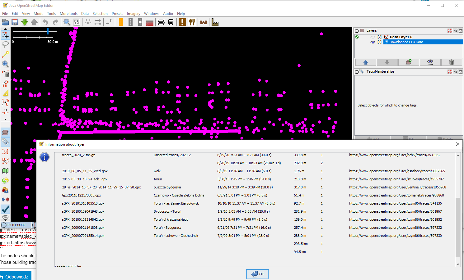
Rarely the trace has actual tags, like:
gpx:desc=Trasa Wiślana: Solec Kujawski - Toruń - Bydgoszcz
gpx:name=solec_kujawski_torun_bydgoszcz_trasa_wislana.gpx
gpx:url=https://www.openstreetmap.org/user/buble/traces/2779945
The nodes should always have time: gpx:time=2018-08-18T10:31:54Z No.
Those building traces have… neither. Puzzling, how come OSM interprets them correctly?
Also, this window exits under right click → info
Which shows that, again, invalid those specific traces have no identifying data beside the latitude/longitude.
Edit: some “real” traces seem to lack time on nodes too. like around OpenStreetMap .