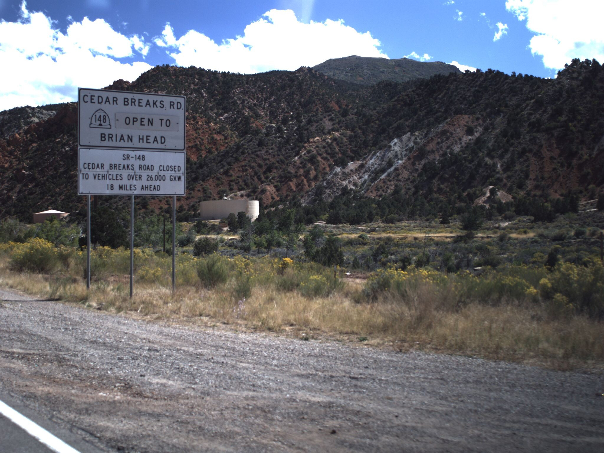
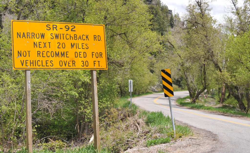
Like most states, Utah doesn’t include any prefix on its state route shields. However, the format “SR-123”, with a hyphen, is the norm on signs in plain text and also in published documents. UDOT is very consistent in this matter, and I’m pretty sure that using “UT 123” would reliably mark you as an out-of-stater among longtime residents.
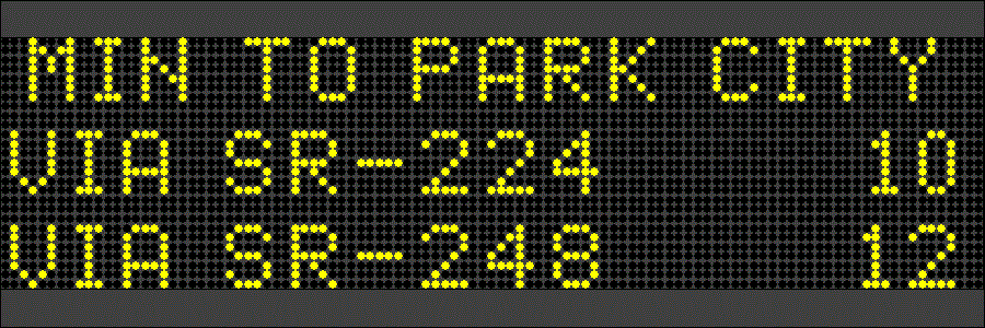
Originally, the U.S. community tended to format ref=* on roadways according to the DOT’s preferred abbreviation, such as on signs, except that hyphens were replaced by spaces to match British tagging norms. State routes in Utah were tagged ref=SR *. However, some mappers preferred a uniform national format of ref=XY *, where XY is the state’s USPS abbreviation. Traditional GPS vendors such as Garmin and TomTom had long used the “XY-123” format. Some in the roadgeek community also prefer this format in writing, for consistency and to avoid having to clarify the state separately when remarking on new road construction or bragging about the roads they’ve traveled.
After the OSM-based MapQuest Open map was released in 2010, there was a push to institute postal abbreviations nationwide. At the time, MapQuest was the most prominent commercial user of OSM data in the U.S. Their renderer was the first to display realistic state route shields in each state, but to do so, it required each way ref=* to begin with the state’s postal abbreviation. By contrast, other data consumers such as Mapbox geocoded roads to distinguish between different states’ route networks.
Mappers in most states went along with the postal abbreviation format, but there were a few holdouts in some states with active local communities, especially Michigan and Ohio, based on real-world usage. (Indiana later went back to the “SR” format.) Tennessee and Virginia also distinguished their primary and secondary state route systems using the postal abbreviation and “SR”, respectively, but out-of-staters usually missed this nuance.
MapQuest Open was discontinued in 2016. By then, the U.S. community had reached a clear consensus that route relations are the preferred representation of a highway route, since the network=* tag on a route relation allows us to encode the route network without any ambiguity. Unfortunately, it wasn’t until 2022 that the OSM Americana project released the first viable reference implementation of realistic state route shields based on route relations. In the meantime, the MapQuest-influenced format has become entrenched in the database. Out-of-state mappers sometimes haphazardly insert postal abbreviations in states that don’t use them, thinking there was an oversight.
On the talk-us mailing list and OSMUS Slack, mappers have often argued that we should do more to encourage data consumers to choose route shields based on route relations instead of parsing way refs. In my opinion, an effective way to nudge data consumers would be to restore way refs that match real-world usage – e.g., ref=SR-* in Utah. This would make it clear that way refs are meant for human readability in plain text, not machine readability. Eventually, we could eliminate way refs altogether, but I think this approach would do more to communicate “deprecated” to mappers and data consumers than any documentation on the wiki ever could.


