Understanding the wiki page on sidewalk

I had just encountered some instances of tagging sidewalk=separate in places where there is no physical sidewalk, and there was no separate line for a sidewalk.

Curious about the rationale, I went to the wiki page for sidewalk=* and started reading. The first paragraph left me perplexed.

Can someone help me understand this?

The sidewalk=* key can be used to indicate the presence or absence of a sidewalk (pavement/footway/footpath) in a public right of way*.* [1] While most sidewalks are parallel a street a sidewalk also can also be a path not next to a street that serves the function of getting someone from the street. A sidewalk can also be in a pedestrian area not served by any street[2]. Position is not strictly relevant to this definition. Comparatively, a footpath is used to travel within a property with the purpose of staying within the property rather than traveling to it.

1 Like

I believe that it’s supposed to suggest the following:

  1. If there is a patch of area where people could walk (paved or not) that is not on the main road, it could be considered a sidewalk/footpath of a road.
  2. Sidewalks/footpaths can be used, even in the absence of streets or buildings that go by it.
  3. Sidewalks/footpaths can be used to stay within a perimeter of an area, rather than exclusively for travel.

Don’t take my word exactly for everything, but it should be a general understanding of it.

That text was added recently (February 25) with the comment “inproved sidewalk definition using FHWA and Acces Board definitions”. I don’t know what the FHWA and Access Board are but I suppose they relate to the links inserted in the text. However, following those links I found it difficult to follow how they relate to the description.

3 Likes

Thank you. I propose to revert these changes. They don’t help, they create confusion.

They could be inserted later on the page, but not in the first sentences.

5 Likes

One other thing to note is that similar text appears in both the “sidewalk=” and “Sidewalks” wiki pages.

I assume the intention is something like: sidewalks in this area are mapped as separate ways; if there is a sidewalk along this street, it’s a separate way. On the other hand, it seems like the prevailing practice is to specify no in the absence of a sidewalk, even if sidewalks are otherwise mapped as separate ways in the area. But as a data consumer, I wouldn’t discount the possibility that a way with a sidewalk only on one side would often have sidewalk=separate instead of sidewalk:left=no sidewalk:right=separate, especially if oneway=yes.

OK, this one seems wrong - though maybe there is footway along road that someone considers as being its separately mapped sidewalk

and doing it this way would be wrong - sidewalk on given way is about this specific way

that is like adding surface=asphalt to all ways just because asphalt is the most common and tagging every singly building as building=house (including supermarkets and purpose-built church buildings) just because house is the most common building type

3 Likes

I notified author of discussed wiki edit at User talk:Flyingember - OpenStreetMap Wiki

3 Likes

I reverted this edit in Key:sidewalk: Difference between revisions - OpenStreetMap Wiki

4 Likes

I am not opposed to including it somewhere but not as basic definition and should have some example to show how it changes things.

And not sure how " Comparatively, a footpath is used to travel within a property with the purpose of staying within the property rather than traveling to it." is relevant, given that sidewalk also can be used to travel within a property, rather than travelling to it.

Also, how sidewalk can be a path not next to a street?

3 Likes

Sort of, but I wouldn’t be surprised if mappers who normally wouldn’t tag like that would still tag sidewalk=separate on both one-ways of a dual carriageway, just as mappers commonly tag cycleway=lane on a one-way without meaning that there’s a bike lane on both sides of the traffic lane.

I replaced the remaining instances of sidewalk=separate in Greater London with sidewalk:$side=separate last week.

I came across a few cases where a mapper had tagged sidewalk=separate on ways within complex junctions which should have been (and now are) sidewalk=no. I think what the mappers concerned were trying to convey was “a segment of highway separate from this has a sidewalk”, but that’s just a guess.

I also came across interesting troll tagging on residential mews with sidewalk=shared, meaning “you have to walk on the carriageway because there isn’t a sidewalk”. They’ve been replaced with sidewalk=no.

2 Likes

I might be able to hypothesize that the mapper was trying to indicate that the combined foot- and cycleway is separated from the carriageway by a grass verge. And the mapper did this on the combined foot- and cycleway, not on the carriageway


Either way, that wasn’t the point at all. I simply removed the incorrect tagging. The point was the wiki page. :slight_smile:

3 Likes

Confusion is the name of the game. Reality is confusion. So the text is supposed to be confusing to show there isn’t a clear standard because there can’t be.

There are people who tag 6 foot sections of sidewalk as footpaths merely because they aren’t parallel to a road or parking lot. It’s not a foot path in the sense of going from A to B away from a road, the building is merely setback.

It’s the same idea that a cycle path isn’t always separated or protected continually. You have to look at context. A biker isn’t going to suddenly ride into the middle of the road because a protected section ends and then merges into a unprotected sections for a few blocks. The cycle path doesn’t make a veering turn to merge with the road to be more accurate to tagging. It’s like that. You know when it’a a sidewalk because it’s continual from a sidewalk no matter where it is.

There’s a really interesting hybrid design at 39.247478, -94.582833 to 39.251669, -94.584343. (google maps has it) Neither the sidewalk or cycle path starts or ends, they split in two and remerge. so despite not being protected it could be a cycle path line the whole length. or could split and remerge. but just adding a tag and visually ending the cycle path isn’t accurate to reality

It’s a problem with demand paths too. It’s a sidewalk even if it’s grass. The material is less relevant than the purpose. it’s not a trail because it’s not paved

Go look at the greater ecosystem. Imagine you’re using this data to spilt apart a formal hiking path from a city walking path that may or may not be along the street. Which one do you use when you’re looking at a courtyard of a building? What about a college campus? What about a city park at a playground or a school? What if the road ends and the sidewalk continues on?

What if the city makes the sidewalk the same width as a cycle path to to go around power poles but there’s no bike lane, path or bike intention?

What if the crosswalk is cycle path width but ends at a sidewalk on both ends, crossing a bike lane, with bike boxes that don’t connect to a bike lane on either side? That one is not yet on any satellite photos.

what if the sidewalk is barely one, but people walk on it. 39.172509, -94.576640

What if it’s clearly a sidewalk, it’ skinny, there’s no biking signs but a municipal org calls it a bike path?

Sidewalks vs paths has an issue, there’s probably 10x as many types as OSM has and the tags don’t always make sense. I fixed an airport to internal corridor, because someone thought “foot path” and that makes sense for it. but somehow it has a tag titled “highway”

we need one halfway between dirt and sidewalk and halfway between sidewalk and path and halfway between sidewalk and cycle path. and how about “you can bike here but it’s not made for it” and how about a walking area that if six paths enter a plaza it creates 15 functional paths automatically for you without needing to be a big thick line
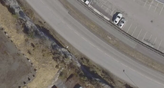
There’s a general “physical separation” principle that determines whether we map a divided highway, bikeway, etc. as a separate feature versus a tag on something else. Unless something has changed in the last couple years, this bike lane only appears to be separated by painted lines and a small buffer. Normally that would be modeled as cycleway:both=lane cycleway:both:buffer=yes on the roadway. It’s true that this can lead some map styles to depict the infrastructure counterintuitively, but standard 2D renderers are only one kind of data consumer we need to accommodate. There are also more detailed 2D and 3D renderers fully capable of depicting bike lanes on streets based on cycleway=lane tags. As it is, routers are producing even more counterintuitive results:

That said, I’m not sure what this has to do with the definition of a sidewalk. Bike lanes routinely merge and split from sidepaths, especially around roundabouts.

2 Likes

Right, and my point is if the bike path still exists it still exists. It’s not a part of the car lanes,

If a bike lane splits then the bike lane exists more than the sidewalk. It should be mapped more than the sidewalk

A tag is a way to not show something And shouldn’t be used when something is distinct enough to argue it still exists.

In that sense a sidewalk doesn’t end because it turns away from a road. The most important part could be the last ten feet to the front door of a big building

The roadway doesn’t just represent car lanes; it’s an abstraction about the whole roadway. A bike lane still exists even if we reduce it to a tag on a roadway. All this means is that it’s part of the roadway. Other kinds of lanes, like turn lanes, are the same; bike lanes aren’t special in that regard.

For a long time, there was a prevailing theory that sidewalk=* tags on roadways were adequate for sidewalks. Eventually, mappers in North America and elsewhere found this untenable due to the often complex geometries we have to deal with (never quite parallel) and the desire to better serve users with special mobility needs. After all, tags just aren’t good at encoding geometry. But mappers in other regions find this fussy, especially in much of Europe, where there’s no such thing as jaywalking and sidewalks are rarely raised. After many, many debates, I think it’s fair to say we’ve gotten to an “agree to disagree” state at this point.

A sidewalk can remain a sidewalk even if it isn’t perfectly parallel to the street, but the walkway that leads to a building entrance is something other than a sidewalk. We don’t necessarily need to leave it as a generic footpath – there are some nascent efforts to establish other categories of footpaths for that, such as footway=residential.

4 Likes

I found the use of “footpath” here and on the wiki page confusing as I’m not sure which OSM tags you are referring to. To me a sidewalk is a particular type of footpath. Do you mean they tag such paths as “highway=path”, or “highway=footway” without “footway=sidewalk”? If it’s the latter, does it matter? Someone walking along a sidewalk and turning to reach a building would be following a continuous footway.

People in general are quite confused about terminology. I don’t think sowing more confusion is a way to improve matters.

The meaning of sidewalk differs regionally. Where I live, the absolutely only thing that is a sidewalk is the one that is raised and separated from the road by a kerb. That’s it. If it’s separated by a grass verge, it’s a footway (or a foot- and cycleway). What suburban Americans call sidewalks, we call footways – but we never build them quite like that anyway.

If there’s truly a place where a sidewalk can run perpendicular to a road, or independently of a road alltogether, or whatever it is you are claiming, by all means add that to the bottom of the wiki page as “In Kansas, a sidewalk can ‘this and that’”, and then the other Kansans can chime in and support or refute that claim.

2 Likes

I followed the link to the FHWA as well, but it seems it’s rotted already. The only similarly-looking document I could find did not mention the claimed traits of a sidewalk at all.

1 Like