Should the admin_level=6 administrative boundaries in Connecticut represent traditional counties, or should they represent council of government planning regions?
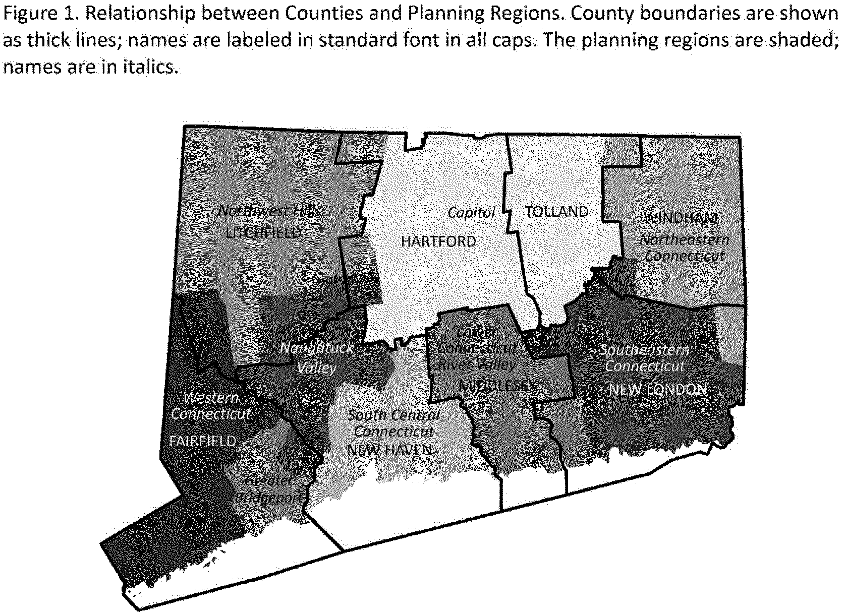
Decades ago, Connecticut abolished county government without replacement, but everyone continued to divide the state into the counties for general geographic purposes. Lately, however, the state has been formalizing its COGs into something seemingly more powerful than a typical COG in another state, but less powerful than a typical county in another state. COGs in other states function more like consortia or NGOs, whereas Connecticut has assigned fixed territories to each COG – the planning regions.
Upon Connecticut’s recommendation, the federal government recently redesignated the planning regions as the state’s county-equivalent political subdivision, replacing counties, at least for demographic and funding purposes. The state is now calling counties “historic” but has continued to use counties for some purposes, including public health reports.
Over the past few years, there have been several involved discussions about whether to retag all of Connecticut’s counties as non-administrative boundaries and map the COGs or their planning regions as administrative boundaries instead. In the database, there has also been some back and forth about how to tag both sets of boundaries, involving multiple mappers.
Currently, counties such as Litchfield County are tagged as:
boundary=political
border_type=county
name=Litchfield County
whereas planning regions such as the Northwest Hills Planning Region are tagged as:
boundary=administrative
admin_level=6
border_type=COG
name=Northwest Hills Planning Region
official_name=Northwest Hills Council of Governments
short_name=NHCOG
Despite the federal government’s newfound appreciation for planning regions, I really wonder whether Connecticuters tend to use them day-to-day as an intermediate-level geography when describing a place. “Lower Connecticut River Valley Planning Region” is quite a mouthful compared to “Middlesex County”, and I have an even harder time believing anyone would shorten it to “RiverCOG” as a place name.
As a starting point, I would suggest the following hopefully uncontroversial changes:
- If the counties are no longer
administrativebut remain in use informally or marginally, then they should beboundary=historic.boundary=politicalis reserved for electoral boundaries, but these boundaries ceased to have any electoral function a long time ago. - The names of the COG organizations should go in
operator=*, notofficial_name=*andshort_name=*. I’ve also created a parallel set of Wikidata items such as Northwest Hills Council of Governments (Q124655976) that can go inoperator:wikidata=*. - The
name=*should omit “Planning Region”; the fully qualified name can go inofficial_name=*. This would be consistent with how agencies such as the Census Bureau are presenting the name. - Continuing the separation between these organizations and their territories,
border_type=*should beplanning_region, notCOG.