This seems reasonable to me. As it is the tag is pretty much technical debt. There’s a few ways around this:
- Keep it as is - this means no work up front, but continual bad data forever.
- Make some minor changes to help clarify it - this may/will cause some things to “break” in the short term but will cause long term data to be more (if obviously not 100%) consistent. Given how broken usage is now, this seems like less of an issue than in some cases.
- Make more drastic structural changes if deemed necessary, which causes more short term pain but hopefully even less long term unreliability.
It seems the community is split between 1 and 2.
Unlikely IMO, I think this is going to have to go to vote vs just signing off informally here. There seems to be too many major directional differences to have minor wording changes sway them.
I feel like fixing the text (or not) needs to come before choosing pictures. The pictures are meant to represent what the text explains, as along as that is in flux then there’s not much point in arguing on the bright lines between values.
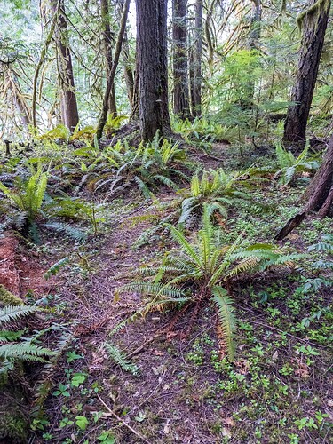
That’s one example of a path - you can have a dirt path in a forest which is unambiguous, and one which becomes faint at times, they would both have the same surface. Not all paths of the same surface type have the same visibility, how often they are used and how heavily they were constructed (if at all) etc play a large role.
This would be an example of a good visibility (and not on the higher side of it), it’s easily followable but not as unambiguous as a clearly maintained trail and if you weren’t paying attention you could step off of it onto a deer trail etc. It’s definitely not a casual tourist trail, but it’s used enough after being abandoned by the land agency to still be followable without having to routefind.
Unless there’s a surface value which would be “dirt with some duff on top of it and some small plants growing” I’m not sure how you would tag its visibility.
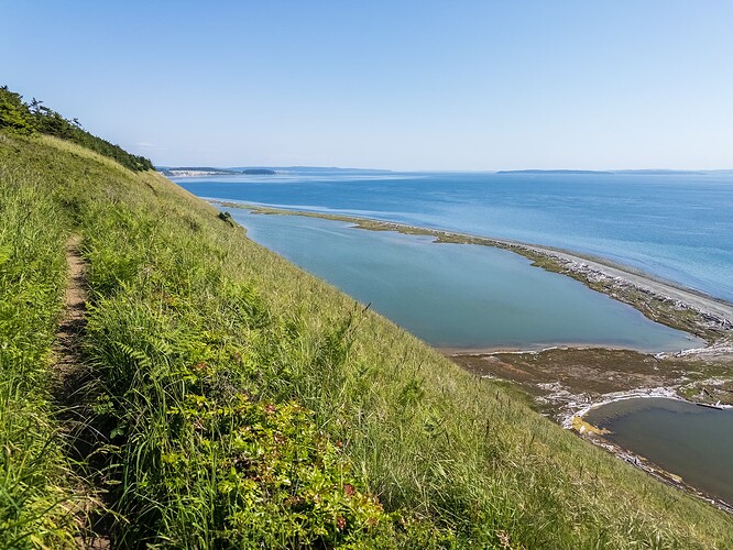
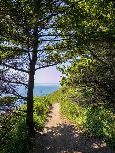
The following, despite being narrow and with vegetation on the side I would consider excellent, the first photo was the least visible it was and someone is not going to confuse the vegetative hillside with it. I could see someone tagging it good.
That’s a new take to me.
I’ve never looked at the surface value of a trail and thought it would be the main indication of how difficult it would be.
I guess you could add a whole bunch of keys and break sections of the trail into different segments whenever the surface changes, but that doesn’t seem like a good idea. You’d have to get extremely specific (are there some ankle high rocks solid in dirt, knee high rocks that are loose, waist high rocks with gaps between them, rocks that slide, etc) with trail surfaces in order to show how “difficult” something would be, and that still doesn’t really address how easy it is to follow the path.
Surface=sand could mean that it’s easy to walk on (compacted like in Joshua Tree) or incredibly tiring and difficult (the fine sand along the old jeep road along salt creek in Needles). I guess you could have surface=deep_sand. A sandy trail could have a nice well worn path in it, or be faint and hard to follow because of wind blowing over it and being only lightly used.
SAC_Scale already exists for “difficulty”, and combined with surface it tells you something, but that’s separate from visibility.
I don’t think trail_visibility tries to solve for all safety issues, including quicksand. If a trail has pools of quicksand in it that’s separate of how easy is it to follow.
Fallen logs often get cleared by maintenance crew on official maintained trails, mapping every one seems like a somewhat ridiculous task.
I’ve come across “trails” in mapping applications that didn’t exist in any meaningful sense, despite having the same surface as would a path that actually exists. Having some level of trail visibility allows for paths that are harder to follow to be weighted fainter on maps, which is useful IMO. Even if it can’t be proven to save a life, being able to see that a path is likely to be come and go etc is useful vs having everything weighted like it’s a well maintained path. This can’t be done solely by surface type, informal/formal, etc.


