The fact is that very rarely, if at all are people mapping invisible (one might even say imaginary) grass paths or if they are other people will delete quickly them.
on rock the situation is quite different
The fact is that very rarely, if at all are people mapping invisible (one might even say imaginary) grass paths or if they are other people will delete quickly them.
on rock the situation is quite different
I don’t disagree. That’s why I brought up grass specifically. Although I’m sure what I said also applies to other surfaces then rock. The question is should there be a whole “visibility” tagging scheme for a wide range of surfaces that could just be tagged as such instead of with a “visibility” scheme because of a few (at least in the grand scheme of things) trails that are rock. Personally, I don’t think so. Especially consider the obvious problems that are inherent to the tagging scheme. Otherwise I guess you could explicitly confine to trail_visibility to just rock paths, but I doubt that will ever happen and I don’t think it’s the best solution anyway. I image rock trail hikers could come up with something better then this tagging scheme for their specific use case if they were forced to though.
you are not forced to use any tags, these are useful in some environments and maybe less in others, just do not add “visibility” if you think it isn’t adding information for the paths you are mapping…
Did I say I forced to use anything? This discussion is about improving the trail=visibility tag, which IMO isn’t possible because the things that need improving are baked into the cake. Your free to disagree with that and respond to it, but at least do both based on what I actually said. The fact is that the tag is redundant in most cases and has issues that aren’t going to be solved by making minor adjustments to the usage or definition regardless. So there’s really only a couple of ways we can deal with that 1. Come up with a different tag for the same thing 2. use tags that already exist and better convey what we are trying to map 3. Confine the using the tag only to the situations where it clearly works, which at least from what I can tell is an extremely small amount of how it’s currently used. That’s pretty much it though as far as solutions go.
At least continuing the status quo of “use it however you want” clearly isn’t working. Otherwise there wouldn’t be this 13 year long (and how many posts latter?) discussion about it. So are we here to figure out a best way forward or just to reiterate guidelines (if you could even “any tag you like” one to begin with) that everyone knows already and no one disagrees with? Personally, I’m here to figure out the best way forward and I think the way to do that is one of the three options that I’ve mentioned, number 2 being my preference. Or at least a combination of 2 and 3 as a reasonable compromise ![]()
BTW, one of the reasons I like option 3 is that I think there’s a probably a much better chance of this tagging scheme being worked out and properly refined by rock hiking enthusiasts within their specific niche where it applies then say by every user of OpenStreetMap within the context of essentially every type of path on the planet. The tagging scheme and this conversation clearly doesn’t scale up well to that wide of a context or audience.
Safety. Did you read the article I linked to earlier? Concerns raised over crowdsourced maps used by popular hiking apps It tells the story of 2 rescue operations that could have been prevented if the hikers involved had been informed about the difficulty (Barf Fell) and visibility (Causey Pike) of the paths they chose. The apps that use OSM data are mostly blamed for what went wrong there, but it also illustrates our responsibility to provide the safety information so that the data users can display it to inform their map users. In the new text proposal, it is suggested to “Add the key trail_visibility to a way that might have visibility issues”. I think it is far more important to add this tag than the surface tag to paths in remote areas: a hiker cares much more about being informed about any difficulties he might meet while walking the path, than where he will be walking on what surface. I tag almost all hiking paths I map with surface=ground because I don’t want to spend efforts micro-mapping all the surfaces of that path, and that’s because I don’t care. If someone else who cares more wants to do that, I don’t mind. If someone wants to add trail_visibility to paths in urban areas, I don’t mind either, but I won’t make that effort myself. There are even mappers who want to map whether electricity poles are made of wood, concrete or steel, and others who like to map the voltage used by trains and trams. I’m not interested in these so I don’t spend time on them, but if others like to spend time on it, I don’t mind.
No, but I’m aware of the general gist of the safety arguments people make as a justification for the tagging scheme. I don’t really think it’s an issue outside of rock paths though. Sure, maybe you could trip over a log with long grass if you didn’t see it, but that can easily be solved by mapping the log and the existence of potential obstacles doesn’t have anything to do with how visible the trail is anyway. For instance a trail can be tagged as trail_visibility=excellent and still step in a goffer hole, break their ankle, and need to be air lifted to a hospital after spending multiple days vainly trying to limp back to civilization while they mumble about how the trail being tagged as trail_visibility=excellent didn’t do anything ![]()
I’ve actually been in similar situations BTW. In one case it was a pretty visible trail that abruptly ended in a pot grow that unfortunately wasn’t mapped. Also, a dog ran out of the woods and attacked me once (well, actually it happened twice, but whatever). At least the trail visibility was excellent in both cases though. So…To repeat what I said early, I think it’s a solution to a non-exiting problem. There’s zero evidence that anyone’s life has been saved or made safer by tagging paths with trail_visibility. And no a clickbait article about “concerns” over crowdsourced maps isn’t evidence. Although I did say I thought it was fine to use on rocky paths since there’s clearly a use case for it. I just don’t think there is for any other surface.
What surface a trail is might be one of, if not the main, way a hiker goes about determining how difficult the path will be. For instance walking across an icy, snow covered dirt path in the dead of winter is a completely different animal then taking a stroll down a gravel one in the middle of summer. Even if you confine it just to rocky paths in the summer the type of rock your walking on can make all the difference. Walking on lava rock is completely different then walking on shale or sediment. Heck, have you ever heard of quick sand? How exactly would the trail_visibility tag help at all in that case?
I don’t mind it either. But again, we are here to discuss and solve a specific problem. Not to just wax poetic about how everyone can tag things how they want or map whatever they want. There’s nothing wrong with that, but it’s not the topic of the discussion. Improving the trail_visiblity tag is. Anyway, I don’t disagree that paths can be dangerous or that those dangers can partially be mitigated through mapping them somehow. I just think that it should be done by mapping the actual hazards. Not tagging a a path with some completely ambiguous tag that doesn’t actually say anything about what the actual hazard is or where its located along the trail. Like I said, if there’s a log in the middle of the path, cool. Map it. There’s no reason to overcomplicate that with something like trail_visibility though. If anything it just makes things more dangerous because it disincentivizes mapping the actual hazards.
This seems reasonable to me. As it is the tag is pretty much technical debt. There’s a few ways around this:
It seems the community is split between 1 and 2.
Unlikely IMO, I think this is going to have to go to vote vs just signing off informally here. There seems to be too many major directional differences to have minor wording changes sway them.
I feel like fixing the text (or not) needs to come before choosing pictures. The pictures are meant to represent what the text explains, as along as that is in flux then there’s not much point in arguing on the bright lines between values.
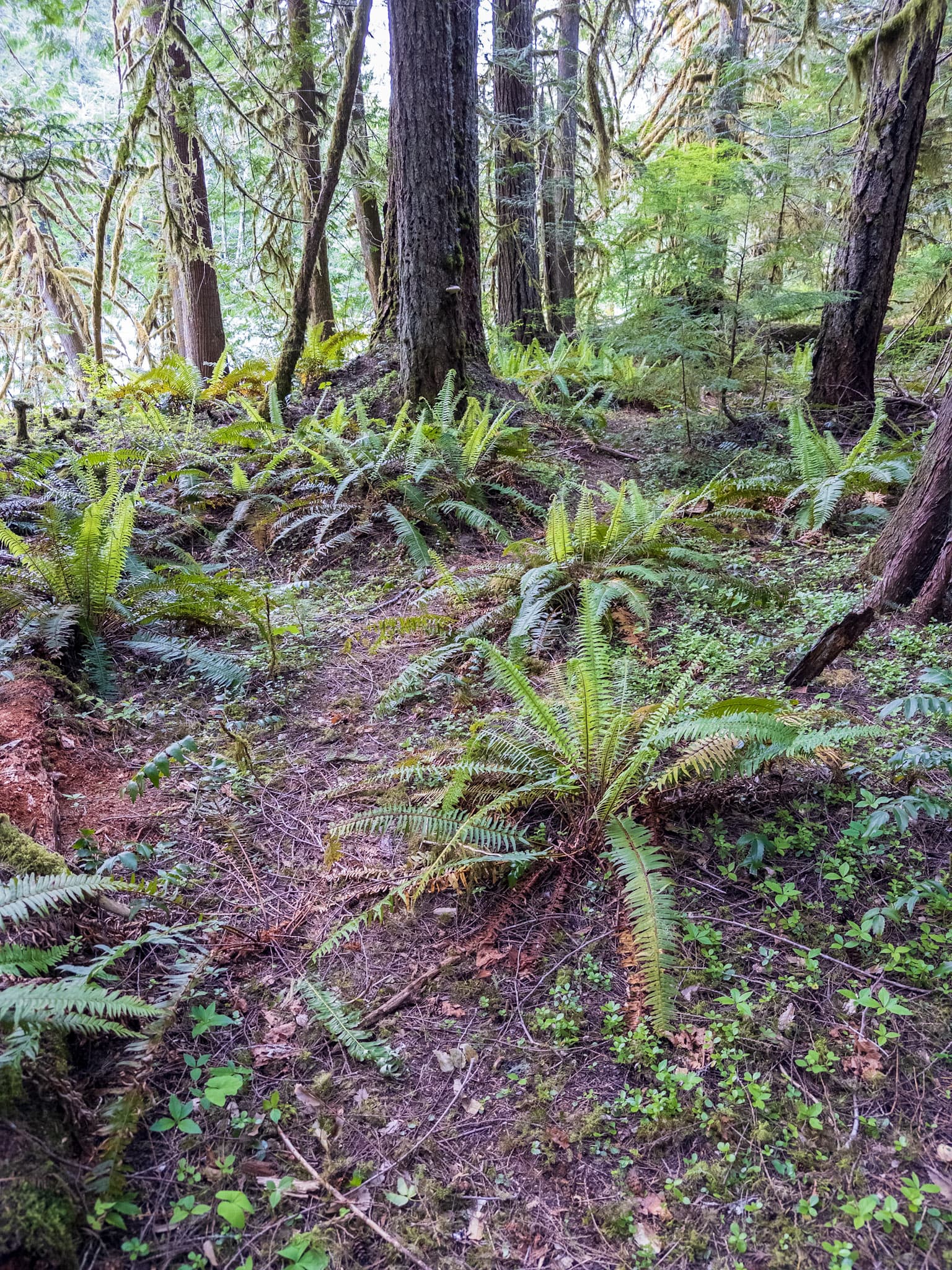
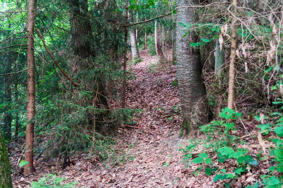
That’s one example of a path - you can have a dirt path in a forest which is unambiguous, and one which becomes faint at times, they would both have the same surface. Not all paths of the same surface type have the same visibility, how often they are used and how heavily they were constructed (if at all) etc play a large role.
This would be an example of a good visibility (and not on the higher side of it), it’s easily followable but not as unambiguous as a clearly maintained trail and if you weren’t paying attention you could step off of it onto a deer trail etc. It’s definitely not a casual tourist trail, but it’s used enough after being abandoned by the land agency to still be followable without having to routefind.
Unless there’s a surface value which would be “dirt with some duff on top of it and some small plants growing” I’m not sure how you would tag its visibility.
The following, despite being narrow and with vegetation on the side I would consider excellent, the first photo was the least visible it was and someone is not going to confuse the vegetative hillside with it. I could see someone tagging it good.
That’s a new take to me.
I’ve never looked at the surface value of a trail and thought it would be the main indication of how difficult it would be.
I guess you could add a whole bunch of keys and break sections of the trail into different segments whenever the surface changes, but that doesn’t seem like a good idea. You’d have to get extremely specific (are there some ankle high rocks solid in dirt, knee high rocks that are loose, waist high rocks with gaps between them, rocks that slide, etc) with trail surfaces in order to show how “difficult” something would be, and that still doesn’t really address how easy it is to follow the path.
Surface=sand could mean that it’s easy to walk on (compacted like in Joshua Tree) or incredibly tiring and difficult (the fine sand along the old jeep road along salt creek in Needles). I guess you could have surface=deep_sand. A sandy trail could have a nice well worn path in it, or be faint and hard to follow because of wind blowing over it and being only lightly used.
SAC_Scale already exists for “difficulty”, and combined with surface it tells you something, but that’s separate from visibility.
I don’t think trail_visibility tries to solve for all safety issues, including quicksand. If a trail has pools of quicksand in it that’s separate of how easy is it to follow.
Fallen logs often get cleared by maintenance crew on official maintained trails, mapping every one seems like a somewhat ridiculous task.
I’ve come across “trails” in mapping applications that didn’t exist in any meaningful sense, despite having the same surface as would a path that actually exists. Having some level of trail visibility allows for paths that are harder to follow to be weighted fainter on maps, which is useful IMO. Even if it can’t be proven to save a life, being able to see that a path is likely to be come and go etc is useful vs having everything weighted like it’s a well maintained path. This can’t be done solely by surface type, informal/formal, etc.
@Hungerburg In regards to the alternative pictures proposal, this wording is still incredibly unclear.
Well cleared path throughout
Well trodden path throughout
A well cleared path would presumably be well trodden, and a well trodden path would likely be cleared of debris. Depending on terrain, having a path be “cleared” or not could have no impact on its visibility. I’m not sure how a trail through a sandy desert would be cleared or not.
“Trail_visibility_really_good.jpg” to me seems to me like a very breaking change - does excellent require a certain width or to have a fence/markers along it? Is this really a proposal for yet another visibility range in between good and excellent.
Path becomes invisible
I don’t think “invisible” is the right word for this.
I do really like having the idea of more photos for each value - I could see having more than two. There’s a lot of different surfaces and situations where a trail could be within a visibility range and having clear examples I think will go a huge way to helping keep thing consistent.
Changes look good to me. In terms of the updated new text proposal I’m not sure that my use of “pathless” makes sense without being unpacked. I do think it is clearer than “invisible”, and it’s shorter than “the path is not visible” or “there are no signs of a path”.
In terms of keeping things short, the one mouthful left would be bad.
A path mostly exists, but the mapped way is partly pathless and you need to be able to continue on for a moderate amount of time before the path is visible again.
to
A path mostly exists, but has sections with no visible signs of a path to follow.
Intermediate could probably be tightened up a little too:
Path mostly visible, but has sections where it is hard to see or short gaps where it isn’t visible but a visible section is within sight.
to
Path mostly visible. It has short gaps in visibility but a visible section is always within sight.
One wrinkle is that perceptions of trail visibility change can be regional.
According to hungerburg’s take the vast majority of the PCT & JMT would not have excellent visibility, which seems ridiculous to me as I and others refer to it as a “highway”. Only “frontcountry” trails next to a road would have that level of overbuilt construction on them in the Sierra Nevada (thinking the paved trails in Yosemite Valley, sequoia tree walking loops in SEKI, etc), they’d be considered visual blight in wilderness.
If many mountain trails in Austria have little rails alongside and whatnot, then it’d make sense that they’d be the standard for “excellent” visibility as that is what people in that region would be expecting.
Fun aside, this is me jumping over the PCJMT after dropping down from an XC lake to an abandoned trail up a creek to a XC pass to an XC basin in order to not defile my boots. ![]()
(I was on it for a few miles before this, dropping onto it from my third XC basin, going over a pass on it, then wiggling around XC to a few nearby lakes, so I’m not an absolutist, I just thought it’d be amusing).
Sure, I don’t disagree with that. But I still don’t think trail_visibilty=whatever conveys anything in those situations either. Let alone help with safety. If neither tag serves a practical purpose at least surface would serve a real world one. If you want a sorta of related example look into some of the paths tagged with trail_visibility=intermediate, which is about 22 of the usage BTW. The tag is essentially worthless until your actually hiking the trail and then at that point your already going to know it has intermediate visibility and where the changes in visibility are. Whereas, surface=whatever is always going to be valuable information for someone viewing the map from home no matter what.
Sure, you maybe you could argue trail_visibility=intermediate is useful because it helps someone planning a hike to filter out those types of trails, but then “intermediate” could mean literally anything between good, excellent, invisible, every two feet, five feet, fifteen feet. So all the person is doing is filtering out trails that they “think” they don’t want to hike because “intermediate” sounds scary, but it’s extremely possible the trail is perfectly visible and therefore safely hikable 99% of the time and the 1% where it isn’t is a tree branch they could have just ducked under or something. Gravel is always gravel though. Everyone knows what it is. If you tag a path as surface=gravel there’s no intermediacy to it. It’s just a gravel path, plain and simple. Anyway, I think you get my point. The thing is completely divorced from safety regardless. Yet that’s the main or only argument I’ve heard from the people who think it’s a good tag.
Surface=compacted maybe? I think a lot of this stuff is baked into the cake of going for a hike to a degree. No one goes back country hiking expecting there not to be some tree branches and bushes along the trail. At least IMO it’s not helpful or ads anything to map things that are inherent to whatever the thing is. The purpose of a map is to show people what’s there that they wouldn’t expect to see or knows exits. Especially if your doing it to make trails safer. Like there’d be zero point in tagging all the trails in the middle of the Nevada desert with the incline. Maybe the ones that are exceptions to the flat land, but that’s exactly because they are the exception.
cultural differences maybe? I’ve never cared about trail visibility. I’ve hiked plenty of extremely vague trails and been perfectly fine and I’ve hiked plenty of extremely clear trails and gotten in trouble. Crossing water ways is a good example of that. If you trying to cross a creek or a river (both of which I’ve done plenty of times) the type and granularity of the rock is really the only thing that matters. Whereas on the other end if I’m riding my mountain bike down a back country trail in complete darkness at 3am all I care about is making sure I stay on the dirt and don’t veer off it into a tree. I can’t think of an instance where visibility matters at all to safety or otherwise. It intuitively sounds safer to hike a trail that’s more visible, but I don’t it maps over to real life.
I’m sure if I asked enough people every one of them would have a different answer about how much safety has to do with it. Which is a large part of the problem.
Sure, I don’t disagree, but then people come along and sweep paths, plants grow and die. there’s land slides, rain washes parts of the trail away, Etc. Etc. All of which effects visibility. Mapping it all and keeping it up to date is a ridiculous task no matter tag your using. So that’s kind of a non-argument ![]()
Why not? Give me one example of a situation where surface type along with other things like mapping the hazards along the trail can’t solve exactly the same problem. And it should be an example that actually exists in the real world to. As a side to that I don’t think there’s any connection between trail visibility and how hard a path is to follow. Again, it sounds intuitively correct, but it just doesn’t map over to real life. Paths can barely visible and easy to follow, visible and hard to follow, Etc. Etc. visibility has nothing to do with difficulty or how safe the trail is. Again, maybe with the exception of rock trails, but that’s it and an extreme edge case. One where surface matters way more (try walking on a shall path versus gravel or sediment in a rain storm or try to cross a river and then get back to me about how the surface isn’t important).
I am not natively speaking English, I just pick up what I read in the context. Obviously, I failed to hit a sweet spot. Cleared for me would imply more than just trodding. And not just marking, but real constructive work.
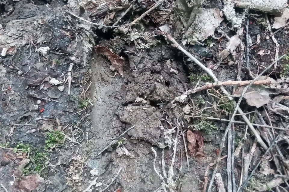
Today I happened on this mapped path, I’d be delighted to learn how to tag trail_visibility there:
Spoiler: Here one of the bootprints:
I guess, I’d have to take all aspects into account?
UPDATE: In German there is only one word for such paths, its “Wechsel”, and only hunters use it.
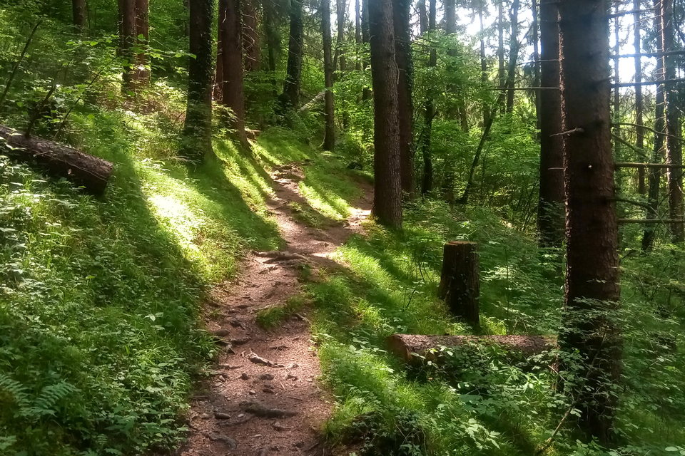
I did update the “good” picture. I know, for some of you this will be “excellent”, even though this one clearly is set in T2 mountain hiking scene.
I guess, I am a bit tired of this discussion. While I have learned a bit. Eg. the JOSM editor presents the sac_scale in a way, that I do not need to tag trail_visibility, as sac_scale already includes that - perhaps in the German locale only?
For reference, the good picture, this time clearly in T2 mountain hiking and no blueish bad weather tint. Trust me, I live in a tourist destination, where people come to hike, and they get offered schooling to walk such paths (Bergwege). To me, this looks like pure nonsense, but that is the way of the world.
If avid backcountry hikers insist on this being excellent, I forfeit.
UPDATE: If so, I’d recommend to go one step further and call the sac_scale hiking difficulty tag osm_scale instead, and trail_visibility osm_visibility too ![]()
UPDATE2: Actually, this path is “well cleared” too, the cut log is the clue!
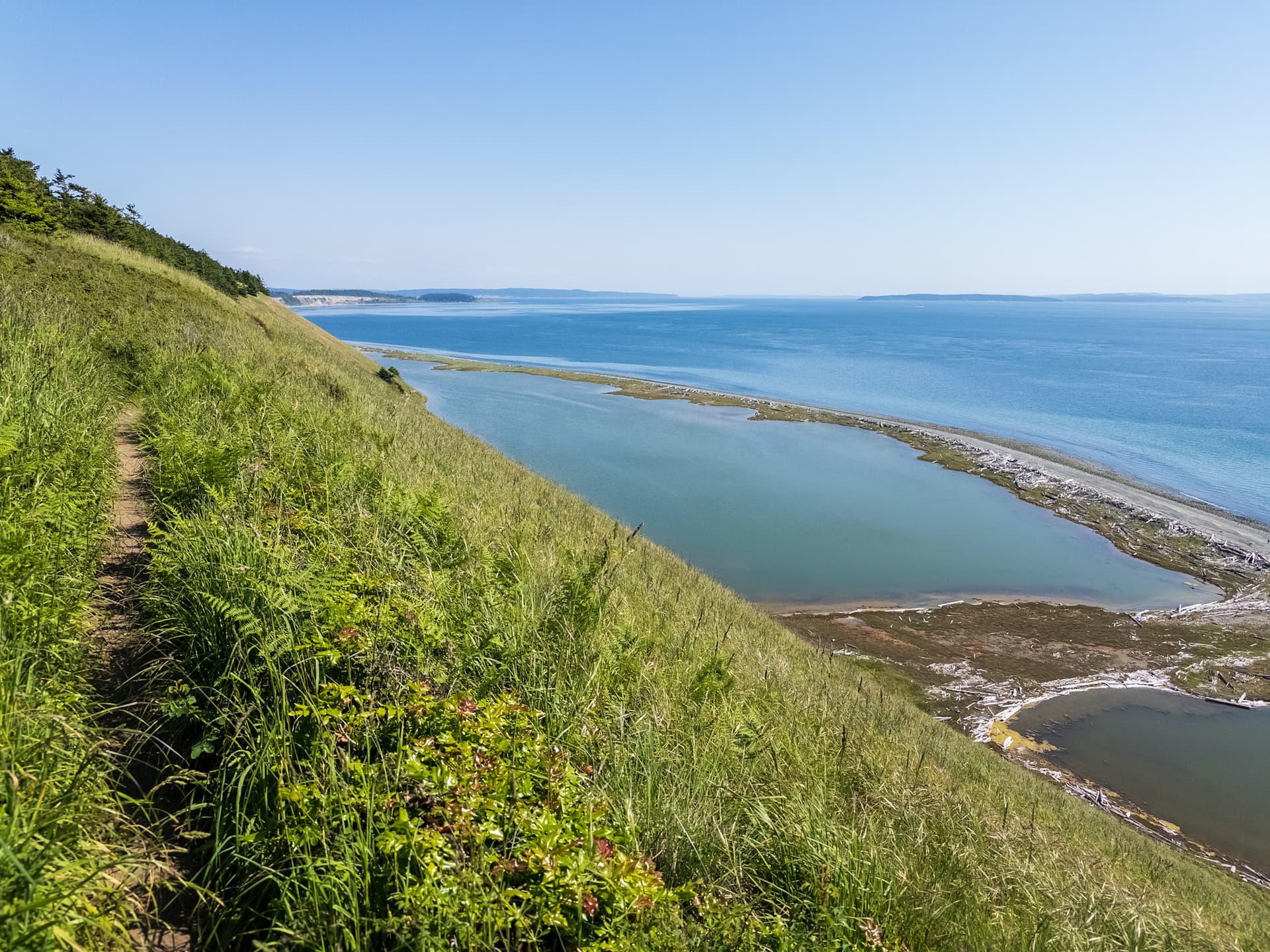
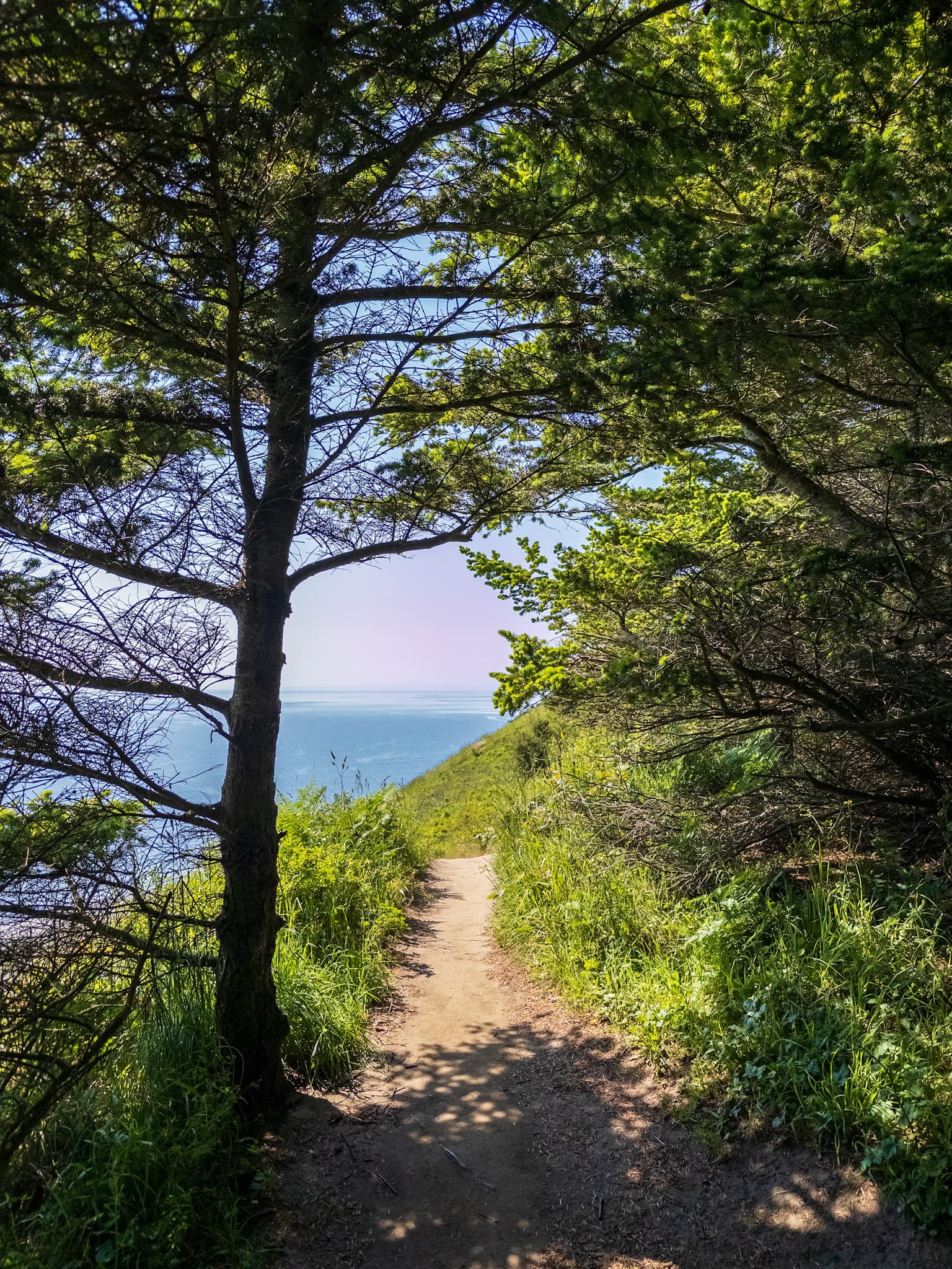
That feels like it’d be a regional difference - the “ideal” trail in the US is generally just a single track compacted dirt path, and anything wider or more constructed is only done when necessary due to heavy traffic or terrain requirements. Many trails are constructed to make them look as non-constructed as possible to preserve wilderness aesthetic.
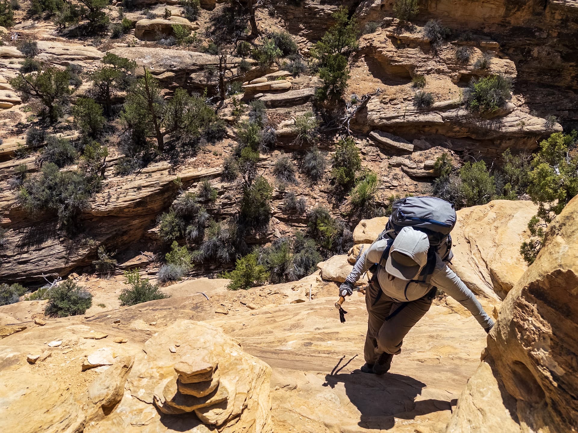
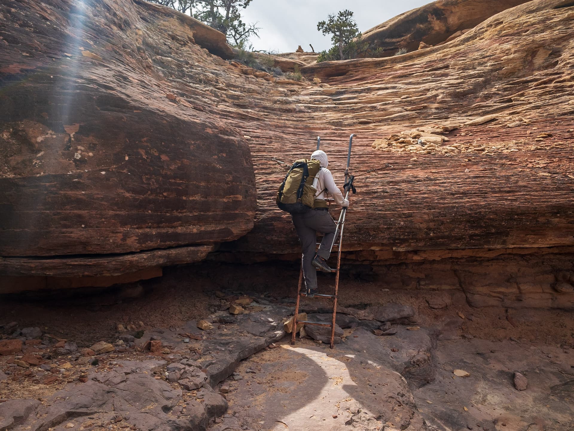
I was honestly a bit surprised at how exposed some popular maintained trails were in Needles district of Canyonlands NP.
This was on a pretty popular dayhike loop (not super tourist friendly, it’s moderately long, but still).
Via Ferrata is used very sparingly compared to Europe - there’s not any reasonable way up this overhang, but they end it as quickly as possible and then have you walk up the rest. A lot of times there were little mantles or drops that people had to make, though sometimes they carved steps into the sandstone. Carrying 12L of water up this wasn’t fun.
One issue with one off photos is that trail_visibility is covering the entirety of a way (or segment of it) - everything below good allows for variation, and basically the lower the rating the more variability there is (e.g. some individual sections of bad could look like no, whereas others would be good). At a certain level this is necessary so you just don’t have a bunch of .1km segments every time visibility changes or SAC changes from T1 to T2, but it’s also an abstraction.
The path looks somewhat obvious going between those two trees in the foreground - you can see a depression in the leaves, they’re scuffled, vegetation isn’t present, etc. Beyond that it could lose visibility pretty easily. You were there, you would have been able to tell if it was a continuous path if faint (good seems incredibly optimistic), or if you had to routefind for sections of pathlessness (bad or horrible) or just look for the next patch of path ahead (intermediate seems as high as it would get). I suppose if you could always see a path, but felt that was unrealistic to expect of most people you could just drop the visibility to intermediate.
As you know I’m not a fan of all these very similar values, but there’s not a ton of appetite to tackle the technical debt on this key. Falling back on the “requirements” is also useful when the description fails (and is arguably more important).
That doesn’t seem controversial to me. Overall how easy was it to tell there was a path and follow it, given bootprints, depressions in the ground, lack of vegetation, etc. It’s not like any system would have a value that would be “well for this value you can’t take the surface of the trail into account, but everything else is fair game”.
I feel like for informal ways there is value in just having something like “hunting path” or “game trail” as a name to show up on a map. That violates OSM norms, but it would help to set expectations. You could put in description=Wechsel, but I have no idea of how much of a real world impact that would make.
There is no mention of sac_scale anymore on the proposed wiki for trail_visibliity. I don’t think that SAC came up with the idea of a trail being visible, there’s not any mention of excellent requiring T1 terrain, and the majority of the world doesn’t use sac_scale so just keeping it trail_visibility seems fine to me. I think you were the one that suggested divorcing it from SAC, and that suggestion was acted on.
This could be regional, but that’d be well within the norms of a standard maintained trail in the US. Pretty much every trail I’ve walked in state parks and national parks in the past few weeks in the PNW has looked like that, and some of those are pretty standard tourist destinations. We’d basically have less than 1% of trails here reaching your excellent, generally a short paved walk or wide gravel path from a parking lot to a waterfall nearby, with basically entire national parks being marked at a maximum of good. US National Park land managers that they have to make sure their trail visbility falls under SAC difficulty requirements from Switzerland.
I can’t see someone walking off the trail into the lush undergrowth in your example, even with that little split in the foreground that meets back up with itself again. Even if someone had trouble stepping over a root, they wouldn’t get lost on that path which is what trail_visiblity is about.
That said I agree with you that the current photos of “good” on the live wiki are really problematic. The first one looks like a trail that can fade away at any moment, and the one with the waterfall basically looks like you’re just walking up a streambed of rocks? I can’t even see a path there lol. I have no issues with excellent though.
I honestly see no issue with there being different norms per country or region vs trying to come to some global consensus - maybe you’re correct for Austria and other people are correct for the US & UK and we’re all right and all wrong at the same time. ![]() Should that be it’s own thread?
Should that be it’s own thread?
FWIW I also feel like this is going in circles, but I respect your take on things and it’s had me look at things differently.
I am just a local living in an incoming hiking destination. I consider much as you, surface not a replacement for trail_visibility. The intermediate sample I posted will all be gravel, the clear sections much like the unclear ones. The term technical debt sums it up. People then in 2008 were in a hurry, prospects for approval looking fine and came up with a nightmare to maintain. The single-handedly provided pictures might be fine for you. So, if you want your or @rhhs wording changes in, at least keep the verifiability moniker to apply to all of the key, not just one of its values.
If you had a picture of a wide path with a nice fence on it, but some roots that made it T2, I’d still call that excellent. Mixing the two together seems weird to me - like how SAC/YDS ec will mix difficulty of technique and exposure together when they can exit separately.
I suppose mapping applications won’t make a visual change between excellent vis T1 and excellent vis T2, but at least it’s in the metadata? It’d be interesting to be able to filter trails by osm tags (maybe some consumer friendly European mobile mapping apps have this?) like T1 only, good or excellent visiblity.
I wouldn’t spend too much time refuting the surface = visibility argument (my example of compacted vs the excellent compacted examples on the current wiki make the point IMO). ![]()
How would you suggest that being included? On a certain level this is a matter of perception - whether something is sometimes or mostly pathless should be verifiable, but no one is going out and measure out the differences in the path between bad and horrible (and honestly when I’m on a come and go trail I’m never actually sure I’ve found all the pathy bits of it, and there will often be parallel informal trails etc where people “find” it in different places etc).
And it will continue to be a nightmare for decades to come! That’s the true gift of technical debt. It just keeps on giving ![]()
So that is excellent. ![]()
I’d agree here, there’s a clear gap in the path with the talus before it continues on the other side. It doesn’t warrant a bad by any means, but that would fall into intermediate in the new proposal, though it’d technically be good in the old one based on description (depending on how long the talus slide was it could fall under intermediate with requirements).
The proposed changes on the wiki talk page would have some trails currently tagged as good fall under intermediate, but going forward that seems like a much more reasonable breakdown while not completely reinventing the wheel. Some things that are no now (depending on which conflicting version of no was used) should be horrible, but at the point where a path mostly doesn’t exist… /shrug
The current mix of one value for “there’s always a path of some sort” and one value for “at least you can always see a path, even if it’s not clear where to go” and then four that just indicate how often it’s pathless (intermediate, bad, horrible, no) with no somehow just meaning a minority of the path is visible is… a very strange mix of priorities.
That’s an extreme oversimplification of the argument I was making. Nowhere did I say there was a 100% direct line between the surface and visibility or that surface on it’s own should replace the visibility tag. That’s why I mentioned mapping hazards along the trail like 5 times. Hazard mapping being one of multiple options for mapping “visibility” in a less subjective way. It’s not like people can’t look at more then thing on a map and generalize from that what the visibility of a trail is.
I’m not going to waste my time on examples when my comment will inevitably just be miss-construed and taken out of context. But suffice to say, it’s pretty easy for anyone to conclude that if the trail is in an alpine forest and it’s going downhill at an extremely curvy angle and they are hiking it when the weather is bad (or really even when it isn’t) that probably the visibility will probably not great. Hikers aren’t children and they don’t need us holding their hands like they are through subjectively tagging how visible a trail is. They can easily put 1 and 2 together using the normal cues everyone else does to figure out this kind of information.
Ask yourself this and then I’ll leave it at, why don’t we tag everything that’s mapped as building=yes with wall=yes or a similar tag? Why not come up with cleanliness scale tagging scheme to go along with amenity=toilets? Heck, I could be wrong, but I don’t think there’s even a tag for how many stalls a bathroom has. Let alone if it has a sink, if you have to bring your own toilet paper, a hand dryer. Do you people not care if people can wipe their behinds clean after a going number 2? You don’t infantilize shoppers in that way through mapping subjective criteria like if they clean their hands or wipe themselves in a bathroom, but hikers? Their children who can’t do basic math by connecting the steepness of a trail with how curves it has to figure out what the visibility might be for some reason.
One issue with one off photos is that
trail_visibilityis covering the entirety of a way (or segment of it)
segment, you name it. If you feel the trail visibility significantly changes along a path you would split the way and add tags accordingly to the segments. There is no “entire way” in OpenStreetMap that isn’t under the control of the mapper, entire ways have to be chosen to make sense with the tags.
Here what JOSM users get presented in the preset for sac_scale - trail visibility is included in T1,2:
Curiously, they use the same term that I used, and that native speakers hardly can make sense of ![]()
Anyhow, the pictures I posted here and there are chosen such that one could at least try to argue that both sac_scale and trail_visibility derive from the same scheme.
There is no highway=path there, it is a “Wechsel” (game trail?) - the “bootprint” clue gives that away. There are no prints of human boots there. In the woods they abound. In my understanding, such do not belong to the highway=* kind of stuff.
Heck, I could be wrong, but I don’t think there’s even a tag for how many stalls a bathroom has.
there is capacity
Let alone if it has a sink,
this is more fuzzy, but sometimes drinking_water=yes is added to amenity=toilets and may give a clue.
If some fields cannot be described in finer detail with established tagging there is nothing preventing us from introducing new tags, if there is the desire. We’re talking about an established tag which you don’t like or see a need for, but apparently others do, hence the usage.
True. I always assumed that was more for how many people could fit in a facility though. A restroom being one small area of that, and stalls being an even smaller one. Even if you were to apply it to a detached bathroom facility it still doesn’t say much about how many stalls there are because more people can usually fit in the main area then there are stalls or toilets. Maybe it’s different in Europe then in the United states, but we like our needlessly large handwashing areas ![]()
I think it’s a bit of a stretch to say the tag is describing “finer details” of the trail. Even if it were though, the assumption in your comment that “finer details” are good in every situation regardless of what those details are or how they are being described is kind of odd if I’m being honest. I’m sure you know what circular reasoning is. We will just have to agree to disagree though. But I will say I never said I disliked the tag or thought there was need for it. In fact I’ve said at several times now that I think it works well with rocky trails. I’m sure there’s others where it’s fine, but of course if I think 2 or 3 out of 12 uses for a particular tag are a problem then it must mean I hate the whole tagging scheme and think it’s completely worthless right? ![]()
Regardless, the tag is used a lot around where I live. I’ve find it to fit with the actual trails when I tried to use it. Nor did it ever help me learn information about the hike that I couldn’t find other ways. So I’m voicing my opinion about it here since someone else started a discussion about it. I should be able to do that without people like you just poo-poo me about how I hate the tagging scheme and want it completely wipe from the face of the planet when that’s clearly not my position. Even if it was though, so what? It’s totally pointless to be defensive about it no matter what my opinion is.