`tactile-paving=yes`: Only "normed" special paving stones, or also clearly different surface, qualifying for the tag?

Ahoj,

I have a situation where there is “tactile” paving in the form of sett insteat of paving stones where the tramway crossing is (and at one place, the road crossing), and nearby there is “proper” standards-conforming tactile paving.

In my opinion, the surface=sett is clearly tactile and marks the crossings.

But since it does not use the usual specia tactile paving stones, I am unsure if it qualifies for tactile_paving=yes.

I attach pictures.

What do you think – does this qualify for tactile_paving=yes, or not?

Regards!


2 Likes

It might fall into the category that the wiki calls tactile_paving=primitive?

Although it looks more deliberate than the description there it also seems to be clearly inferior to blocks/studs made specifically for that.

2 Likes

Sett stones are super annoying to navigate on, because the white cane tends to be blocked by the big gaps. Most blind people I know rather tend to “knock” up and down on the sett, instead of pushing the cane, because it’s constantly blocked otherwise. For me, none of the sett in your pictures would qualify as tactile paving. They might be understood as a warning ripple, but since the function is unclear, because it’s not a standard tactile tile, I would rather map the short segments of surface=sett as such on the crossing way and let data consumers decide how to present this to the blind.

3 Likes

Thanks; according to this answers, I am going to tag the elements in that area as tactile_paving=primitive, which previously had tactile_paving=yes due to the sett surface.

1 Like

Ich würde mich mal kurz mit einem anderen Beispiel anhängen,: in Dresden gibt es an vielen Kreuzungen gepflasterte Bahnen, die scheinbar zu den Ampeln hinleiten sollen. Teilweise gehen die auch längere Strecken über Plätze sowie über breitere Bürgersteige bis zur nächsten Kreuzung. Ein einfaches “surface” funktioniert nicht, da der Rest der Fläche meist aus anderem Material ist.

1 Like

How are those other instances mapped in Dresden?

(The place in the original question is in Dresden, too: This area.)

That’s the problem why I’m asking, I have seen many notes of different users, and noone seems to know exactly how to map it. For example: Note: 3629469 | OpenStreetMap , Note: 4182150 | OpenStreetMap , Note: 4365737 | OpenStreetMap , Note: 4545210 | OpenStreetMap .

(i knew that your place also was in Dresden, that´s why i used this thread instead of creating a new one (it´s for the same type tactile paving))

I only tag tactile_paving=yes when purpose-made standardized truncated dome tactile warning surfaces (example) or directional bars wayfinding surfaces (example) are present.

surface=* is the appropriate way to communicate a surface change.

There are muncipalities, that want to use more natural product to express things.

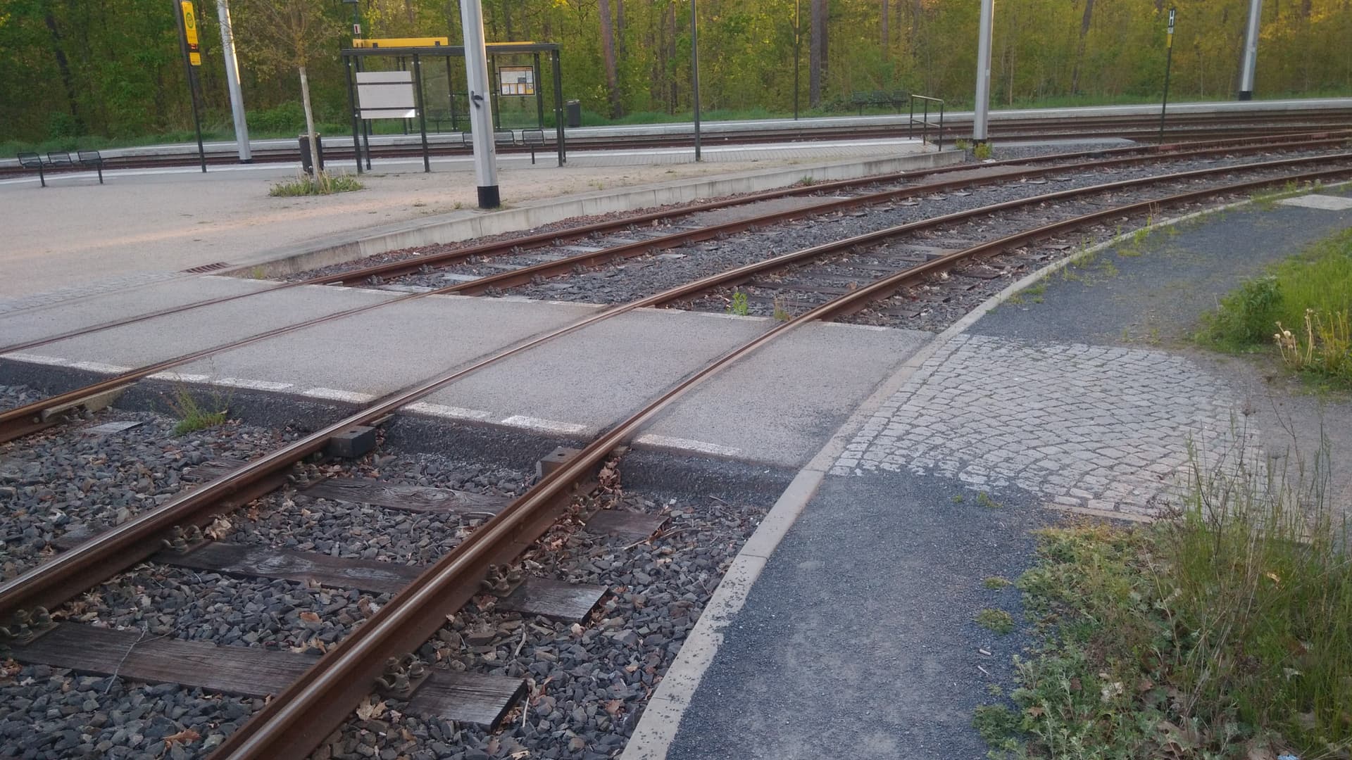
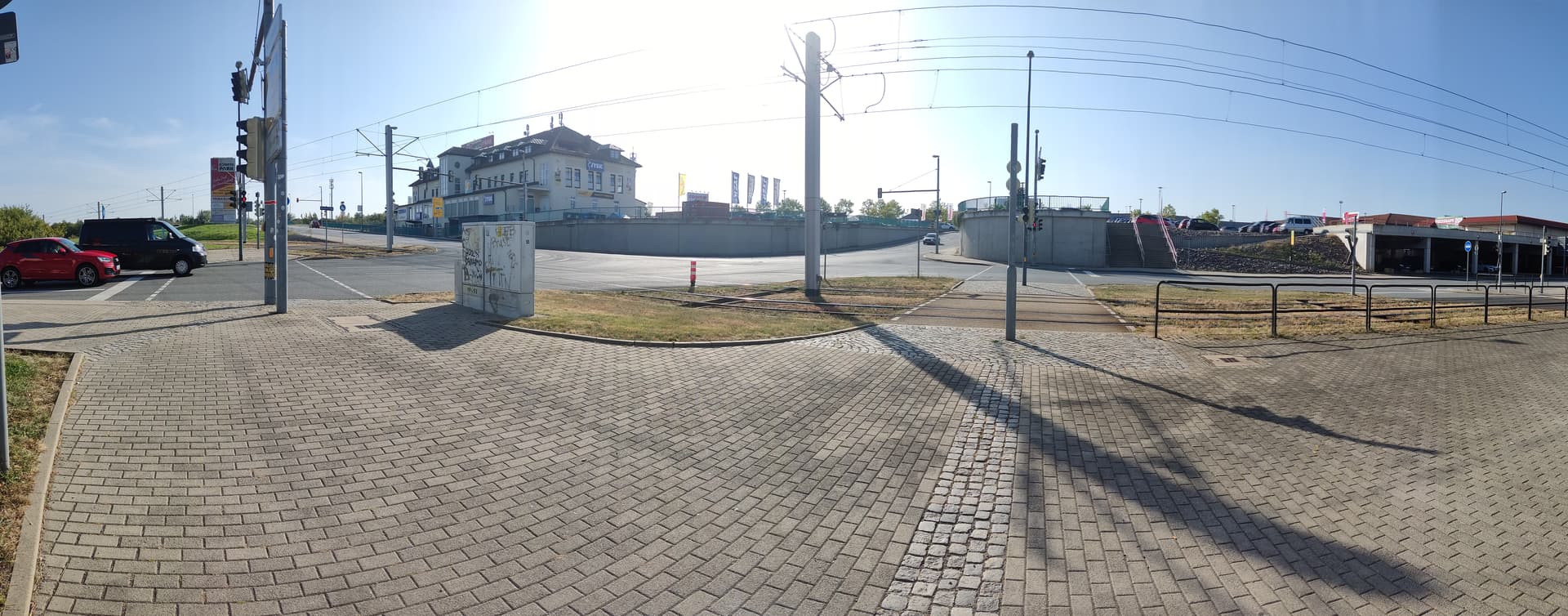
First, when we map a sidewalk, we place the footway=sidewalk at the middle of the area, that is fine, it should be placed there.

But how does a visual impared walk, in the middle of a area, they do not get a clue, when it is all the same surface. They walk by the sides.

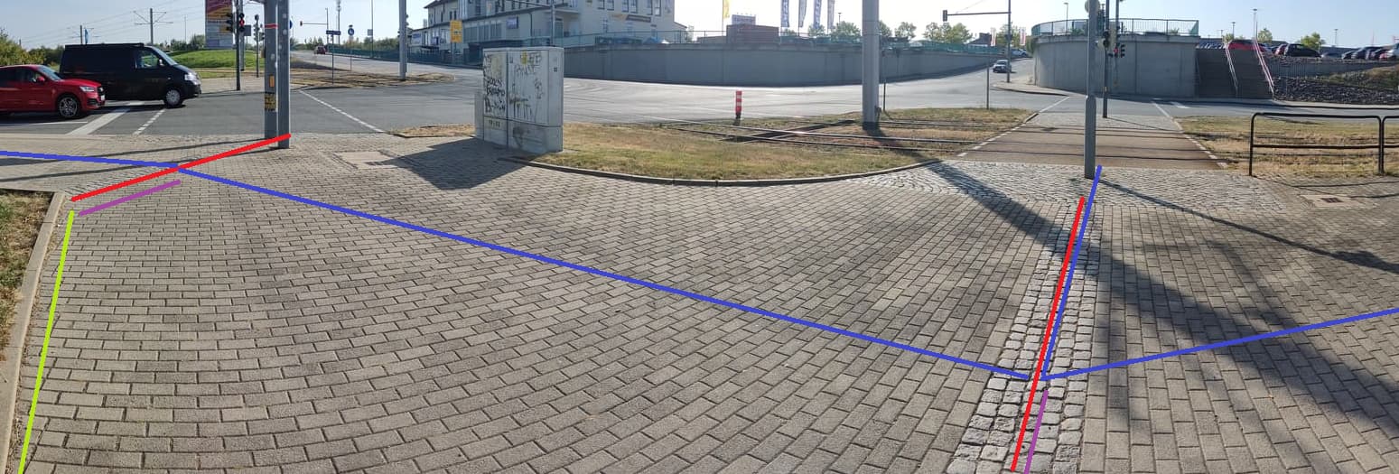
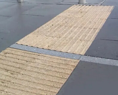
And this is what you see, it is a hint to the side.
So that they can walk, the green line and the red (purple) back.

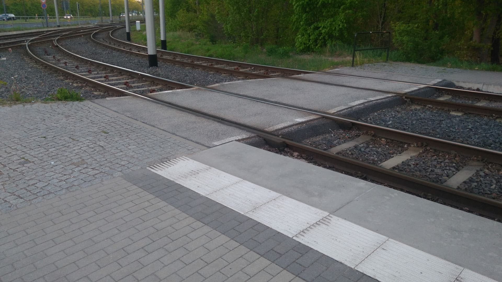
But is it tactile_paving?
The model of elements, that visual impared can use is not worked out till a detail that usable. Also the placement of the tags.

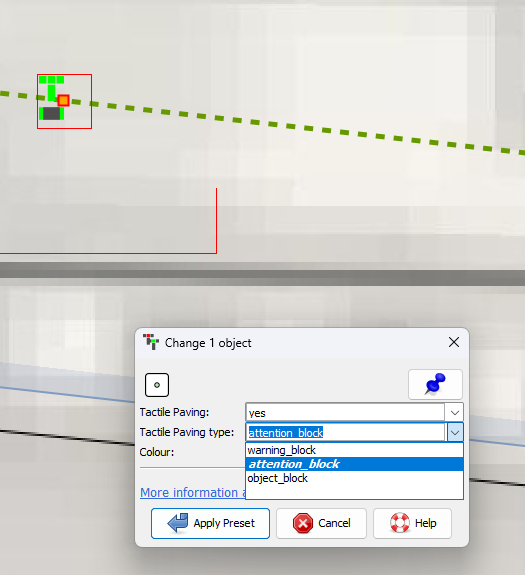
Where?, middle of the area tagging and tactile is on the same line, but tactile goes further (purple), so I did set tactile_paving=yes on a way with no other tags, drawn in till the side of the area. This is what you see and should be tagged. If you express all in detail.

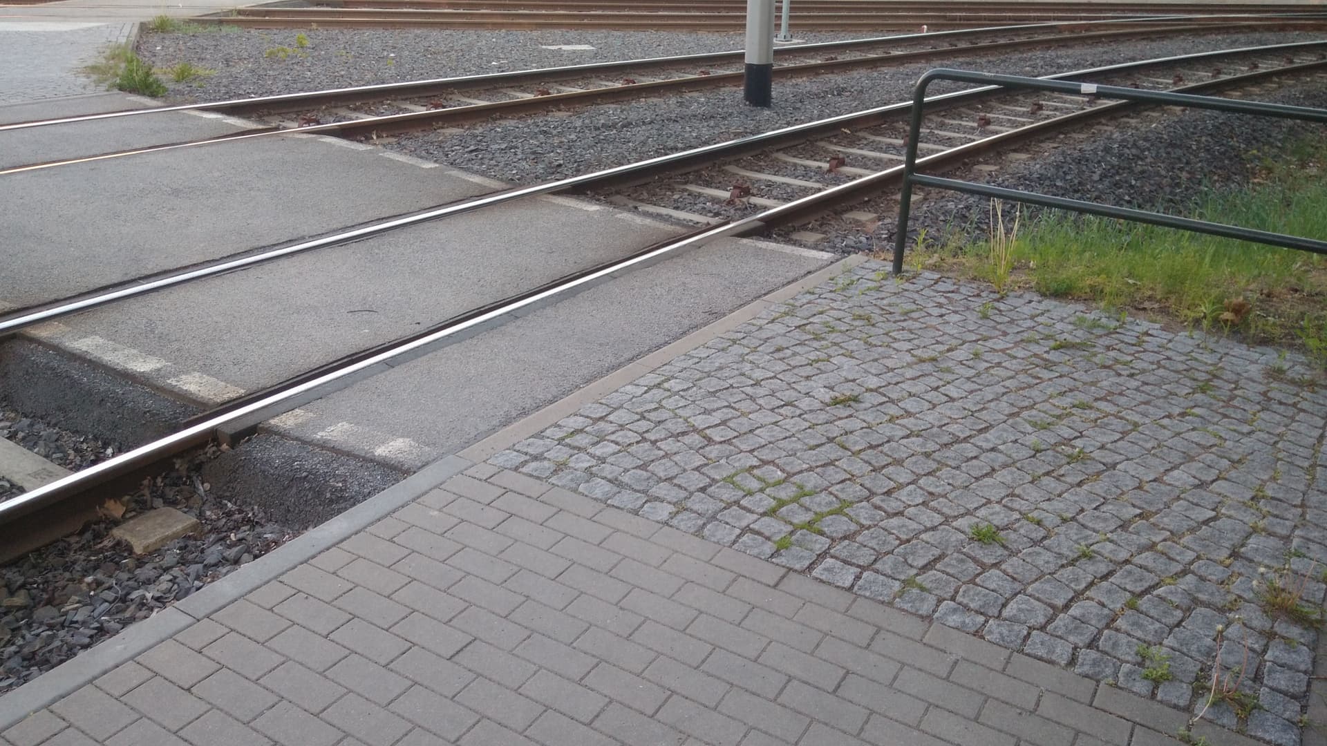
I asked myself, should I map green line (image) as a kind of tactile_paving? I did not do that, because, first the area must be tagged well landuse=grass even maybe a kerb line. These lines are visual impared navigation lines.
Is it?
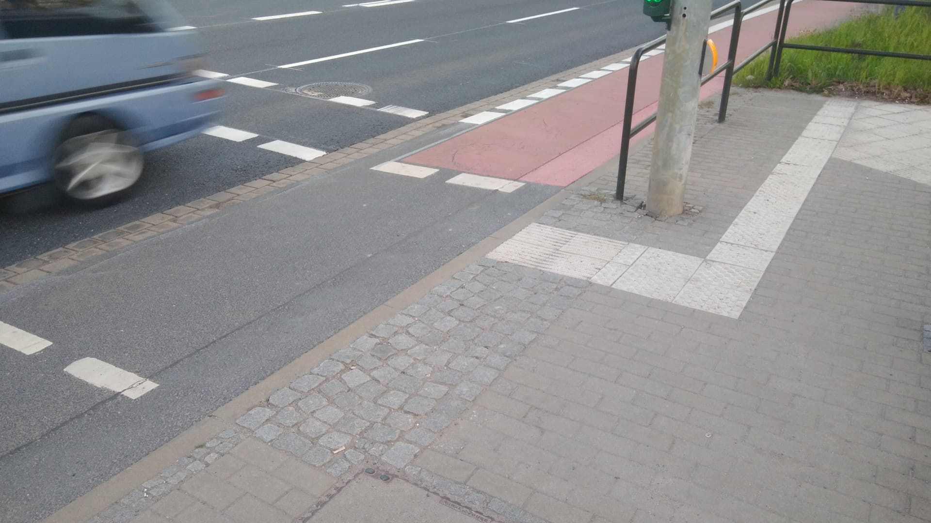
tactile_paving=primitive primitive=* what kind of primitive? Is it usefull data…

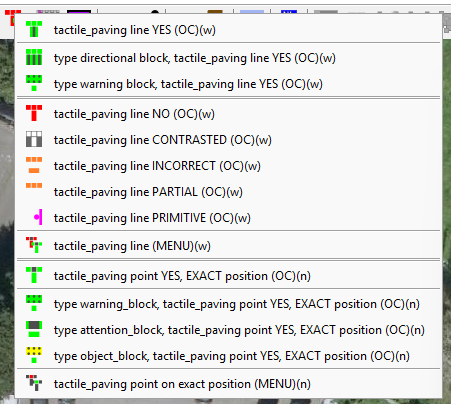
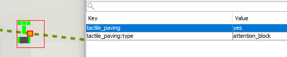
Lately, I made a one click setup (JOSM preset) for my own, experimental.
Still learning, what I should use for node and way.

So, I am intrested in what others think.

Is this preset available somewhere so we can test it, like GitHub?

Not on github.
What I did, made some type, others are wiki standard key/value. Setting with One Click, make it easier.

Or Menu, …if typing value is needed.

i was thinking about same thing for tagging types of tactiles

  • what is their surface shape pattern on lines, so ways
  • and if at different points, so nodes usually start and finish
  • how it is shaped. If it is T shape for instance or none at all, meaning that it ends

This should be added to the wiki page specifications.

I do also find a variant where tactiles are along a side of a footway next to a cycleway, so visually impaired people don’tactually walk along that line, but more like near it over a footway and not the cycleway.
https://maps.app.goo.gl/EozYUjfVfWYi2Tf57
IMO It needs additional type on specified on wiki as well