Should we just use `smoothness` and `surface` along with `sac_scale` on multi-use paths and trails instead of making new keys?

There has been a lot of discussion in the spring to early summer about hiking keys. Here’s two conclusions I’ve come to.

Trail variability can make accurate smoothness and surface tagging counterproductive

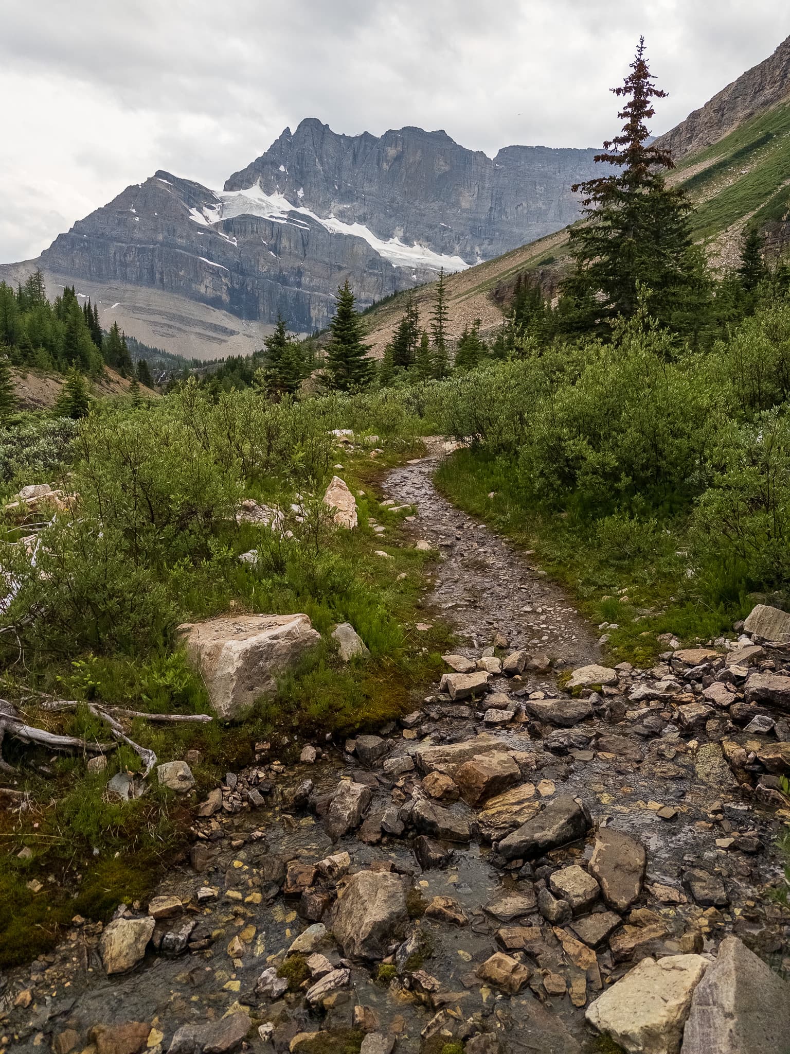
One issue I see with relying on smoothness and ground is that many trails would need dozens to perhaps hundreds of segments on longer trails, which makes them hard to parse. These photos are all from the “Iceline” trail in Yoho National Park Canada (and are only a small fraction of the variations on it).

In many places there would need to be a new way every 50 meters or less as the smoothness or surface changes (in others it would be hundreds of meters). We could just pick the most uneven surface, or pick a point nearest the trailhead where it changed to simplify things.


This surface=rock is actually one of the simpler bits amusingly.


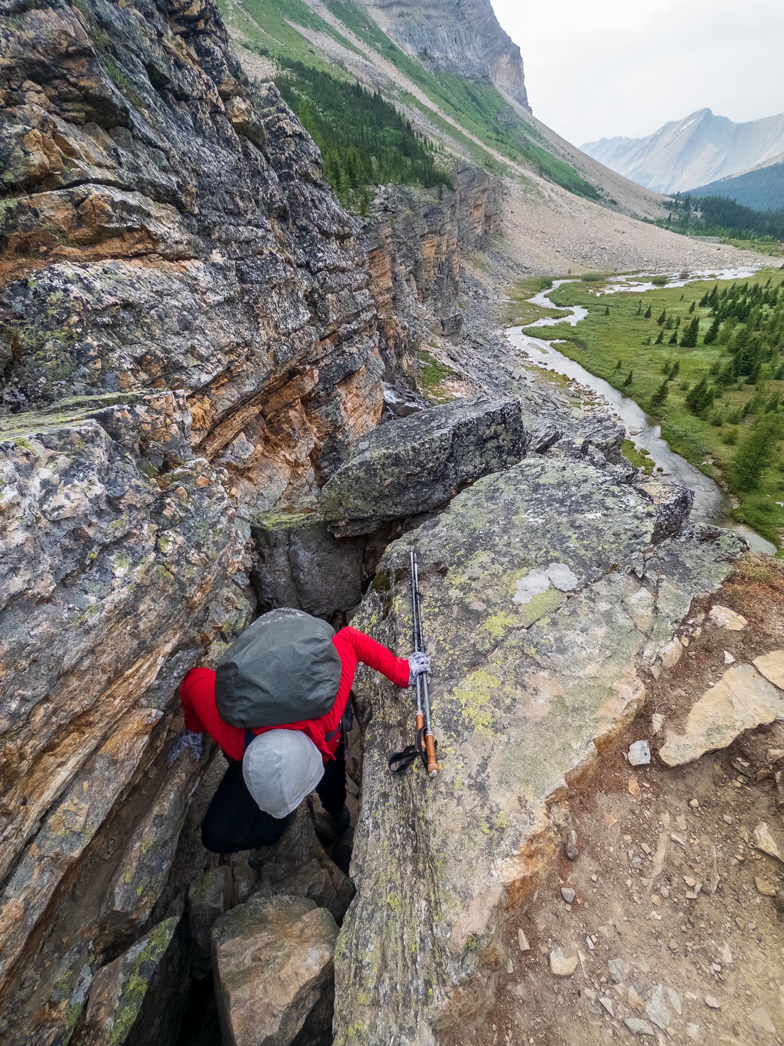
We saw a few dozen people a day on this trail, a mix of backpackers, trail runners, day hikers etc. Footwear ranged from heavy old school leather boots to athletic sneakers. I was in a middle in a pair of mid top La Sportive TX Hikes I got for 50% off for being used once and returned in the southwest.

Smoothness maxes out at 24cm - it’s pretty common to have some obstacles in the trail at or above that height that don’t pose a significant challenge (around lower shin high). They also could be one 24cm high rock you can easily walk around, or a 24cm high obstacle that covers the entire trail. The former doesn’t mean much to a hiker, but will to a wheelchair user.

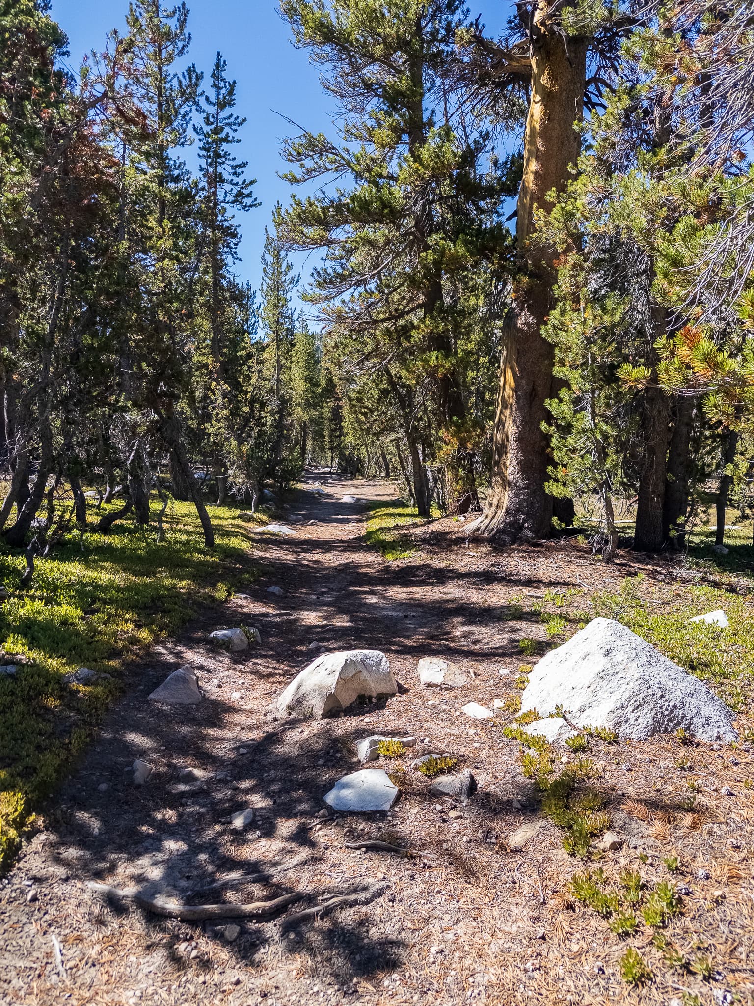
Instead of having a hundred or so segments, you could have 2-3 at most. The low end of hiking_technique or sac_scale and surface=gravel for the bit from the trailhead including a smoothness fit for wheelchairs, then take it up a notch in technique and just used surface=ground. Trying to parse out hundreds of variation in surface and smoothness (as some people have suggested tagging every change in the name of accuracy) doesn’t seem all that helpful or likely to be actually parsed by the vast majority of people.

Knowing that the first kilometer or two is hiking_technique=casual-walking and then after that it’s say hiking_technique=surefooted-walking seems like it tells the story well enough.

Amusingly the most “difficult” terrain in this area would be trivial in terms of smoothness and surface (we enountered it on a few social trails). It’s compacted glacial mud with small pebbles in it that shift when moved on, sort of like walking on marbles at any reasonable slope angle. The smoothness is near perfect and the surface would probably just be dirt or ground.

Along the PCT/JMT in Lyell Canyon (a trail that has many thousands of people a summer on it, many just in trail runners or sneakers) there is a lot of borderline T2 terrain due to the trail being “upgraded” for stock back in the 1950s or so or just a lack of willpower or conscious decision to not blast out a nice even T1 path. Most of the upper image has a pretty even path between rocks for someone on foot. The rest of the trail is mostly dirt and duff but will switch to slab or gravel at times.

Also along that stretch of trail in Lyell. Here is a change in surface from a nice dirt single track to (oh no! how scary!) rock. Except it… isn’t. This happens fairly regularly.

Foot (hikers) and wheeled traffic are impacted significantly differently by smoothness

Different perceptions of smoothness will exist for foot and wheeled traffic if we ignore the wiki, editor suggestions, etc and just go by “feel” or “vibes”. This has accessibility implications as smoothness is part of what is used to calculate whether something is wheelchair accessible. It also means that a lot of multi-use paths in either mountainous or just forested terrain that is rocky will have some obstacle at some point which is more than 24cm high and will just be “impassable” if we try to avoid poisoning accessibility by sticking to pure vehicle usage and try to have it be of use to foot traffic.

This path (continuing on from a dirt road for quite a ways before it slims into a more normal single track trail) in Banff National Park would be good for a hiker or mountain biker, intermediate to poor for a road biker, and impassible for someone in a wheelchair.

This section of another trail in Banff would clearly be impassable for wheelchairs and bicycles, but in terms of foot traffic is fair to intermediate at worst.

In the same region a side trail was mostly dirt, but changed to gravel briefly as it crossed a streambed. I don’t think that’s worth tagging. You can see past the streamed more rocks in the trail that would impact smoothness for wheeled users, but be trivial for foot traffic.

Another stretch of trail had smoothness that’d be simple for foot traffic but impact wheeled traversal. Would this be excellent or good as you can walk on a near flat surface the entire time, or impassible because that one rock is more than 24cm high?

A similar example from the JMT nearby

I bruised my calf on a fairly trivial fall from some T3/T4 terrain that wasn’t as grippy as it looked, so was icing it heh. Again this shows variability in smoothness from foreground to background as well it being uneven enough to not be an issue for foot traffic vs most forms of wheeled traffic (this is in a national park and wheeled traffic is not allowed, though horses/stock is, but the general point still stands).

This type of terrain gets discussed in the hiking_technique thread, but isn’t well covered by existing broad tags (SAC) and would be tedious to try and cover with smoothness and surface segments.

For me, I don’t feel like we need more levels than sac_scale=hiking and mountain_hiking. For those who want, there is the possibility to tag with smoothness=bad or maybe very_bad to indicate that the trail is at the difficult end of sac_scale=hiking. I think sac_scale=mountain_hiking starts somewhere in the smoothness=very_bad range.

As for the granularity of tagging hiking trails, I think we should use the same approach as explained here Key:smoothness - OpenStreetMap Wiki I think a way between two junctions should be tagged with one key value: the one that will determine if the user will choose that way or not. Sometimes it may be good to tag a small section of a way between two junctions with a different tag value, to indicate where the critical part is. This summer we were hiking in the Vercors (France) and found it helpful that this section up to the pas de l’Œille was tagged with sac_scale=demanding_mountain_hiking (red)
Screenshots_2023-10-19-14-30-24

You are entirely free to only use those two values (and not map things that other OSM editors would consider outside that range).

That link does not say what you say that it does. It actually suggests that people use their common sense (“But don’t overdo it”). It’s trying to avoid people splitting a way for every single boulder on a path, which would clearly be silly. It does not say “a way between two junctions should be tagged with one key”.

But what about a multi-use path that is uneven? Users wanted to traverse it by wheels will be expecting the smoothness key to reflect actual values.

One of the example photos for bad on the wiki shows potholes, which would be equivalent to having occasional rocks in the path. To a pedestrian that smoothness is still essentially excellent as they can easily route around them and stay on smooth ground.

The photo for horrible is still T1 terrain.

The photo for very_horrible shows a nice smooth foot path alongside the right of the ruts.

Smoothness of terrain also doesn’t always directly impact difficulty on foot as it does for wheeled traffic - as noted in my post the most difficult terrain we encountered in Skoki only had the height difference of pebbles. The much more “unsmooth” bits of rock stairs etc were very simple.

Photo taken from an informal path that shows up on OSM in Skoki. It’s quite smooth (though moderately angled) but awful traction (small hard things on a compacted glacial mud/clay surface). Not a multi-use path obviously, but there’s a lot of paths in BLM/NFS land in the US where some sort of wheeled transportation is allowed.

IMO keeping smoothness concerned with how wheeled vehicles are impacted by terrain (any smoothness in it) makes more sense to me than having it in some places be a hack to impact SAC (here it’s T2.5 because smoothness is bad).

Every time I add a smoothness tag I’m trying to make it consistent with other previously mapped tags, in other places, included where other modes of transport may be allowed. I’ll regularly tag something as smoothness=bad when I’m walking, even though (because I’m walking) I am not in any way inconvenienced by any unevenness of the surface.

It’s not rocket science - just try and use keys and values consistently with previous use in OSM.

1 Like

(I don’t know yet what’s the post is about but the area is beautiful. ;-))

In my experience I usually differentiate surfaces about 1 km apart (give or take), if it’s “similar” (various unpaved kinds, for example), and try to record them (no closer than about 100 meters) if they are significantly different (like any paved vs. unpaved), unless I consider it irrelevant for most intents and purposes (like a 10 meters long asphalt strip remains from an old highway usually irrelevant for everyone, except for people tasked to remove it and they won’t work based on OSM).

As for the other part of the topic I don’t think tagging must be (and could be) pushed to perfectly describing any possible path and road, and I consider our current tagging satisfactory. (I often use obstacle=vegetation which is not that popular key but in practice it is pretty useful in bike/foot routing).
surface + smoothness + tracktype often describe tracks pretty well, and trail_visibility is a good one for paths; these usually describe most of the common cases, and there are sac_scale (and mtb_scale) for the least common ones. (I confess, I do not use sac_scale since my country is T1 all the way 'round. Also I do not really like how sac_scale is describing paths since I cannot remember the values, but it’s like that.)

I think I could tag all the images with these pretty well.

That seems appropriate to me if the level of unevenness is roughly in line with the wiki.

This is what I have an issue with.

I don’t see the logic in downgrading a rating in order to indicate difficulty. Mountain bikes at least can travel on T2 terrain, which would pretty always be horrible or impassible. If someone thinks “'wow this is really hard T2, I better change it to very_bad” they are actually UNDERRATING the terrain.

All T3 is basically impassible by definition. I struggle to think of terrain that was so uneven I had to use my hands for balance that was less than 24cm high. Making hard T3 bad is just… weird.

If the smoothness key is going to mean one thing for T1 terrain, then another thing for T2-T3 terrain that should be documented instead of being a sort of “shadow key”.

In a broad sense SAC or my proposed hiking_technique cover the smoothness in any way a hiker will care about (I think my proposal which adds another T1 level value does a better job) as per Trail_visibility explained - #12 by erutan

It’s either smooth enough I don’t need to think about my footing, not smooth but I can walk between obstacles, not smooth enough I need to walk over the obstacles, even less smooth that I’d probably need to use my hands for balance, or (this sounds weird) so unsmooth I need to scramble.

That makes sense to me, and feels a lot cleaner than saying that terrain which I need to use my hands for balance is so rough that it should be marked as uneven as a road with some washboarding or potholes in it.

SAC is not well understood or used outside of Europe. I’ve come across some clearly T1 paths in Canada that were marked as T4 because they were “alpine” hiking above treeline I suppose.

I think compacted gravel and pavement on paths is useful to know as compared to natural ground. Having something be sand or rock makes sense if the entire way is like that (or a very significant section). In previous threads people have said that surface and smoothness can accurately denote how difficult terrain is, which I haven’t found the case to be true.

As an aside:

Smoothness is also just one factor that impacts difficulty of moving over terrain, and not the most significant for foot traffic as opposed to wheeled traffic. I’m generally far more concerned with:

Is the terrain stable? Do things not move at all, move a little / wobble, slide around, collapse above and below me?

How good is my traction? This can vary depending on surface, the localized angle of that surface, what footwear I’m using, etc. Smoothness can actually be a bad thing - a steep slope of water smoothed or glacially polished slab will actually be more difficult than a rougher one with some texture despite being smoother.

How exposed am I / what are the consequences if I lose traction.

Unless I’m on T4 terrain slight differences in height usually don’t impact things much. I’d much rather be on medium sized stable low angle talus I can jog over than a steep slope of loose scree. The fixation on smoothness seems to be because it’s an existing key for wheeled traffic, not because it’s one of the 3 most useful keys.

Aside from exposure (which could be a key on a way or a hazard node) I think this is probably outside the scope of OSM.

Harder smoother rock (glacial polish & water smoothed)

Easier rougher rock

To put this into some picture examples (I was thinking about this on a hike I got back from yesterday).

This would be T1, and the smoothness would be good.

These two following examples are T1 and have obstacles but you can walk around them, roughly progressing from having more space between them to less. Having a smoothness=very_bad would seem to fit with the wiki. That’s useful for someone riding a bike, but I feel like the hiking_technique=attentive_walking does a better job of actually preparing someone for what would be there. Technically some of those boulders are 24cm high at least in the last photo so it’d be smoothness=impassible.

As someone familiar with hiking in the range that spends as much time on off-trail “Alpine Routes” as on trail I’d subjectively think of it as somewhere between intermediate and good, it doesn’t seem out of norms or particularly bad to me (but that’s not how I would tag it). It’s worth noting the MTB tracks in the first photo, despite there being more footprints.

Now it gets interesting, here’s some T3-T4 terrain from a trail in the Canadian Rockies again along the packer pass trail.

T2 rock hopping on this stream crossing (would be better as obstacle technically if the rest of the trail was T1). I think smoothness=very_bad is also appropriate here, though it results in a different experience in terms of coordination, technique, and difficulty. (though SAC scale would give the context).

Now we get to a T3 section of trail. If someone thought this was difficult they would also tag it as… smoothness=very_bad? At this point the value has become meaningless unless we just have a different set of values for every SAC level and that is documented.

Someone that sees a path with a smoothness on it shouldn’t have to try and guess if it’s the formal smoothness or an ill-defined informal smoothness. If people feel very strongly about the utility of smoothness, perhaps a pedestrian_smoothness=* should be proposed that has more realistic values instead of having 10 levels up to shin high for obstacles.

The final move after the photo above is technically T4 (though would be more of an obstacle than a new path/way). If someone had a hard time pulling themselves up, would it also be smoothness=very_bad?

There’s an interesting opportunity to nit-pick (and maybe improve?) definitions here.

A mountain bike is a two wheeled vehicle. The definition of smoothness=impassable is “no wheeled vehicle”. Is impassable then the same as mtb:scale=6 (“not rideable at all for a mtbiker”), in other words as soon as it’s rideable by a pro mountainbiker it’s horrible but not impassable?

As for the comparison with SAC, the wiki page for mtb:scale says a value of 6 (“not rideable”) is typically T5-T6, and a value of 5 (“very few mountainbikers can ride at this level”) is roughly T4.

While we don’t have to be so literal as to equate smoothness=impassable with mtb:scale=6, this does mean that the idea that a lot of T2 terrain and all T3 terrain is impassable doesn’t sound right to me. The picture for impassable shows a collapsed bridge… that’s orders of magnitude harder to cross for a specialised vehicle than a T2-3 path.

1 Like

I’m not sure if I understand your posts above. What I meant to say about the use of smoothness for hiking trails is that it could be used to provide some more detail for T1 trails only (which I understand some find desirable). One section could be tagged with sac_scale=hiking + smoothness=very_bad and another with sac_scale=hiking + smoothness=horrible to indicate that the first is easier to walk on than the second. But smoothness and sac_scale are difficulty scales for different applications, so they overlap a bit but don’t match very well.
About obstacles that you can walk/ride/drive around, I think what Key:smoothness - OpenStreetMap Wiki (“vary in smoothness along their width”) is trying to say is that “if you can go around it, it doesn’t count”. However, what you can go around is different for different vehicles and for walkers.

T3 is demanding mountain hiking (I hate the SAC names), so you weren’t mentioning that, but the example photo for T2 is someone hopping talus along a lakeshore, and most obstacles that can’t be avoided by someone on foot are probably going to be at least 24cm high. I suppose roots covering a trail aren’t, but roots tend to have worse traction than rocks, unless the rocks are very unstable. At which point 2-3cm gradients of height aren’t the major issue anymore.

I think adding smoothness in the context of wheeled transit on T1 paths is useful, especially as it relates to accessibility of wheelchairs, someone using a walker, pushing a stroller, taking a road or gravel bike on a compact dirt or gravel path, etc.

It just seems like there’s too many weird edge cases to focus on it for foot traffic, and it doesn’t really tell all that much. Does a single water bar across a trail make it impassible? I suppose that could be a hazard on another wise “smooth” trail. Density of obstacles seems more important than height to me. Is it 16cm or 19cm? /shrug

I think we also have different ideas of SAC - I feel like some obstacles in the trail is fine for T1 (they’re in multiple example photos) and T2 kicks in where you’re moving over uneven ground and can’t avoid them. That was at least what I built my hiking_technique / foot_scale around. :slight_smile:

Potholes are used for one of the bad photo examples - that’s something that may or may not be able to navigated around in a automobile. A pedestrian could navigate that path as excellent (as would a mountain bike).

Agreed.

It honestly feels like it’s built for automobiles first, then people added in other wheeled modes of transit as an afterthought. Looking at you hazard tag. :stuck_out_tongue: I suppose road bikes and rollerblades make more sense as they want just the higher ratings, but yeah MTB can navigate terrain quite differently.

T3 could be very challenging depending on terrain for a MTB if it was large talus (or it could be not that bad, just be a very steep slope that someone would need to use hands on for balance). T4 seems like it’s in a realm of professionals for the most part.

Even for autos, many OHV’s can handle 24cm obstacles. The Rivian R1T has a ground clearance of 37.8cm. And that’s not looking at heavily customized vehicles.

I’m not sure how you make a scale that fits trucks, road bikes, and mountain bikes. At least mtb_scale can be used as an override for smoothness.

1 Like