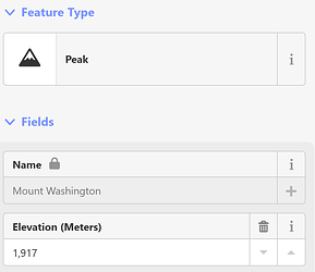
This is a second RFC for formally condoning the use of feet in the ele=* key. This is essentially a proposal to edit the wiki to reflect the status quo in the database. It is not about retagging. Normally, edits to the wiki don’t go through the formal proposal process, but I recognize that this change would surprise some in the international community, so the proposal is intended to keep the community informed.
Since it’s been a while since the first RFC, I’m taking the opportunity to retell some of the story behind this key, but you can go to the proposal for the full rationale.
Background
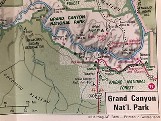
Maps of the U.S. almost always label elevations in feet, not meters. In the more rugged parts of the country, elevations in feet are strongly associated with populated places and peaks (to the extent that many peaks are named after these values).
ele=* is one of the oldest keys in OSM, from back in the days when apparently we thought it was a good idea to abbreviate the word “elevation” to match the lat, lon, and ele attributes in the GPX file format. As in that standard, ele=* was approved to mean the altitude in meters only. However, this was back in 2007, when there was hardly a U.S. community to speak of. Even those who were mapping in the U.S., including myself, assumed that keys like maxspeed=*, maxweight=*, and height=* should always be expressed in metric units so that data consumers could perform the conversion back to customary units on the fly.
After years of fighting against surprisingly incorrect values, we changed our minds and began tagging customary units like mph and '…" (feet and inches) explicitly in most keys. However, we never got around to updating the documentation for the ele=* key, so it along with depth=* stand out as the only two measurement keys that require mappers to hard-code converted values. Yet, in practice, plenty of features have elevations tagged in feet.
In 2021, I wrote a proposal to reword the documentation to acknowledge other explicit units, as we did for the height=* and maxspeed=* keys. I got some good feedback in the RFC but put it on hold out of concern about compatibility with OpenMapTiles and a lingering rivalry between the international foot and the U.S. survey foot. (Yes, even when these non-international units get standardized internationally, we still find a way to do things differently…)
Since then, the situation has improved somewhat. Apparently OpenMapTiles is actually handling feet just fine. Meanwhile, the U.S. survey foot has finally been deprecated at the national level in favor of the international foot. (The survey foot continues to have official status in some states, for purposes that shouldn’t affect us.) Elevations in feet continue to be tagged, whether explicitly or implicitly. These values surprise some international users because of the lack of documentation.
Proposal
- Document that
ele=*can be expressed in feet, but only if the unit is indicated explicitly. - Deprecate
ele:ft=*in favor ofele=*.
Anticipated impact
ele=* is almost exclusively used by renderers. This table shows that the impact to renderers would be negligible overall, even if we were to systematically retag all the peaks and other features in the U.S. from meters to feet (but that is not what I am proposing). If you know of another tile schema or stylesheet that specifically processes elevation and covers the U.S., please add it to the table, or let me know and I can investigate further.
Nothing uses ele:ft=*.
In practice, there should be no effect on mappers outside the United States. Retagging is out of scope for this proposal. Local mapping communities can still decide for themselves whether meters or feet is more appropriate for elevation, just as they can with other measured keys.
Thank you in advance for your feedback. I will be watching both this topic and the proposal’s talk page for responses.


