Request for assistance from the Norwegian community in the resolution of a mapping dispute

I find myself in a dispute regarding the mapping of a selection of features in Norway. I have failed to reach agreement or consensus with my counterparts in said dispute, and rather than arguing though editing, I’d like to present the case to the Norwegian community in the hope of there being some degree of consensus on how we want to deal with such matters, one way or the other. This seems to be encouraged by the linked page above as an initial step before progressing matters to the DWG. I also think it makes sense to discuss this in the Norwegian community first as the matter involves the intricacies of Norwegian right-to-roam laws. I suspect that the DWG would prefer to outsource the interpretation of said laws to the Norwegian community, unless they possess experts in this field themselves.

A disclaimer: I know Norwegian, but I prefer having this conversation in English so as to make the content of the conversation more useful and actionable for entities such as the DWG, and foreign mappers contributing in Norway.

The dispute

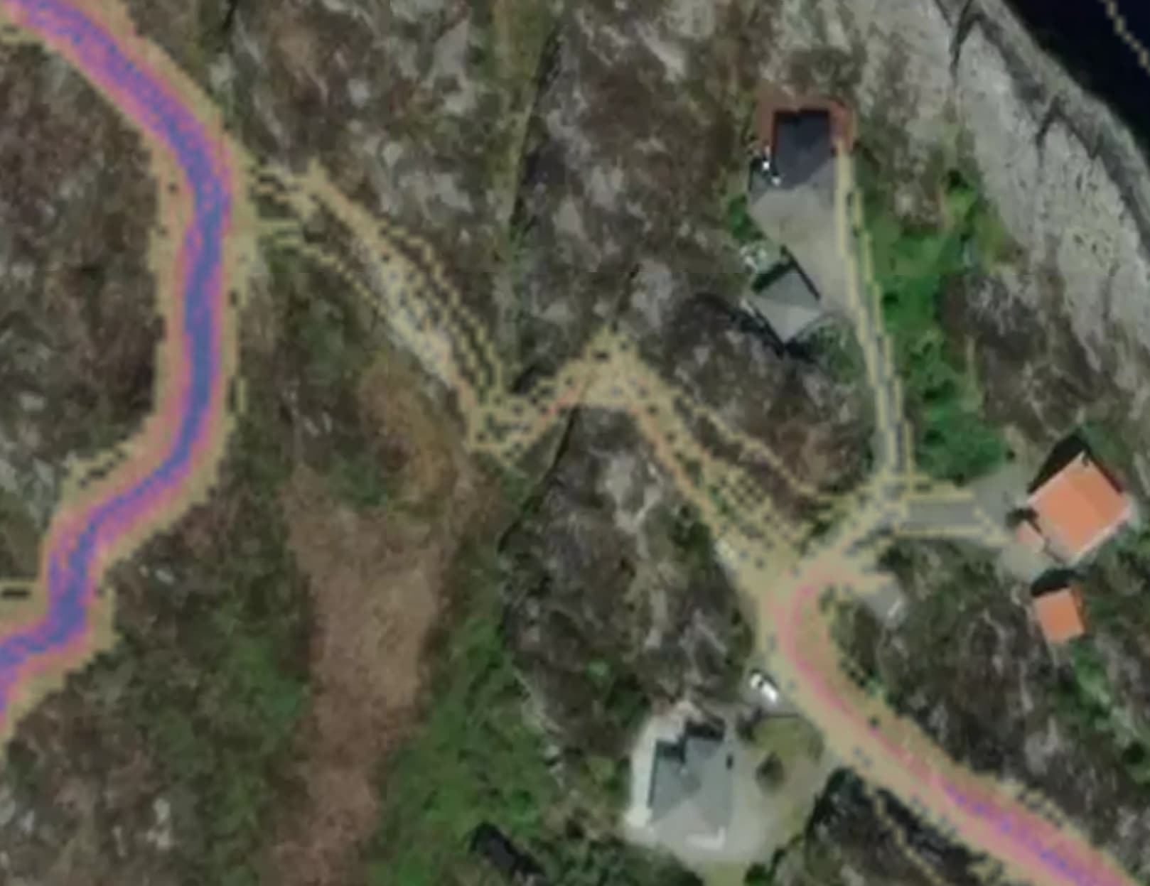
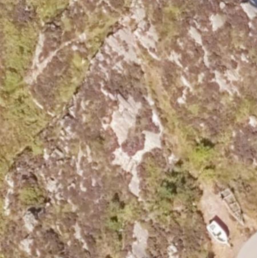
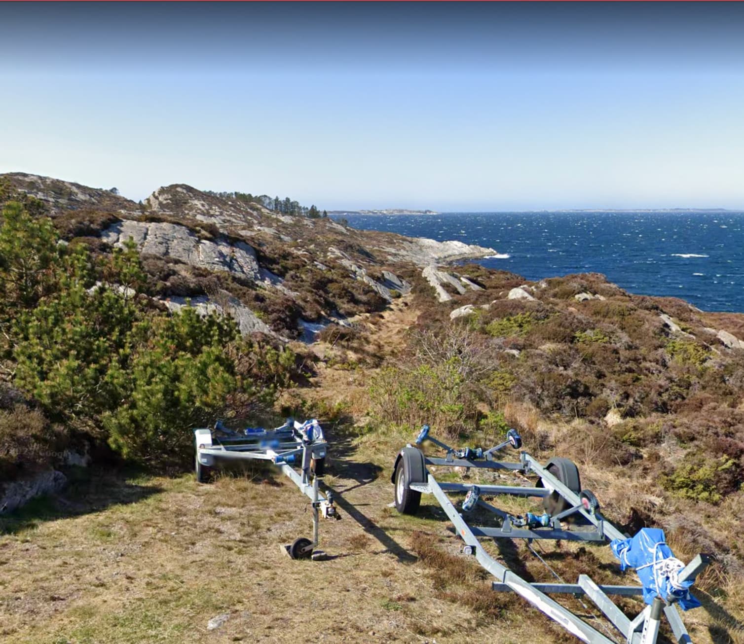
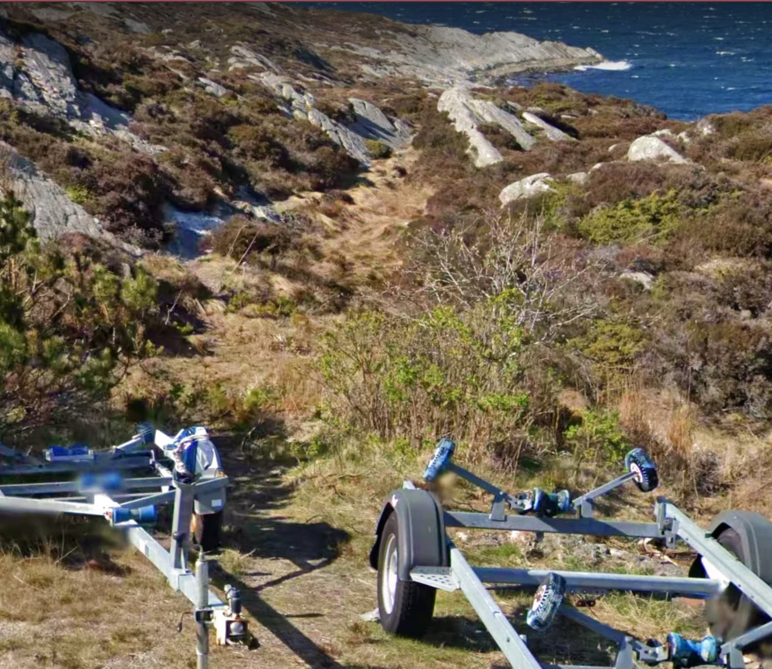
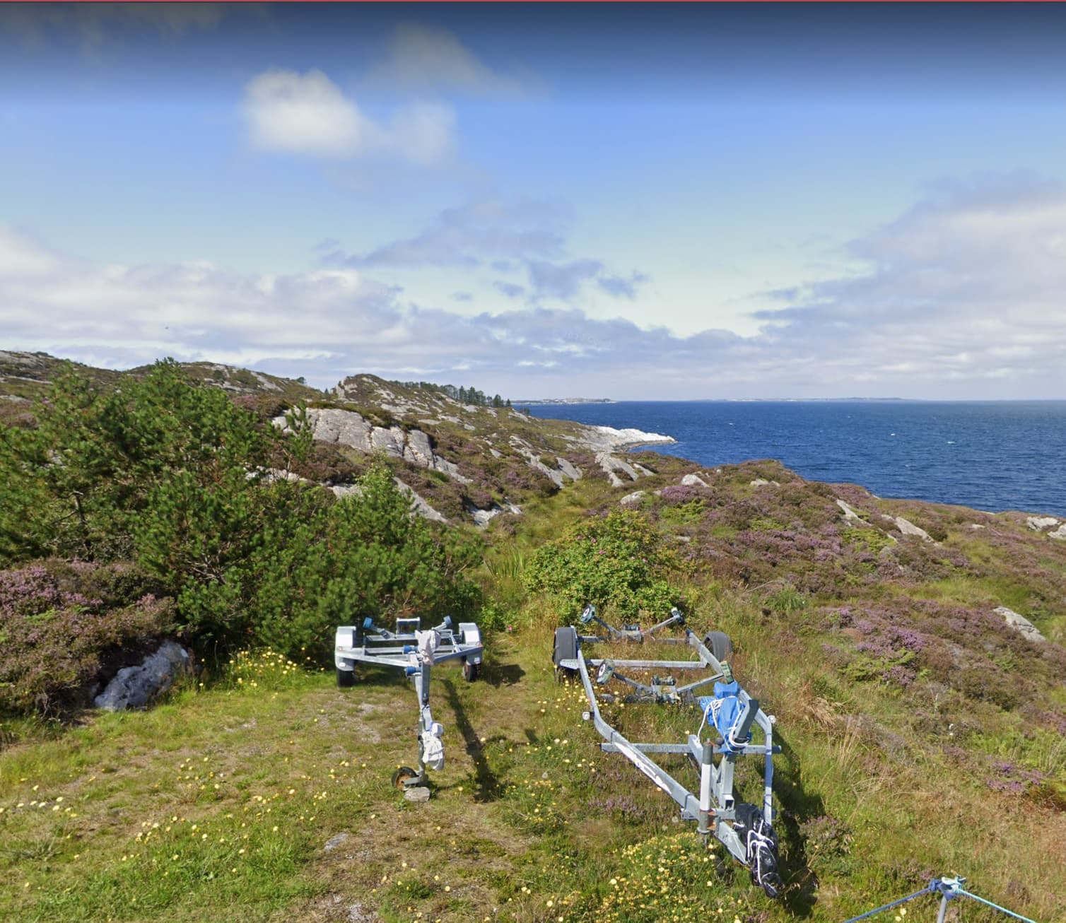
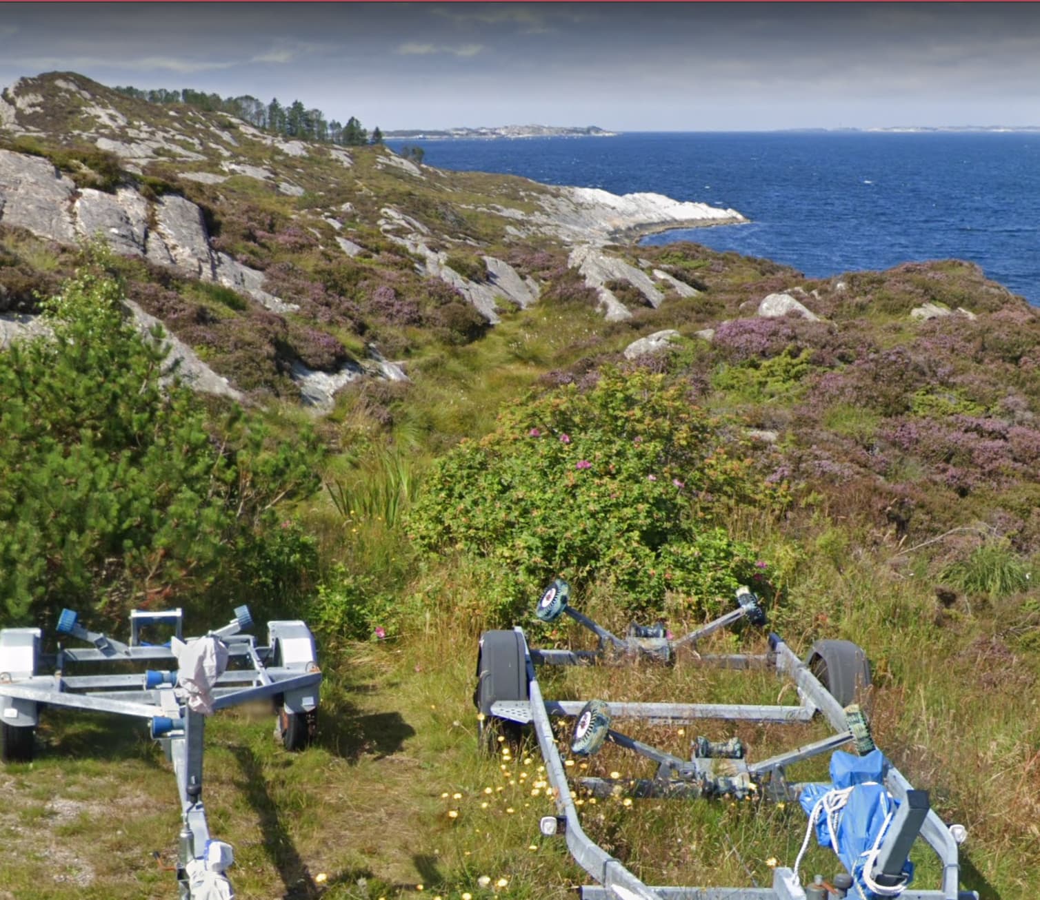
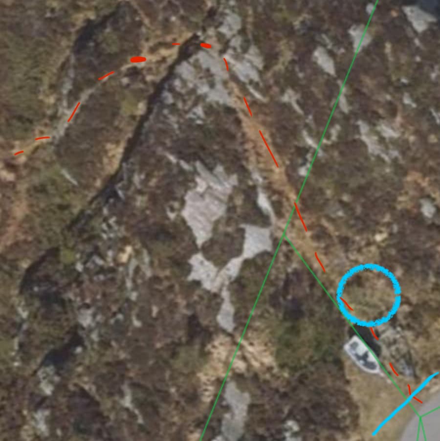
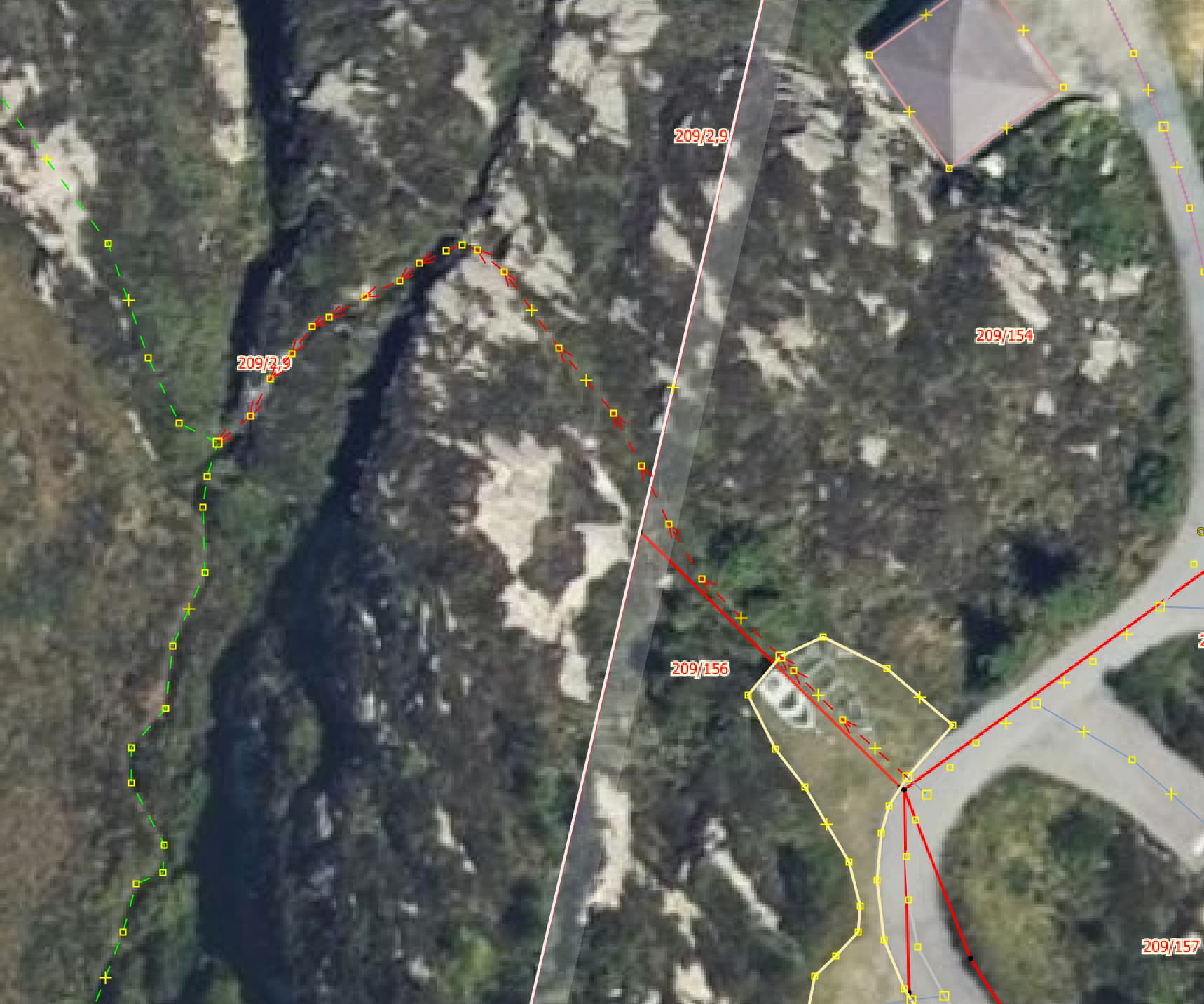
A month ago I painstakingly mapped a path in the north of Øygarden municipality, in Changeset: 140816240 | OpenStreetMap. The path in question is Way: 1204964987 | OpenStreetMap. The path looked approximately like in the picture below.

Then, two weeks ago, the path was deleted by oarn | OpenStreetMap in Changeset: 141495337 | OpenStreetMap. This sparked a discussion on the changeset, and, to my understanding, though private messages between him and @Gazer75. The deletion was reverted by @Gazer75 to maintain the state of the database while the discussion was resolved. This happened in Changeset: 141516829 | OpenStreetMap.

The user oarn again tried to “discuss on the map” by removing the path in Changeset: 141589160 | OpenStreetMap. This deletion was subsequently reverted by @Gazer75 in Changeset: 141592259 | OpenStreetMap. From what I understand, the discussion between these two users petered out, and I don’t know the conclusions reached. If need be @Gazer75 can probably shed light on this. After this the path is left alone for a while.

Three days ago, however, the path is again deleted. This time by a new user with no prior edits, Turid Nordbye | OpenStreetMap. This happened in Changeset: 141994746 | OpenStreetMap. I instigate a discussion on the changeset. The user shifts the discussion to private messages, the contents of which can be seen here: Message Log. This user’s change is reverted by me while engaging with them to resolve the disagreement: Changeset: 142003692 | OpenStreetMap. This user never touches the trail again.

It seems, however, as if the action by this new user spurred oarn back to life. He adds a parking lot on top of the path, before eventually proceeding to delete both the parking lot and the path in Changeset: 142051472 | OpenStreetMap. I revert his deletions again, while engaging with him on said changeset. I argue that both the path and the parking lot should remain mapped.

This marks the start of a series of deletions and reversions of deletions between me and him, where I consistently engage with him, while he more or less ignores my communication attempts. In one of these edits I make a mistake and loose history of the path. The path continues its life as Way: 1212547085 | OpenStreetMap. Note that there is some overlap between the lifetimes of the two paths.

The user oarn is at some point releaved in his efforts to suppress this path and parking lot by a new user account, also with no prior edits: qwertet | OpenStreetMap. He starts his deletions with Changeset: 142095738 | OpenStreetMap. This changeset starts a protracted discussion where the final word is a simple impoliteness from said user. His change is also reverted by me. This is from a desire to maintain my work with the discussion is worked out and because I perceive this user account as an attempt, in lack of good faith, from the same person or persons to sidestep the resolution process. While this discussion is ongoing, the user proceeds with repeating his deletions again and again, while I keep reverting the deletions. I encourage him to seek out the community in order to mediate, but he seems unwilling, so instead I am doing so now with this post.

I’ve also decided to stop the edit war until we can work something out.

My interpretation of the dispute

First of all I think it is worth noting that this is not a dispute between @Gazer75 and me on one side and three unrelated users on the other. From our dialogue I’ve gathered the following:

  • qwertet | OpenStreetMap represents the owners of Sprengsneset 67, the property that the path passes.
  • Turid Nordbye | OpenStreetMap is the owner of Sprengsneset 26, the property with the disputed parking lot, and the property which the path passes right next to.
  • I suspect that oarn | OpenStreetMap is Turids partner or similar, due to the patterns of his actions.

These users seem to all be in direct communication with each other. oarn | OpenStreetMap was the original user deleting the path, and, as he received pushback, he likely encouraged the other two to sign up in other to gather support. Hence, from now on I will treat these accounts as the same entity, “the counterpart”. I’ll now go on to summarise their arguments and my take on them.

The counterparts arguments

  • The path does not exist de facto, and hence shouldn’t be mapped
    • The counterpart argues that the path does not, in fact, exist on the ground. The exact shape of this argument varies. They argue that the path of too recent origin to be considered a path. They also argue that it isn’t “formally sanctioned” or the like, and therefore cannot be considered a path. They also argue, it seems like, that the path cannot be seen on the ground anymore, without going into further details.
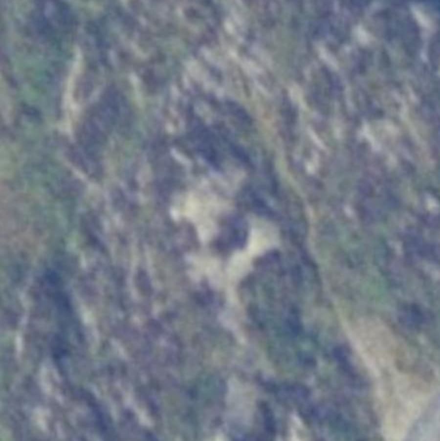
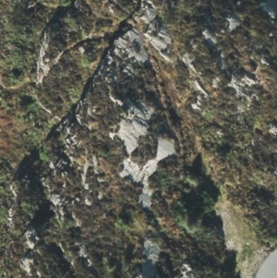
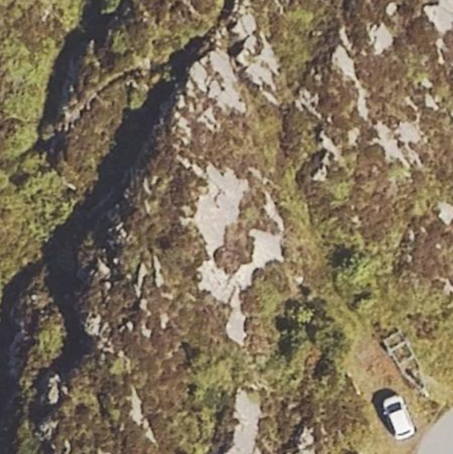
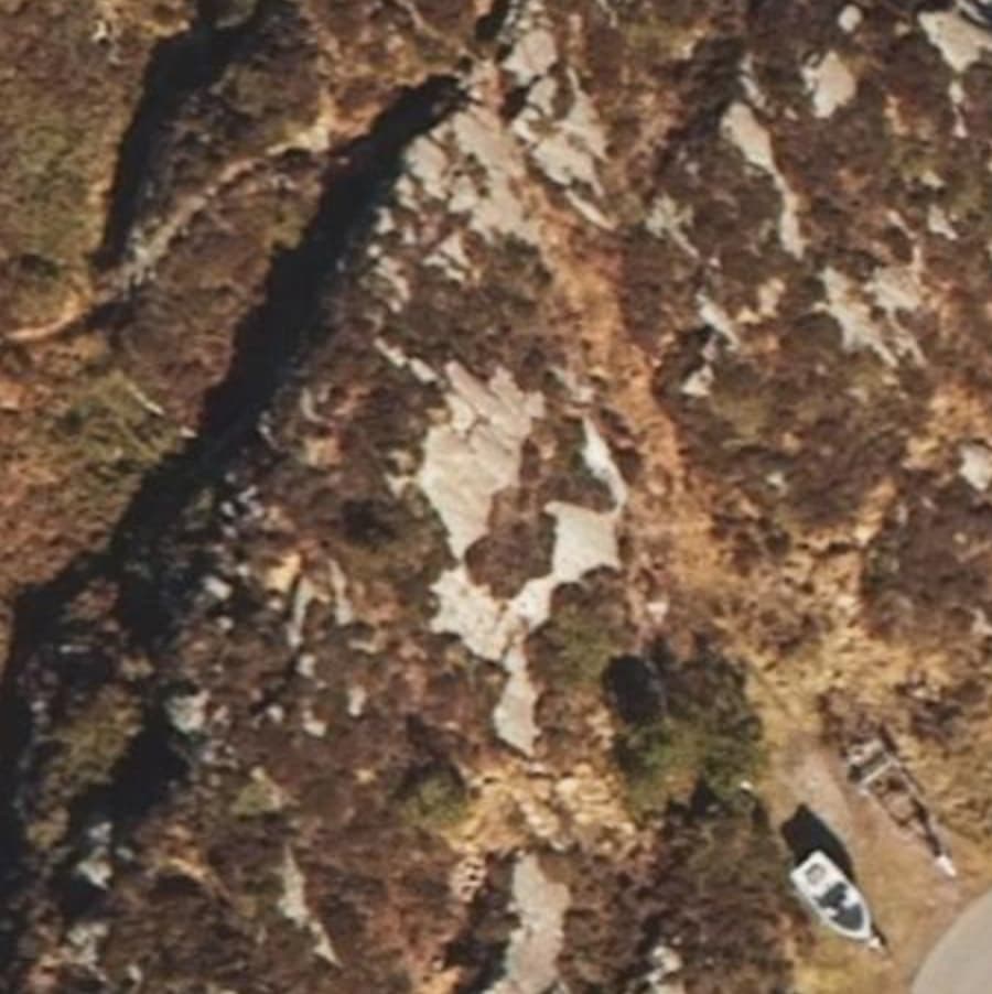
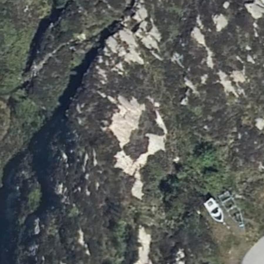
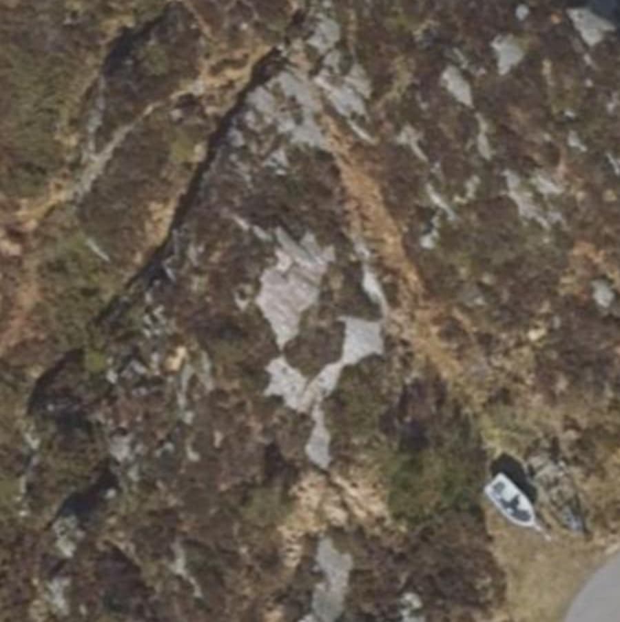
    • The fact is that this path is visible in orthographic photography from 2023, 2021, 2004, and 1962. The Strava heat map also shows trail-like activity on this trajectory. It was also visible on the ground when I walked it some years ago. Furthermore, I have verbal confirmation from friends that have walked the path recently that it is still in fact there. In light of this I feel there is ample evidence that there is, in fact, a path there, despite the counterparts claim to the contrary. It can be argued that the trail does not have excellent trail_visibility. But it cannot be argued that the trail is not there. Also, there is no requirement for a path to be legally sanctioned for it to be mapped in OSM. Finally, despite the counterpart claiming local knowledge, I don’t think this should be taken at face value, since they have expressed multiple motives for wanting the path to not exist.
  • The path crosses private property and access is thus not allowed. Hence the path should be deleted.
    • The counterpart argues strongly in favour of the path crossing what we in Norwegian call “innmark”. The main argument seems to be that the property, as a whole, is zoned as residential land. This argument is used to justify the full deletion of the path.
    • My take is that neither conclusions can be justified. The jist of my argument is that legal precedent shows that one does not consider the entirety of residential properties as “innmark”. Particularly not in the coastal zone, which this conflict resides in. Furthermore, even if this was “innmark”, I feel that the right approach would be to set an appropriate access tag on the path, rather than deleting it outright. If nothing else this documents the state of affairs to future mappers, such that they don’t add the path again.
  • The parking lot isn’t actually a parking lot, and should not be on the map
    • The counterpart argues that the parking lot that was added and subsequently deleted is not a parking lot, but just an “open space”.
    • I argue that this contradicts both the zoning documents for the area, which describe it as a “biloppstillingsplass”, and verbal confirmations from the counterpart that this is in fact what it is.

They do present more arguments than this, but this my attempt at a summary. For more details one can look at the correspondence that I share further up in this thread.

My request from the Norwegian OSM community

This is a dispute that represents the conflicting interests of land owners and everyone else. The final say in this dispute is had by the municipality and the county governor (statsforvalteren). The property owner can demand that the municipality make a verdict in matters of dispute regarding the right-to-roam law. However, this demand cannot be put forward by your every day OSM contributor.

Hence, it sets a dangerous precedent if we allow property owners to get away with path deletions while a dispute has not yet been decided by the municipality. This creates no incentive for the property owner to get the dispute settled.

I am also of the opinion that the law here is quite clear, and that the counterpart does not have a right to lay restrictions on the path in question. I think the community should support this notion.

Therefor I ask the Norwegian community to consider the following:

  • Do we want to allow property owners or their representatives to delete and/or damage database content without putting forward legally binding statements from the municipality or county governor?
  • Based on the details of this concrete dispute, does the counterpart have a worthy case?

I’ll of course be around in order to clarify and answer questions, as needed.

4 Likes

Just m2c:

To me the path should clearly be present on the map, and there are of course many, many of these paths present already in OSM. (It’s not illegal to walk on the road Sprengsneset, so using that path can make it a nice round-trip.) The parking is private, I assume, and doesn’t have to be mapped.

So the answer to your two questions is no and no.

1 Like

Is the path a visible trodden way and or at any point marked on trees, rocks, signs?

(There was a discussion a few months ago here on how to map paths that only have markers but otherwise, find your own way from A to B to C. t Think it’s this one Should we strive for a global or regional consensus for things like trail visibility & difficulty (sac etc), and possible pathless paths? - #22 by ezekielf

This is an unmarked “informal” path. It is maintained, not by active effort, but by people walking on the ground. It isn’t very obvious at the moment, probably qualifying for a trail_visibility=intermediate. It is growing less visible because the property owners are excerting an active effort to keep people away from the path, with partial success. It is still there, though.

I agree, but it seems to me that @harahu and @Gazer75 are mapping places where they have never been, mapping based on publicly available sources, not local surveying? This core idea of OpenStreetMap: Maps created by people having extensive local knowledge.

So even if I agree that the trail should be on the map, it might be that @harahu should leave the mapping to the locals? I personally don’t like it when “sofa-mappers” are editing trails in areas where I have put in a lot of effort trying to make high quality trail map data. Sorry for sounding harsh, it has to do with the following.

I have now seen discussions originating from public authorities wanting to programmatically update OpenStreetMap based on their data. Entur, a national public transport route planner make use of OpenStreetMap data, and this service needs accurate data. Accurate in their view is national data sources. So I’m concerned that Kartverket (N50) or Statens vegvesen (Elveg from NVDB) will set up automatic merging of their data into OpenStreetMap, and break the intention of OpenStreetMap data, making it a presentation layer instead of an independent map database.

This is partly what this dispute is about: OSM should in my opinion not accept independent data being manipulated by actors having economical or political interests, or by actors not having local knowledge.

I also don’t like people deleting objects with metadata. I think it is a better practice to change the tagging of objects. E.g. was:highway=path and adding relevant tags and a note or description explaining why that was made. This way we can safeguard deleted objects from reappearing in imports or similar editing approaches by actors not having up-to-date local knowledge.

In Norway you can park “anywhere” in “utmark” unless there are signs explicitly stating “No parking”. This is governed by Vegtrafikkloven. This means that “biloppstillingsplass” may actually qualify as a parking lot.

Friluftsloven, where the origin of the right of way, also defines “innmark” and “utmark”.

And there is no reason for not mapping a path crossing “innmark”. It can be labeled with relevant access tags. We do that all the time with grave yards, golf clubs, parks, meadows, which are “innmark” according to Norwegian law.

Fun fact: Drammen kommune has defined Hamborgstrømskogen, which is a forest area, as a park (and thus “innmark”) to be able to regulate bicycling on paths in that area. However I don’t think they have formalities around that in place (public hearing, “forskrift” etc.).

1 Like

I don’t disagree with you points. At least not on your concerns re. government bodies seeing their own data as the unquestionable truth.

I am definitely a “sofa-mapper” in the sense that I sometimes do mapping in places I’ve never been, only relying on publicly available data. I don’t consider this as problematic in the same way I thing you might, though. At least not when it is done with care, conservatism, and when combining multiple sources. IMO, mapping paths using a combination of strava heatmap and high quality orthographic photography will often result in results of higher quality than mapping by surveying and memory alone. I’ve probably made suboptimal edits this way at times, but over all I think it can be a very efficient way of improving the map.

Until you encounter a dispute.

That being said, although I kind of “sofa-mapped” said path, I have in fact been there before and walked it. It’s just been a few years. And, after this dispute unfolded I’ve consulted with mappers with local experience that do confirm that the path is there. They just don’t want to engage in this matter after seeing the toxicity of the discussions that emerged. I’ve also consulted with non-mappers that are telling the same story.

So, at this point, I think it is a bit of a stretch to claim I don’t have local knowledge. It’s just second-hand.

all that is irrelevant

Can any of them take photos of location when they will be there next time?

maybe they would be happy enough to provide photo of the location?

1 Like

That could very well be. I’ll forward the request, and I think it is a reasonable one.

Ah, the second-hand knowledge you are describing here is valid knowledge, in my opinion, confirming your memory is still correct: You have made sure that the area has not been regulated to a building site or “innmark”.
Regarding the dispute, you should read David Weinberger’s book “Everything is miscellaneous”. It is a fantastic book about organization, creation and ownership of information, and also looks into edit wars at Wikipedia.

This is regulated as a residential area. It’s just that the precedent for how the law is interpreted does not imply that the entirety of a residental-zoned property can be understood as “innmark”. See: Spørsmål og svar om allemannsretten - Miljødirektoratet

Thank you for the advice!

This particular case has been ongoing for I believe several years now. It its not so much a tagging war as a neighbour feud that has spilled over into OSM. A lot of arguments have been made from both sides and nobody is willing to back down. Photos, legal documentation, written decisions by local government or authorities, or similar should be presented here to settle the facts of the legal status of the path.

The evidence presented should lead to one of these outcomes:

  • The path exists and is legally publicly accessible. (highway=path)
  • The path exists but is legally only privately or permissibly accessible. (highway=path; access=private)
  • The path exists but is legally blocked (barrier=*; access=no)
  • The path has been (legally) removed: (removed:highway=path)
  • The path does not exist (way deleted)
6 Likes

In the United States, we very often get folks removing things from the maps because they don’t want something mapped due to ownership. As @Wulfmorn has laid out, those disputes are usually about the access= tagging and routability not actually about the way geometry. We have also had success arbitrating these disputes by working with the various trail apps to better respect access= tagging and deemphasize it on their maps.

More reading available here:
https://wiki.openstreetmap.org/wiki/United_States/Trail_Access_Project

3 Likes

I’ll follow up on your suggestion. I’ll start with the evidence I have currently justifying my claim that the path does in fact exist. We can come back to the access considerations later.

Exhibit 1: Strava heatmap shows path-like usage in the last 12 months.

The usage pattern is concentrated enough to strongly imply this is a path, but obviously shows that it is significantly less popular than the trail it connects to in the west.

Exhibit 2: The path is evident in several series of aerial photos from the last few years.


Pay attention to the fact that the trail is still evident in photos from the 20th of april this year. Also notice the change between 2019 and 2021* when suddenly a bunch more bushes appear behind the boat trailers. We’ll get back to that.

* EDIT: In retrospect I see that this measure could have been taken even earlier. I don’t think the bushes are there in 2013 at least.

Exhibit 3: The path is (somewhat) visible in Google Street View

I know google shouldn’t be used as a source for mapping, but I think it is fair to use in order to strengthen my case in this dispute. The path has been featured in Google Street View two times. April 2022 and August 2023.

First the images from 2022. The path passes between the boat hangers and follows the grassy area towards the background.


Now the images from a month ago. With fresh green grass it becomes harder to see the trail, but the evidence of path usage is evident between the boat hangers where one can see the grass being depressed and stubby.


Exhibit 4: My interpretation of the counterparts claim that the path does not exist

My counterparts have been invited to attend this discussion but thus far they have chosen not to. They have not elsewhere clarified their claim that the path does not exist, so we can only speculate as to what they mean. But I’ll do just that.

To support my theory I’ll bring up the 2023 aerial photo, this time in annotated form.

Here the path is shown in a red dashed line. Property boundaries are shown with thin green lines. Certain “barriers” are shown in cyan.

The big property to the north west is indisputably “utmark”. As such, IMO the trail isn’t really disputed beyond this line. Some of the counterpart deletions left the path alone beyond this line. The last of the deletions deleted the trail in its entirety, though.

My leading theory is that their claim of non-existent path refers to the few meters of path that crosses their property between the road in the southeast and the undisputed area in the northwest. So what might they mean with the path not existing there?

The two items I’ve annotated in cyan are some rose bushes planted behind the boat trailers, as well as a blue rope used as as improvised fence in front of the trailers. These should be visible in google street view, and the bushes can also be seen in aerial photos.

My suspicion is that the existence of these “barriers” is thought to somehow have made the path go away in the eyes of my counterpart. I’m sure they have succeeded in reducing the usage of the path, but the strava heatmap suggest people are more than capable of navigating past these barriers. And as such I think this would be a silly case to make.

I’ll repeat that I’m only speculating as to what their position is here. They haven’t made it particularly clear.

1 Like

My understanding is that deliberate attempts to block or obscure the path have been made by the “counterpart”. That’s a fair stack of visual evidence, @harahu.

As a neutral party, I feel this satisfies the “does it exist” question. But what about legality of access?

1 Like

Suggestion has been made to the other parties involved in this dispute that they join in the discussion here.

Graeme Fitzpatrick

OSMF Data Working Group

1 Like

We do have a tag that describes just this situation without stating anything specific about access: informal=yes Key:informal - OpenStreetMap Wiki. Adding this tag may not fully solve the dispute, but it would help distinguish this informal path from formally maintained (sanctioned) ones.

I have no stake in the Norwegian mapping community. I was just notified by the link to my post. However, I am always interested in helping to resolve these sorts of issues where informal path mapping conflicts with the wishes of property owners and land managers.

2 Likes

There appears to be clear evidence that there should be both a highway=path or highway=footway and an amenity=parking object mapped.

For the footpath the evidence is

  • it is visible on imagery,
  • is is walked by Strava users, and
  • you know people who have confirmed there is a path there, supplying local knowledge.

It is not relevant if it is sanctioned, has allowed access, is supported by anyone, or is on residential land.

For the parking log, there are vehicles and trailers parked there in multiple sources. It does not matter if it is public or in a residential area.

Any deletions of the path and parking lot are incorrect and should be reverted.

For access and related tags, the parking place is easy. It is roped off, so it is access=no, or possibly access=private.

The entire path should be tagged with informal=yes, based on the evidence. It’s possible the path might need to be split at the property line, but absent any signage, this is difficult to tell, and this is where the parties who disagree could likely contribute.

I cannot see any argument about if the path exists being productive unless more recent photographs reveal a substantially different environment.

3 Likes

I know of a similar situation – without the edit wars – in which the land owner (resident) doesn’t want the public to know of or use a path on his property that leads to several cabins (not his property), and resists any effort to improve the path to deter usage by anyone other than the cabin owners. I’m sure there are thousands of these quarrels all over the country.

You’ve summarized the rules governing travel on such paths. The advisory information also says that a rule of thumb regarding the “private zone” around a cabin is 10-20 meters in all directions. The path in question is more than 20 meters away from the cabins, except for the first meters where it heads off the main road. The main road itself is only 8 meters from the cabin.

The terrain the path runs through looks like the surrounding terrain in every aspect. It would be hard to argue that this is a private garden and that it extends more than 20 meters away from the cabin.

The path seems to run exactly on the property line between no 67 and no 26. If this is correct, it indicates to me that the path was placed intentionally, or that the property lines were drawn along the existing path.

I would say there’s ample evidence that the path exists, and reasonable evidence that public access is at least likely, even if disputed. Until there is an official verdict, my conclusion is the path should stay in OSM the way it was mapped.

1 Like

It’s not relevant for tagging, but more facts would better resolve the “war”.

It’s a good opinion, but again, it’s another opinion among many. More people having opinions never resolves a feud. This case evidence - preferably from both parties, preferably the original parties. Nobody wants this to continue. Let’s find a solid and undisputable end to this squabble.

I feel the same way too. I think the claim of non-existence is fundamentally motivated by the desire for the path not to exist, rather than the realities on the ground. That is why my sense is that the counterpart’s claim of local knowledge can’t be taken at face value.

I will explore my take on the legality of access next.

To be clear; even though I primarily request support from the Norwegian community, I think the rest of you are fully entitled to have your opinion heard. At least with regards to the “existence” question. There are no special or diverging practices regarding the way we map paths in Norway, so your intuition about what constitutes a path should be as good as ours.

The question that is perhaps best left to people with at least a strong understanding of Norwegian language and law, wherever they might live and map, is the question of how to tag access in this case. I can try to dig up translated primary sources if I can, but I can’t promise much in that regard. At least I’ll keep my lines of reasoning in English, beyond a few hard-to-translate terms like “innmark”, “utmark”. The former is the name for land that has potential restrictions on public access (though there are subtleties here as well), while the latter is land that, independent of ownership, should be kept accessible for the public.