Sure, but I’d prefer a map using the LIDAR hillshading directly as a background with contour lines generated from the same high resolution source. If a map has those two things I can see where the cliffs are quite well. Adding traced cliff lines on top of this just adds clutter and makes the map harder to read.
2 Likes
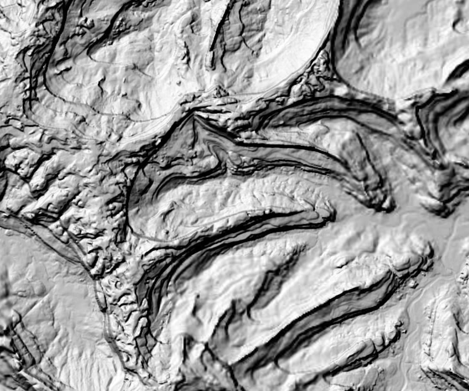
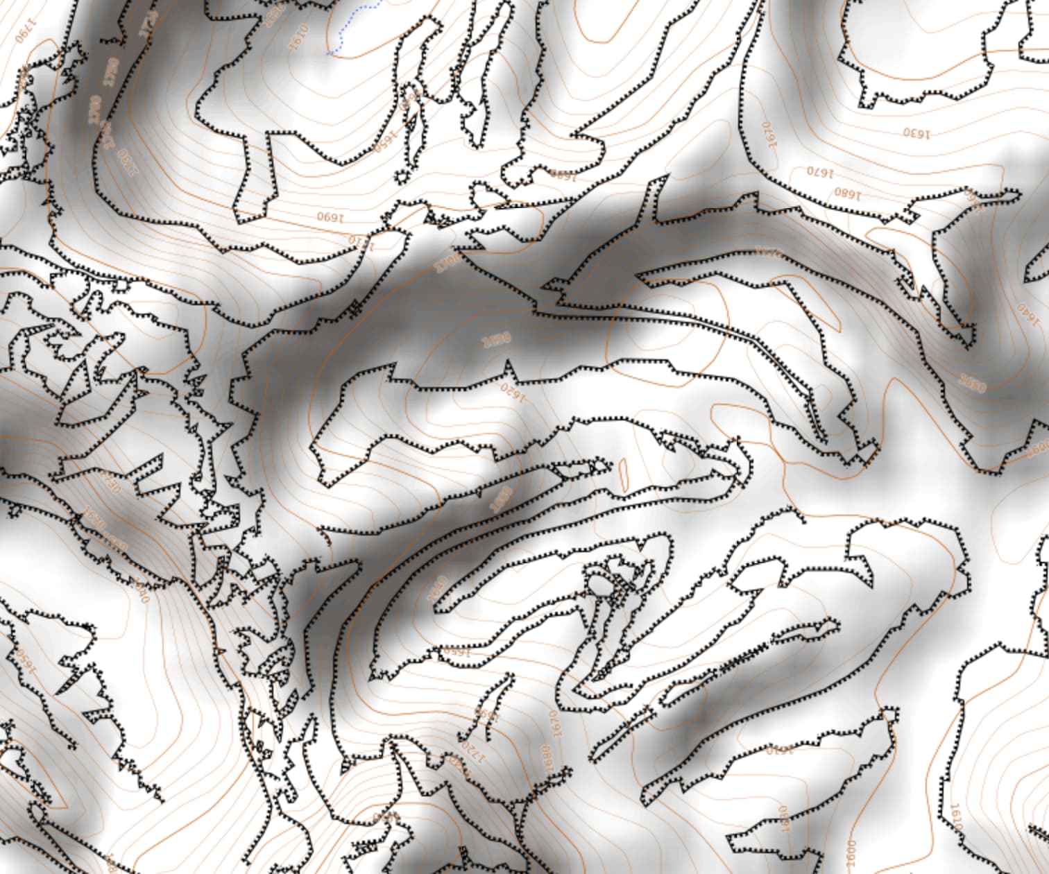
It is pretty difficult to tell from a DEM (lidar may be the underlying collection method, but what most people look at, is a hillshade of the resulting DEM) if there is a cliff or not. For example, in some areas of the US, the post spacing for 3DEP is 1/3 arc second, which at the equator, is about 10 meters. If the difference in heights between adjacent posts was, for example, 6 meters, it could be a vertical drop (and therefore a cliff and dangerous), or it could be a 30 degree slope (and not a cliff nor much of a danger generally). This is why we, and others, map “break lines”, such as cliffs. Having said that, in the case cited by the OP, without some photos, or an onsite visit, I don’t think we can really tell if these are cliffs or not. If we were looking at the actual lidar data, we would be looking at a point cloud, and, with the right software, it may be possible to get an idea as to the existance of a cliff.
6 Likes
Hi all,
First of all, thanks to the contributors who agree that I’ve mapped correctly and point out other examples with even more complex cliffs. I greatly appreciate!
-
As other contributors reported/rated you, @dpolovinkin , like in this CS or here, you often perform subjective mass deletions, labeling various elements as useless (for you). You did it again in this CS. Agree with @Mammi71, some people would consider this vandalism.
-
I’ve been adding cliffs since 2013 in Micheville, Mersch, Haard alongside other contributors, not solely relying on LIDAR. Stereo from Lu and OSMF chairman, has also followed this approach in Lux-city, again here and Kirchberg. The intricate and numerous cliffs reflect the natural complexity of the region you referenced. They are one of the reasons why it has been added to the Unesco Geoparks and it is visited by many tourists. Over a decade, no complaints arose except now from you and your friend ex-tomolobla, seemingly due to our conflict over his numerous abusive deletions of existing ways, some even having structures.
-
According you, the non-existing track added by myself, come on it is literally visible on SPW’s most recent aerial photos. I don’t get why you complain about it…
-
The blocks I had are not about the cliffs but about an ongoing conflict with your friend ex-tomolobla, AKA Kugelbaum (providing conveniently misplaced photo shots, I’ve proven so here) and his other sock-puppets AKA grauwutayette, eyasonu, etc (at least 8 accounts) for deleting ways which I’ve proven existing. The DWG admin in charge of the ticket promised a conclusion here to resolve it, but we were never given any. In the mean time, your friend continued the deletions and changed account when exposed by my evidences. Stereo suggested me to discuss this in the IRC channel but because our tiny LU community lacking responsiveness and DWG’s inaction, instead of coming in this forum, I preferred warning contributors on changesets with evidences and via fixme tags with explanations. The admins considered that ad-hominem, with which I disagree (read definition), since I’ve given evidences and explanations directly on the data. NB: despite my blocks, I’m still here with my account, not ashamed because I know I stand right.
But that’s not an issue of the OSM-DB but rather on the renderer-side. ![]()
2 Likes
I believe the wiki says if you can jump over it, it’s a stream. If not, it should be mapped as “river” with width specified.
I would rather see the topic here and the US case as excessively tagged =cliff features, but not necessarily excessively mapped geometry. The objects could be re-tagged to something else. Eg if it’s a “rock column” for the Swiss example. Pillar (landform) - Wikipedia USGS GNIS - OpenStreetMap Wiki
As a side note, didn’t know Tag:natural=cliff - OpenStreetMap Wiki point is documented for spires. Wonder if OSMAnd and @SomeoneElse actually renders them, or it’s unspecified. natural=cliff | Tags | OpenStreetMap Taginfo
It’s actually a German example ![]() and the mapping discussed in this topic is near the area of Little Switzerland …
and the mapping discussed in this topic is near the area of Little Switzerland …
During my hikes last year I saw a lot of streams I could easily step over, then a fortnight later the same ‘stream’ overflowed the area.
for you “often” is this one time before in Romania? ![]()
To clarify for others - back then I deleted a lot of mechanically imported trees in Bucharest, many of which were obviously incorrect (standing on the streets, buildings, sometimes 15 trees instead of 5 in real life, so on), and remapped some of them as wood areas - and my mistake is that I didn’t talk with community before, but after reverts and warning-block (not a proper ones which you had, just saying) I’ve chatted with them in Telegram and indeed most people agreed that such tree mapping didn’t make much sense. It’s just that I started cleaning the map before asking people, that’s my bad, yes.
friend? I don’t even know who this is ![]()
ok, great you didn’t do it lots of times, and important you are writing here and explaining those accusations against you are unfounded. It is important people are researching well before publicly accusing others for vandalism. Still, in the case of the deleted cliffs in Luxembourg it is seems they were not justified (at least the edit comment doesn’t suggest it) and these should be reverted.
UPDATE: @dpolovinkin thank you for reverting the deletions of cliffs in LUX!
Just to answer that question - I don’t do any “special handling”** on cliffs on my raster or Garmin maps; the representation on raster maps is unchanged from how OSM Carto did it 10 years ago. I’ve not actually looked at how “small diameter” rock pillars are mapped in OSM - there aren’t too many of them near me! “large diameter” ones I’d expect to see as “circular cliffs” but I haven’t investigated that either.
** “special handling” means looking at other tags and seeing if some other representation would be better.than he vanilla one for that feature type. As an example, the “buildingness” of a ruined building is shown slightly differently to a regular building, and “ruined” can be implied by 3 or 4 different tagging styles.
The difference here is that we have a pile of different tags to explain what’s going on here - river vs stream, intermittent, flood_prone and more.
Is there anything similar for cliffs? How high does something have to be before it counts as a “cliff” in OSM? My naive thought as a mapper and with “what people map as cliffs in the UK” would be 3m vertical or so, but there might be different opinions elsewhere.
Is anyone aware of an attempt in OSM data to say “how much of a cliff this is”?
With quite accurate lidar data available, micromapping cliff height is not unrealistic.
2 Likes
I just did an on-site estimate in the linked place above. Administrative GIS allows me to make measurements by drawing lines that query the terrain model to create a height profile. Comes out it is 50 m instead of 40, at 80° incline. This cliff here is said to be 900m high (Wikipedia), administrative GIS gives me ~650m, also at 80° incline. In another topic though I got told that adding such data will stain the whiter than white waistcoat of osm, so I refrain from corrections.
LIDAR based hill shading says little actionable about height, contour lines can give a rough estimate, but only for high cliffs. LIDAR alone is also prone to misperceptions. Sometimes there is no cliff at all, just a steep embankment kind of terrain, @tekim already mentioned that above. Some kind of local knowledge should be there.
There are a number of cliffs where I map that I have doubts. While they got mapped from LIDAR, I have to visit them, one by one. I already could falsify a few, but progress is slow. All that said, cliffs are useful in maps, their presence can change how to approach a site or can save a large detour. Not all users have high res hill shading in their apps. With SRTM even the 50m cliff cannot be seen.
So yes, adding height to cliffs very much welcome! Less than 1% of cliffs have that.
I agree that some of the trees in Bucharest could have been plotted as areas instead of individual trees but not all and part of those were not reverted. It’s not only these though, you also deleted a lot of buildings with an offset that could have been just repositioned very easily. I bet even more easily than recreating them (filter elements > move).
2023.08.14 cliffs Luxembourg OSMCha
2023.08.17 trees Bucharest OSMCha
2023.08.28 trees Bucharest Changeset: 140499434 | OpenStreetMap
2023.09.12 trees Serbia Changeset: 141181140 | OpenStreetMap
2023.09.12 trees Bucharest OSMCha
2023.11.16 buildings Russia OSMCha
2023.11.26 buildings Russia OSMCha
2023.12.04 buildings Montenegro OSMCha
2023.12.04 buildings Montenegro OSMCha
2024.01.17 cliffs Luxembourg OSMCha
2024.01.17 cliffs Luxembourg Changeset: 146370525 | OpenStreetMap
Isn’t this often? And I can fo further back in time if you insist…
As I said you talked about someone who thinks I excessively add paths only thanks to LIDAR (which I’ve demonstrated existing), he also started deleting cliffs after your deletions from 2023.08.14, you came here talking about cliffs + my blocks even though there is worse elsewhere and you don’t live here, finally here apparently he knows you are Serbian. So yeah, you seem knowing this guy who also does massive deletions.
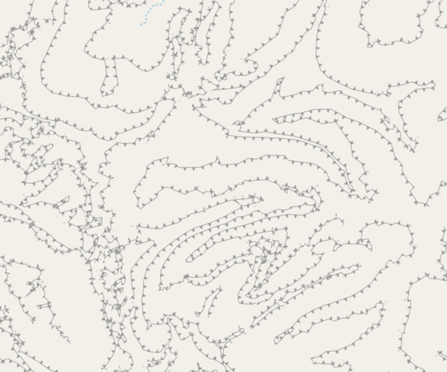
Agree, but contributors who value these topographic elements I’m convinced they try their best to plot complex shapes. Personally I do try to keep them simple and with a low ratio of nodes, avoiding plotting every corner and every height. On very large distances in mountains/large hills, I only plot the highest, lowest and most relevant in between. When close enough and surrounding roads/trails only top/low. When tight, only one line of cliff.
Yes there is a height description in OSM Wiki: above human height with a risk of danger for various users (horse riders have a higher risk than pedestrians). Also in Wiki’s discussion, there is a contributor who talked about plotting complex cliffs, some being not a straight drop but dangerous anyway.
I would like to emphasize this concept of “various users” i just talked about. Off topic but important. Across my decade of contributions I noticed several contributors only have their point of view but forget there are other kind of users using OSM. Pedestrians, cyclists/mountain bikers, horse riders, drivers, tourists, etc… Each might find something useful but not another. We really need to avoid subjective interpretations and focus on facts: does it exist/can it be recognized and how to tag it properly thanks to a clear definition.
Yeah tris thread is about lidar cliff mapping, not about whether I deleted something among my 2k+ changesets, so I don’t know what point are you trying to make going through this all to collect places where I deleted something heh…
And I’m Russian, not Serbian :)))
Indeed about cliffs, that you deleted and these are part of your other mass deletions that have been reported by others. Since you questioned my “often”, I just replied politely to your doubts by pointing out each of them with a date to make a clear statement. :)))))))))
On the rest, good then…