Is the following mapping of Peru’s boundary correct? It looks like Carto is showing Peru’s EEZ rather than its territorial waters boundary. Wrong boundary level tagged?
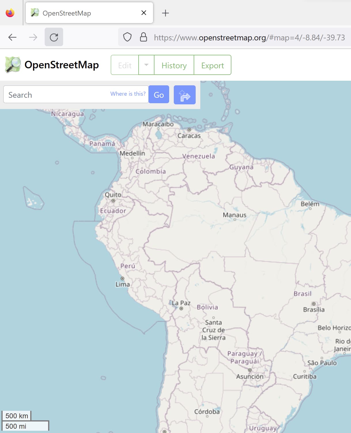
This would be the Mar de Grau, which Peru claims as its maritime territory. Peru is one of four countries that claim a maritime boundary 200 nautical miles out. A small part of the boundary was decided by an international court in 2014, resulting in the jog that the boundary takes in the south before it meets the Chilean boundary.
3 Likes
Interesting! That sent me down a rabbit hole!
So the four are: Benin, El Salvador, Peru, Somalia.
But it’s only Peru that is actually mapped like this. The nautical boundaries of the other three are mapped like the rest of the world (presumably using the 12 mile limit set out in UNCLOS).
Would this class as a disputed boundary since signatories of UNCLOS wouldn’t recognize the claim? I had a look at OSM’s disputed territories page but it’s not listed. I guess because no other country claims the area as theirs?
Of this list, Benin, El Salvador, and Somalia are parties to UNCLOS, but Peru is not. Incidentally, the United States is another notable non-party to UNCLOS, but it claims only 12 nautical miles anyways as part of a nuanced relationship to the convention.
I have no idea if that’s how it works, especially considering the concept of freedom of navigation. But I would be careful about marking that boundary disputed without a solid source. For what it’s worth, Peru’s original 200-nautical-mile limit partially overlapped with Chile’s 12-nautical-mile limit, but the ICJ has ruled on that dispute, so at least there’s no longer a dispute between those two countries.
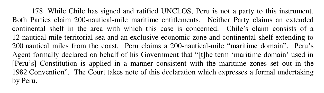
I now remember someone pointing out to me that Peru has in fact accepted the UNCLOS limits of maritime zones, despite not being a party to UNCLOS. From the International Court of Justice decision of 27 January 2014:
I have now edited the maritime boundaries of Peru accordingly:
This is quite difficult language for me as a layperson to make sense of. Hopefully the person who pointed this out to you is correct about how to interpret that part of the case’s found facts. Breaking out separate areas for concepts like the Mar de Grau is a good idea in any case.
I got into an argument with another mapper who argued that Peru has not made legislative changes w.r.t. the maritime domain. Which also turns out to be true.
I’ve written a summary of the situation for the disputed territories page of the wiki:
https://wiki.openstreetmap.org/wiki/Disputed_territories#South_America