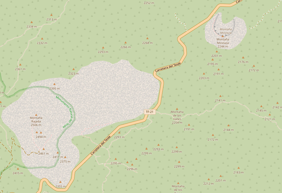
As a rough rule of thumb, I think, one needs a good reason to include a natural=peak if a name can’t be found. Sure, nameless peaks a fine, but “I have survey point elevation data” isn’t a good enough reason alone IMO.
I noticed at least one example where it seems there may be duplication (2 peaks with the same elevation very close to each other, where I can only see one on the IGN map). I asked about that in the changeset comments here:
Aside from that, I’m not sure if there is a problem here. There seems to be no guidance about how prominent a peak needs to be to be recorded in OSM. Arguably if IGN thinks it is worth marking, it could be worth recording in OSM also. I am based closer to the city of Málaga where a lot of peaks are already mapped in this way, by a different mapper or mappers.
I am more concerned about this possibly being some sort of stealth
import - I spotted one example where what the user mapped was clearly
not from either of the sources specified so I asked what the real source
was here: Changeset: 150749353 | OpenStreetMap
In that example, the IGN map shows either 981m or 982m depending on how far you zoom in. I suppose there are two series with different scales, perhaps surveyed at different times. Of course that leaves the question of which series is being used and whether it is used consistently.
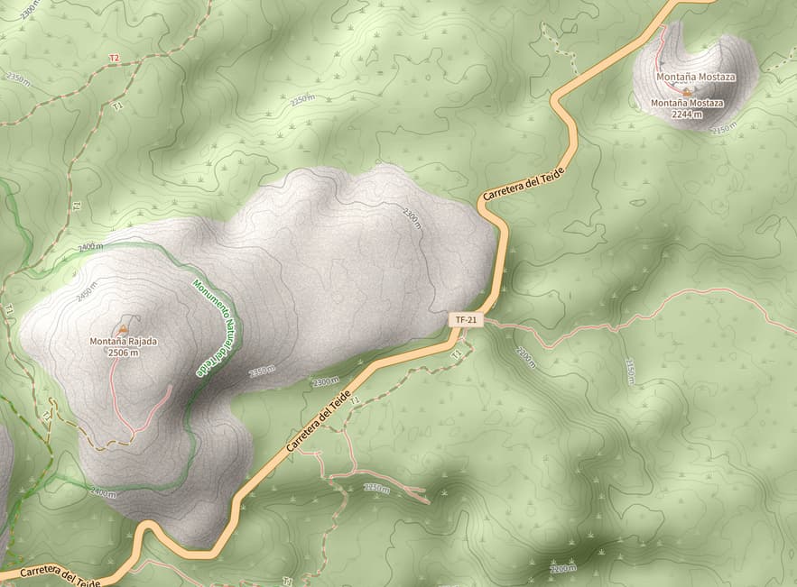
On the “standard” layer, yes. But that’s largely because they render all “peaks” regardless of any other consideration such as whether the peak has a name. Tracestrack Topo, for example, uses the same data to produce a rendering that looks OK to me.
Right. The display part is certainly half of the problem. Tracestrack looks nice because they use full isolines, and drop many not so prominent features. The standard map consideres all peaks important enough to display (when used well, they well suited for navigation).
The other half of the problem is that two “peaks” 50 meters apart simply are no “peaks”. The OSM wiki says the node defined “The top (summit) of a hill or mountain”. Nobody would call a height difference of less than one’s own height a hill.
So far the OSM principle has been to not map elevation data, but to amend it from other sources when required. Having a “peak” just about everywhere quite goes against that.
Esos conjuntos de cambios son míos. Los datos están tomados del Instituto Geográfico Nacional (IGN), diferenciando picos de collados. El IGN ya nos dio permiso hace años para la utilización de sus mapas y datos publicados bajo licencia CC-BY y el Instituto está correctamente acreditado en la página de colaboradores de OSM.
That’s something the spanish community is aware of. These elements come from the Centro de Descargas del CNIG (IGN), since they are rendered by the IGN raster map (it’s cartographic information). Actually, they’re altitude level marks.
The big issue here is the render, specifically, the carto-css or mapnik, which is doing nothing about it, since 2019:
You can test different renders to see how they deal with natural=peak (spoiler: better)
If they are just elevation marks then they should be not be tagged with natural=peak. natural:peak denotes the top of a mountain. These are not tops of mountains.
To blame the renderer for this is IMHO incorrect.
No me importaría volver a revisar los datos para eliminar la etiqueta «natural=peak» y dejar solo la clave «ele» donde corresponda. Usé «natural=peak» porque no se recomienda usar la clave «ele» sin otra etiqueta. No obstante, como los datos son de interés, entiendo que se podría dejar la clave «ele» sin contradecir las directrices del wiki: «OpenStreetMap does not try to be a general elevation database, so do not tag elevation of nodes with no other tags, as well as for objects whose elevation is not an information of general interest».1
Esperaré a que más colaboradores opinen sobre este punto para empezar a revisar los datos. Donde las fuentes faciliten curvas de nivel creo que será fácil determinar puntos singulares. Donde no esté claro, eliminaré la etiqueta «natural=peak».
Se eliminarán aquellos objetos que razonablemente pueda considerarse que efectivamente no son picos y cuyo dato de elevación claramente no pueda asociarse a un objeto geográfico inmediato del que sea de interés general conocer su elevación sobre el nivel del mar.
Se eliminará la etiqueta «natural=peak» de aquellos objetos cuyo dato de elevación pueda asociarse a un objeto geográfico inmediato del que sea de interés general conocer su elevación sobre el nivel del mar, trasladando el dato de elevación a dicho objeto. Se creará una lista de estos objetos para su posterior revisión.
Se eliminarán aquellos objetos que no haya sido posible asociar a un objeto geográfico inmediato tras su evaluación en el paso anterior.
Se revisará la lista de objetos a los que se haya asociado un dato de elevación para eliminar dicho dato de aquellos objetos de los que no sea de interés general conocer su elevación sobre el nivel del mar.