I used the osm-river-basins to spot waterways of the Saint-Lawrence river to connect. This is a major river basin from the Great Lakes to the Gulf of Saint-Lawrence. I started with rivers = 17,000 km.
I commented on the pattern of “waterway that ends at the edge of a lake or river and is disconnected from the rest of the network” and two users (@AntiCompositeNumber and @Kovoschiz) in the global Discord generated this wonderful Overpass query: overpass turbo
It’s very nice to load a big region of these nodes into JOSM with Carto as the background layer and work through things.
See the thread Waterways mapcss JOSM-Style where I present the JOSM-Waterways style I just implemented. This should complement the tools available to find topology problems. In JOSM, dont forget to reload Styles to assure you see the new style.
I think this is sound advice. In the past, I have occasionally tagged an individual waterway with wikidata, but as soon as I need to split the main channel into more than one way, I create a waterway relation and move the wikidata tag to that relation. The individual waterways no longer have wikidata tags.
Usually, the reason I split a waterway is that a creek flows through a culvert (tunnel=culvert), but a name change would be another reason. This also allows us to model a nested naming convention within a river system.
This workaround isn’t quite sufficient because the lower reaches would ideally have a more specific Wikidata QID than the upper reaches:
I noticed the RSS feed claims the tile data was updated 2023-09-28T08:09:01Z but the main site still has the previous time stamp. It’s not causing me any real trouble of course but I figured I’d mention it.
Ah, I suspect this post is related. Nice work team! We were so enthusiastic we broke it.
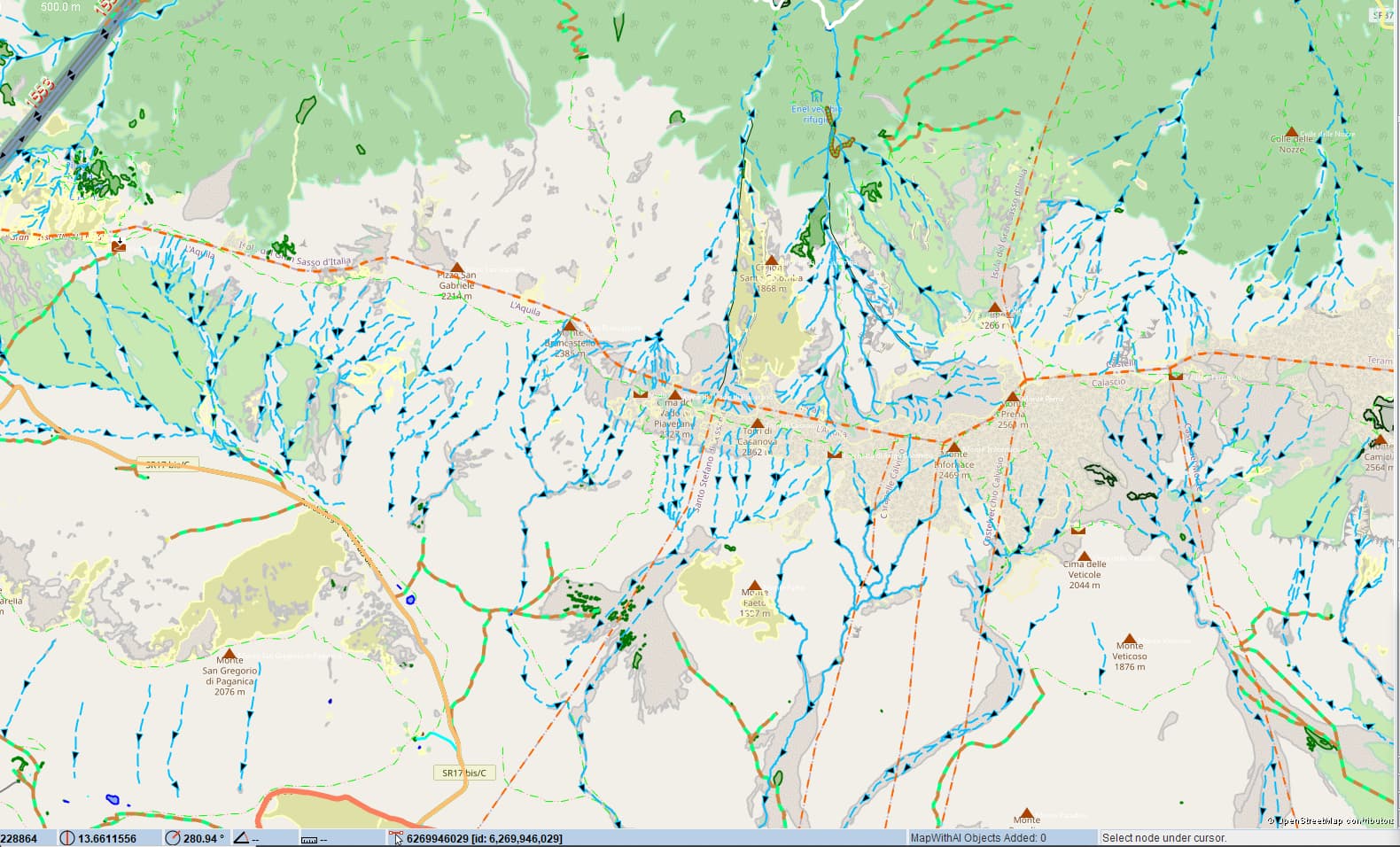
Been working 8 days a week for the past 3 on this mountain and it’s evident you don’t want to be hiking here when it starts raining (and I cycled thru once and when it does it pours), winds blowing from NE across the warm Adriatic and then rising from zero to 3000 (9000 ft) within 50km as the crow flies.
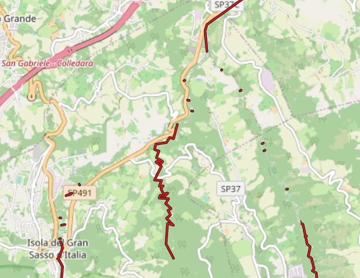
And the many north bound disappearing into the forest still to be added, impossible to see with the closed canopy, just shades of indentations hinting at where they’re going.
PS Courtesy of newly added Open TopoMap at least known which way the water flows.
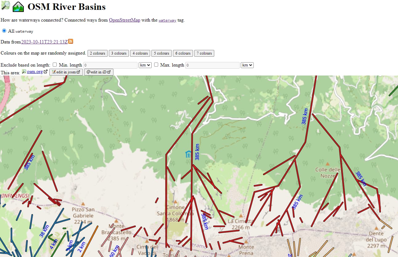
Ok, delete pinned tab and relaunch for, Oh, a more symbolic representation of the waterways… well the Vomano went from 324 to 385km in feeds from all the added mountain streams so guess the storage banks seem to have been flooded by additions. :O)
Hi. Amanda.
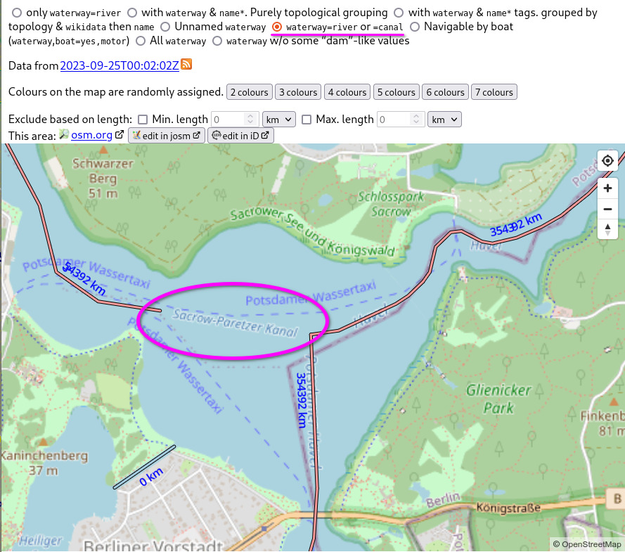
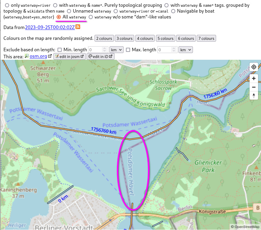
Very nice work. One thing I notice is that a “boatyard” area is treated as a circular waterway since the its tag is “waterway=boatyard”! Maybe that can be excluded so as to avoid false positives.
it’s alive! It should be back working, with improvements!
I’ve also made some internal refactoring and improvements (look at all those software releases) to keep it updatable. The file sizes are smaller (nice for me), and there should be less “gaps” (good for you).
I’ve reduced the number of views, because many are no longer needed now that there’s “all waterway” support. Which would you like to see?
I added a [waterway∈stream,river view}(OSM River Basins) (requested here), i.e. “no canals”. That should show more natural river basins. Somehow the Rhine & Danube are still connected. Interesting! Who can figure out why?
Certainly observing that streams are missing when there’s weir’s drawn across (those do get a node connect at the waterway crossing point) and the weirs are shown as stream. At least think it’s those weirs why part of the Mavone is missing connecting a large Gran Sasso stream group with the Vomano via said and which still gets all added to the new total going from 385 to 449 km.