Mini_roundabout does not need to be really mini, the distinction from regular roundabout is traversable center island.
So, as it may by quite large in fact, why is it required to be a node at intersection and not a circle tagged as mini_roundabout?
Sometimes it is big enough to draw a circle.
I was just about to create a new topic but this old one popped up, so I’ll re-use it…
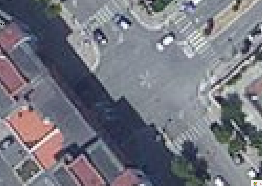
I found a mini roundabout that is fairly large and the roads feeding into it (out of it) are split by traffic islands:
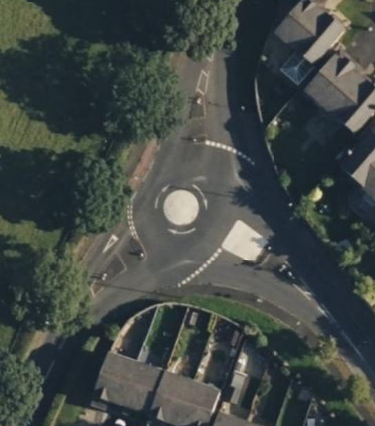
(Bing)
This leads to a rather unusual look when rendered:
In this example, it seems like it would be more representative of the real world situation to draw as a traditional roundabout.
4 Likes
We discussed this problem of larger roundabouts with traversable island it in the German community
see Discussion here (in German) Mini_roundabout
and created this solution:
https://wiki.openstreetmap.org/wiki/Key:central_island:traversable
Background:
In Germany, there is only one type roundabouts in terms of traffic law. These can be large or small, with the small ones having a center island that can be driven over so that long vehicles can pass.
Caution is advised with this tagging when different rules apply in your country in mini roundabouts than in normal roundabouts
To make it more clear - The mini roundabout is more of a simple crossing in British Road Laws, made for junctions with equal priority. Same as a 4 way stop in the US.
As we have the German default crossing rule “rechts vor links” there is no such need in German road laws.
Mini roundabouts need to have a traversable center, but a traversable center does not make a mini roundabout.
And to even more clear about this - British drivers would not assume to get roundabout announcements in routing for mini roundabouts - so its “Turn left” whereas a normal roundabout would get “Take the first exit”. This is known and explicitly wanted.
So whenever you encounter a roundabout which you would expect the routing announcement to tell you “Take the nth exit” its most likely not a mini roundabout.
Flo (Reveal: One of the most stubborn mini roundabout opponents in Germany)
1 Like
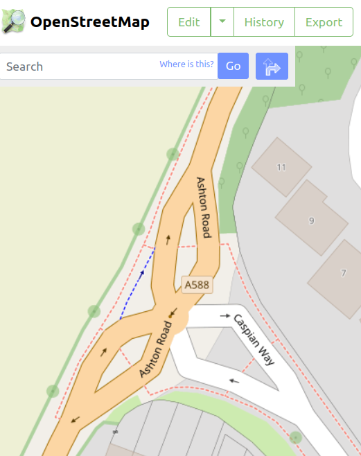
The exhausting march of the wiki=law soldiers lead to me too many perverted road mappings. This one was for many years mapped as a full roundabout, the centre left traversable because heavy and long lorries arrive here needing wide turns like city busses often need to do too.
In JOSM edit mode
In real live it looks like this, the signs, the markings all as were it a roundabout.
How it looks in sat.
East-west and west-east are separate oneways. actually going straight rather than doing the twist. Truck routers will ask themselves before hand… can I make that turn approaching from the west?
The IIRC Swiss section had on the old forum a pragmatic approach… mapped in full, leave it alone.
Thanks. I’ve tried to follow along (but I can’t translate a whole thread and there were a lot of replies!).
Interesting point. I think in the UK (which is where I imagine this tagging came from) actually there isn’t much legally different. They have different signs and you wouldn’t see a multi-lane mini-roundabout, but the rules to be followed are almost the same (e.g., see Rule 188 in the Highway Code.)
Good point. Again, when referring to the UK there are actually quite a few requirements to define what a mini roundabout is (see S2.1). But these are all physical descriptors rather than legal.
Hmm. As British driver, driving in the UK, I can’t say I’d actually ever thought about that! I think I’d be comfortable with either and actually probably expect the same as a normal roundabout.
Agree - it does look odd (as with my example). I almost wonder if we should just allow junction=mini-roundabout for those cases where a mini-roundabout is better mapped by a circular highway segment rather than a point.
I would be strongly for. Or even let’s make them both roundabouts, both might be mappable as a node or as a way; and if there is a legal difference between regular and mini roundabouts, just add a tag marking a roundabout as a mini roundabout.
1 Like
Nono - they are legally very different things and drivers expect different things. There is a very old and long discussion AFAIK on tagging about that and the consensus was that they are different and it should stay like that. I also proposed to unify them but there was no consensus on that:
This is the thread where i proposed that already:
https://lists.openstreetmap.org/pipermail/tagging/2019-October/048852.html
And there are threads about mini roundabouts all the way back to the big bang.
And the point of mapping one as a road/circle and one as a node is the size. Mini roundabouts are small, and we dont want announcements (take the 3rd exit, which is very hard to do on a “point”)
So the current mapping practice (node vs circular road), and what a roundabout and a mini roundabout are is pretty consistent.
Flo
1 Like
I forget all the time - does traffic on the mini-roundabout have priority, legally?
In the UK you must give way to traffic circulating a roundabout, whether that be standard or mini. It helps to think of the roundabout/mini-roundabout being cut open and straightened to form a row of T-junctions. But, although legislation is clear, the official summary guidance book (Highway Code) states “give way to right” resulting in most road users giving way to vehicles that have not yet entered the roundabout.
Then I see no obstacle for drawing a large mini-roundabout the same as a small regular roundabout.
Announcements by navigation systems can be adapted, as long as the information is available in the OSM data. tagging highway=mini_roundabout on the circular ways is clear enough, I think?
Junction=roundabout has made the same journey, from node to circle to cut-up circle.
OTOH, in my area I would probably just go back to single ways for the roads, ignoring the flare islands. Afer all, many regular junctions have those islands, which are rarely mapped because they don’t even widen the road area.
Do not use highway=mini_roundabout (currently 16 uses) on paths! Then the highway class information is lost and I suspect that most applications will not understand this as a valid road segment.
The use of junction=mini_roundabout would also have to be proposed first the with 23 uses so far no software will evaluate this yet either.
A backward compatible solution could be a new tag mini_roundabout=yes.
1 Like
Right, of course! I was surprised to see mini_roundabout mapped as a highway node anyway. So, junction=mini_roundabout, which means data usung software has to adapt, or tag the ways with junction=roundabout (which it is, the traversible island notwithstanding) for compatibility, and mini_roundabout=yes to enable more precise handling for data use, mainly for navigation I think.
True , although that is implied by the size of mini-roundabouts and the
time taken for traffic to reach you.
Traffic does not generally slow to the speed needed to go around the
paint.
There is also the rule that you shouldn’t use mini-roundabouts to make
U-turns, which routers would need to be aware of.
Basically we have been using this method forever, it works and as they
say 'if it ain’t broke, don’t fix it".
Casey_boy and SekeRob have just shared some images of it “working”.
I believe if it worked, we wouldn’t have this discussion returning ![]()
I think if this is causing people to “bowtie” intersections we need to mini roundabouts on circular ways (probably with a junction tag).
As a bonus it might mean we get magic roundabout mapping that reflects the usage.
1 Like
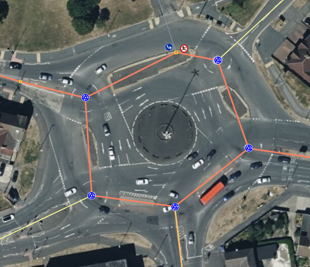
THis Magic Roundabout, does it have two-way traffic between the mini-roundabouts?
Most definitevely.
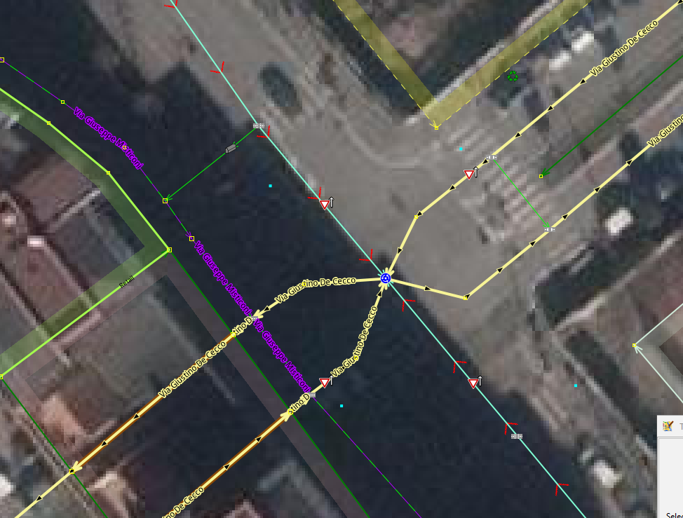
From what I can tell on the aerial view and from people discussing it (I haven’t driven it myself):
It’s a two way ring of road with a mini roundabout at the entrances of the proper roads. The issue from an OSM perspective is that it’s a dual carriageway. If it was a single carriageway it would be fairly simple to draw (it would resemble the sign), but to have a separate way for each direction someone has added fictional “radial” roads going from the centre of each mini roundabout to the joining parts of the dual carriageways.
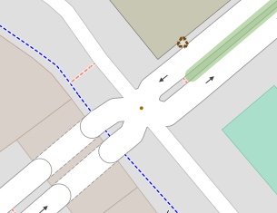
If only it was a single carriageway:
#/media/File:Magic_Roundabout_Schild_db.jpg)
1 Like
Took a peek. That someone has made it very very complicated. Though I admit that the inner circle of the larger circular junction could be seen as a large bypass, not entering the miniroundabouts untilthe driver takes a turn onto one of them.
I think in your picture the circular sections could simply be two-way. Then it’s just a series of mini roundabouts connected by a two-way road which happens to turn onto itself.
To map the circular as two separate cariageways (a valid choice, because of the physical separation islands), I think I would choose to map the mini-roundabouts as roundabouts, just smaller than usual. I.e. a oneway ring, and each approach and exit lane lands on its own junction node on the circle instead of a central node. Takes much more work, but would route ok I think, and the rendering would be much more realistic.