Mapping the upper and lower slope edges can’t be that difficult, various CAD software can do that too.
@Kogacarlo have already shown it here

Connecting the upper and lower line with fine strokes may not be trivial for renderers with the possibilities of OSM.
That is why I am thinking of rendering the two lines separately as a first step:
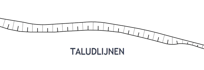
The upper edge (crest_line) of the slope (in the image this is the lower line!) has alternating shorter, thicker strokes and longer thinner strokes at somewhat closer intervals. This is - at least as far as I know - a widespread form of representation of the upper edge of a slope.
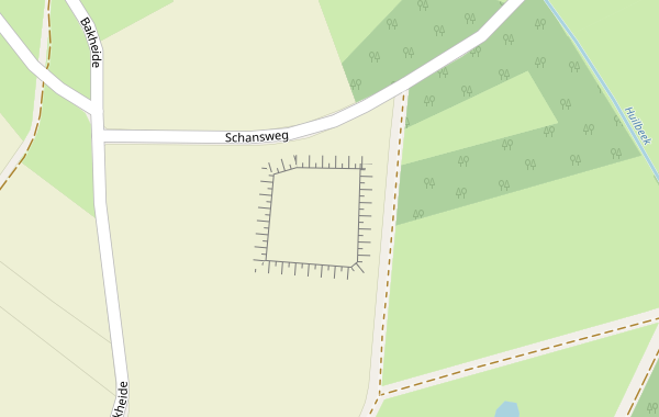
That this can be done easily has @Kogacarlo already been shown:
The lower edge (toe_line) of the slope (in the first image this is the upper line!) is to be mapped and rendered separately. This way has only thinner strokes at somewhat larger distances.
The length of these small strokes is to be chosen in such a way that in most cases they are opposite each other in the different zoom levels and at most touch each other. If they form a gap at larger distances, this is probably not a problem; a sighted person then unconsciously completes this in his or her brain when looking at a map.
In a second step, we can consider whether we can connect crest_line and toe_line with a relation and this enables a renderer to connect both ways with fine lines.
