This project has been a success, and we are preparing to expand the effort beyond the US. We’re sharing notice here to ensure that you as a community outside of America have adequate notice, consistent with the Organised Editing Guidelines.
Given the number of contributors/km2 in Canada, I can only welcome such an initiative!
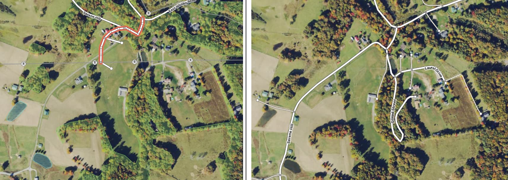
My only concern at the moment is about the edits made to the geometry of existing roads.
I take particular care (almost compulsive?) to improve the accuracy of the road I update. For instance, I use Strava Global Heatmap (GPS) whenever possible, simply because it provides a much more reliable and accurate reference than OSM tracks to shift the images.
Can you provide more details on the sources used to edit/improve the geometry of existing roads?
Hello @jfd553, right now we’re using all available sources on OSM.
Also usually we’re fixing existing roads if it’s a really bad geometry (ex. TIGER roads from 2007).