Many rock features drawn as `natural=cliff` but not correctly

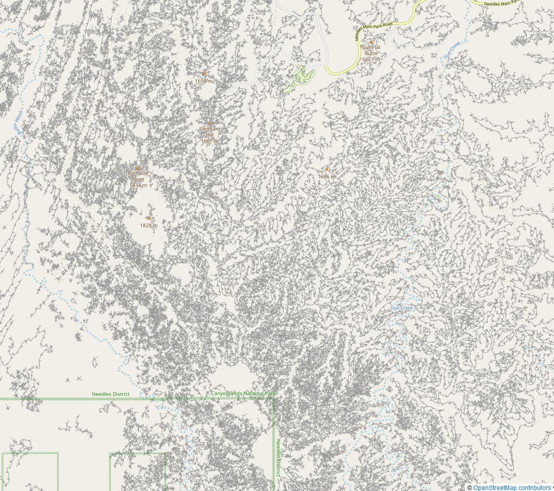
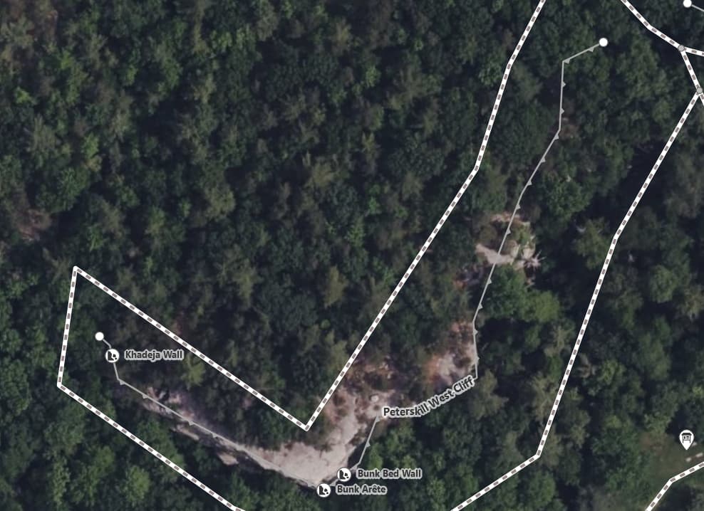
I went to Red Rock Nevada to climb recently, and the OSM has a huge number of areas on it tagged natural=cliff (Here is an example area.):

The rock formations are complex, so I’m not sure how they should be drawn, but I don’t think it’s currently correct, according to the tag wiki. For example, Tag:natural=cliff says:

In the ID editor, the arrows on the line should be pointing out to the bottom of the cliff or low land.

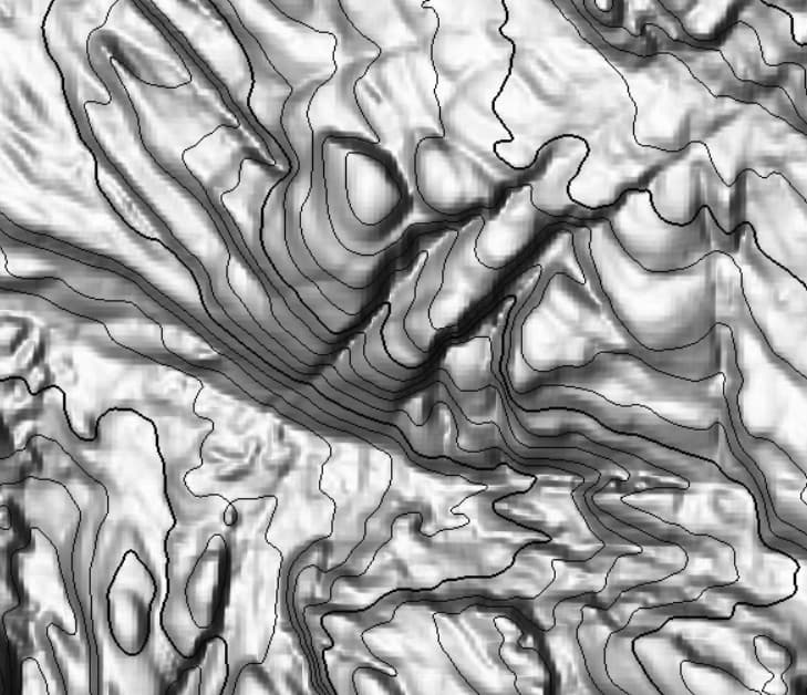
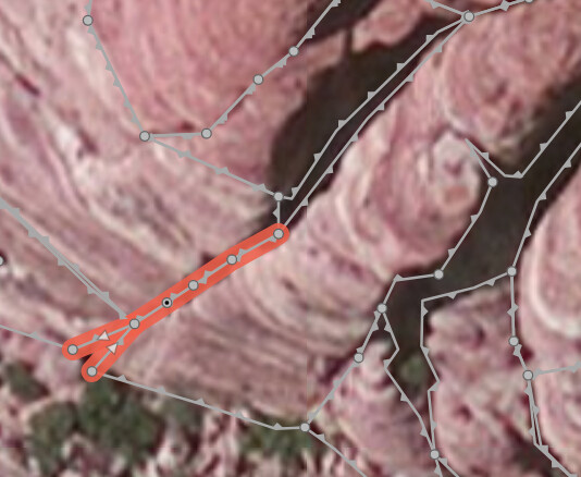
Some of these lines are definitely not correct according to this, as the dark region is the bottom of the cliff, and the reddish region is the top:

It also says

A cliff is a vertical or almost vertical natural drop in terrain topography

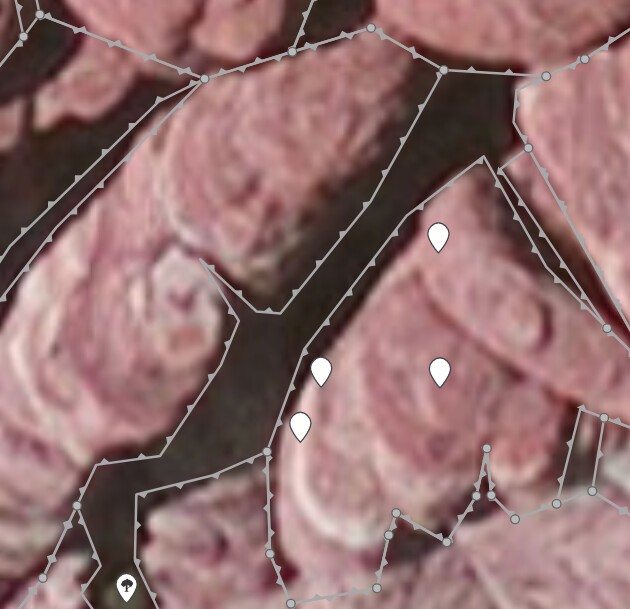
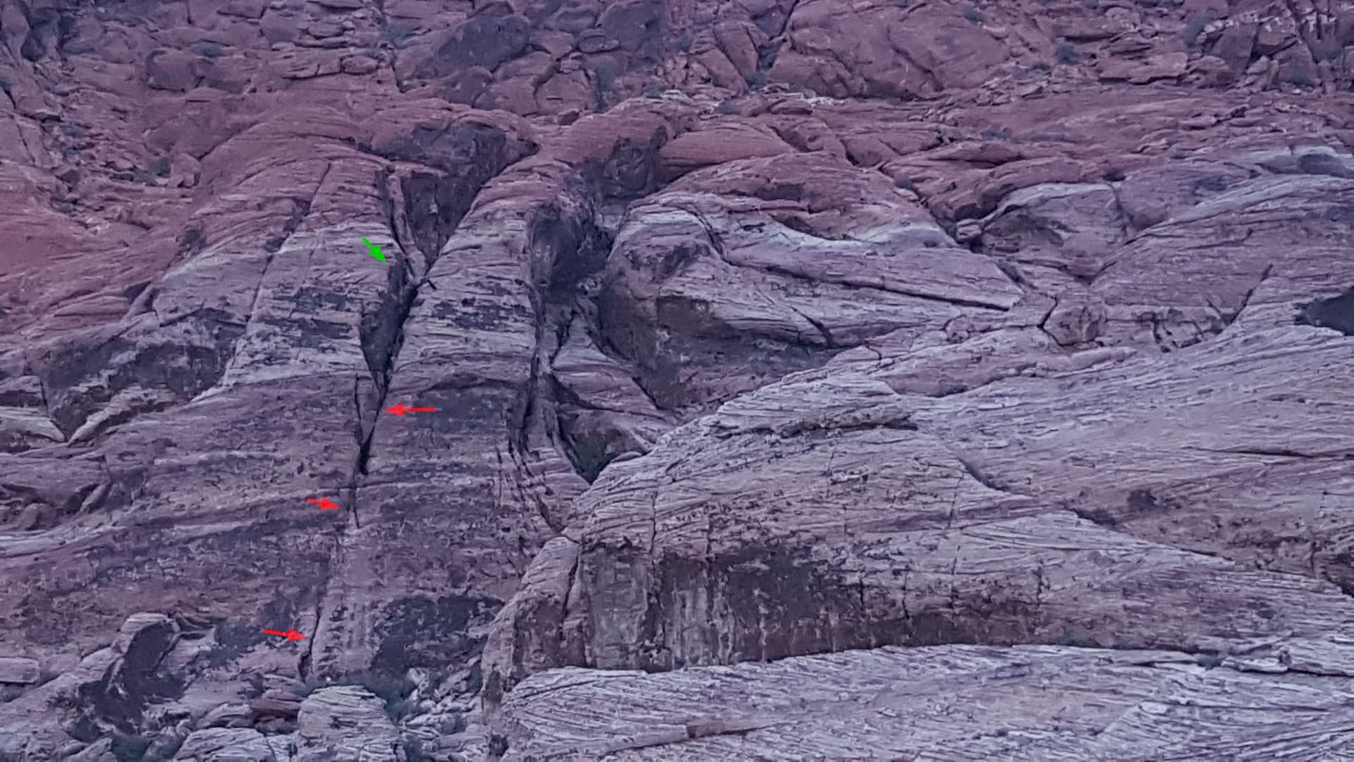
Some of these gray edges do represent steep drops, such as these:

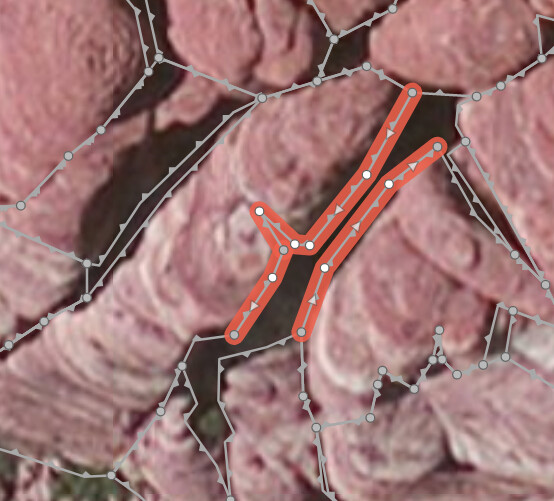
But these other gray lines are not a cliff, they just represent a shallow crack in the steeply sloping rock face:

image

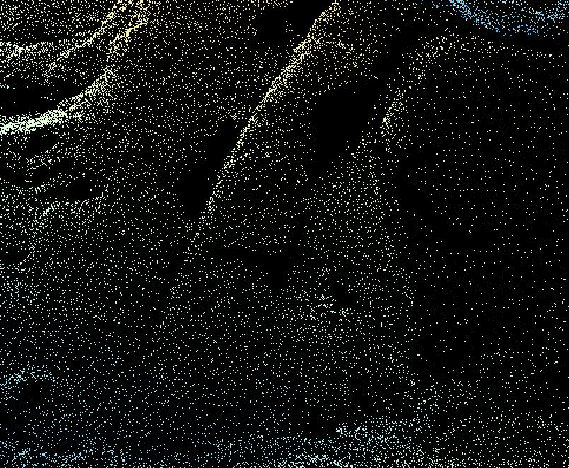
This is what this formation looks like from the side, with the above shallow crack shown in red:


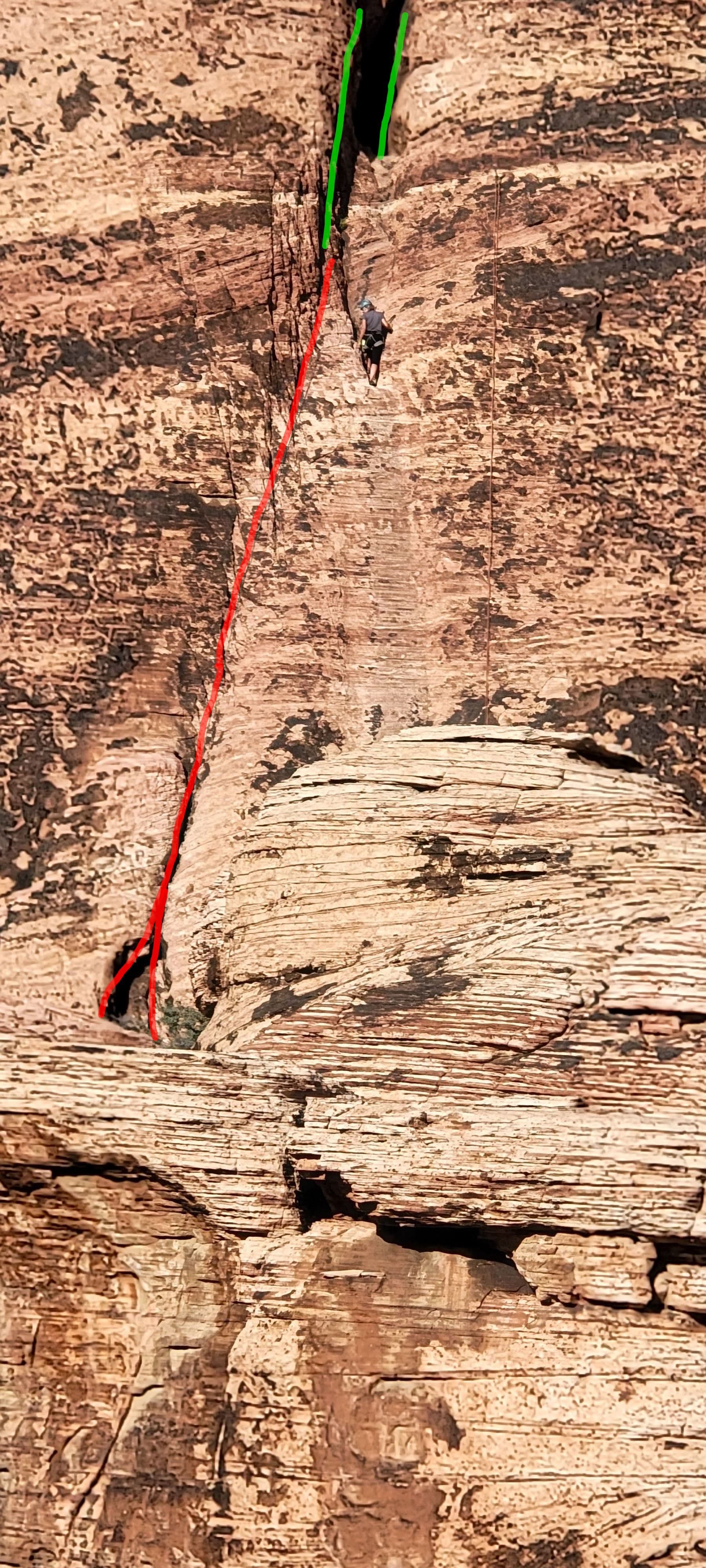
Red is the shallow crack in the face. In the highlighted green area it arguably becomes a cliff, or just a wide crack, depending on interpretation.

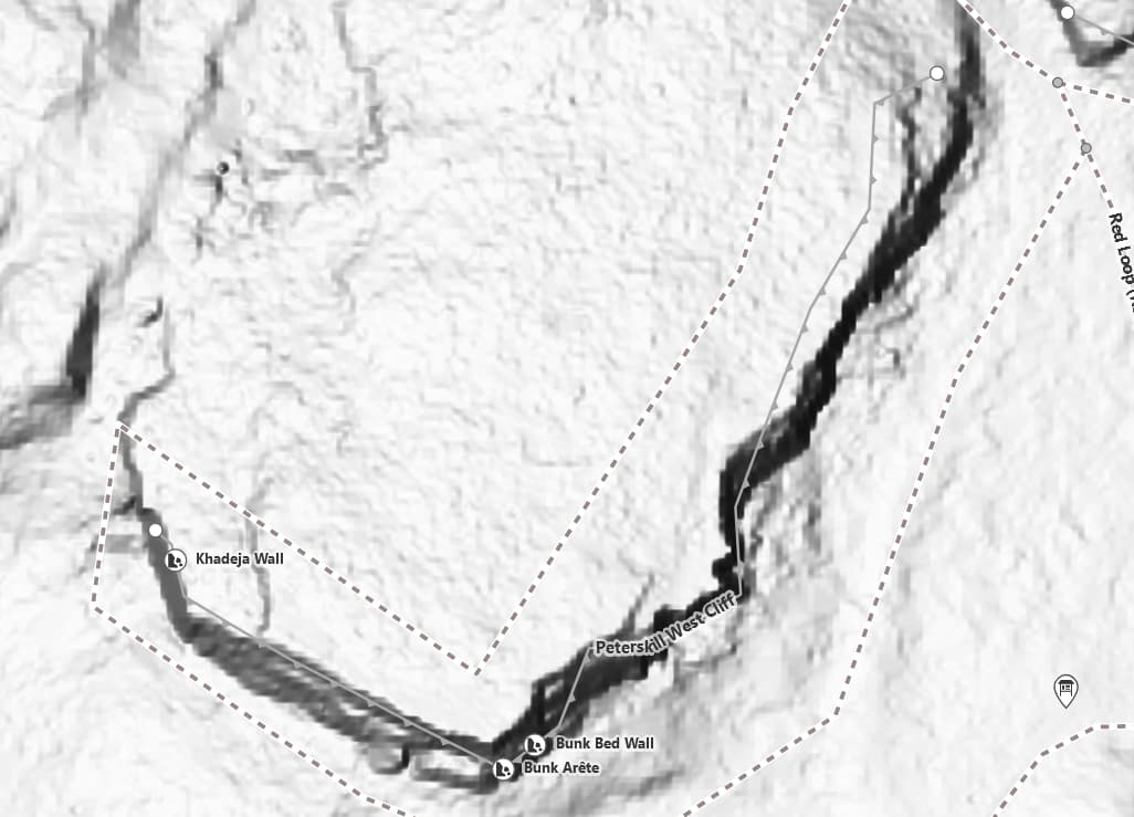
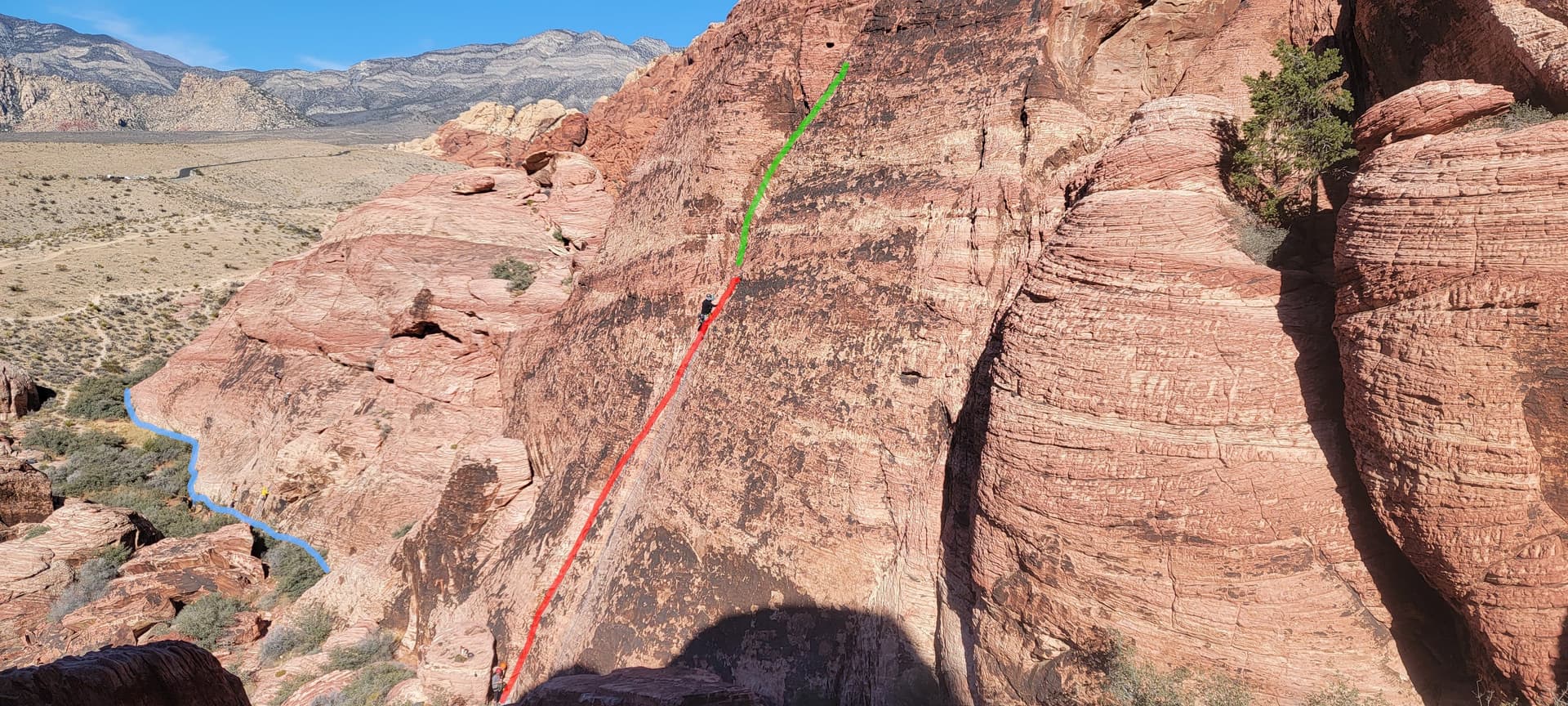
The face of this rock formation is steep enough to be called a cliff, I think (since we’re climbing them), but the tag wiki says:

If the cliff is not perfectly vertical the way should be located on the top edge.

But there is no clearly defined “top edge” for these formations; it smoothly transitions into walkable horizontal surface. There is a clearly defined bottom edge for some (highlighted as a blue line above), so I can understand why they drew that boundary instead, and that probably makes more sense, but it technically isn’t correct.

So someone drew boundaries around each cliff face and tagged it natural=cliff instead of just drawing the top edges? I feel like the shapes should be natural=bare_rock instead, but even then, the whole formation should be, not just individual features of it.

Someone else left a map note and I did, too:

  • Note: 922541 | OpenStreetMap
    • ‘I don’t think that this is the proper usage of the tag “natural=cliff”’
  • Note: 3436101 | OpenStreetMap
    • “This Way, as drawn, indicates a hole with cliffs all around it, but it’s actually a face of a bedrock cliff that slopes up in one direction.”

So my questions are:

  1. What is the correct way to draw these types of features?
  2. How to handle such a large number of features drawn incorrectly?
6 Likes

I’ve seen this style of cliff mapping in a variety of places in the southwestern United States. Here’s Canyonlands National Park:

on OpenStreetMap
on OpenTopoMap

While I have to admire the dedication of whoever is doing this, it seems like a significant overuse of the natural=cliff tag. I’m not sure what exactly should qualify to be mapped as natural=cliff and what should not, but tracing every single rock formation in a landscape like this is not producing a very useful result.

3 Likes

Whoa, it looks like USGS publishes LIDAR and 3D elevation models for this area, too, which should all be public domain?

All 3DEP products are available, free of charge and without use restrictions.

I imagine cliffs could be automatically extracted from this? And tracing it would be more accurate than tracing satellite images which are often skewed due to the viewing angle?

Well written post, especially with the pictures’ context. Being an east coaster I have little experience finding/mapping cliffs. I usually find them around the edges of quarries or earthen banks with severe erosion.

The cliffs here and in @ezekielf ’s example seem a bit extra. I suppose it is valuable to show where one cannot easily walk, but I’d say remove the ones that aren’t dangerous.

RE USGS, you could generate elevation lines with the DEM but I’d only use this to mark cliffs systematically when elevation contours approach a certain density. You could also use it to generate elevation peaks.

This is feeding into Mapbox and Alltrails, also.

One could even wonder if the edge of a quarry may be tagged as natural=cliff.
Further a minimum height (say 10 meter?) could be a discriminator as well?

It seems very wrong to me also. I’ve never been to that place in Nevada, but some of those do seem very wrong. I’ve been to Canyonlands & Arches NP & there are some places which are literally a maze of cliffs and slots. If one were to map each one which was dangerous you would have something like what is shown above. I’m not sure what the solution is but perhaps there is an area tag that would be better?

The same labyrinth of cliffs can be found in Germany in Saxon Switzerland.

I don’t think there’s anything wrong with mapping every cliff, but the lines drawn in Red Rock are not all cliffs.

4 Likes

10 meters as a threshold is far too much, I’d rather see a limit around 1.5-2 meters and not a cliff when less

I don’t have a strong opinion on the right way to do this, but the data @brightj found does seem to be a wrong way.

In the ID editor, the arrows on the line should be pointing out to the bottom of the cliff or low land.

I need to go back and check if cliffs I’ve drawn obey this.

2 Likes

That convention is not specific to OSM, either:

Cliff: A cliff is a vertical or near vertical feature; it is an abrupt change of the land. When a slope is so steep that the contour lines converge into one “carrying” contour of contours, this last contour line sometimes has tick marks pointing toward low ground (image below).

2 Likes

Great documentation, well done. My personal opinion

  • Cracks are definitely no cliffs and should not be tagged as such
  • Cliffs forming a narrow gorge can be tagged as such with a single way natural=gorge which would make the total appearance less chaotic (yes one can additionally tag the cliff edges of a gorge but it is not a must).
  • Ways marking cliff edges drawn in the wrong direction (arrows pointing to the top of the cliff) have to be turned around and I believe there is no other way than doing this manually

A quarry edge is a fine cliff imho but earthen banks have their own tag natural=earth_bank.

1 Like

I contacted the creator of these lines, but no response:

Looks like alecdhuse hasn’t been active in 6 years. Same editor who made the cliffs at Note: 3436101 | OpenStreetMap I sent a message to see this note.

1 Like

The 3DEP can be used in iD Editor! I just added instructions to USGS 3D Elevation Program - OpenStreetMap Wiki

It shows cliffs so much better than satellite imagery:


1 Like

Any suggestions on what should be done about these “cliffs” in Red Rock?

Quite a few of them should be deleted in my opinion.

2 Likes

OK, so three of us agree. Probably can make a query to identify any cliffs added by that user within a boundary that haven’t been modified since they were created, and delete them all at once? Then anything that has been modified since can be dealt with case-by-case?

1 Like

I agree with what’s been said above about the natural=cliff features in these examples.

If you wanted to maintain some of the features but use an alternate tag for them, I might suggest geological=joint, which is the term for a crack in a rock. There are currently no uses of that tag, so it’s definitely in ATYL territory.

2 Likes