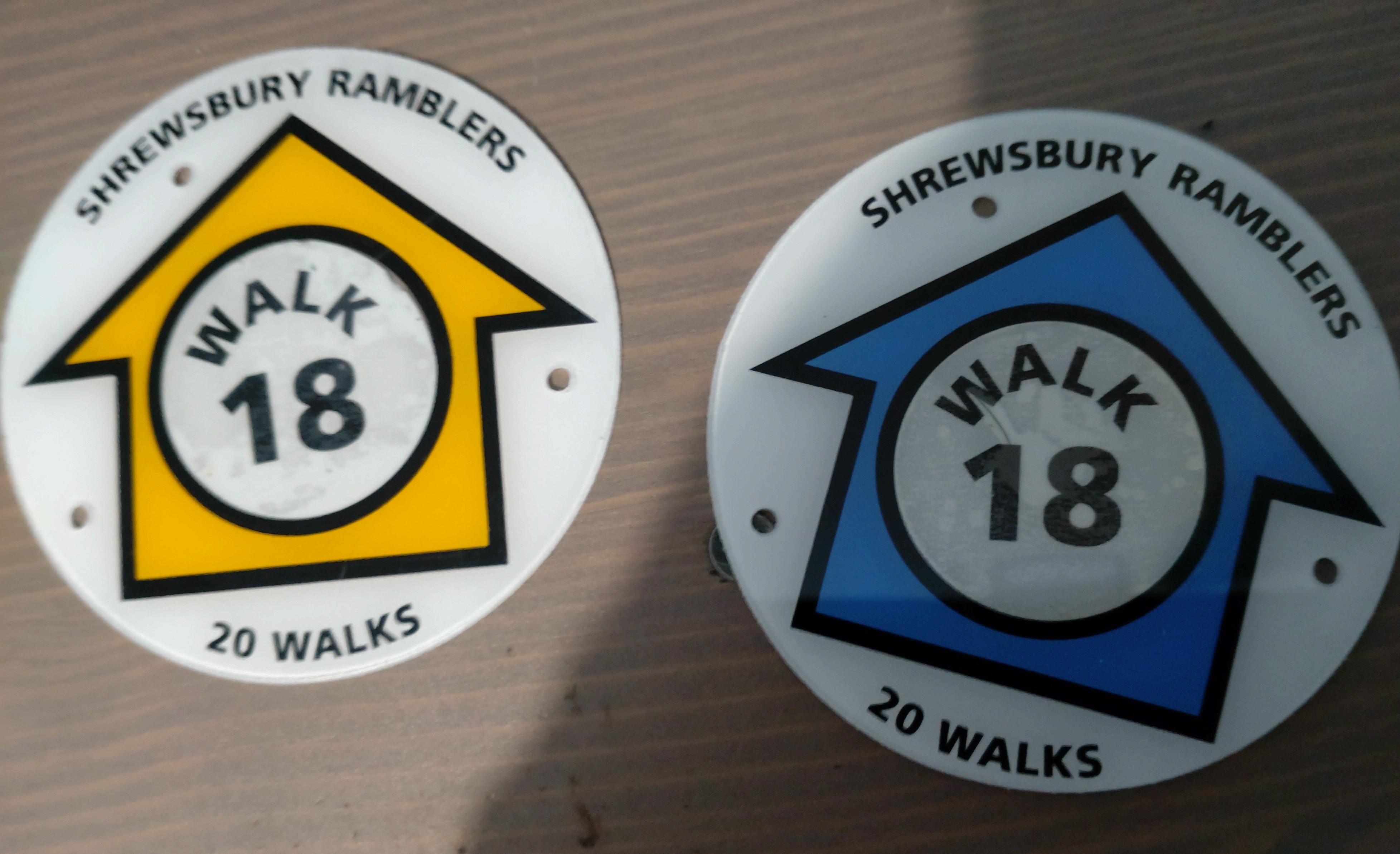
A tin of paint is all you need to blue-dot any E-route. Once operators discover that, they’re gonna adopt it, for sure.
Good idea Richard.
I am wondering why they aren’t waymarked.
My local Ramblers group have produced a book of walks and have waymarked the routes. We obviously paid for the waymarks and maintain them.
Surely the promotors of the route can do that too? Highway Authorities are generally amenable to such waymarking as long as you don’t ask them to either pay for it or provide staff do it.
Phil (trigpoint)
I think splI think splashing paint around would be frowned upon by landowners. Also blue in England/Wales means bridleway.
Plus it doesn’t give any feedback as to what it means.
You just need some of these, a hammer and nails.
Phil (trigpoint)
1 Like
Forgot the smiliey, sorry!
Just try not to get lost:
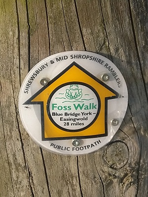
For those unfamiliar with English geography, that sign above, between York and Easingwold, is a long way from Shropshire!
More seriously, there is a general move to provide better signage on some of the routes around this area. The Coast to Coast Walk was previously officiallly unsigned, but has been adopted as a National Trail, and now has fairly good official signage at least at the east end.
2 Likes
We use knooppuntnet analyser for node networks and knooppuntnet monitor for long hiking routes ![]()
We discuss hiking/riding/cycling/skiing… routes in the Groupe OSM Plein Air (OSM outdoor group).
Now knooppuntnet (alias KPN) monitor support hierarchical relations ![]()
Marc (his author) as already improved the code to analyse them better.
But this is not yet in production.
Still, there are many shady areas around hierarchical relations: how tags are propagated from parent to child (or the opposite?) during rendering, how alternative routes should be represented in the hierarchy, how to tag sub-relations that belong to several super-relations, the role of the “superrelation” type, etc. Practices vary. But what is worse is that apps and renderers do not interpret hierarchical relations in the same way (JOSM, Thunderforest, OsmAnd, Waymarkedtrails).
A very focused and very nice project would be to help app developers converge on a unified understanding of how hierarchical relations should be analyzed…
1 Like
Unfortunately OSM Relation Analyzer (aka OSM-RA) don’t work for multi level routes (aka super routes).
OSM Route Manager support “super routes” but crash for some long french hiking routes.
Actually KPN monitor is the best tool to analyse long (hiking) routes, although this feature is in beta version.
Hi everyone! Nice to see some familiar faces in here, of people I’ve seen around various forums. Just wanted to mention I’ve worked on a similar project to catalogue long distance hiking trails with OSM data, superroute.org
I also wonder, would people perhaps be interested in a “Hiking” community forum here on community.openstreetmap.org, so we can come together as a global OSM community interested in hiking data & standards? I know I’ve got lots I’d like to discuss, I’m sure we could chat all day.
If you’d be interested just can thumbs up this message! And if we got enough I can message some mods here.
5 Likes
Awesome.
So, in ‘where’ and ‘how’ will you proceed?
I will inform the Korean and Asian communities as well.
Has this project been featured on ‘WeeklyOSM’?
I think it should be introduced to different communities in multiple languages.
In fact, OSM already is a worldwide catalogue of waymarked long distance trails. What does your project add to that?
OSM is a database, superroute.org is a catalogue in the sense of consumer-oriented catalogues with nice paper feel and lots of selected information such as “what convenience stores are nearby”.
Having talked to quite a few tourist offices in the last months, it is clear to me that the tourism sector still has little to no clue how they will use the new mapping capabilities in the future. superroute.org illustrates one of the candidate concepts.
1 Like
That certainly is a rather odd site when compared to (say) https://hiking.waymarkedtrails.org/. Presumably it’s some sort of curated list of something?
Ah, now I remember… you presented this some time ago on Telegram I think?
The tourism sector indeed needs initiatives like this to make proper use of the OSM information. Things like associating POIs (including hotels, parking lots, restaurants, PT-stops) with routes, trip planning, cutting and exporting sections at will including the POIs), OSM doesn’t do that. Which is fine, because other parties are much better at that, but it could do more to enable it.
I seem to remember that you use a list of trails, which includes selected OSM-relations but also other trails, including non-waymarked routes?
1 Like
So essentially Topics tagged hiking, but in the Communities - OpenStreetMap Community Forum? That would help with discoverability (I’ve forgotten to tag some of my posts hiking), but might be odd if someone wants to have a hiking related discussion for a specific country.
Maybe having a sidebar navigation page that has lists of some common thematic tags along with a sentence or so would allow for granularity. Being able to tag something as “hiking” and “tagging-discussion” is useful.
(apologies; nothing to do with hiking routes, just me commenting on Discourse again)
You can certainly combine categories and tags - https://community.openstreetmap.org/tags/c/communities/pt/176/tomtom is an example of that,
https://meta.discourse.org/t/how-can-i-search-with-multiple-tags/27769/7 suggests that it should be possible to search for multiple tags (and and or), but the functionality is pretty well concealed ![]()
Edit: The advanced search box is sometimes available, sometimes not, but a URL search as https://community.openstreetmap.org/search?q=tagging%20conditional%20tags%3Atagging%2Bconditional will search for two tags together. There’s no automatic link from there to “create a new post with these tags” (which there usually is for categories or just one tag), so the UI’s a bit rubbish though.
The original question of whether we need to create a hiking community on OSM was out of context of hiking routes in and of themselves as well. ![]()
There’s still ambiguity in combining categories and tags. For example - would a theoretical post about trails in Denmark belong in the Denmark category tagged with hiking, or would they be in the Hiking category (tagged with Denmark)? Or if it was about tagging hiking trails, would it belong in the tagging-discussion category with tags of hiking and Denmark. One benefit of just sticking with tags is that less topics would be siloed, though it’s not intuitive or discoverable as things stand.
If there is a community / category just for hiking it’d seem like other communities / categories would also logically spring up because of that (which would have it’s own pros and cons). Perhaps a more general category like “outdoors” or “non paved surfaces” or something would be better, as there’s overlap with climbing, walking in parks, skiing, etc.
I know we’re offtopic now:
I don’t think such communities (with the need of moderators too) are needed. You can create these on the fly by editing your preferences and select the tags you’re interested in.
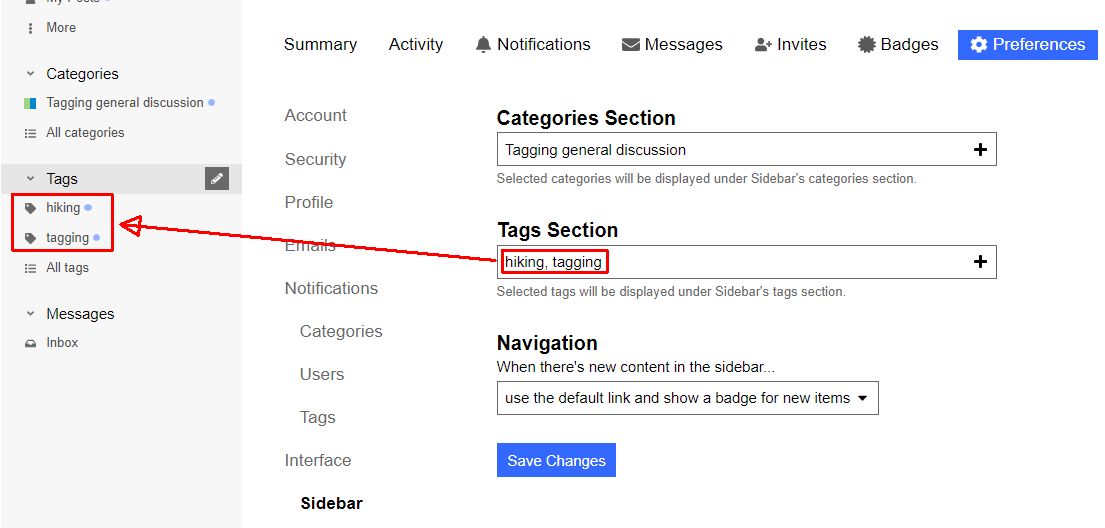
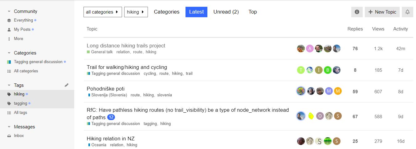
You can then select one of the tags in your sidebar and get the list of topics with the selected tag:
5 Likes
Nice to hear you had use of the data. If I remember correctly I was the first to digitize that path based on a permission by the association that maintains the path ![]()
I have never walked it so it might not be accurate ![]()
Based on my experience the data is we usually have on hiking paths in Sweden is high quality when it exists, but a lot of paths are still missing a relation.
Thanks, I just added this to my mental list of things to discuss in our sub-community: how do we track progress? In France we have figures published by the national hiking federation but it’s not clear how they obtain them and I’ve found that figures produced by each local authority or tourist office are inflated. Anyway, nobody here seems to have spent much time tracking progress so far.
This makes at least a half dozen if topics I’like to raise with you guys. Hopefully you have yours too. But with my current perception of this community Discourse I feel that creating threads would be like throwing pebbles on a beach hoping the right people find them.It is only months after it was created that I discovered this very thread, lost amongst threads in Korean and Dutch, and pointed @pyrog to it. So I believe Davey’s intention was “create the conditions in which we easily detect new topics and can work more efficiently towards consensus or action”
The trick above (setting our application parameters) may be what we need for that. If that is the case we probably need to advertise it (where?). Otherwise we need everything else we can find. Maybe even a report to the site managers to explain our difficulties? Something like “we’re the long trail mapping experts but we keep losing our way”.