I think we should formalise the tagging rules for lcn and above.
Motivation
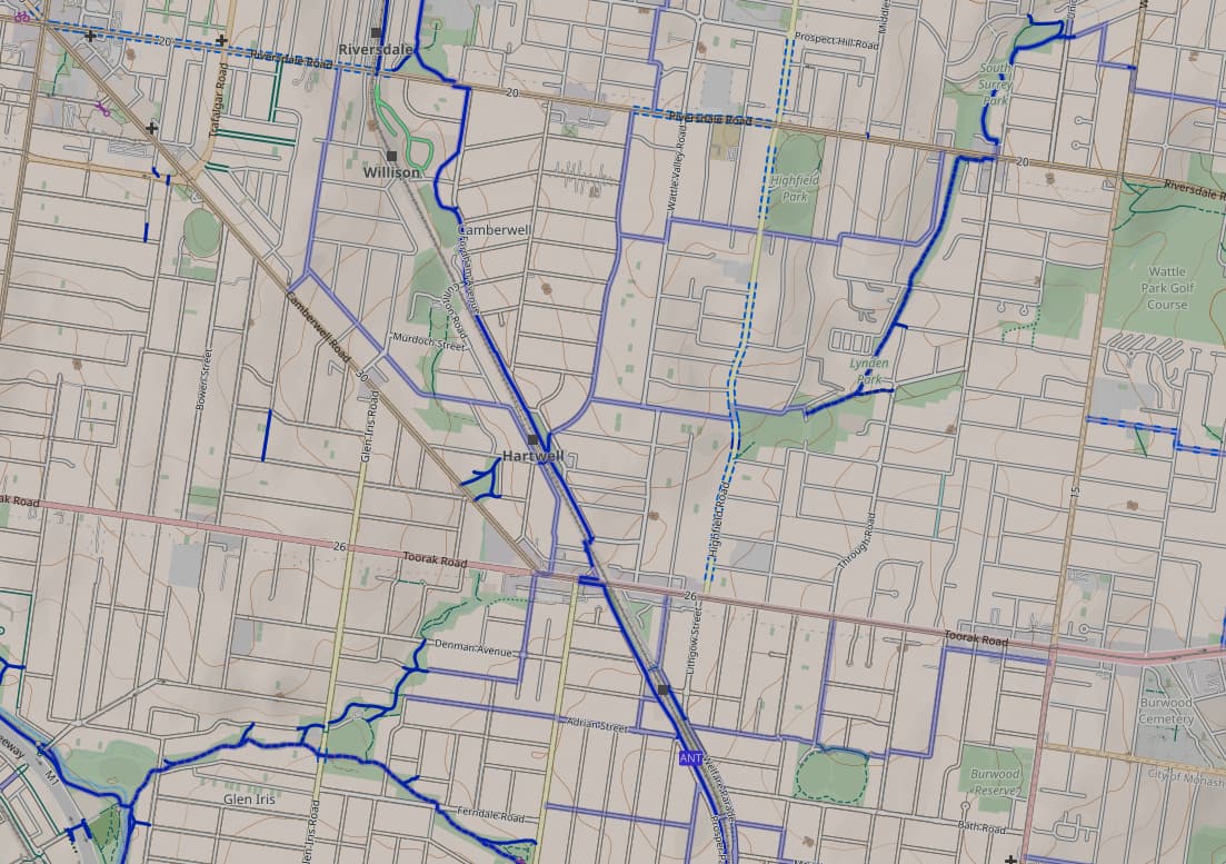
My concern is that the city suburbs of Melbourne and Sydney at least (probably other cities too) are littered with lcn=yes which show up on CyclOSM and imply the existence of a network that either has signage or cycle infrastructure or local awareness, which may not be the case. Consequently, the cycle infrastructure can appear safer and more extensive on OSM than it is in real life. For that reason I’m inclined to remove many of these tags. Here is an example of this phenomenon in Melbourne using CyclOSM. The pale blue streets are lcn=true despite often having no physical signage:
There is some discussion about the difference between lcn, rcn etc here, but I’m less concerned by the difference between them. I simply want to find a rule to answer the question “is this street part of a cycling network?”
Each region can have its own tagging guidelines for lcn, and Australia’s are here. I’d like to focus on this line:
These routes are often maintained and signposted by local councils and can include fragmented infrastructure and bike lanes. Local routes may be identified only by destination signage rather than having a gazetted name.
This descriptor is vague enough to allow almost anything to count as lcn, which I don’t like.
Proposal
Here is a new definition that I’d propose:
A cycle network in Australia does not need to have a name, but must be identifiable by physical signage indicating that it is recognised by some level of government. A street is not part of a network just because it has cycle infrastructure, or connects to a prominent cycle route, or has signs towards other cycle infrastructure.
Examples
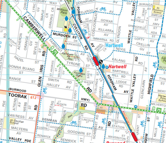
Here are some examples all from the Boroondara LGA, for consistency.

This is located about here. Although this is a dangerous route along a main road (Power St), I guess we have to tag this as lcn?
Location. This is an easy
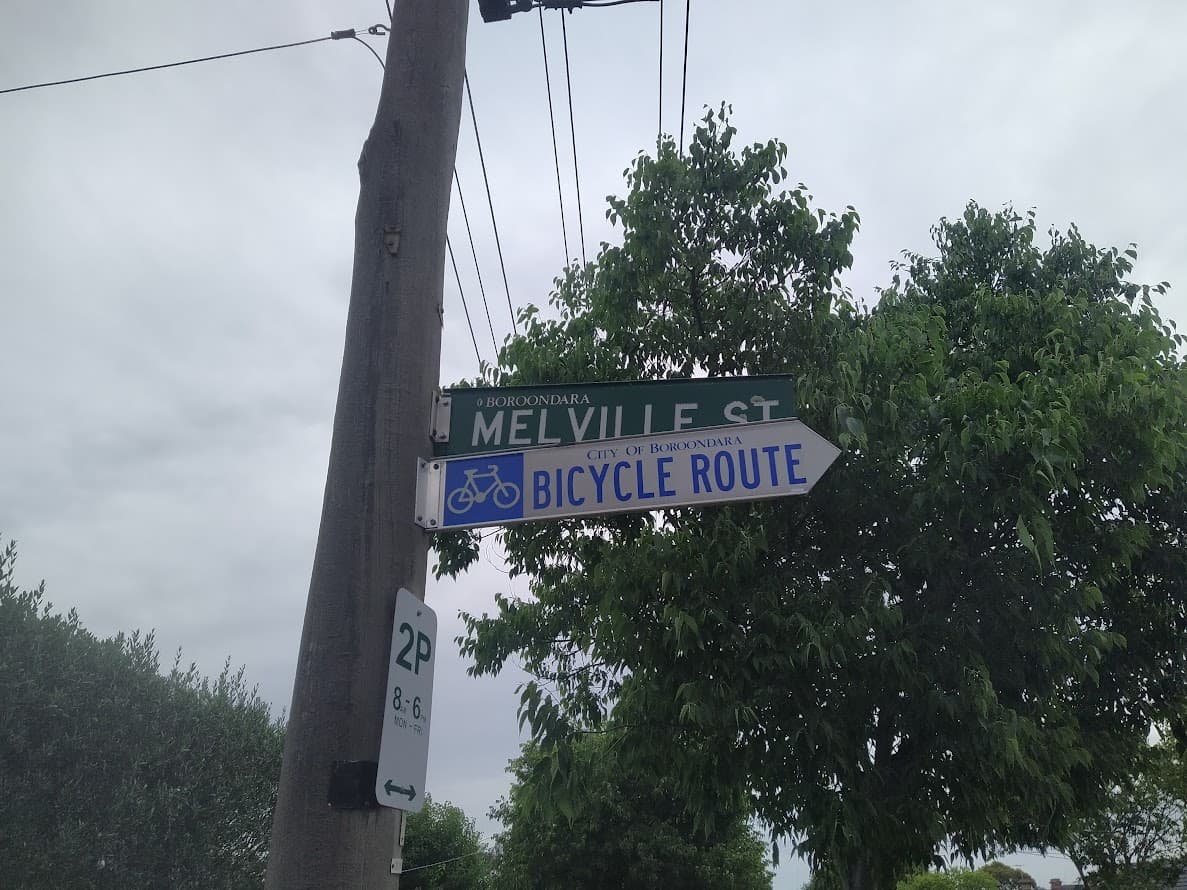
lcn=yes tag, because the local government recognises it and states as such.

Location. I don’t think this counts as an LCN, as this is just pointing to another notable bike trail, and doesn’t form a network itself.

Location. This has no cycle signage, so I think it’s not LCN. However it does show up in the Travelsmart map (see next section).
Council Maps
To add some confusion, many Melbourne councils have a so-called “Travelsmart” map, which is annotated with “Informal Bike Routes”. Here’s an example in Boroondara corresponding to the OSM screenshot I attached (or you can view the original here:
 .
.
Almost none of these dotted blue lines have physical signage, but should they count as lcn=yes? If so, we set a precedent for virtual information being used in the absence of physical signage.
Please share your opinions on my proposed definition and these examples, so we can work on a consensus!