I always find these sorts of topics fascinating, as I’m interested in urban foot mapping and it always quickly becomes clear that the lived pedestrian experience is so variable across the world. In the interest of “concrete” examples, I took some pictures on my walk this morning relevant to this tagging question.
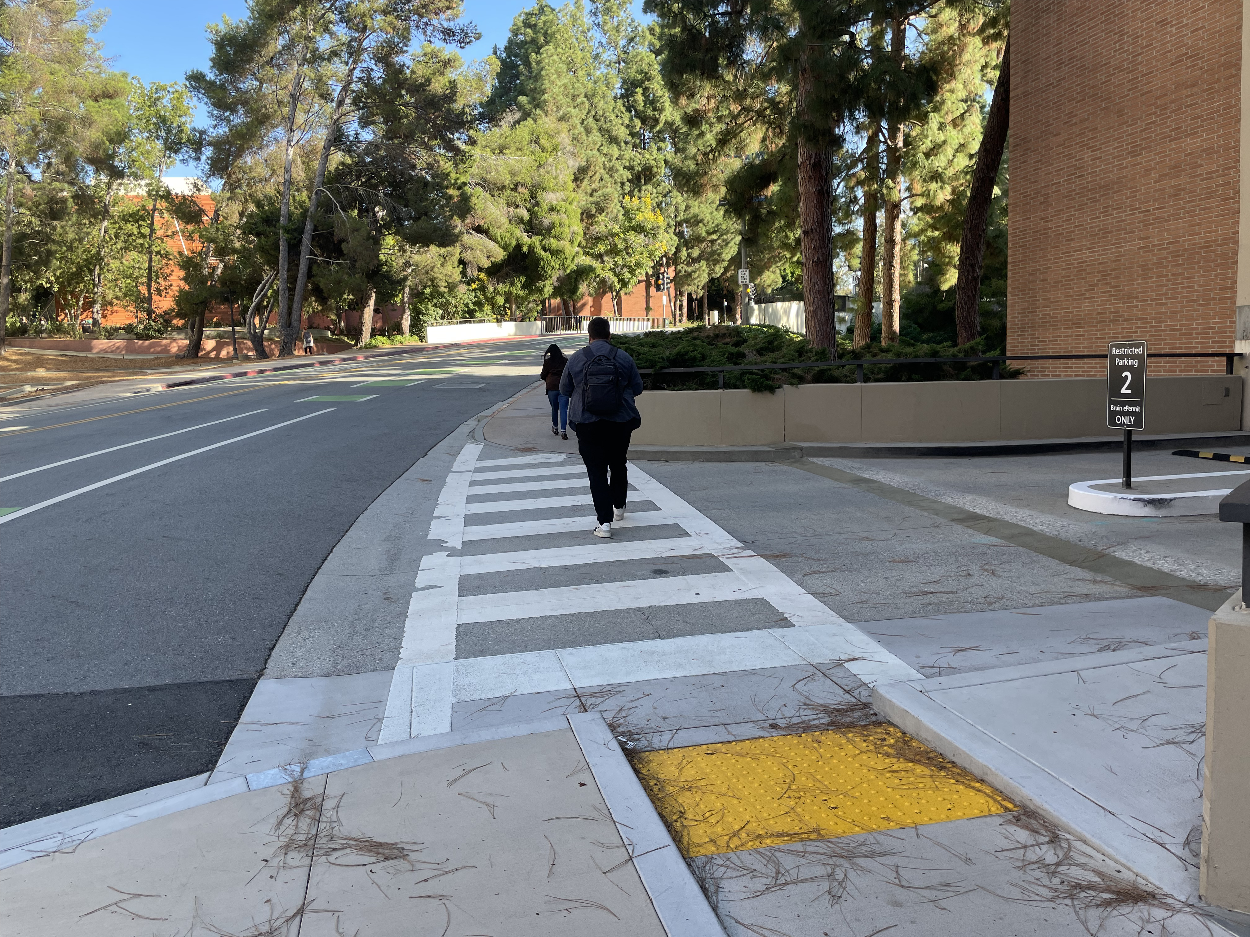
Case 1:
Unambiguously
highway=crossing + crossing=unmarked (across a highway=residential). The sidewalk clearly disappears, and the pedestrian has to go into the asphalt roadway.
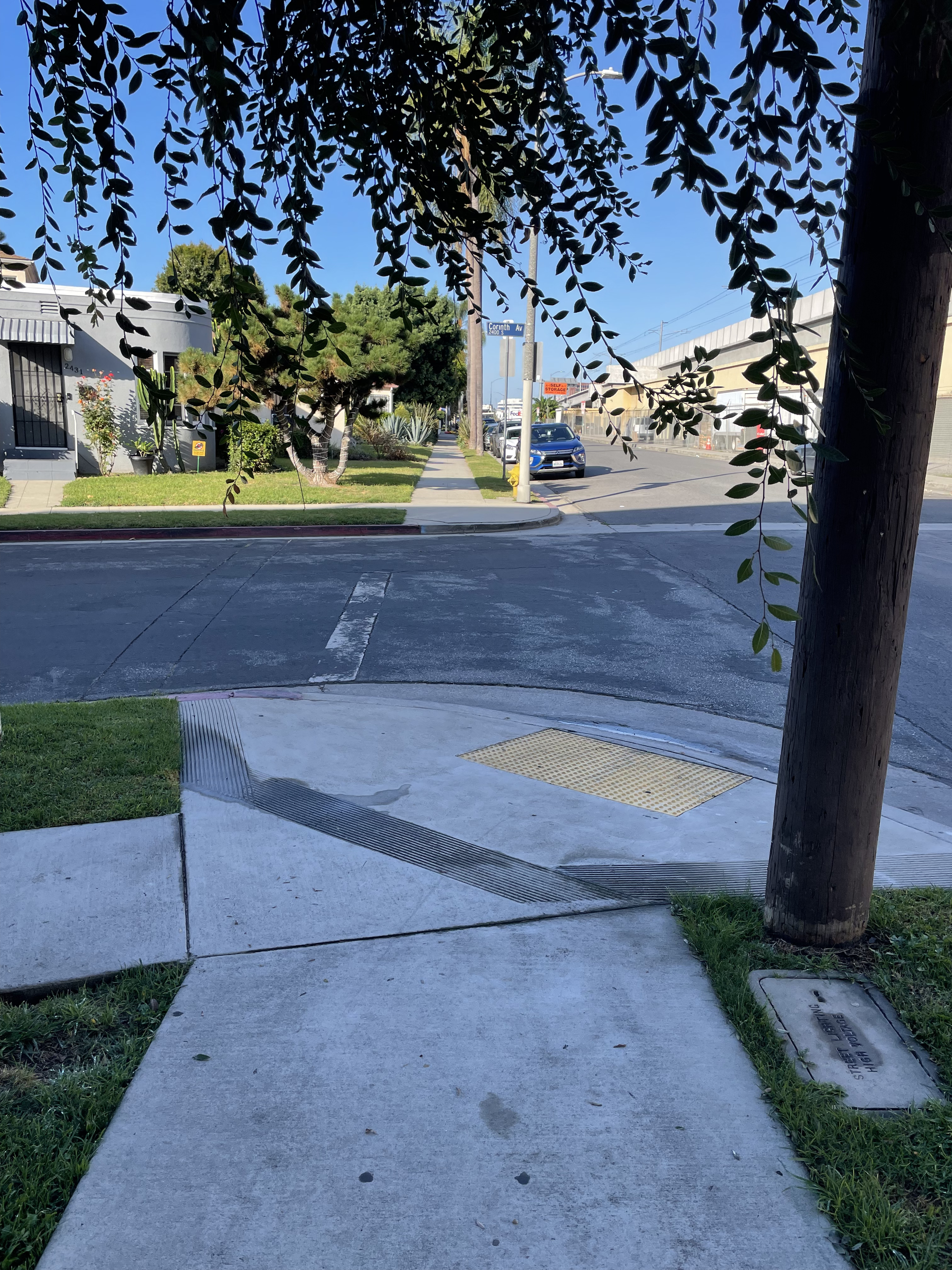
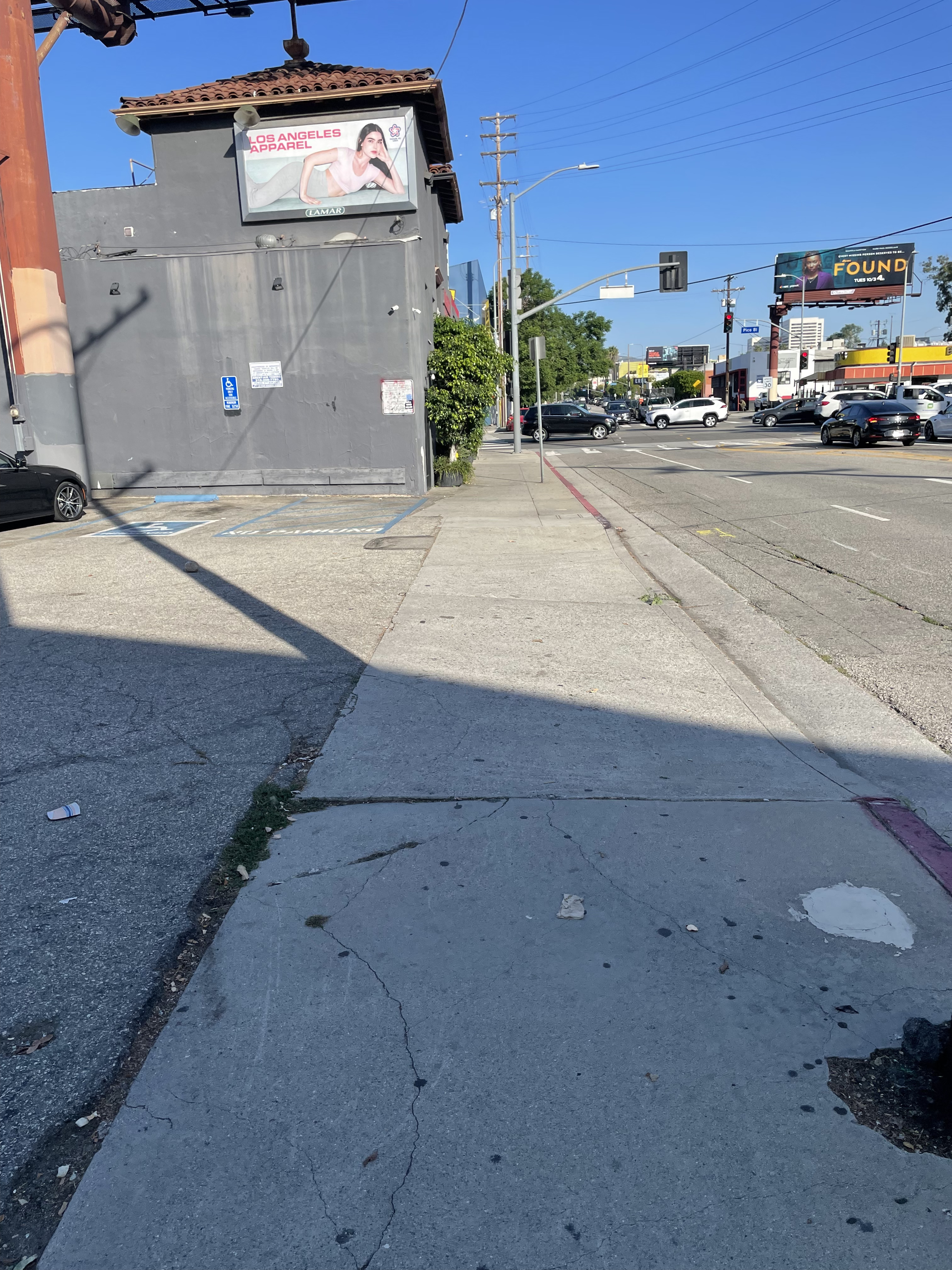
Case 2:
This is across a
highway=service entrance to a parking garage to the right, but the sidewalk clearly dips to “road” level, evidenced by the curb cut. It’s currently tagged as highway=crossing + crossing=marked, though crossing=uncontrolled could conceivably also be tagged (I don’t particularly like crossing=uncontrolled, but my rant against it is probably off topic here)
Case 3:
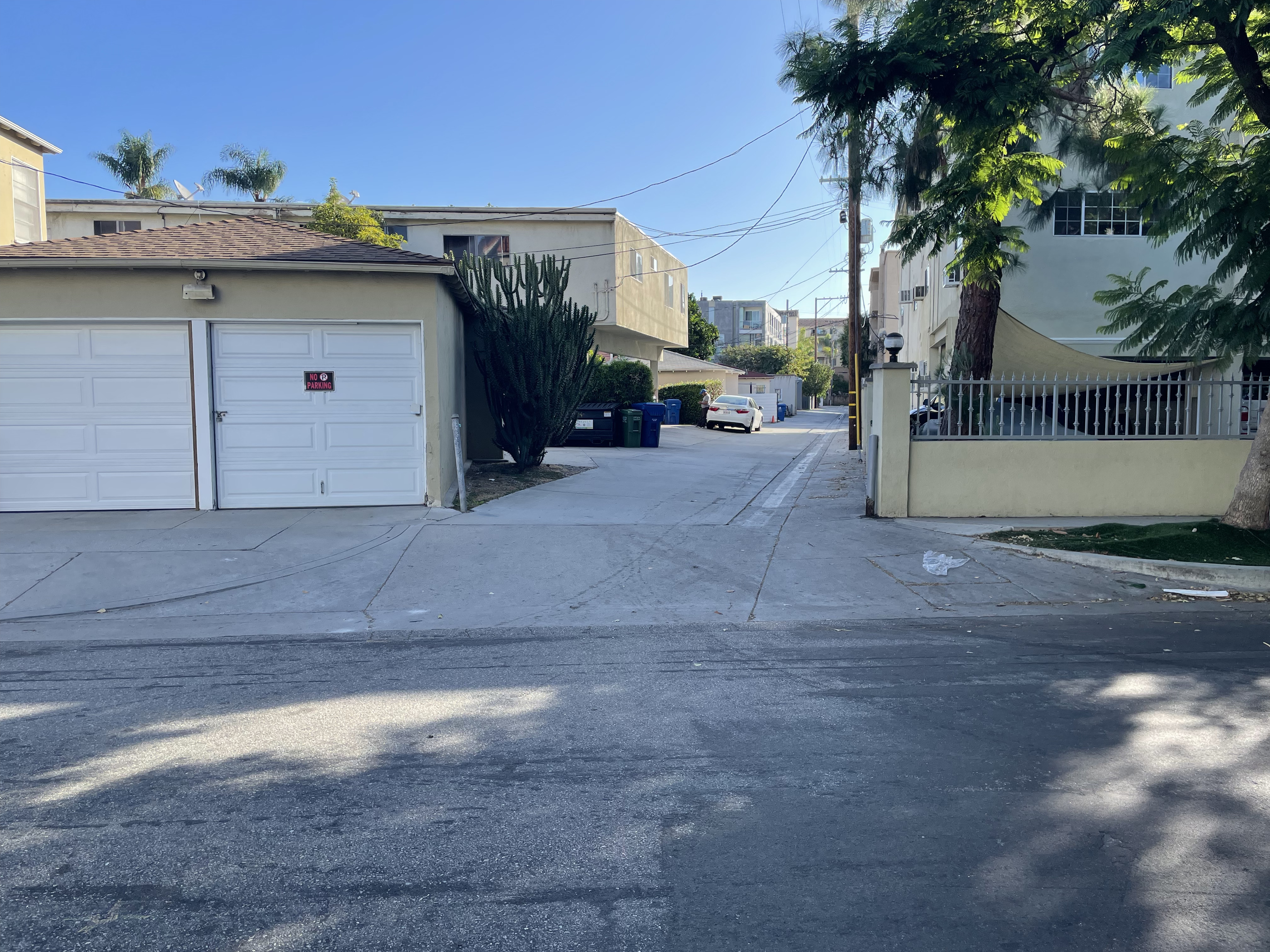
Across a public
highway=service + service=alley. This one’s a little less clear: there’s a stenciled in flush curb, but the alley is at the same level and made of the same concrete surface as the sidewalk. In my mind, the sidewalk here isn’t really interrupted, but I could understand someone else interpreting this differently. Until the most recent post, I assume this was the case for which the new crossing=sidewalk was being advocated, but now I’m not totally sure. crossing=marked + crossing:markings=surface doesn’t seem quite right here either. I’d probably just map the intersection between the sidewalk and alleyway as a bare node TBH.
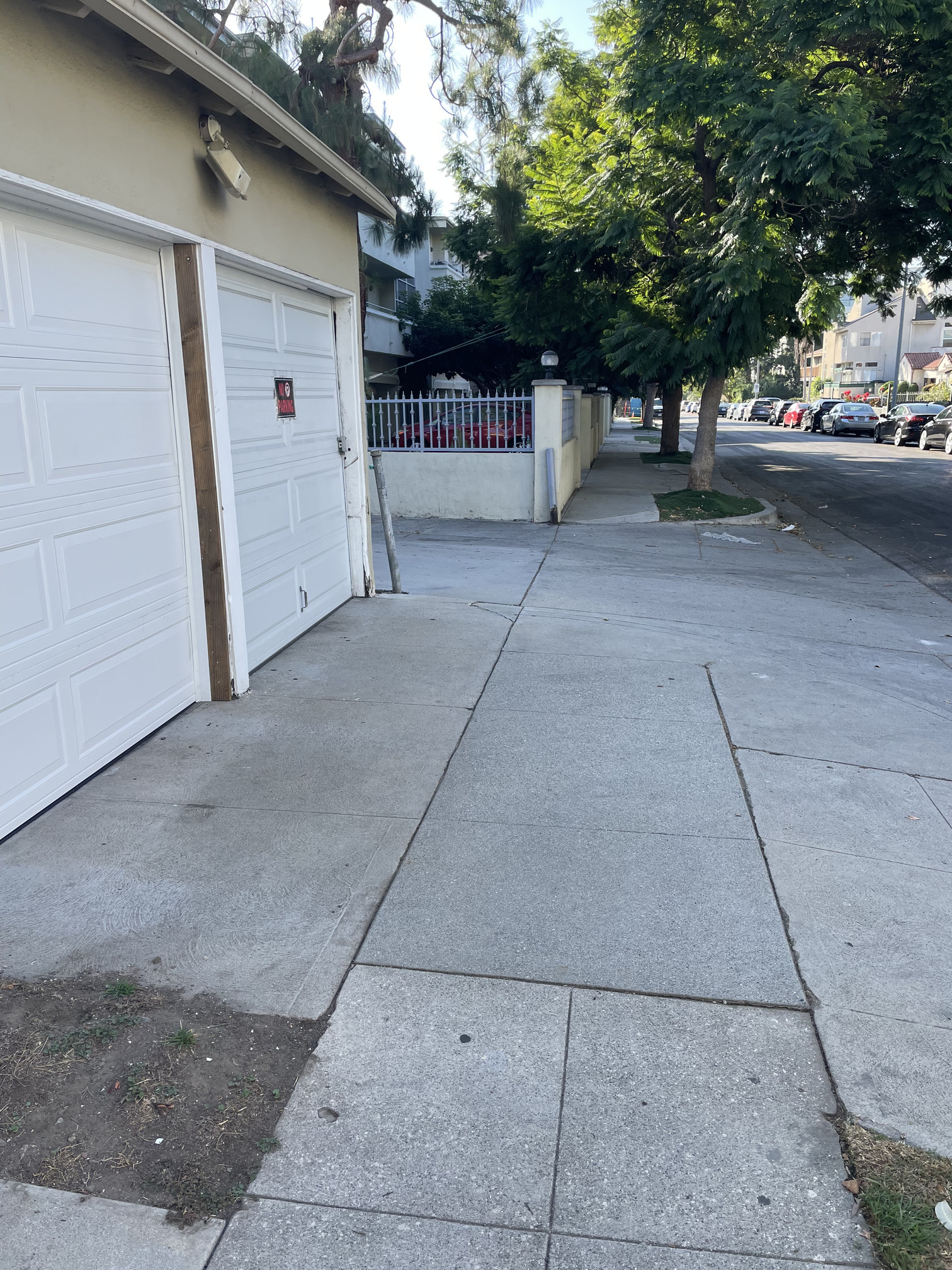
Case 4:
Across a
highway=service leading to a parking lot for some businesses. Clearly to me here, the sidewalk is not interrupted, as it remains concrete despite the parking lot to the left being asphalt. It does dip a bit on the right side to accommodate the curb cut. I would leave this intersection as a bare node, which is how it’s currently mapped.
Interested in any thoughts on these examples with regards to the current topic!