What that means is that this relation is no longer a valid multipolygon (you can see it’s now a figure of 8). Normally I’d just fix these, but the scale of the breakage near Clonskeagh is enough that it’s probably worth thinking about the best way to handle these.
There are a lot of relations in total here - this bit of river is part of 102 and this bit 94. Not all are broken, just mostly the ones for which this is the north-east corner. Moving this node the other side of the bridge would fix the “north east corner” relations but break any “north west corner” ones.
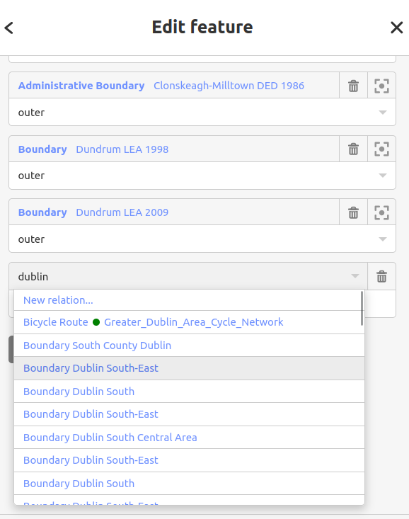
Fixing it is complicated because many of the relations have the same name:
Some of the duplicate names like here and here seem to have similar tags but different geography, though others like here and here do have different dates. Sometimes the geography varies between dates - compare here with here and here.
I suspect that the work required here might take considerably longer - it might be worth thinking about what the best way of recording some of these relations actually is.
Is there anything written down to explain what needs to happen for someone who has previously uploaded such data to OSM (and therefore is clear about what the licence is) to do the same to OHM?
There is this rudimentary guide to transferring individual features. However, I suspect an import directly from the original source would be a lot cleaner. The LEAs have gotten all tangled up with other features like roads that aren’t quite ready for OHM because of undetermined dates, not to mention run-of-the-mill errors like the one you’re working through.
Depending on the rights associated with the original sources, anyone could reproduce it in OHM, not necessarily whoever did it for OSM originally. Unfortunately, neither import seems to have been documented in the usual places on the wiki, such as “Contributors”, the import catalogue, or this category, unless they’re somehow related to the townlands project.
I’m guessing that this will be “good enough” if features such as townlands and the larger features based on them start making their way into OHM, and “could benefit from more information” if they don’t?
As I understand it (based partly on what people have said in the “OpenStreetMap Ireland” channel in Telegram) most of these things are based on townlands, but some may change over time. Perhaps “Electoral District A” was “townlands A, B and C” in 1940 and “townlands A, B and D” in 1950?
Until now, I’ve been under the assumption that these boundaries were all imported from some external dataset. However, the documented process for mapping townlands sounds exactly like the process for manually mapping something in OHM based on old maps. Anyone could carry out this same process in OHM, but it wouldn’t be as straightforward as loading a shapefile and massaging the tags.
If the LEAs and historic census boundaries were mapped in similar fashion, then unfortunately there’s no silver bullet. You’d have to ask for permission to transfer others’ contributions under CC0. In the past, some have promoted the idea of “per-feature licensing”, so that you’d transfer whatever you want but tag each individual feature with license=ODbL. However, I personally don’t find that to be a sound or sustainable approach and don’t recommend it for these boundaries.
As I understand it, at least some townlands remain relevant in everyday life in rural Ireland, so I certainly wouldn’t push for their removal from OSM. But frankly, I’m amazed that the Irish community has gotten away with mapping such boundaries as Pembroke Township [1863–1898], Drumgath Electoral Division [1911–1973?], and Pembroke LEA [1998] in OSM, given the sensitivities around defunct features such as historic railways. If someone were to map an analogous boundary in my country in OSM, they’d get called out for it or summarily reverted. This practice is detrimental to both projects, getting in the way of OSM mappers while depriving OHM mappers of useful points of reference.
Fortunately, it seems that at least some of the mappers involved with these initiatives are still actively contributing to OSM. Perhaps we can reach out to them to figure out where to go from here?
In case it is not clear, old maps were used because they were out of copyright, not because the townlands are purely historical features. I think townlands themselves are clearly current features that belong in OSM.
That is separate from the question of historic boundaries that happen to be based on townlands. I once noted on Mastodon that my house in Spain is enclosed by a mere 9 OSM features, while one of my former addresses in Ireland is enclosed by 65. One of the replies (Alan Grant: "Mapping with a focus on two different countries (…" - OSM Town | Mapstodon for OpenStreetMap) mentioned that many of these boundaries are still relevant.
So perhaps anyone wanting to suggest a change could ask how these boundaries are used in practice, and think about whether OHM could meet those needs better. It’s possible this process began when many mappers were unaware of OHM.
As noted elsewhere, townlands are current data that belongs in OSM. You’ve said that they would also be useful in OHM - and I’d agree - but it’s worth mentioning that it has only since OHM has been reestablished that adding to OHM as well has become a viable option.
For example, when someone added some no longer visible tramways in London in 2015, with a DWG hat on I transferred them to OHM (I was happy the the licence was compatible after checking with the OHM admin at the time). Unfortunately, this data was lost from OHM when the database was lost (as was the other data I’d personally added to OHM at that time).
If people associated with OHM want this data then I think that they need to make a better case than “you can do all the work that you have already done, again”. Surely an approach that takes into account the source of this data - out of copyright maps - would work?
Please don’t take this the wrong way - I’m from neither country but have enjoyed working in and visiting both - but maybe mappers in Ireland are on the whole just nicer - more willing to accept that different people may have different goals and to work together in a way that meets everyone’s shared objectives?
Just to add a point of information, I notice that the sources of some of the boundaries are given on the relevant changeset as Statutory Instruments, abbreviated as SI or S.I.
I completely agree: townlands belong in OSM. Historic boundaries that follow townland boundaries probably deserve more scrutiny. All the boundaries would be welcome in OHM, if we can figure out the logistics of mapping them there.
Yes, this mapping did begin a few years before OHM was passably viable. I don’t mean to cast blame on those who reached for the closest tool they had available at the time. That would be particularly hypocritical of me, as someone who pioneered the practice of hoarding historical data in old_name=*, amenity:historic=*, and demolished:building=*. However, more historic Irish census boundaries are still being mapped in OSM as recently as last year, probably because there’s already a critical mass of them in OSM. I’m making a stink now because we still have an opportunity to change course while folks are still actively involved in the project. I’m not personally going to delete anything, but I’m concerned that these features are on the chopping block the more visibility they get from renderers and QA tools.
Since you’ve mentioned this on a few occasions: I completely understand your frustration about OHM having lost your contributions in a hard drive failure eight years ago. If I had participated in the project by then, the experience probably would’ve demotivated me for years and soured me on the project forever. All I can offer is that, nowadays, we have more redundancy in cloud storage and are looking into additional partnerships for long-term backups of old planet files. Hopefully as time goes on, we can recover what was lost, even if it requires doing it the hard way.
The case I usually make is more like: someone is bound to redo all your work in OHM sooner or later. It might as well be you, rather than someone about to naïvely repeat all the mistakes you wish you hadn’t made! In seriousness, the benefit to mapping history in OHM is that you can say more about that history without having to constantly look over your shoulder and self-censor and apologize for it.
On a more practical level, iD supports academic/industry standards for encoding dates and times and can filter features by time period so you don’t get overwhelmed. The interactive time slider on the main map is a real crowd-pleaser, something you can’t do with OSM without knowing the ins and outs of QGIS.
Yes and no. One can certainly use OSM to discover these out-of-copyright maps and trace them all over again. And technically, since OHM is based in the U.S., one can probably make a convincing argument that purely factual data traced from these maps would also be in the public domain, so it can be imported outright. But I don’t push that line of argument too aggressively, because I don’t want people to get the idea that they can completely disregard the ODbL. OHM might not be bound by European database rights, but we want to be good partners with the OSM community.
Another problem is that many of these boundaries have been conflated with other features, including 3,562 kilometers of roadways, for which we don’t know the start and end dates. When you map a street in OHM without a start date, it shows up anachronistically when you move the time slider to Roman or prehistoric times. This is a great QA tool, but too many undated features get in the way when mapping in OHM, just as too many dated features get in the way when mapping in OSM.
You’ll notice I didn’t say who does the calling-out. When it comes to boundaries of any kind, past or present, it’s usually someone from outside the country who rushes to judgment. Ireland is the outlier in terms of its inclusion of historical boundaries in OSM. I just hope that Ireland won’t also be an outlier in OHM for a lack of boundaries because we’re trying too hard to shoehorn them into OSM.