I suspect that that depends on the other tags used to describe the airport. Sometimes an example helps, so have a look here. That code decides whether an airport is one of
A large civilian airport
A small public sport airport such as a gliding club, etc.
A military airport
It does this by changing the tags from OSM into something that the next stage in the process (in this case, creating a map for Garmin devices) can understand.
The tricky bit is that there’s only one “aerodrome:type” tag for the whole “aeroway=aerodrome” object. In OSM, if part of something deserves one tag and part another, we tend to split it in two and have the other tags (such as in this case “icao” or “iata”) the same on both parts.
Yes, that makes sense as a multpolygon relation with 2 outers because the tags for the object are common to both parts of the object. I’m sure that there will be airports like that too.
However, in my comment above I said “if part of something deserves one tag and part another” - that’s the key difference here.
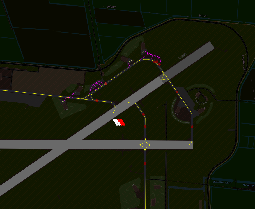
I’m watching both the chit-chat here and the renderings themselves, wow. KLAX certainly gets sweeter. It has that “rough but precise” technical look like a blueprint and with good use of color and very likable “airport elements” to it. It’s human and technical and aeronautical all at once, lookin’ sharp.
My rating as a pilot? Hang 1 (beginning paraglider). Hey, I’ll say I’m a pilot, as I have landed the aircraft.
Without having done an in-depth look at this tag’s variations I’d add that the vast majority of airports are a one-kind-of-airport thing, but there are also “military area of an airport” which in some cases is best called military-only-airport and others where it’s shared-with-commercial-aviation. Also, a general aviation airport is not a glider port is not a STOLport is not a seaplane landing is not a ballooning area…
I think there are icao-and-iata-familiar people who can parse this better, but it’s clearly part of a conversation working its way into OSM tagging. With this renderer, I mean it’s more than clear, it’s vivid!
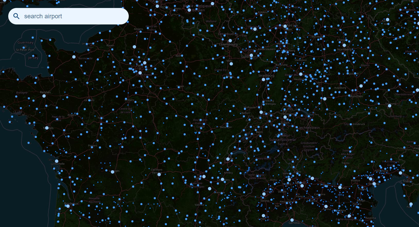
I can imagine an OT query for “all hanglider and/or paraglider areas in Australia” and now have an ability to view them with precision and beauty — hey, even if it is a windsock: pretty! Pretty useful, too!
The timestamp of the cache for each airport is shown on the bottom right. There is also an option for immediate cashe refresh. If no one refreshes manually, the refresh is triggered automatically upon showing the airport if the timestamp is older than 28 days.
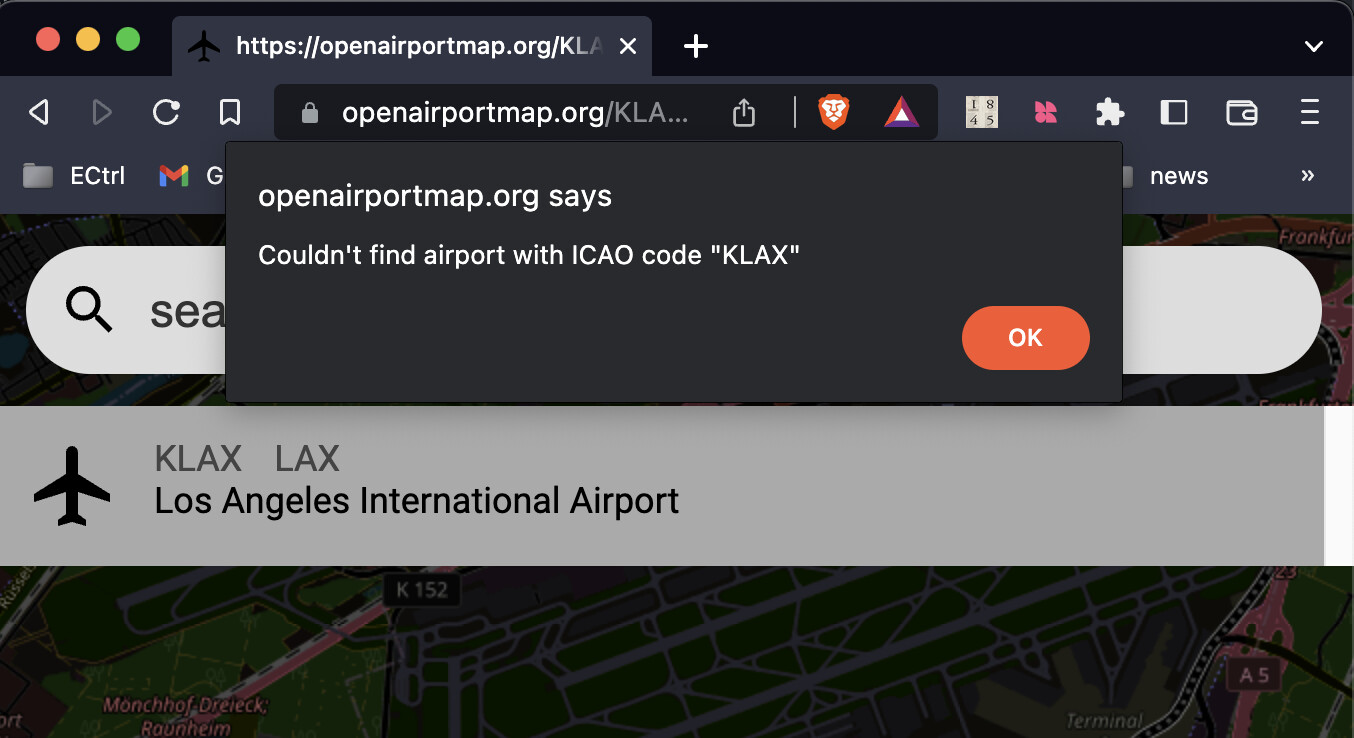
The international airport in Santiago de Chile (SCL / SCEL) is broken. Neither navigating there via the map and clicking on the dot in the overlay nor via search opens the details panel. https://openairportmap.org/SCEL
There are errors in the JS console
Search / opening link with ICAO code:
Uncaught (in promise) TypeError: t is undefined
    overlaps LatLngBounds.js:208
    processOsmData app.js:345
    getData app.js:320
    (Async: promise callback)
    getData app.js:316
    goto app.js:214
    <anonymous> app.js:104