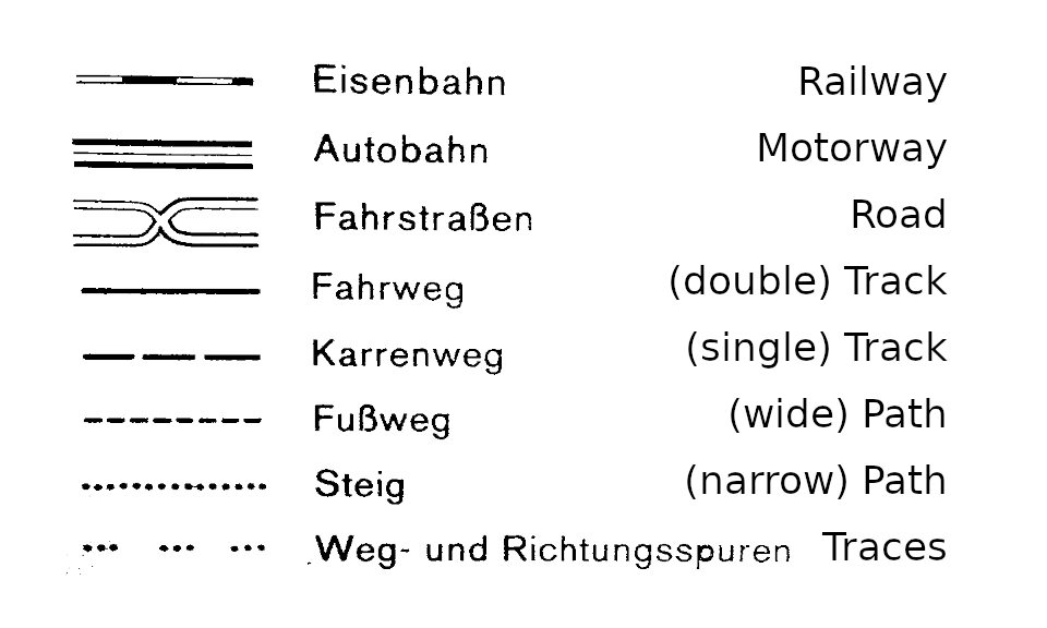
I opened one of those I have around, a paper map that is: Here the map legend:
Alpenverein (ÖAV) is the top local ramblers club in Austria. It is the second biggest club in all of the country, only behind the motorists club ![]() They operate their own cartography. There is no indication on difficulty given in their maps. The same holds for the administrative map of Austria https://maps.bev.gv.at/ and basemap.at Karte that shows more or less the same trails.
They operate their own cartography. There is no indication on difficulty given in their maps. The same holds for the administrative map of Austria https://maps.bev.gv.at/ and basemap.at Karte that shows more or less the same trails.
I am not aware, that the SAC (Swiss Alpine Club) publishes maps by itself. The Swiss administration does, https://map.geo.admin.ch/ - The signatures there are very similar to the ÖAV/BEV maps. I have not found a map legend.
These are cartographers not tour guides. If people want to learn about the difficulty, there are guide books covering all the routes, even more of them than openstreetmap has. Including estimates on duration and detailed descriptions of where the key spots are.
That is what sets openstreetmap apart from them: Openstreetmap caters to be tour guide too. I rather not dive into footwear requirements again.
PS: How to word that – Coverage of *alpine_hiking trails in openstreetmap in Austria or Switzerland is a bit better than on the AV or administrative maps. Especially the two top grades.
PPS: As Kompass was mentioned, I overlaid their PRO map of the Conca delle Levade with OSM, and one of both must be severely wrong in where there are paths and streams, not only the sentiero (path) 30. I guess I know who.
