Voor knooppunten gebruiken we survey:date. Knooppuntnet heeft een weergave met kleurtjes op basis van survey:date.
Wandelnet kent wel kleuren.
Alleen dat lijkt in Arnhem Nijmegen nog niet te werken, als ik daar een route plan, krijg ik rood als routekleur en in de routelijn verschijnen geen kleuren.
Als ik op de Veluwe of Overijssel in Wandelnet een route plan, krijg ik wel kleuren, zowel op de kaart als in de routelijn.
Hi folks!
I live in Nijmegen and just learned about the newly opened hiking network. (Wandelen in het Rijk van Nijmegen)
What is the best way to support getting this into OSM? Seems to me like there must be some better way than just manually creating all those relations - or is there? Is there some consolidated effort to get this done that I can support somehow? I might even be able to help organize a osm taggathon with the local Hackerspace if that helps.
I wish! The OSM system for Node Networks is very different from the official sources. So far, nobody has been able to convert. Main difference: sources give us unattached lines and points, but OSM uses ways and nodes representing actual roads/paths and intersections.
Maybe some kind of ‘snapping’ tool could help:
- snap unattached route line to the road system to create the string of way objects for the relation
- snap unattached waypoints to intersection nodes for the network Nodes.
However, even with such a tool, you would have to check all the results meticulously.
In my experience, in the end you still have to do the work, but there are several neat tricks and shortcuts in JOSM to make life a little easier.
When working with non-mappers, I found that it helped me if they tracked the route and created the (unattached) nodes, and I did the relations according to the gpx traces (using JOSM’s download-along-gpx function), merging the unattached nodes with the correct intersection nodes.
Adding unattached nodes on road can be done with several end user tools. I think we used a MapComplete theme.
If there is a reliable source of the network, which can be used in QGIS, it’s possible to create maps comparing the source data with OSM and building a workflow to enter/correct the differences.
Ik weiger Engels te schrijven. We zijn hier in Nederland.Ik kan het prima lezen en begrijpen, ik heb 30 jaar in de IT gewerkt en tich cursussen in het Engels gedaan, maar het actief beoefenen is te lastig.
Ik begrijp niet waarom het handmatig invoeren een probleem is, ik doe het al sinds 2015 in OSM en sinds 2009 in FB. En het is gewoon leuk werk, nog steeds.
Waarom zien mensen mapping klussen als een opgave, die zo snel mogelijk OSM in geramd moet worden ipv gewoon te genieten en soms te ergeren van het rustig invoeren?
En in een netwerk als Arnhem Nijmegen, dat een keuzepunt netwerk is, ontkom je niet aan handwerk. De gekleurde routes krijg je er echt niet gemechaniseerd in. Maar het invoeren van die routes levert weer leuke puzzeltjes op.
Ik hoop dan ook dat geen tools gaan verschijnen om dit werk uit te voeren.
En als je handmatig invoert, kom je van alles tegen dat je gelijk kunt meepakken. Afgelopen dagen nog diverse ontbrekende paden wegen ingevoerd, diverse wegen nog wat gedefragmenteerd.
Wat het netwerk Arnhem Nijmegen betreft, dat is inmiddels grotendeels ingevoerd, handmatig door een aantal mappers, dus daar hoeft geen meeting of een of andere sessie voor georganiseerd te worden.Zie ook Waymarked Trails. Waymarked Trails - Hiking Let op deze link openen in een apart tabblad, je kunt van Waymarked Trails niet terug, die functie is uitgeschakeld.
Bovendien is het enorm lastig om met meerdere mensen aan 1 netwerk te werken. Routes en knooppunten/keuzepunten moeten lid gemaakt worden van een netwerk en dan heb je al snel conflicten te pakken. Dan moet je met lastige constructies gaan werken als de routes en knoop/keuzepunten in een tijdelijk bestand zetten en aan het eind van de wijziging het netwerk op te halen en de inhoud van het tijdelijk bestand daarin over te hevelen.
Dat lukt alleen als je middenin een netwerk bezig bent, aan de randen wordt het lastig omdat je dan met connections zit en dus meerdere netwerken
1 Like
Welcome,
As @dvdhoven mentioned the best way is to enter the routes manually after visiting them. If you don’t know how to do that you can ask here. Or ask another mapper to enter the route in OSM if you draw the route and nodes on OSM background. @dvdhoven helped me map a lot of routes that way when I started.
It is very important to check the route ‘in the field’ as it is not uncommon that nodes on the official map are missing in the real world or vice versa. Errors in the signing (for example wrong arrow colors on the ‘plates’ or wrong rotation of the poles) are also not uncommon.
Just saw an example of that. The following node in the middle has no number on the official map:
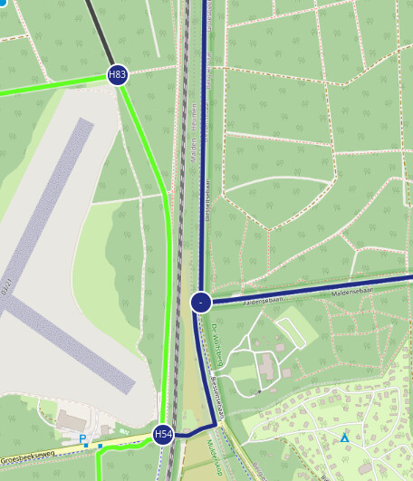
But @spaanse has mapped it in OSM as B25 (which I can confirm from observation).
A great tool to see which part of the Nijmegen area is already mapped in OSM is WMT (Waymarked Trails):
https://hiking.waymarkedtrails.org/#?map=15.0/51.8439/5.8605
All routes you see in WMT are in the OSM database already.
The network is pretty much complete in OSM within the city limits of Nijmegen (for a big part thanks to @spaanse). Malden is complete. Outside that there are some big blind spots. I intend to finish the area southwest of Nijmegen (remaining part of municipality Heumen) where I started last winter.
Beuningen and Wijchen are still blank for the most part so that may be good places to start walking / biking / running (my preferred mode of transport :D) some routes. It’s a good idea to mention that you want to survey a certain part in this topic. Have fun!
[quote=“Peter_Elderson, post:244, topic:103203”]
If there is a reliable source of the network, which can be used in QGIS, it’s possible to create maps comparing the source data with OSM and building a workflow to enter/correct the differences.[/quote]
Dat lijkt op wat FB doet in zijn editor met de knooppuntfietsroutes uit routedatabank. Die staan in de editor op een achtergrondkaart als blauwe lijnen, de LF routes als roze.
Ooit waren de routes uit routedatabank ook beschikbaar via PDOK, maar volgens mij is dat nu niet meer zo, omdat routedatabank een andere policy heeft voor het downloaden van routes uit routedatabank.
Wat ik als nadeel ervaar van het volgen van dergelijke achtergrondkaarten, is dat je makkelijk de oriëntatie kwijt raakt, je volgt de blauwe lijn, maar je weet soms niet meer waar je bent.
Waar staat FB eigenlijk voor?
Fietsersbond.
Die heeft een eigen database en een daarop gebaseerde routeplanner.en een editor om de database te bewerken.
2 Likes
[quote=“dvdhoven, post:247, topic:103203”]
Het probleem met achtergrondkaarten is dat ze niet vergelijken, en ze geven het verrichte werk niet aan. Ze doen niks voor de workflow. Mijn voorbeeld is de zebrapaden-kaart van PeeWee32. Die vergelijkt periodiek wat er in OSM staat met de gegevensbron, en dan krijg je een kaart van wat er nog moet. Wat jij (of iemand anders) al ingevoerd hebt, verdwijnt dus na de volgende verversing van de kaart. Zo zie je wat er nog gedaan moet worden.
Dat zorgt dus voor de samenwerking en de workflow. Hoe de mappers precies werken maakt niet uit; het resultaat telt.
Ook survey gevolgd door invoer telt, want de bijgewerkte vergelijkende kaart ziet dat gewoon als “al gedaan”.
Ook voor controle van bestaande punten kan dit systeem worden gebruikt, als je een goed kriterium kan vinden wat zegt “deze is al gecheckt/bijgewerkt”. In het geval van knooppunten ligt het voor de hand om “survey:date” te taggen, de kaart kan dan filteren op datum. Knooppuntnet heeft daar ook al een weergave voor, dus dat kan ook helpen.
Bij FB is er voor het fietsknooppuntnetwerk een “half” controle systeem.
Als een weg het kenmerk fietsknooppuntnetwerk heeft, maar die weg ligt niet op een blauwe streep, dan wordt die in een foutlijst gezet.
Dat kan overruled worden mbv een POI, die je aan de weg kunt plakken.
Andersom een weg zonder fietsknooppuntwerk op een blauwe lijn signaleren lukt niet.Dat hebben de ontwikkelaars tot dusver nog niet voor elkaar gekregen.
Die foutlijst wordt dagelijks ververst.
Maar ik heb ook aan die “halve” controle al heel veel gehad.
Daardoor zie je dat er ergens iets fout zit en als je dan gaat kijken, zie je meestal veel meer.
Walk a route, record a GPX and photograph all choice points and maps you come across. Then enter it into JOSM. Points is easiest, network routes are a bit harder. Both of these have to be added to the network relation. Colour routes are not added to this relation. I have attached my preset below (updated with a survey:date field).
I usually start by downloading the network (see overpass query) and manually download areas around intersections (especially if you need to split roads).
Een behoefte aan volledigheid in OSM. Maar ben het eens dat gebaseerd op survey kwalitatief beter is.
I have of course seen many cases of this. In such cases I map the intention, not the errors. But report it at meldpuntroutes.nl so that Folkersma can fix it.
I intend to finish Berg en Dal
Nog steeds? Enkel voor Limburg mag je het niet gebruiken. Voorkeur nog steeds voor veldwerk, maar als je dit gebruikt laat dan survey:date leeg.
Ik heb zelf voor mijn knooppunten nu survey:date toegevoegd op basis van mijn foto’s. Een enkeling mist een datum omdat ik in het begin nog geen foto’s maakten. Deel van de routes heb ik ook een survey:date gegeven, dat moet ik nog afmaken.
Overpass Query
[out:xml][timeout:25][bbox:{{bbox}}];
relation(3591208); // Wandelnetwerk Arnhem Nijmegen
>>;
out meta;
<;
out meta;
JOSM Preset XML
<?xml version="1.0" encoding="UTF-8"?>
<presets xmlns="http://josm.openstreetmap.de/tagging-preset-1.0" author="Jelmer Firet">
  <item name="RWN node" type="node" icon="presets/misc/note.svg">
    <label text="RWN node"/>
    <text key="rwn_ref" text="node ref" length="6"/>
    <text key="expected_rwn_route_relations" text="#endpoints"/>
    <text key="note" text="note"/>
    <text key="survey:date" text="survey date"/>
    <key key="network:type" value="node_network"/>
  </item>

  <item name="RWN node route" type="relation" icon="presets/misc/route.svg">
    <label text="RWN relation"/>
    <text key="ref" text="ref"/>
    <label text="I only use white-red and yellow-red if no other colour of the network follows it."/>
    <multiselect key="colour" values="red;orange;yellow;green;blue;aqua;purple;gray;black;white-red;yellow-red" text="colour" values_sort = "false"/>
    <text key="colour (custom)" text="colour"/>
    <text key="survey:date" text="survey date"/>
    <key key="network" value="rwn"/>
    <key key="network:type" value="node_network"/>
    <key key="type" value="route"/>
    <key key="route" value="foot"/>
  </item>

  <item name="RWN colour route" type="relation" icon="presets/misc/route.svg">
    <label text="RWN relation"/>
    <text key="name" text="name"/>
    <combo key="colour" text="colour" values="red,orange,yellow,green,blue,aqua,purple,gray,black"/>
    <text key="osmc:symbol" text="symbol" value_template="?{ colour=red 'red:white_round:red_arrow' | colour=orange 'orange:white_round:orange_arrow' | colour=yellow 'yellow:gray_round:yellow_arrow' | colour=green 'green:white_round:green_arrow' | colour=blue 'blue:white_round:blue_arrow' | colour=aqua 'blue:green_circle:blue_arrow' | colour=purple 'purple:white_round:purple_arrow' | colour=gray 'gray:white_round:gray_arrow' | colour=black 'black:white_round:black_arrow' }"/>
    <text key="ref" text="ref" value_template="?{ colour=red 'rood' | colour=orange 'oranje' | colour=yellow 'geel' | colour=green 'groen' | colour=blue 'blauw' | colour=aqua 'turquoise' | colour=purple 'paars' | colour=gray 'grijs' | colour=black 'zwart' }"/>
    <check key="roundtrip" text="roundtrip" default="on"/>
    <key key="network" value="lwn"/>
    <key key="route" value="hiking"/>
    <key key="type" value="route"/>
  </item>
</presets>
That is what I meant but understand my post could be read as “map the errors”. You are right, it is often clear what the correct (intended) situation is, so that should be mapped and errors can be reported.