It is a fact that administrative boundaries in our country is somewhat incomplete. So, I have came across some datasets from the Sinar Project; where they do have a copy of district boundaries. And the best bit is that they’re published under Open Database License (ODbL) - the same license that OSM is using. By the way, Sinar Project is an NGO that deals with open data and the initiatives behind the idea of an open government.
They have district boundary data for most of the states. LATER EDIT: Please see the second reply.
As a polite gesture, I’ll be contacting them, letting they know that we could benefit from their effort.
Technically, this is an import, where the data will be imported using JOSM, step-by-step. I’d like to know whether everyone fancies this import, and if it’s the case, then I may proceed with plans and other technicalities.
―――
Peta negara kita masih lagi tak sempurna… ada negeri langsung tak ada sempadan daerah dan seumpama. Kebetulan, nasib, terjumpa set data sempadan milik NGO Sinar Project. Bolehlah… walaupun bukan semua negeri ada (kot). Tapi yang penting, set data tu pakai lesen ODbL, kira boleh kautim dengan OSM yang pakai ODbL juga.
Data yang nampak macam boleh import tu ada kat bawah ni je.
Ni, atas kertas, boleh dikira import. Formalitinya macam ni la, kena tanya warga OSM sama ada nak ke tidak. Kalau OK, OKlah. Boleh maju ke langkah seterusnya…
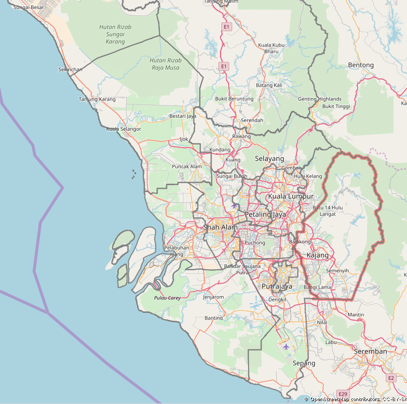
I checked their Selangor data and they have PBT (pihak berkuasa tempatan) boundary.
PBT is different from district.
according to wikipedia, Selangor only have 9 districts but this data have 12 PBT,
Petaling district break up to Shah Alam, Petaling Jaya & Subang Jaya
Gombak district break up to Selayang & Ampang Jaya
so you have to decide what to map…district or PBT?
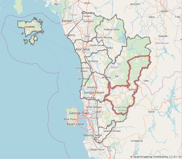
Actually, I really wanted to update the district boundaries. It appears that in my state (Kedah) for example, it seemed just right - based on my personal assumption and some hit the surveyed points quite accurately.
Does that mean that a “pihak berkuasa tempatan” is the next administration level to “district”? I.e. a district contains 1 (“typical”) or a few (not so typical) “pihak berkuasa tempatan”. Or are there also “pihak berkuasa tempatan” which do fall into 2 (or more) districts?
Bernard,
This is my observation. Historically, a district by default will always have a majlis daerah (municipal services I think). At certain point, a town grew big enough that it has its own services, thus having a majlis perbandaran ( town/city services). If this town/city (usually a district capitol) gets big enough like Petaling Jaya, or lies close to the district border, then the city services boundary will overlap with other majlis daerah.
So, one is adminstrative boundary, a true district in a sense, something that is indicated in land deeds etc. The other is more of a distinction of who provide services to which areas.
If we are going to say PBT boundary is the same level as mukims, then I can see some problem. Theoretically if the mukim boundaries will be mapped, it will be admin_level=8.
E.g. in Kedah, where Kuala Muda district is under Majlis Perbandaran Sungai Petani. Kuala Muda district has mukims under it as well, so both will be overlapping.
Currently admin_level=7 is exclusively for use in Kucing Subdistrict. Since Majlis Perbandaran/Bandaraya could also cover multiple mukims, maybe, then it would be higher than the mukim.
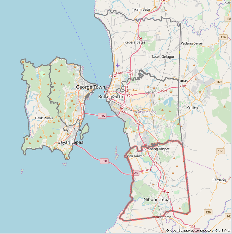
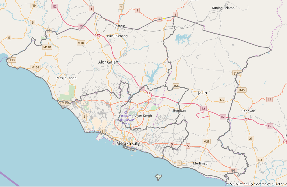
Selangor is special case, The district’s borders were recently modified during the detachment of Kuala Lumpur in the 1980s so use PBT. Melaka is 2010 and same. Penang no problem and Seberang Perai border just follow the Perai River and Junjung River. Johor may refer to Selangor as they have 10 district and 16 PBT. I think the newer minister will study for this and we should follow PBT first (except Penang) as they are law enforcement agencies in the area/district.
So, I go Raya first. But of course: feel free to discuss more details either to support or oppose this import. This has been also linked to the Facebook group.
So far:
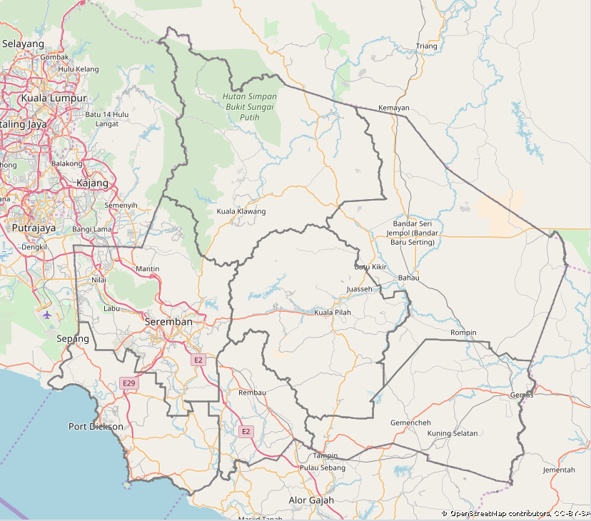
Selangor: PBT boundaries, another kind of import is do-able, but probably admin_level could be refined. Personally I’m suggesting admin_level=7 because some PBTs happen to handle different places, even overlapping with other districts
Kedah: PBT boundary coincides with the district boundaries; district boundary import should refine rough district boundaries from an out-of-copyright map
Penang: “no problem” from user:angys
Melaka: PBT boundaries at admin_level=6; will join the import process with Selangor
From the Facebook poll, one vote for yes to import
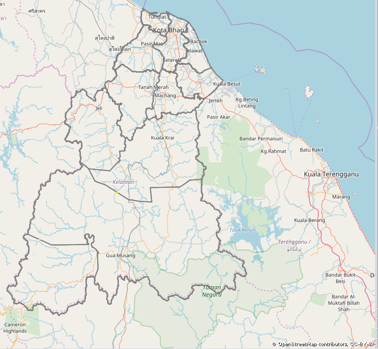
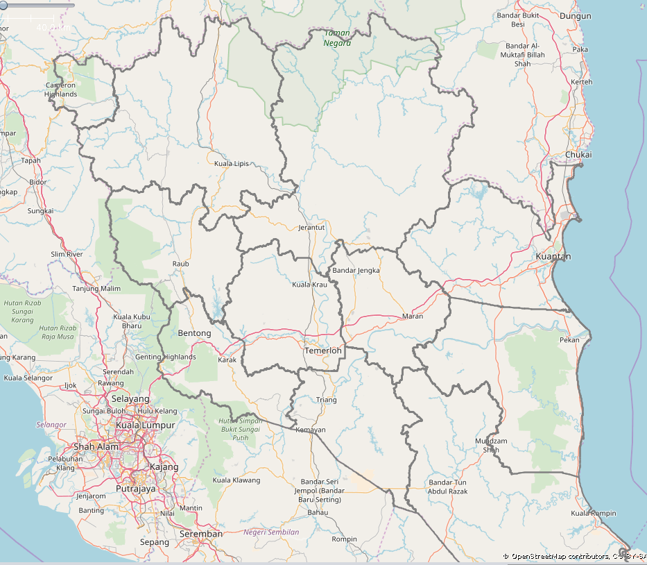
No decision yet: Kelatan’s jajahans, Negeri Sembilan and Pahang. My personal take is that Kelantan’s jajahan is also good to be imported.
Unfortunately, these are all the available data, provided by Sinar Project. Please hope that one day, the government’s stand on open data could be better.
Note: admin_level refers to the hierarchy of the degree of a kind of boundary i.e.:
3rd admin level: currently not reserved
4th admin level: negeri (state)
5th admin level: bahagian Sabah & Sarawak (Sabah dan Sarawak divisions)
6th admin level: daerah (district)
7th admin level: from the Wiki, something like Kuching District
8th admin level: mukim (county)
9th admin level: currently not reserved
10th admin level: PBT boundaries, again, this is what have been described in the Wiki.
This can be changed accordingly, suitable to reflect the reality.
What’s next if the majority has decided it’s a good thing to proceed? Well, I would have to post an update on the Imports mailing list as well, and perform some other import formalities. I’ll be using the JOSM editor to make this import.
Long time no update. I’m in the process, getting an explicit yes from Sinar Project to import the data.
Okay, that one, I try to import district boundaries first, then PBT boundary. Other boundary, I have to check first how they are mapped in other countries.
Wednesday update: got a reply from Sinar Project, and they said it’s all clear. Now I have to prepare for all formalities: let the upper hands know that this import could go.
This is a snippet from the e-mail exchange with them:
So, I’ve decided to improve details on state boundaries in Peninsular Malaysia (except the Johor-Singapore boundary). District boundaries for Kedah, Penang, Kelantan and Pahang would be imported as well. Selangor and Melaka would get the PBT boundaries.
Wiki page is up, so the last thing is to be scrutinised further, if any, in the imports mailing list.
It’s almost ready.
@angys: I don’t think I want to import electoral boundary data. Things can change by the next general election (could be 4 or 5 years).
Sunday, March 10 update: That’s Penang and Kedah, completed. Perlis and Perak now with improved boundary. The next move would be some clean up across Kelantan first, then proceed with import.