In my area, some areas will sink by a melted water from Antarctica in the future. I know the roads “way” will be removed. But do its GPS traces will also be removed? If it was, my hobby of making GPS traces will be gone forever. I love my hobby. I appreciate and take care of my habit as a GPS tracer. My hard work as a GPS tracer will be gone forever if it was. I don’t want my hobby to be destroyed. I hope the GPS traces won’t be removed even the area was deconstructed, nuked and sinked.
Hi, didn’t you ask it already in another topic with another nickname?
3 Likes
To be clear, you’re talking about things a very long way in the future. See for example here. Past estimates of post Antarctic ice loss sea level rise can be inferred from ice cores from Antarctica. Your GPS traces around KL include areas less than 30m above sea level, which would be affected - and are actually also likely to be affected by other climate change effects (storm surges etc.) in the much nearer future.
However, there is no policy to remove GPS traces from OSM that cover land that has become sea since the trace was uploaded. The “background” GPS traces that you see in the iD editor come from a separate layer; even if traces were removed from OSM there is no process to remove individual traces from that layer.
However, whether OpenStreetMap’s servers will still run the same software or will still exist is a different question - at the timescales you’re talking about (100s to millions of years) all bets are off.
2 Likes
Another question, why it takes 1-2 days or long to uploaded GPS traces to be rendered on different zoomes? Is Wiki server so slow?
Anyways, what kind of GPS traces OSM don’t accept?
If you’d like to ask lots of questions interactively, perhaps one of the many chat servers that discuss OSM would be for you?
Well in that case (If I don’t have a guarantee that OSM will be around in 100k years) what are any of us even doing here?? Putting in all this work just for it to be wiped out in a heartbeat ![]()
1 Like
I see no reason why they would be removed.
OSM contains lots of GPS traces that are not on land, some may be ferry routes, and roads which no longer exist.
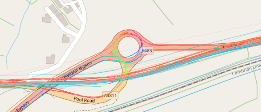
Here the road layout changed during the lifetime of OSM, but the old road can be seen in the GPS traces. To remove there traces would require editing, part of these traces may be the only trace we have for some roads.
Assuming OSM still exists, I see no evidence of traces being removed.
Have never heard of any selection criteria either for them not to be accepted.
2 Likes
I feel like some smart rendering logic could go a long way with the stale/outdated GPS info. Something like “For a given tile or group of tiles, render the 100 most recent traces at full opacity, then the next 100 at 60%, then everything else at 10%.” Then for areas where they’re really sparse nothing would change. The thresholds could be tweaked for different zoom levels.
Maybe I’ll try something like this out as a proof of concept in QGIS. ![]()
Maybe it was an error recorded by someone else. Or the road was newly built, just it not showing up on satellite images and street view images.
If a GPS trace really does need to be removed from OSM, then email OSM’s Data Working Group** to let us know. We may be able to do something about traces in OSM, but likely not in the overlay layer that iD uses, for the reason mentioned above. However, a change to a road layout probably isn’t a good enough reason.
** which includes me.
1 Like
Does that mean it would be removed in real map but it still can be seen in iD? And other editing software like JOSM, Merkaartor & Potlatch?
As I understand it, here is how GPS traces in OSM work:
- You can upload a GPS trace to OSM. This adds it to a big database of traces. DWG can remove files from this database if necessary.
- Some editors like JOSM can download these directly. (Downloading the actual GPX files.)
- People can download the files directly from the website, or using the API.
- There is a server somewhere that takes all the traces in the database and renders them into a nice color-coded raster (made of pixels) layer.
- The raster tiles are is the stuff you see in iD and on osm.org slippy map, used as an overlay. And this is the layer that Andy is saying that traces will not disappear from, even if they’re removed from the above database. (I think new traces are “baked” onto existing tiles, as opposed to tiles being re-rendered from scratch every time.)
1 Like
you can also just drag the gpx file into Josm and use it locally, no need to upload. I think iD has a similar feature, but I am not sure.
1 Like
Yes, you can map with a gpx file in iD by dragging it in as well. (Or use it directly from the osm api)
1 Like
What I know is the older traces on the road that does not showing up finally shows up after the new traces uploaded on the same road. I’ve going through this. When I see GPS trace that I uploaded doesn’t show up on road (or it can be only seen when zoomed in or zoomed out), I make another GPS trace on the same road and uploaded it and the both of them finally showed up (or sometimes just older traces fully showed up).
Interesting, I’ve never seen that. Perhaps when there is more than one pending trace for a tile, it’s boosted to the top of the queue?