I’m in the middle of rewriting the English Wikipedia’s “OpenStreetMap” article, currently focusing on the section about various incidents we’ve had over the years. Maybe I should include this photo under fair use as an irreplaceable image of an historic event:
That is an access tag? Perhaps should have been more specific?
I think, opposition was mostly concerned about ways tagged scramble dropping from rendering/routing in consumers not interested in rendering/routing those.
I think those are related and many people were weighing the downsides of 1) keeping highway=path + ‘simply’ using sub-tags and not having a more specialized tag vs. 2) moving to a new tag and losing existing software support.
The downsides of 2) are obvious while many might not be fully aware of the arguments against 1)
The way already had golf_cart=designated and this changeset added motor_vehicle=no. Depending on who you ask, either motor_vehicle=no overrides golf_cart=designated so that golf carts can’t use the tunnel, or golf_cart=designated overrides motor_vehicle=no so that they can. (Someone still needs to update this golf course to reflect the current consensus against highway=service.)
From the time of this accident, it took almost two more years for us to arrive at a less problematic tagging combination that leverages the plain-English meaning of the word “path”, still without involving the wiki proposal process. I describe it as a stopgap because the priority was to prevent accidents with an imperfect solution that the community would tolerate for the time being. Sometimes workarounds can give the community needed time to agree to a more perfect solution, if it ever arrives.
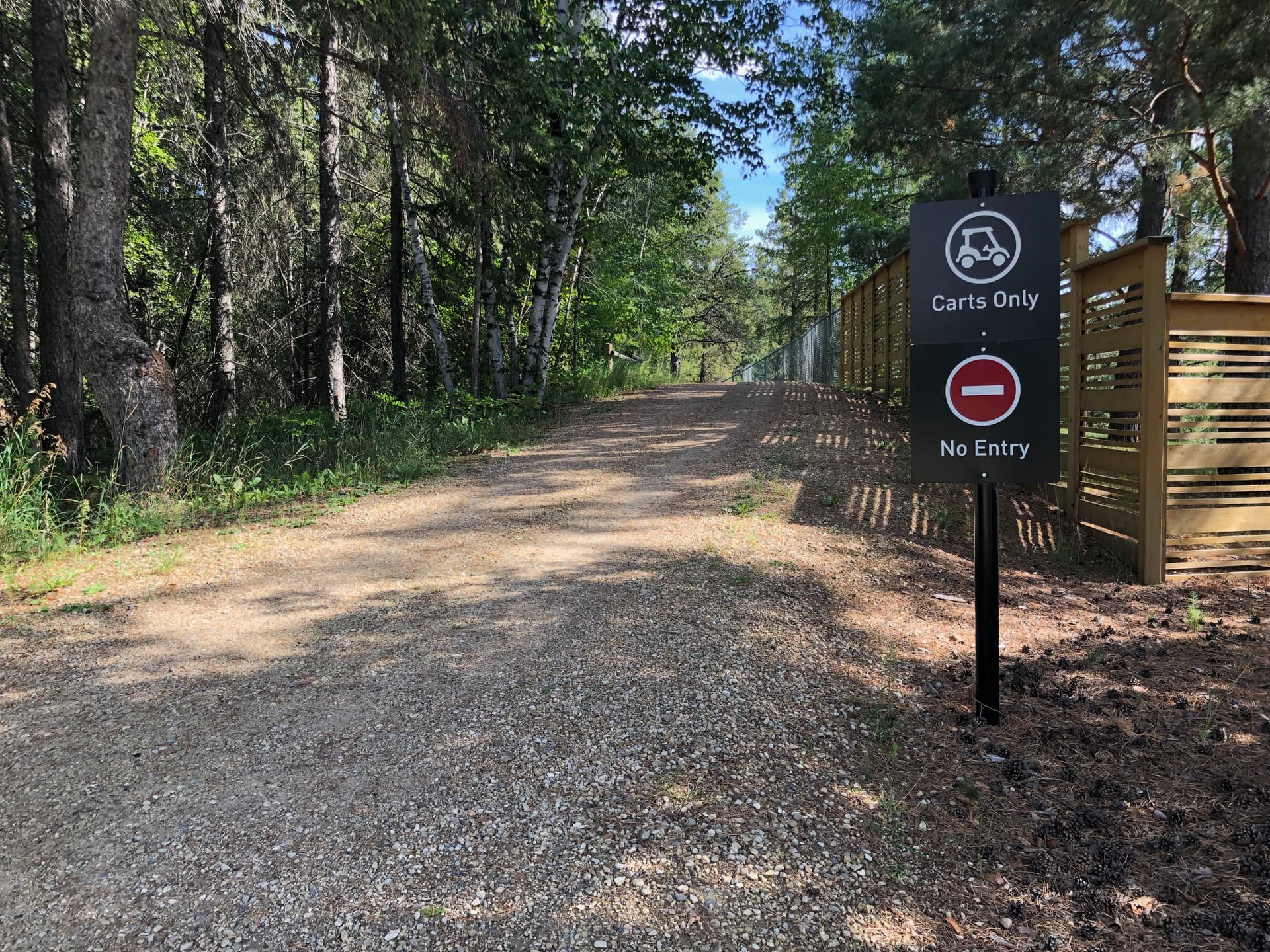
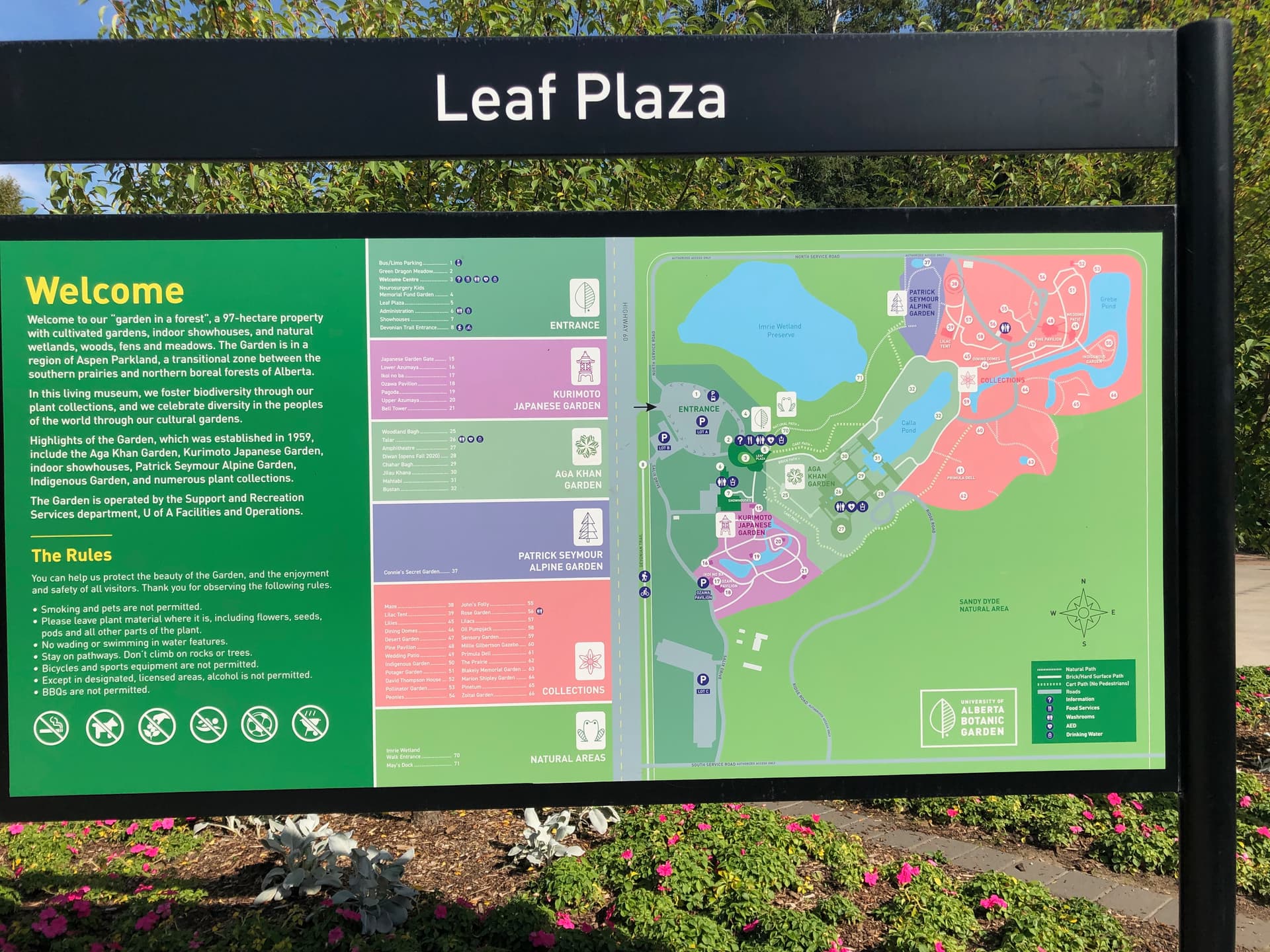
But enough about golf. I recently visited the University of Alberta Botanic Garden in Edmonton, where they post signs and clearly marked maps to keep pedestrians on the natural paths and off the cart paths:
Do confirm out the paved/unpaved distinctino I made:
For footway, asphalt/paving_stones/concrete/paved/cpmapacted/sett make at least 80 % of the values of surface.
For path, unpaved/ground/dirt/grass is almost 2/3 of the surface tag.
From other tags combinations, it also attests to the urban/rural divide.
The material (as opposed to procedural) criticism of the edit that I noted in this thread was:
Using “most countries” instead of weaker “some” or “many” – solution: just talk about a tendency without quantification
The distinction is about access (in South East Asia, paths are sometimes for motorcycles) – solution: bring back the mention of path for multiuse ways, stress access
In Germany, there is a common usage where path is for cycleways with pedestrian accesss a.k.a. erasure of a mention about multi-use paths – explicitly mention this
(I am also removing the UK specific texts, they are already in the See also section.)
(When copying, I lost links - they would be there as appropriate, I am including just the new links.)
The tag highway=footway is used for mapping minor pathways which are used mainly or exclusively by pedestrians.
Usage
Footways tend to be constructed and either paved or with smooth surface (compacted, wood or similar). The elderly and small children and quite often also wheelchair users can use them with ease. They tend to be in urban settings, but not always. Access is primarily for pedestrians.
— Paths kept mainly by the fact of people walking on them or paths that are only minimally constructed are usually tagged as highway=path. Their surface might be uneven (typically ground) and one might need to be physically fit and situationally aware to use them. They tend to be located outside of urban enviromnent. Hiking trails are a typical example and sac_scale=, trail_visibility=, surface=* and access=* are useful. However, in some countries like the UK or others, this distinction does not hold and highway=footway can be used for these too.
— Ways closed to cars but open to motorcycles, cyclists, horses or other users are mapped with highway=path with appropriate access tags, but see duck tagging as well…
— For wider pedestrianised streets, typically, lined with shops or commercial buildings, use the tag highway=pedestrian.
— Where a pathway is designated for pedestrians but is also allowed for bicycles, you can use highway=footway and bicycle=yes or highway=path, foot=designated and bicycles=yes.
— Dirt roads for mostly agricultural, forestry, etc. uses should be tagged as highway=track.
— For tagging sidewalks that span a road, see Sidewalks.
Well, unlike you, I tend to listen more. A lot of countries don’t really have alpine or scrambling routes, but I get your point. Maybe we should classify paths based on their function, like roads. I’d be up for a new tag for routes that involve scrambling, to make them stand out.
But in developing countries, there’s usually no clear difference between urban and remote tracks or paths. Some tertiary roads might only be passable with a heavy-duty 4WD, while a main pathway between settlements might be only passable with an off-road motorcycle. Then there’s the issue of regular cars/motorcycles trying those roads/paths and getting stuck. Do we need new highway tags for these, or just stick with another one (highway=track), even though it doesn’t quite fit?
Tagging for the renderer isn’t the way to go. We can use smoothness=very_bad or horrible and get renderers on board with that. Some already are. Maybe the same thing can be done for trails.
Just to be clear, this would be for something akin to a highway=path designed for motorcycles, as opposed to something akin to highway=road designed for motorcycles?
I’m pretty sure Vietnam and Thailand have very similar construction standards, but neither the Vietnam tagging guidelines nor the very different English version encourage the use of highway=path for, well, anything. It’s certainly in use, but I don’t sense that this usage is clearly because of off-road motorcycles or 4WD vehicles.
The vast majority of highway=path is from Meta’s old mapping team, which never really engaged the local community as far as I’m aware. Looking around Cà Mau, most of these highway=paths appear to be canal towpaths and other agricultural roads, clear candidates for highway=track. Some percentage of them may be highway=path in the sense that they aren’t for any vehicles, just pedestrians and water buffalo, but we don’t have a tag for designated water buffalo access. Maybe Meta unconditionally applied highway=path in order to err on the side of caution: car routers are very unlikely to route over highway=path, so any false positives are unlikely to cause real-world trouble.
In Vietnam, highway=residential and highway=service are assumed to be for motorcycles by default and only maybe for cars. After all, this is one of the few countries that has adapted the Vienna Convention’s “pretend it’s a motorway” sign to indicate a high-speed, motorcycle-only road instead. A motorcycleway, if you will.
In Vietnam, they mostly use the controversial service=alley for motorcycle paths that are too narrow for cars, along with a mix of highway=residential + motorcar=no + motorcycle=yes. I think both approaches are off, and as you know, it’s been discussed in detail here.
This is intended for narrow paths used mainly or exclusively by motorcycles. If a typical 4-wheel cars can access the path, it would fall under some other minor road classification.
I’m not sure what you’re referring to with highway=road. That tag is reserved for unsurveyed/unknown ways and could represent anything from a motorway to a sidewalk. highway=path is commonly used for hiking trails, so I’m confused about the comparison you’re making with highway=road.
I was simply drawing an analogy that the paved vs unpaved (“built”) distinction shouldn’t be used to determine highway classification. In Vietnam, there are many unpaved roads connecting villages that are tagged as highway=track, but they should really be tagged as highway=unclassified or highway=tertiary.
To the extent that a layperson has thought about highway classification prior to their initiation as a mapper, they would never have conceptualized an alley as a path that happens to only allow motorcyclists. An alley is an alley. But I must admit, Vietnamese speakers are very prone to defining words by intuition alone. I should know, having tried to define such basic words as “bánh” for English speakers.
Alright I’m not entirely sure where it would fit best because, at first, the wiki states that pathways are meant for non-motorized traffic only. However, it’s pretty common, even in the US, for some outdoor trails to be accessible to off-road motorcycles.
That said, the difference between highway=path and highway=track is clearly outlined on both pages.
A trail or path that is not wide enough for a typical four-wheeled motor vehicle
A path is not for use by four-wheeled (two-track) vehicles. Often the path is simply too narrow. Other times it is wide enough but such vehicles are prohibited
Your numbers sound high, but if you put them in relation to the total number of ways with a surface tag at all, then:
For footways, 25.69% paved
For paths, almost 15% of all ways are unpaved/group/dirt/grass tagged
You are trying to infer a surface tag from path/cycleway/footway, even though you can’t do that reliably – definitely not on a global scale. As someone already said: the definition what a road, cycleway, or footway looks like, varies greatly per country.
The only thing that I can see is that highway=footway tends to be used in settings where there’s signs that mark them as such – which is usually in urban environments. As soon as you leave the cities, in a lot of coutries, things get less restrictive, and a bit more muddy, which is where highway=path comes in with its default access tags that make it well-suited. So yes: I’d say that the majority of uses of highway=path are in areas where there are fewer or no signs at all. With the notable exception being the shared-use path. But you already talked about the urban/rural divide yourself.
I know what you mean, and I’m also completely against the whole access=designated tagging, because it is not access-related. However, we have the same issues with shared-use paths on private, or military compounds. The designation of what a path is, should not be tied to an access tag, but that’s what people voted on But as much as I’d like to rant about it, I’m not sure it’s related to the actual discussion
It would at least be a good idea to put some thoughts into this. Even if people are shaking their heads right now, it could be the best solution.
The way presets are presented in JOSM (and maybe other editors) probably reinforces this too - again there is a formal-looking blue circle sign for “dedicated footway”, i.e. highway=footway. Whereas highway=path has both “road sign” presets for shared use, plus the very first preset which doesn’t look like a road sign at all.
So, a new version based on further feedback (bold are changes to the previous versions). Unless there is opposition, I would try to edit it on the wiki later.
The tag highway=footway is used for mapping minor pathways which are used mainly or exclusively by pedestrians.
Usage
Footways tend to be constructed and either paved or with smooth surface (compacted, wood or similar). The elderly and small children and quite often also wheelchair users can use them with ease. They tend to be in urban settings, but not always. Access is primarily for pedestrians, which is often specified by street signs (or implied by local law).
— Paths kept mainly by the fact of people walking on them or paths that are only minimally constructed are usually tagged as highway=path. Their surface might be uneven (typically ground) and one might need to be physically fit and situationally aware to use them. They tend to be located outside of urban enviromnent. Hiking trails are a typical example and sac_scale=, trail_visibility=, surface=* and access=* are useful. However, in some countries like the UK or others, this distinction does not hold and highway=footway can be used for these too.
For ways used mainly or exclusively by cyclists, use instead highway=cycleway.
For ways used mainly or exclusively by horses, use instead highway=bridleway.
For ways used mainly or exclusively for motorcycles, use instead highway=path + motorcycle=yes or motorcycle=designated.
For ways closed to cars but open to motorcycles, cyclists, horses or other users without clear primary user, use highway=path with appropriate access tags.
For wider pedestrianised streets, typically, lined with shops or commercial buildings, use the tag highway=pedestrian.
Where a pathway is designated for pedestrians but is also allowed for bicycles, you can use highway=footway and bicycle=yes or highway=path, foot=designated and bicycles=yes.
Dirt roads for mostly agricultural, forestry, etc. uses should be tagged as highway=track.
For tagging sidewalks that span a road, see Sidewalks.
I m not saying this is realiably at all! I am just saying there is a tendency (that those tags that have surface notfilled in will behave like the ones that have is a guess – I might be wrong of course). In general when using maps, one needs to be aware of the local area since a lot of things will mean something different in Paris and at a town 50 km from Kathmandu even if they are mapped and rendered the same.
Some of us live in topsy-turvy countries outside Europe where the little carefree walking stick figure graces signs along many, many natural hiking trails but almost never along urban footpaths anywhere. Where I come from, stickperson only ever appears behind bars. The sign, along with , is more or less the only law that governs which roads or paths a pedestrian may travel along, as long as they keep to the side of the road.
(I agree with your broader point, but I just want to make sure the underlying assumption doesn’t take on a life of its own, since previously someone only rebutted it by pointing out a curious exception.)
This is where we need the expert advice of those who come from a common law country with an unwritten constitution. What to do when the ancient law is entrenched in our way of life but makes little sense anymore?
“Without a clear primary [mode of transportation]” is a good way to phrase it.