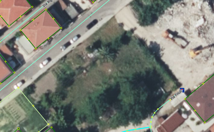
A mapper came to town and has only one change set comment on all to be mapping buildings using Bing, (admittedly it looks the glossiest of the available imagery), so the mapper did a few missing streets of buildings here, thank you. Included in the Bing area is this.
except when surveying yesterday all the building=yes, no floors, no roof, nothing but one tag, found there to be more and ESRI shows it too, a few years later.
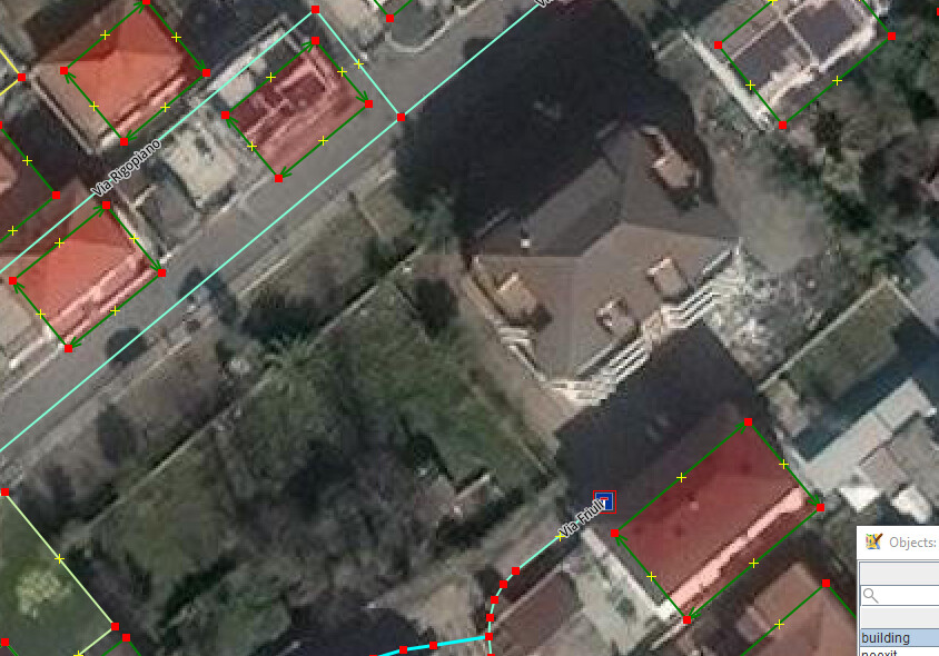
It’s not only a preference between Bing and Esri (or any other available imagery per region) based on release date (which I can never tell for each area I map), but you also have to consider the offset, seeing the images you attached. Bing itself changes the offset with every update, so it isn’t reliable as it is. Also, being glossy depends on the area. There are areas where is perfectly clear and areas where you can’t even distinguish a building.
Well, as for the offset, checked in JOSM, switched to Bing, for which I have no offset entered and the newly mapped buildings trace perfectly on the image building outlines ergo, no offset corrections and ESRI (no offset warning in JOSM) and Bing (with offset warning in JOSM) showing multi meter differences.
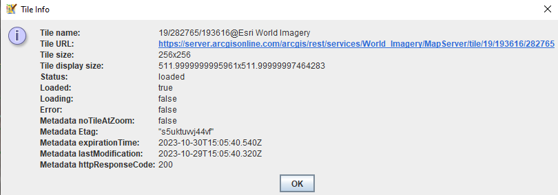
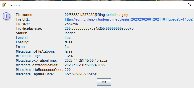
As for date, how to get it in JOSM:
To see the tile information in JOSM, you can load various imagery layers, zoom in, right-click the map, select the name of one of the loaded imagery layers, and select “Show tile info” for the tile at that map position. Various info fields will be shown, and may include the imagery date
ESRI - No Metadata capture date (neither for Clarity)
In the early days, I did propose for my community to use Bing as reference imagery. Any new imagery should be aligned to Bing so that traces would be uniform in position, then later with availability of trusted coordinates etc… we can offset the whole area at once to the correct position. You probably know how well that went…
Years ago I remember hearing about the Imagery Offset Database, which was supposed to do that. Is it just no longer used (by enough people)?
That does only offsets, it would certainly be nice to have some collaborative rating of other imagery attributes (“This is more up-to-date than that”, “this has better resolution than that”) etc. Sometime when mapping a new area, I’d love to be able to ask the local community “OK, but which imagery should I use?”
Lots of ideas on how to handle that have been bandied around over the years, they all tend to not really work because
layers are not uniform, even at quite a small scale any kind of quality measures tend to differ widely
since the contents, particularly of the global mosaics, can change at the drop of the hat, the information you just entered a second ago can already be out of date now
only partial integration in editors (offset DB available in JOSM and Vespucci, not in iD, other quality indicators having even less support over all).
One potential avenue that could be explored is resetting offsets and “best” indicators automatically when the underlying imagery has changed (but there’s a lot of reasons that might not actually be a good idea).