Isn’t this the same question as “Why is it accepted to map roads on amenity=parking”? Do you also question this https://www.openstreetmap.org/#map=19/52.95912/5.92720?
Breaking?!? “avoid” does not mean “may not”. This rule was made with situations in mind where multiple ways were surpassing by one or some few ways, e.g. a railway field surpassed by a road. The situation with aqueducts are completely different, a single way is surpassing by some few ways. Taking the count of ways into consideration, a bridge has precedence over a tunnel yet since both are similar counts it’s acceptable map both.
I don’t see the need for any precedence of one over the other. I agree that it’s acceptable to map both in some situations, especially if they have consequences for both waterway users and road users. The only thing not really acceptable is mapping nothing if there clearly is something worth while!
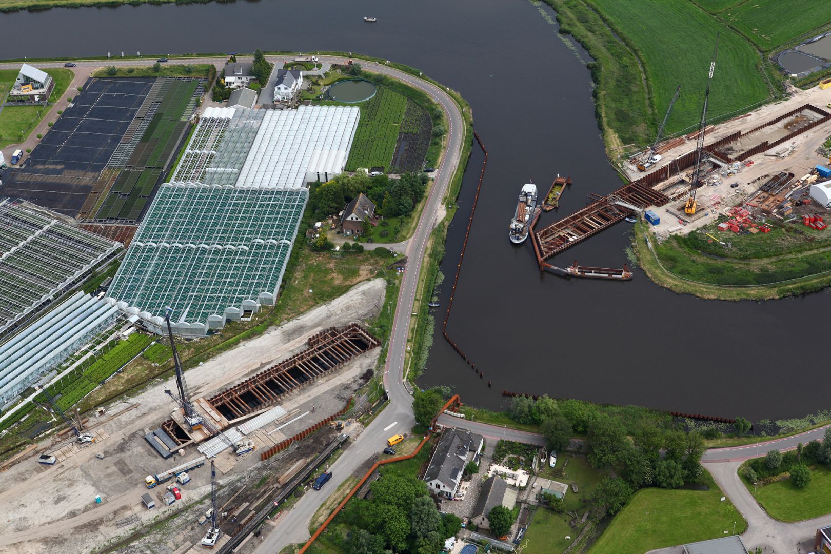
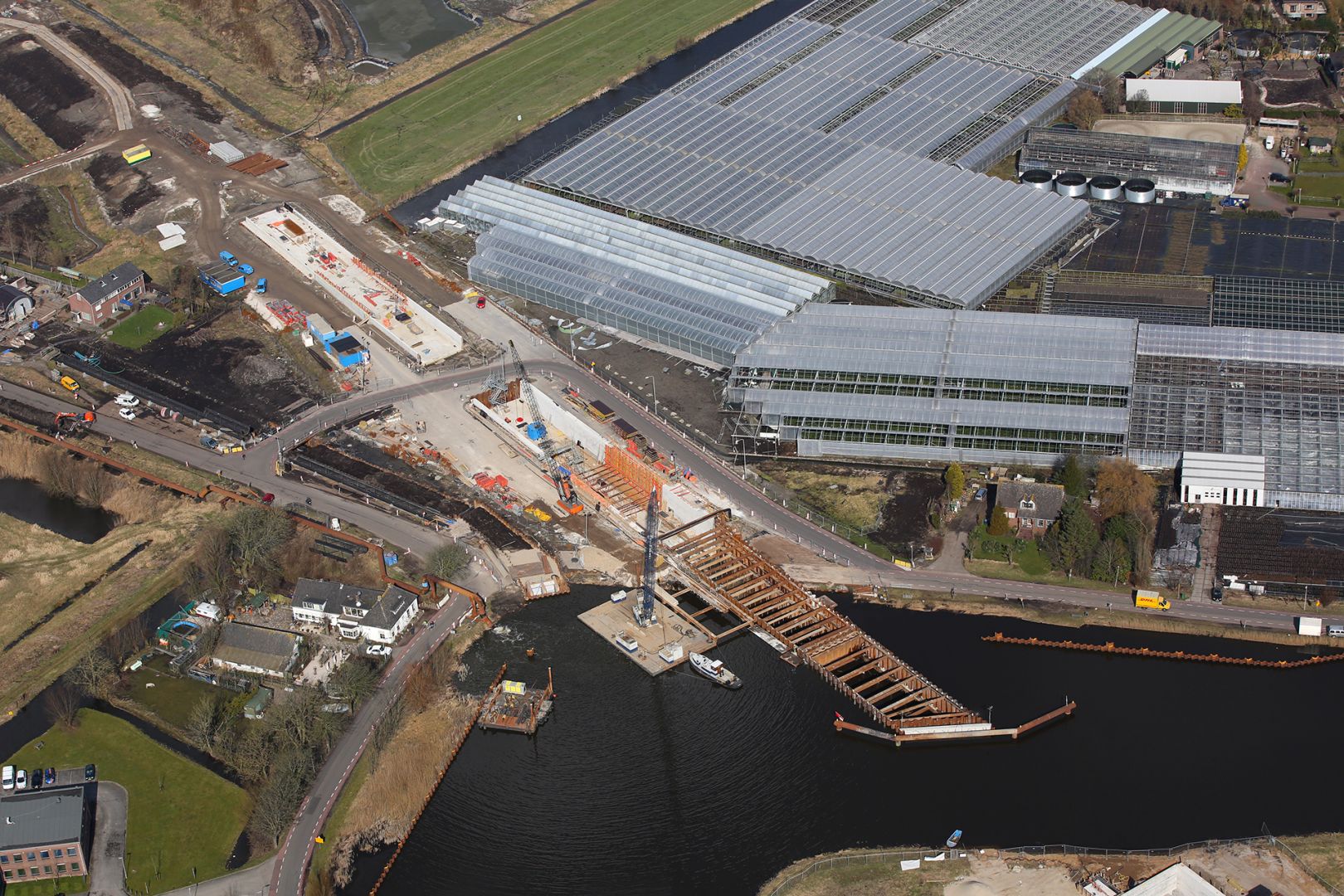
Currently, lots of structures are like open tunnels, “tunnelbak”. The concrete walls of the road stretch way beyond the bridge/viaduct/aquaduct go over it. Sometimes they support the structure, sometimes not (as multimodaal’s aquaduct pictures, which happen to be taken about 500m from my house).
Do we have a tag for that? If not, I would probably use tunnel, if it’s in any way relevant for people using the road. Otherwise I would not tag the road.
@Wyo thanks for the examples and comments.
Although I agree with you that all the examples except the Calais tunnel are aqueducts (not sure either about Amstel) that deserve a bridge=aqueduct on the waterway, I can’t understand the argument “air not belonging to”.
Do you mean the rounded walls seen approaching the aqueduct from the road up close?
For me it depends on the point of view, from a greater distance I don’t see a bridge, but the road lowering below ground to cross the aqueduct
I guess when the waterway is new it is an aqueduct by definition, because the bedding is artificial and freestanding.
When the waterway existed before a road crossed underneat, it can be either an aqueduct or just a tunnel.
I agree with all the cases you call aqueduct and also think that the Princes Margriet Tunnel is actually an aquduct, just like
https://www.wegenwiki.nl/Prinses_Margriettunnel
(don’t trust our names, what we call Maas at Rotterdam is actually Rhein for the last ten? centuries… ![]()
The reason? Even if might it is perhaps not visible from the water looking north, it appears to have an artificial freestanding concrete bedding instead of a tunnel dug under the original bedding
@Allroads pointed to this interesting link in this post
https://bezoekerscentrum.rijkswaterstaat.nl/SchipholAmsterdamAlmere/waarom-aquaduct-muiden/#.W9elQmhKibh
The national road authority explains, from the water perspective, why this -despite its length dfrom the road perspective- is an aquaduct instead of a tunnel:
Their use of this criterium is good enough for me, sounds logical and saves a lot of discussion.
Sometimes though I guess you have to look at how the structure was built when it’s not clear from the end result, like at the Amstel Aquaduct. And after that it seems to me that -after first doubting that, looking from the road alongside the water- the name is apptly chosen after all, even if it is really not a typical aqueduct, especially looking from the water, but I guess that’s a compliment to the builders in preserving the “natural” feel of the waterway:
(on second thought: the “freestanding” isn’t so obivious here, arrgh…)
https://aerovista.nl/langlopende-projecten/
https://www.mapillary.com/map/im/Dsq-_8rDiDAGYuLA7da7bg
No. Roads are real objects in a parking area. Waterways are fictional lines in a water area.
But I do accept the importance of the lines for routing purpopes. It’s wouldn’t be reasonable for me to expect that routing software can find a logical route through an area without that additional information.
Routing is one of the major uses of OSM data. But certainly not more important than rendering maps. We should take rendering in consideration when mapping.
I’m not sure what your argument is with counting of ways. And of course there are no hard rules.
But just as you think that this rule or guideline was made for other situations than aqueducts… I think that the tag man_made=bridge was or is not yet intended for aqueducts and the tag bridge=aqueduct was intended for waterways but not when there’s also an area mapped for the water.
![]()
Dutch people seems to have some special sense for names.
Very interesting link, thank you.
When mapping I always take the impression of the users of the map into consideration. When someone drives on a road into something like a tunnel it would be nice to give some advanced warning of having time e.g. to remove the sunglasses. Similar for driver on the waterway to get enough time for taking pictures. I for sure will once drive across the aqueduct near Muiden and see how it looks and feels, of course only after I’ve found it on the map.
What about ferry routes? Are these also fictional lines in a water area?
We should look at the structure and not at the impression that it gives. It is called “infrastructure” and not “infra-impression.”
Btw, I thought that you were on the bridge side of the story.
This topic will be closed as this is a Dutch language sub-forum.
What I do no appreciate in this thread is the high frequency of postings, repeating opinions, not listening to others and being too self-convinced.
To Wyo I would advise: respect how Dutch mappers tag Dutch aqueducts in Dutch landscape (flat); they have the reasons for that. You might disagree, but democratic principles rule.
On request, this topic has been re-opened…