Aqueducts are rather easily recognized as a bridge where water flows across. In some cases these objects are even named something like “…Akwadukt” or “Akwadukt…”. So there shouldn’t be any question how they are mapped.
Aqueducts are a rather important information on waterways and have to be shown on the map. Aqueducts are definitiv an important information for tourists regardless if they travel by bicycle, car or boat. And knowing that an aqueduct is ahead is informative even for drivers on highways.
Aqueducts are all over the world the same, simply transporting some water above some air and something else which clearly means a bridge. This is no different in Nederlands. Therefore aqueducts should be tagged “bridge=aqueduct” and “bridge_name=”…" on the waterway as everywhere on the world.
Water which flows goes rather seldom upwards, so aqueducts should be normally tagged “layer=0” (or no layer which implies zero) yet it’s not wrong to tag them “layer=1” or higher if necessary. Ways below should be tagged with negative layers.
Usually the water of a waterway is much wider than the waterway itself and bridges aren’t. This can be helped by a “wide=…” tag on the aqueduct. A more complex solution is to map a “man_made=bridge” according to the size of the aqueduct. With this renderer might someday render aqueducts correctly.
Now what with the under passing ways. Even in Nederlands nobody questions how waterways below an aqueduct are tagged, simply as normal waterways. So what is different with other ways, e.g. highways? Nothing is different, a way is always a way, regardless of it’s type.
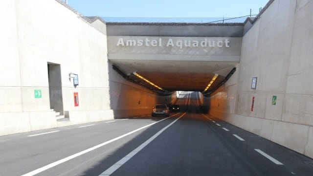
Unfortunately matters aren’t that simple with highways since drivers on the highways might think of driving through a tunnel even if the know they are surpassing an wide aqueduct. In that case it’s completely acceptable to map a “tunnel=yes” to the highways.
Now what about the rule “avoid tunnels below bridges”? Well “avoid” does not mean “must not”, therefore it’s quite acceptable to not follow this rule here. Rules are never always correct and here is such a case.
When mapping we always should try to map what’s there in reality or what the user of the map sees or thinks it’s there. Only then maps might eventually give the right impression of a location.
I think I’ve now made clear how aqueducts should be mapped even in Nederlands.