I’ve been adding building footprints, and got wondering whether there were some open datasets of all the world’s buildings. Looks like Microsoft has one using ML AI. I searched for it and only found one mention, is there a reason we don’t just import all the footprints and boom we’re mostly done adding buildings?
Dont know this one but we have MS AI or more precise MapWithAI as a JOSM plugin to read in MS sourced building footprints. There were over 17 million in OSM with their source tag when last looking. Your car in the driveway is included as building and if it has a shade its a bigger building to give you an idea of the boom. In short, each shape needs review and a very high percent is to be dismissed or (drastically) corrected. Not good IMO.
-
not checked their dataset license but it is an important part
-
no known dataset with automatically detected buildings is of high quality, all that I have seen often detect nonexistent buildings, some have weird shapes some are broken - and require manual cleanup to be usable. Have you looked at quality of that dataset? Also, none of this datasets include all buildings in the world
The GlobalMLBuildingFootprints has been licensed by Microsoft under the Open Data Commons Open Database License (ODbL): GitHub - microsoft/GlobalMLBuildingFootprints: Worldwide building footprints derived from satellite imagery
Because the quality of the detected data is so bad that an import without a building-by-building review by mappers with local knowledge will result in rubbish being added to the OSM database.
You’ve searched poorly, the microsoft buildings layer is available in RapId. The quality of it ranges from very good to unusable
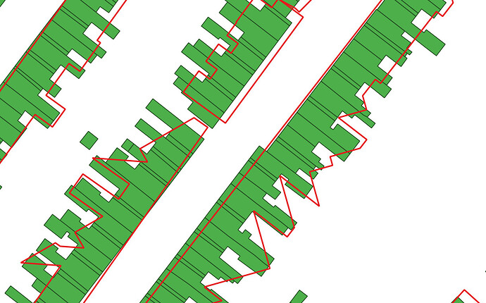
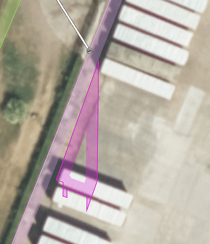
Some actual examples as images, such cases are typical in all automatically detected buildings:
green: Ordnance Survey Master Map (often can be assumed to be fully accurate), red: automatically detected outlines in Microsoft Buildings
purple: automatically detected outline in Microsoft Buildings
(I researched quality as part of another project, not for OSM - but I would not be happy about quality of this dataset for OSM purposes either - and there are some other issues)
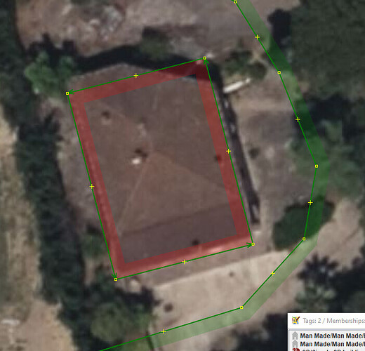
Trucks, bridges, rocks, waves etc are also often detected as buildings. Tree covered building parts are not detected as part of buildings.
(before I would import or support import I would check several other things including some legal issues)
Not always, although the scope has changed in recent years to capture new extensions (whereas before about 2018 these were not added).
Terraces with returns (as shown) are certainly one thing where the Bing footprints are definitely too poor to use, but in general the work required to get individual buildings to a reasonable standard (roughly right size, oriented correctly to the road, etc) is often far higher than drawing them de novo.
would “fairly accurate” or “accurate for this area” be better? Or maybe “more matching to reality”?
I’ve just looked at the same area and most of the gotchas I mentioned have disappeared: the change to capturing extensions makes a big difference, and is a substantial improvement.
There’s a demolished factory still shown, an office building (currently unoccupied) marked as a factory, and new purpose-built student housing missing.
Just stumbled on a little locality outlining the 'residential area, then seeing buildings and it so happens MS footprint pulled in with rapid. An old mapping hand did this so I’d have expected better… no longer existing building incl. and this example where lots is just flat squared, which is why I wrote to review each and every box on it’s merit… no boom. On Bing background it fits, no offset considered.
The long side is too short, the diagonal side vanished. Mapping this by hand is most definitely quicker.
Importing is map filler and seeing buildings that are street-long, inner open spaces absent. Are we waiting for that? Me thinketh, positively not.
I can’t say for sure, but seeing this is what made me ask the question. Seems like this license would permit openstreetmaps use
I’m not a lawyer, but it’s probably not that simple. It sounds absurd, but as far as I know, ODbL is not compatible with ODbL.
I thought that as well, but I was recently corrected in a discussion on Discord. Following Import/ODbL Compatibility - OpenStreetMap Wiki, using ODbL data is OK.
Q is, what imagery provider you’re looking at.
In my experience MS buildings matches what bings aerials show, but in say, Poland, local imagery (Geoportal) is better and newer.
There’s chance, even if you use bing, that area you’re looking at got updated too.
Still, i found this layer to be usefull in USA.


