I had evaluated a few apps for cycling navigation, here’s what I currently do for longer rides:
- Use BRouter to plan my route, using whatever [sometimes custom] profile makes sense for that bike ride, sometimes with manual adjustments.
- Export as GPX from there.
- Import GPX in Ride with GPS while still on the computer.
- Use the “automated tracing” tool in Ride with GPS. This turns the route from BRouter into one that Ride with GPS gives turn-by-turn directions for. Ride with GPS also has its own route planner, but I prefer BRouter because of the profiles.
- Add any specific info in Ride with GPS, e.g. custom markers that will show up while reading or will be read out loud by the app.
- Choose “Send to mobile” on the computer or just “Download for Offline” in the Android app.
- Navigate on the phone.
Checking your requirements against Ride with GPS (the paid version, though the free versions covers some of your list as well, not the offline stuff though):
Important for me:
- setting favorite locations (not routes) on the PC in the browser (so much easier than on the mobile)
Yes.
- syncing between PC and various Android devices
Yes. All planned routes and tracked rides can be accessed both from a computer and in the app.
Yes, on “Terrain”, “Ride with GPS”, “OSM Cycle”, “OSM Outdoor” and “ESRI Topo” layers.
- anything for bicyclists and hikers
“OSM Cycle” has a lot of useful cycling-related POIs that are shown, like drinking water points, public bathrooms etc.
- offline use in the country (of course)
Yes, the route and the map around it can be downloaded, only “Ride with GPS” layer though. I usually do that as a backup for when the mobile connection is weak.
Nice, but not essential:
- satellite photos in same app as OSM, ideally offline
Has Google satellite layer, either just the pure imagery or “Hybrid” which is satellite imagery plus names of streets, POIs etc.
- planning routes (as opposed to favorite places)
Yes, can be done on PC and on Android directly itself.
Yes, but only in the paid version.
When I compared apps, Ride with GPS was the app that had the most and best layer options, including OSM and OSM Cycle. I also use Osmand+ and Organic Maps for other things here and there (quickly looking things up or spontaneous things), or Verspucci to see satellite imagery and map things.
I used the free version of Ride with GPS for some time. That gives you all the layers etc, but no planning, no GPX import, and no offline map. If you’re just riding a mapped cycle route and have a mobile connection, that works, you can just turn on the OSM Cycle layer and ride with that.
BRouter can also be run on Android, but I haven’t gotten that to run first try, and I too find planning on a computer to be easier. If I need to re-route during the ride, I either use the Ride with GPS routing option or see what Osmand+ suggests. Both use OSM data.
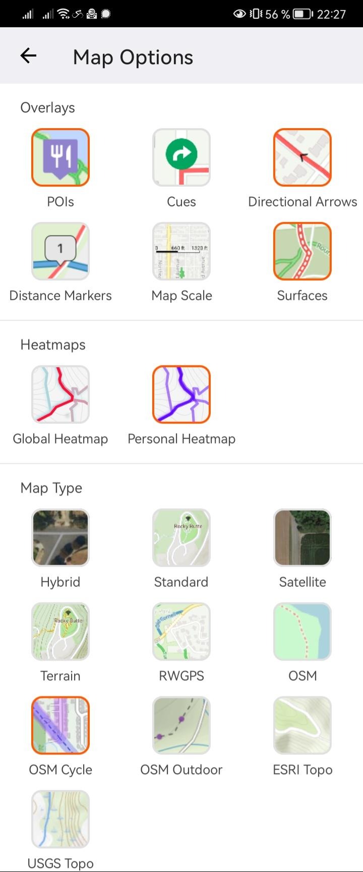
Lastly, here are the map options from Ride with GPS: