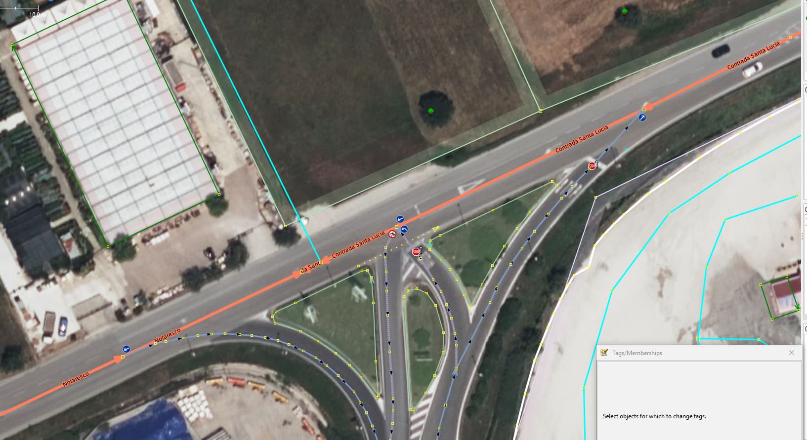
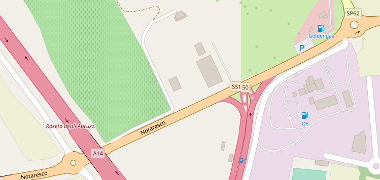
Outside view roundabouts left and right where drivers have to loop around to come off motorway wanting to go west and coming from east wanting to get onto the motorway
The question as per the topic title, when do we mapping wise make it clear, now turn restriction rules set, that for all intends and purposed the 2 directions are separated but for absence of a nice jersey barrier or guard rail to make it ‘physical’. Possible they were not placed so emergency services can get to the motorway unobstructed by taking a shortcut.
The centre junction access=no tagged on/off are blocked by fixed bollard, expressing it’s permanency as well.
paint is not enough (though there are extreme outliers where bending rules a bit may be justifiable, I would not say it applies here)
where is the distance you would say it becomes a different feature? For example on a rectangular paved area with 60m width and painted oneway „lanes“ on the opposite sides, but no physical separation, would that be a 60m wide 2-lanes carriageway or a paved area with a 1-lane road running along the sides?
In these cases, sometimes there is a physical separation from parked vehicles, sometimes it may be just an empty paved area.
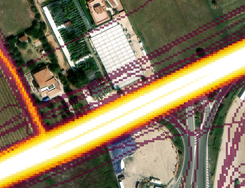
Are we sure the diagonally striped areas are part of the same carriageway, or maybe they aren’t part of the carriageway hence they separate 2 distinct carriageways even if they are all on the same level without kerbs.
It is ultimately subjective. It is not a matter of finding the right answer, but to make an useful choice. Would the map be more useful if this road is mapped as a single way or separate ways?
That’s a fine observation. Unfortunately the consumer GPS tracing is dubious, saw few days ago someone ‘fix’ a major way based on a single GPX trace taken as reference. Did not think of it but we have Strava summing countless recordings showing distinct separation.
My information may be outdated, but I don’t think gps (on mobile phone) can tell on which lane you are driving. Basically gps has accuracy of 20 meters and application is programmed to “stick” your position to correct lane (based on calculated road, direction you’re facing etc.). That’s why if you missed your turn, it takes some time to navigation to notice you are on the wrong way.
So basically, while drawing roads, we want to keep things as simple as possible. Navigations usually can’t tell you that you are on the wrong lane, and also they have problems with complicated restrictions relations (well, in this case separating ways makes less relations, but that’s an exception)
Pragmatically, if two lanes are definitely, undenyably separated by whatever physical means, meaning that drivers cannot change without a major misbehaviour, the lanes are separated and can be drawn as separate ways.
Crossing a single line would not count as such a separation; light kerbs between lanes which can be driven over in case of need, already counts as separation. A substantial double line with striped space in between is enough physical separation in most cases.
There is room for choice, based on practical considerations such as renderability and routability. You don’t want to be so strict that the driver would see on the navigation system something completely different from the reality in front of the vehicle.
You misused the word “physically” there. Physically you can ride on those lines, you can’t legally. There is a huge difference between those cases. If someone’s car broke down on the street - you can use this space to overtake it (legally it’s also possible), if there is a wall… good luck, you are stuck.
They are still physical things, you can see them, touch them. Nowadays, many are made for a certain touch and feel effect. Physical doesn’t mean impossible does it? A kerb or a raised traffic island can also be driven over, I would still call it physical. It’s more a question of: how uncrossible should it be, in normal traffic.
It doesn’t work like that I’m afraid. “Physical barrier” doesn’t mean “the barrier you can see”, but “the barrier you can’t physically cross”. It refers to situations like, when there is a wall, and it’s literally impossible to jump over it.
What counts as barrier is a difficult question sometimes, because it would be different for a person, different for a car, different for a truck and so on, but a “painting on the floor” is basically passable by everyone. Is it legally allowed or desirable don’t matter - it’s not a “barrier”.
This general rule is used in different places too. Eg. we map (Sorry, I don’t know the correct English word for that) shared paths for bicycles and passerbys as one line, even if they are separated by white line.
Barrier is not implied in the word physical. I think it’s about physical separation. A strip of grass or a slightly raised flare island is not much of a barrier, but it is a physical separation. A rumble strip is a physical separation. Many European roads have separate carriageways which are only hard separated at crossings and junctions, and between those points by white striped or green painted asphalt bands. These are also physical separations.
The debate is, AFAIC, whether the separation is strong enough to warrant mapping lanes as separate ways.
Yes, it’s outdated. Consumer GPSs claim three meters of accuracy, and actually get about six. “Stickiness” is an application-by-application feature: 30 meters of separation isn’t enough for OSMAnd to realize that I’ve exited the freeway and am now driving on the frontage road, but OSMTracker will draw its line down the correct road (and mostly down the correct lane).
Answering the original question is a funny and very typical problem with tagging.
Someone wrote the statement in question on OSM Wiki or elsewhere without giving (and/or having, as well as testing) clear criteria.
Then someone else read that and naturally started wondering, what exactly it means.
Then a number of individuals took an approach of those who interpret sacred writings (that “can’t” be changed) to create an interpretation that fits their personal conviction, more or less based on practical criteria such as consistency with other cases, matching random external concepts (such as being able to resolve a difference using GPS), etc.
But no, whatever anyone says here to interpret the words “physical divider” (no matter how logically reasonable it sounds by itself), it has no power over the prior use, because everyone who interpreted it, did it in their own way.
The only way to clarify it is to declare a new clear set of criteria, get a bunch of people to agree with it, and invalidate any prior use that doesn’t match it.
Rumble strips are not a barrier. They are designed to indicate the edge of the road.
In this situation, a barrier is anything that will prevent most consumer vehicle from crossing the seperation in the carriageway. This could be guard rails, concrete wall or those yellow water barrels. Trying to drive though any of them will slow down the vehicle and likely cause substantial damage from the impact. Even large trucks would trouble crossing the roadway.
On the other hand, paint, grass or even a regular island with kerbs might be uncomfortable and unsafe for a commuter car. An SUV would have even less of a problem. Anything laeger would be unaffected.
Basicly a barrier has to be able to prevent a truck from cross on a break in the carriageway.
hmmm, talking about something else in ‘/OT’ There’s ‘rumble’ strips to the side of the road, see them on motorways for long distance drivers who then wake up if they cross them (thick paint with dimples in them which make a serious noise when tires roll over them’, I’m talking about those in a series across the lane to tell you in an audial manner to slow down. We’ve got them but are only visual from slim to ever wider, as wide or wider than the solid line of a stop spot painted on the road conveying there something ‘raised attention requiring’ ahead. The ‘shaded’ area of the OP is noiseless too.