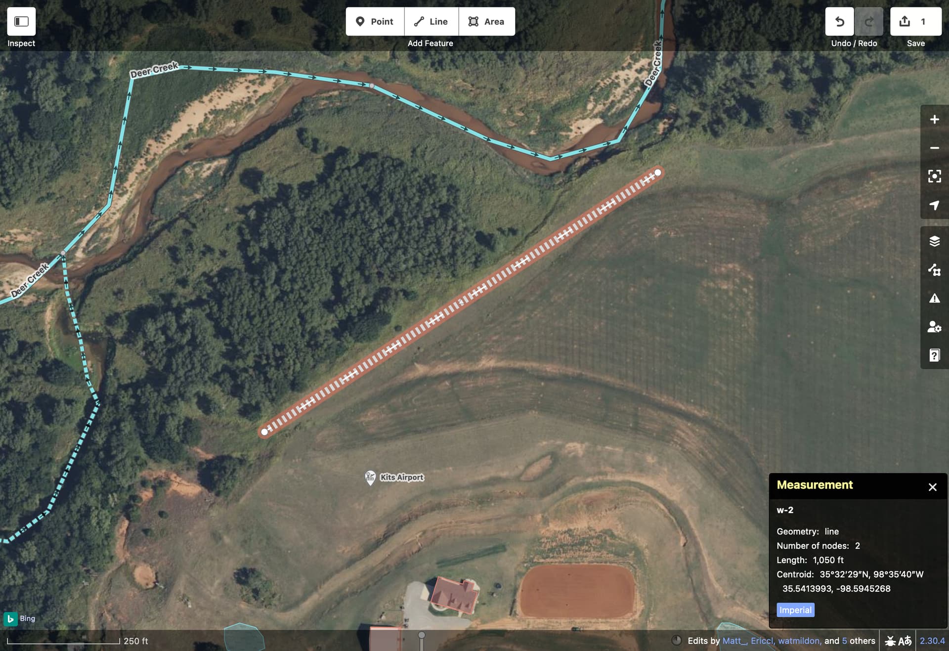
In this case, are you referring to something like Kits Airport? The faa=5OK0 tag refers to this FAA record about a private turf airstrip 1,050 feet long and 40 feet wide (320×12 m). The FAA coordinates are slightly to the north of where the mapper put the aeroway=aerodrome in OSM, pointing to a plausible location for the runway:
I recall when similar features were added to my neck of the woods in bulk many years ago. I had no idea that such facilities existed so close to me and was tempted to delete all of them. Some of them checked out, while others were clearly outdated FAA records; the runway had been plowed under for a residential subdivision a few years earlier.
I would map the runways that still exist, tagging them with accurate surface=* values, so that fellow mappers and data consumers would be able to tell what the aeroway=aerodrome point refers to. aerodrome:type=private would distinguish this airstrip from the actual airports. There’s also a discussion (in German) about whether to replace this key with aerodrome=*. These tags won’t necessarily prevent the default map style (“OSM Carto”) from marking them like airports or the built-in search engine (“Nominatim”) from labeling them as an “aerodrome”, but some other applications may recognize the tags and suppress them when you’re looking for actual airports.
Most of the edits by this user appear to be manual retagging of existing features that had previously been imported from other sources such as OurAirports and Geonames, and they attempted to clean up surrounding features too. If there were lots of new additions, it would be better to discuss the edits informally with the local community (such as in United States) beforehand.