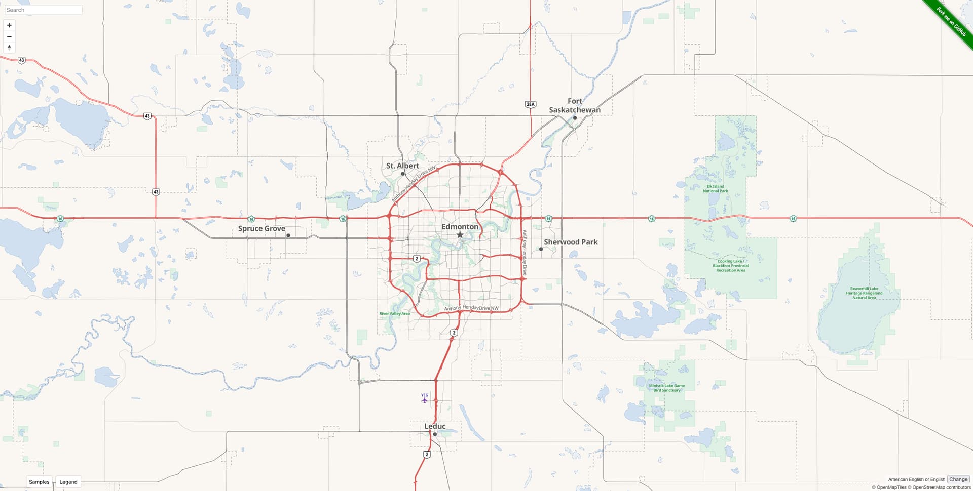
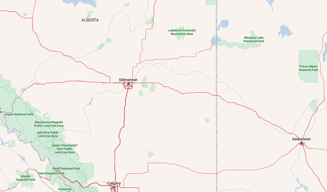
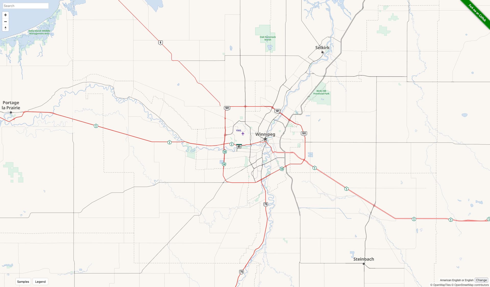
I was recently browsing around Canada in the OSM-Americana rendering and saw that Edmonton is a fabulous example of the highway classification hierarchy and expressway=yes tagging that we are also using south of the border. Edmonton’s regional connections are all highway=trunk|motorway while most intra-urban and suburban connectors are all highway=primary|secondary with expressway=yes on the enhanced construction. This is just a great example of how this tagging enables effective zoom-dependent rendering that can highlight important regional connections at low zoom while not turning cities into an unintelligible pile of spaghetti.
Are there folks from Canada here that have been involved in highway classification efforts? It would be great to coordinate and link up additional important cross-border routes.
It may be tangential / off-topic, but I’d like to say here that two “networks” I work on (long-distance / national-scale route=bicycle relations and route=railway relations) are similarly pretty-well-established (and pretty-well-developed and developing) in Canada.
Being in the USA, but as Canada and the USA share the world’s longest peaceful border, I’ve been reluctant to edit (rail networks, bicycle networks) in Canada (I’ve done a tiny bit correcting small but significant errors). However, what I CAN do is to “offer good (tagging) examples” (of rail networks, bicycle networks) and brush up our wiki for national-level rail and bicycle networks, and after many years of such editing: “so far, so good!”
We’re not 100% perfect in the USA (but we do get closer) with these networks, but about eight or ten years ago, I began to see that the Canadian equivalents (of mainline rail, national-scale bicycle routes, regional-scale bicycle routes…) have developed right along with ours, and on the other side of our shared border. This has been happening with politeness (to not cross boundaries into “other mappers territory”), although some discussion has happened between American and Canadian mappers at the individual level when such dialog is necessarily helpful.
My point is that good tagging, good documentation of “what’s right and how we do it here” in wiki, good renderers (like OpenRailwayMap, CycleMap, CyclOSM, Americana…) and good communication (one-on-one when necessary, but also in broader forums like this) go a long distance towards well-coordinated networks (of many sorts), even across national borders! And it looks like the same goes for tagging road networks in urban Canada. Nice job, everyone! This is how a shared map grows well! (By inspiring each other with good community, good communication / documentation and good tagging).