Hi
I have been adding watercourses to southwest Queensland from the Surface Hydrology Lines Australian Data Sources - OpenStreetMap Wiki recently and trying to preserve already well mapped waterways.
Hope Creek appears to be incorrectly named in OSM. I believe this area should be corrected to Ravensbourne Creek.
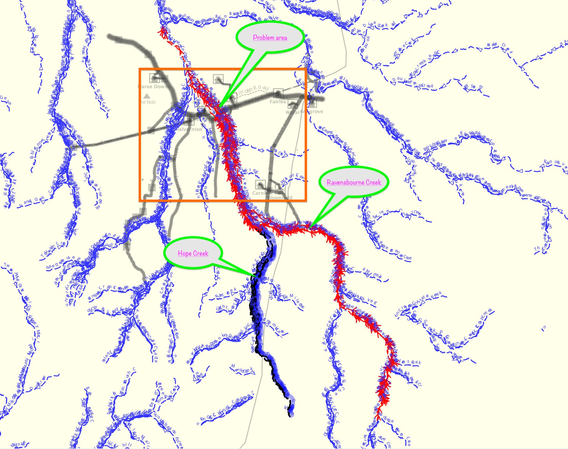
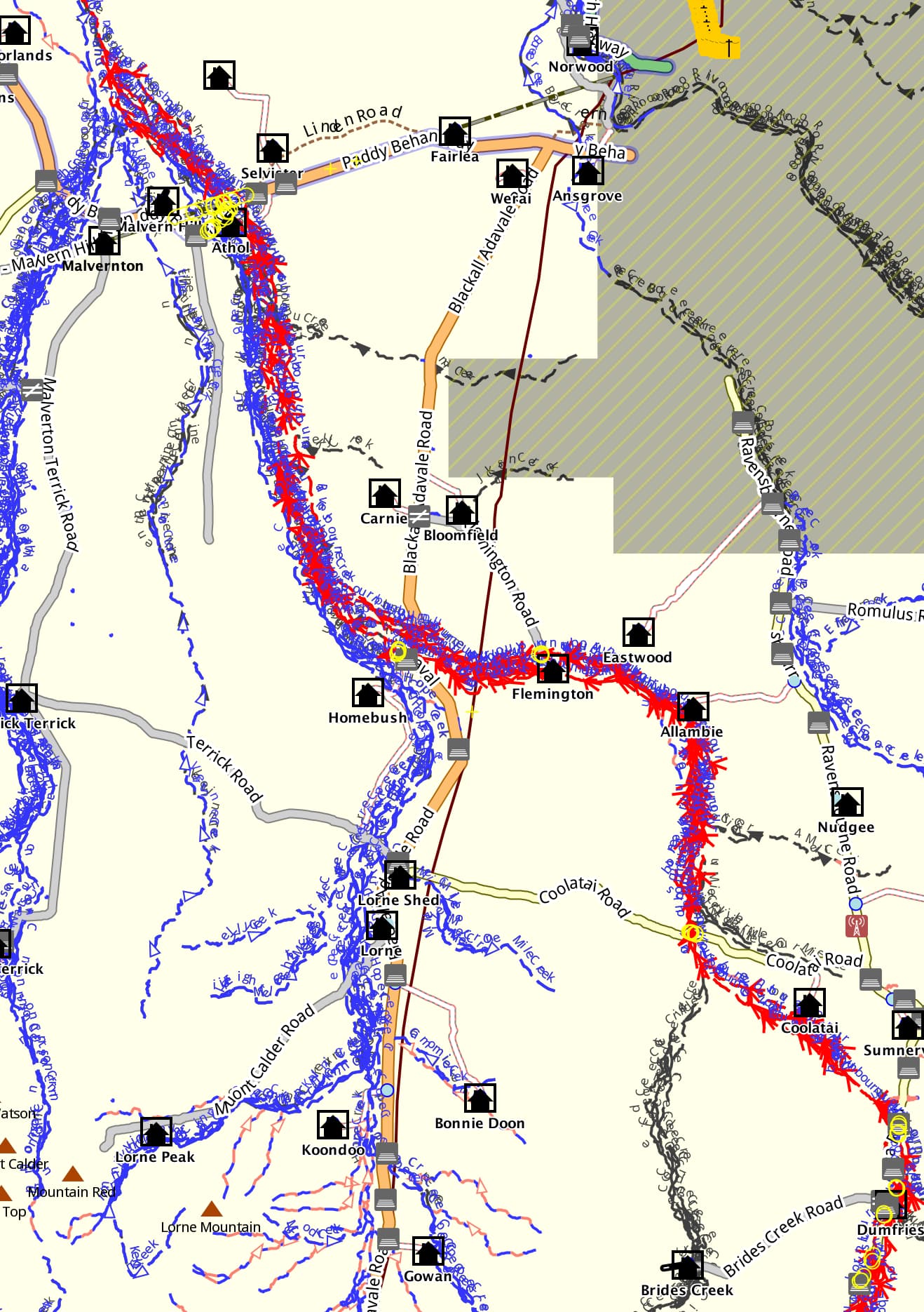
The view below shows the wider area with Ravensbourne Creek selected in red and Hope Creek in black/blue highlight just below the orange rectangle as named in the Surface Hydrology Lines dataset.
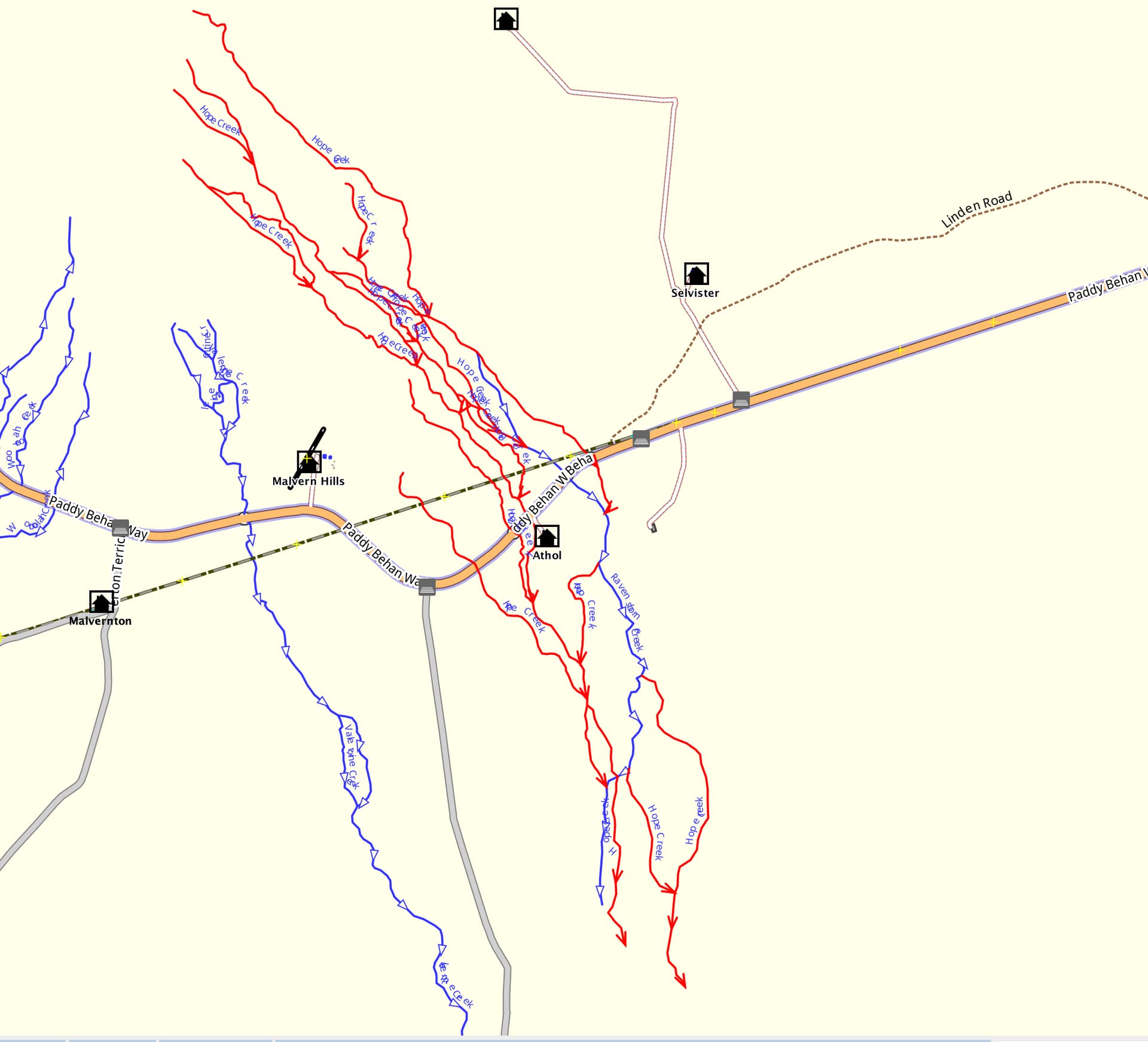
In OSM the section in the orange rectangle however, as shown below, where the creeks cross Paddy Behan Way, Hope Creek is depicted as red lines with a steak of Ravensborne Creek (sic) running through the area. Outside this area, it remains unmapped.
Near Athol (which leads into Athol Station) there is a creek crossing sign marked Hope Creek which I think is incorrect and has led to the mapping error and the source as “source:name=sign at Paddy Behan Way”.
A couple of other creek crossings were signed Ravensbourne Creek.
If there is consensus, I will rename Hope Creek in the orange rectangle area as Ravensbourne Creek. Otherwise I will leave as is.
I have been unable to find any Mapillary imagery along Paddy Behan Way naming Hope Creek but didn’t look very diligently and someone may have their own recent imagery.
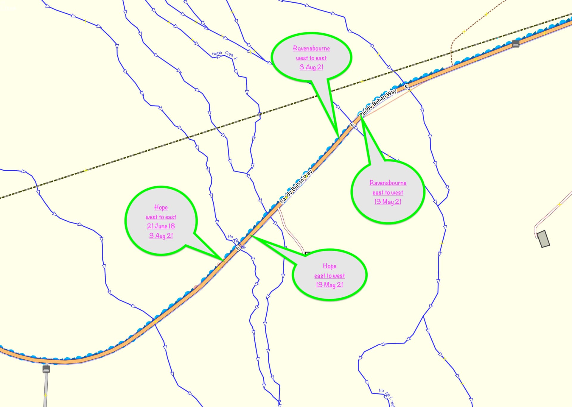
I did a single west to east photo travel that crosses the creeks, but found no sign for the Hopes Creek eastern extent. I did not check the east to west pass. Hope these are of some help to you.
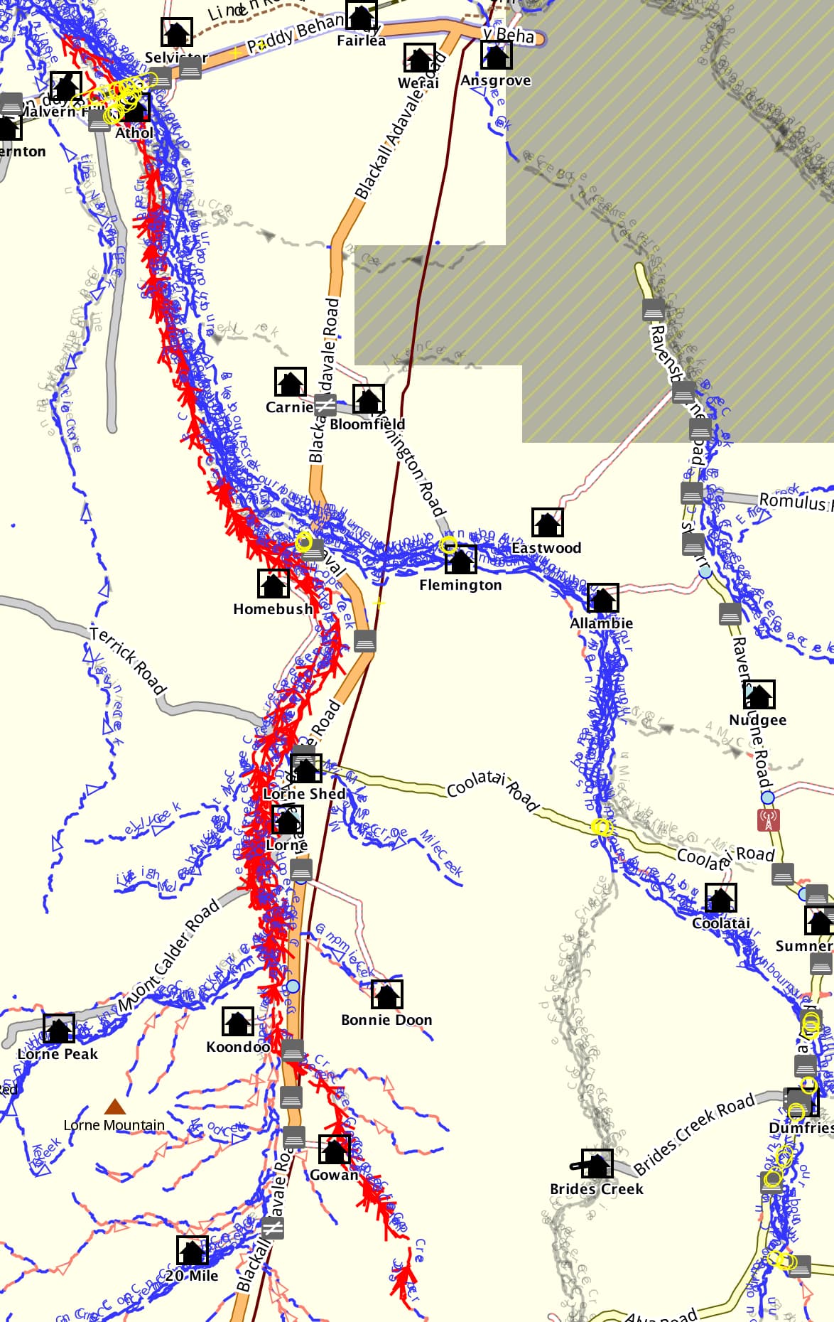
Note that OSM currently has a “spur” or eastern extent/loop of Hope Creek between the east and west Ravensbourne signs, so if nothing else that should have a name change.
Thanks for the help with this dilemma.
Because the signs were present in 2021 where mapped along Paddy Behan Way, I guess it is best to continue for now to map Hope Creek down the west side as depicted on the 1956 map with the eastern side as Ravensbourne Creek south to where the Blackall Adavale Road and Homebush meet and Hope Ck diverges from Ravensbourne Ck.
Because the Qld Topo and the Geoscience dataset both have the Hope/Ravensbourne junction further south near where the Blackall Adavale Road and Homebush meet, I will try to make some enquiries as to which is correct.
Here are the signs I spotted in Mapillary via Josm…
I couldn’t display your links bob3bob3, but they are likely those as below plus some back of sign shots. [edit…links worked fine on my phone]
If I remember… There is a small chance I’ll be traveling N-S through Blackall in 1-2 months, so can make a quick diversion and another Mapillary grab. Will msg you if this happens.
I have been concerned about using “logged in links” for Mapillary images so tnxs for the advice about Josm.
I have mapped the Hope and Ravensbourne Creek waterways now.
Hope Ck now extends north from where it ended in the Geoscience dataset and the Qld Globe, along the west side of Ravensbourne, until it merges out just north of the Paddy Behan Way where the named creek signs are.
Hope Creek portion on west side of Ravensbourne in red
@nevw@TheSwavu
As mentioned I have just done another Mapillary pass over Hope and Ravensbourne Creeks. Did it in both directions with front, side and 3/4 rear views. This is the first sign crossing;
There have been no sign changes since the 2001 capture.
Thanks bob3bob3,
I sent a couple of emails, including to the custodian, but did not receive any useful info to help sort this out. In view of the signs being still in place, I will leave the osm map as is unless I unless I receive differing info in the future.
Cheers, Nev
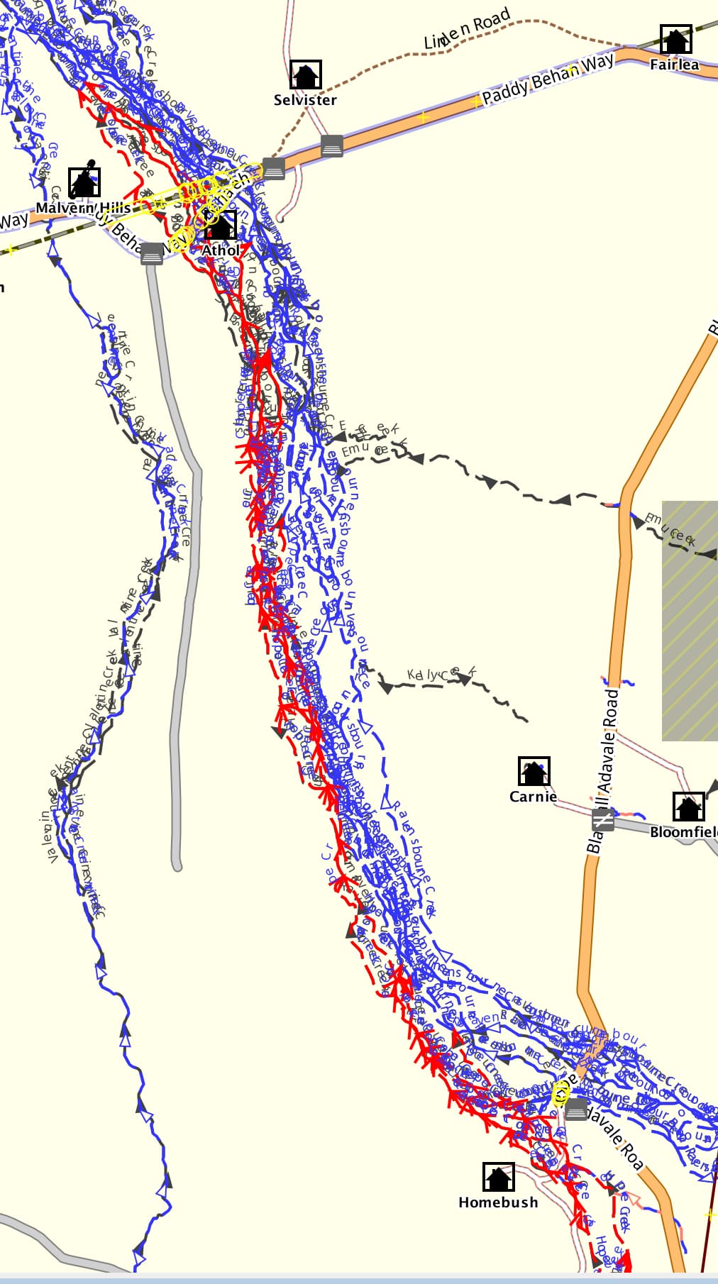
I have received updated data from the Queensland Spatial Help Centre, Department of Resources (Queensland) following my enquiry and have updated Hope and Ravensbourne Creeks on OSM from their junction north of Paddy Behan Way south to where they cross the main roads near Homebush.
The road signs observed on Paddy Behan Way also align correctly with the new data.